List of National Historic Landmarks in Oklahoma
Encyclopedia
The List of National Historic Landmarks in Oklahoma contains the landmarks designated by the U.S. Federal Government for the U.S. state
of Oklahoma
.
There are 21 National Historic Landmarks in Oklahoma. The following table is a complete list.
Table notes: see below.
U.S. state
A U.S. state is any one of the 50 federated states of the United States of America that share sovereignty with the federal government. Because of this shared sovereignty, an American is a citizen both of the federal entity and of his or her state of domicile. Four states use the official title of...
of Oklahoma
Oklahoma
Oklahoma is a state located in the South Central region of the United States of America. With an estimated 3,751,351 residents as of the 2010 census and a land area of 68,667 square miles , Oklahoma is the 28th most populous and 20th-largest state...
.
There are 21 National Historic Landmarks in Oklahoma. The following table is a complete list.
| Landmark name | Image | Date desig. | Locality |
County | Description | |
|---|---|---|---|---|---|---|
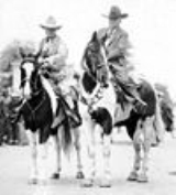
| 101 Ranch Historic District Miller Brothers 101 Ranch The Miller Brothers 101 Ranch was an cattle ranch in the Indian Territory of Oklahoma before statehood. Located near modern-day Ponca City, it was founded by Colonel George Washington Miller, a veteran of the Confederate Army, in 1893. The 101 Ranch was the birthplace of the 101 Ranch Wild West... |
 |
Ponca City Ponca City, Oklahoma Ponca City is a small city in Kay and Osage counties in the U.S. state of Oklahoma, which was named after the Ponca Tribe. Located in north central Oklahoma, it lies approximately south of the Kansas border, and approximately east of Interstate 35. 25,919 people called Ponca City home at the... |
Kay Kay County, Oklahoma Kay County is a county located in the U.S. state of Oklahoma. As of 2000, the population was 48,080. Its county seat is Newkirk. The largest city in Kay County is Ponca City.-19th century:... |
Ranch where rodeo bull-dogging was developed to an art form by Bill Pickett Bill Pickett Willie M. "Bill" Pickett was a cowboy and rodeo performer.Pickett was born in the Jenks-Branch community of Travis County, Texas. He was the second of 13 children born to Thomas Jefferson Pickett, a former slave, and Mary "Janie" Gilbert. Pickett had 4 brothers and 8 sisters... ; home base of 101 Ranch Wild West Show. |
||
| Bizzell Library |  |
Norman Norman, Oklahoma Norman is a city in Cleveland County, Oklahoma, United States, and is located south of downtown Oklahoma City. It is part of the Oklahoma City metropolitan area. As of the 2010 census, Norman was to have 110,925 full-time residents, making it the third-largest city in Oklahoma and the... |
Cleveland Cleveland County, Oklahoma Cleveland County is a county in the central part of the U.S. state of Oklahoma. The population was 255,755 at the 2010 census. Its county seat is Norman. Cleveland County is part of the Oklahoma City Metropolitan Statistical Area.-History:... |
Library of University of Oklahoma University of Oklahoma The University of Oklahoma is a coeducational public research university located in Norman, Oklahoma. Founded in 1890, it existed in Oklahoma Territory near Indian Territory for 17 years before the two became the state of Oklahoma. the university had 29,931 students enrolled, most located at its... , focus of racial segregation Supreme Court case. |
||
| Boley Historic District Boley Historic District The Boley Historic District, in Boley, Oklahoma is the area of an all-black town founded in 1903.It was declared a National Historic Landmark in 1975.It is roughly bounded by Seward Avenue, Walnut and Cedar Streets, and the southern city limits of Boley.... |
Boley Boley, Oklahoma Boley is a town in Okfuskee County, Oklahoma, United States. The population was 1,126 at the 2000 census. It was founded in 1903.The Boley Public School District is one of the smallest public school districts in the state of Oklahoma. For the most recent data available, it tied with Sweetwater for... |
Okfuskee Okfuskee County, Oklahoma Okfuskee County is a county located in the U.S. state of Oklahoma. As of 2000, the population was 11,814. Its county seat is Okemah.-Geography:... |
All-black town founded in 1903, product of segregationist policies. | |||
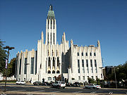
| Boston Avenue Methodist Episcopal Church, South Boston Avenue Methodist Church The Boston Avenue United Methodist Church, located in downtown Tulsa, Oklahoma and completed in 1929, is considered to be one of the finest examples of ecclesiastical Art Deco architecture in the United States, and has been placed on the National Register of Historic Places... |
 |
Tulsa Tulsa, Oklahoma Tulsa is the second-largest city in the state of Oklahoma and 46th-largest city in the United States. With a population of 391,906 as of the 2010 census, it is the principal municipality of the Tulsa Metropolitan Area, a region with 937,478 residents in the MSA and 988,454 in the CSA. Tulsa's... |
Tulsa Tulsa County, Oklahoma Tulsa County is a county located in the U.S. state of Oklahoma. According to the 2010 U.S. Census, the population is 603,403. Its county seat is Tulsa.-History of Tulsa County:The history of Tulsa County greatly overlaps the history of the city of Tulsa... |
One of finest examples of ecclesiastical Art Deco Art Deco Art deco , or deco, is an eclectic artistic and design style that began in Paris in the 1920s and flourished internationally throughout the 1930s, into the World War II era. The style influenced all areas of design, including architecture and interior design, industrial design, fashion and... architecture in the U.S. |
||
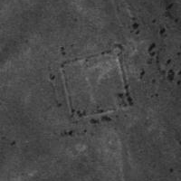
| Camp Nichols Camp Nichols Camp Nichols, also known as Fort Nichols or Camp Nichols Ranch, was a historic fortification located in present-day Cimarron County, Oklahoma. It was built by New Mexico and California volunteers under the command of Col. Kit Carson to protect travelers on the Cimarron Cut-off of the Santa Fe Trail... |
 |
Wheeless Wheeless, Oklahoma Wheeless is a small unincorporated community in Cimarron County, Oklahoma. The post office was established February 12, 1907, and discontinued September 27, 1963. Nearby are the ruins of Camp Nichols, a military encampment on the Santa Fe Trail, which is listed on the National Register of Historic... 36.75266°N 102.92627°W |
Cimarron Cimarron County, Oklahoma Cimarron County is a county located in the U.S. state of Oklahoma. Throughout most of its history it has had the smallest population and the lowest population density of any county in Oklahoma. As of 2010 census, the population was 2,475... |
Ruins of fort built by Kit Carson Kit Carson Christopher Houston "Kit" Carson was an American frontiersman and Indian fighter. Carson left home in rural present-day Missouri at age 16 and became a Mountain man and trapper in the West. Carson explored the west to California, and north through the Rocky Mountains. He lived among and married... to protect the Cimarron Cutoff trail followers from hostile Kiowa Kiowa The Kiowa are a nation of American Indians and indigenous people of the Great Plains. They migrated from the northern plains to the southern plains in the late 17th century. In 1867, the Kiowa moved to a reservation in southwestern Oklahoma... and Apache Apache Apache is the collective term for several culturally related groups of Native Americans in the United States originally from the Southwest United States. These indigenous peoples of North America speak a Southern Athabaskan language, which is related linguistically to the languages of Athabaskan... . |
||
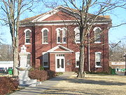
| Cherokee National Capitol Cherokee National Capitol Cherokee National Capitol, in Tahlequah, Oklahoma, was the capitol building of the Cherokee Nation from 1869 to 1907, when Oklahoma became a state.It was declared a National Historic Landmark in 1961.... |
 |
Tahlequah Tahlequah, Oklahoma Tahlequah is a city in Cherokee County, Oklahoma, United States located at the foothills of the Ozark Mountains. It was founded as a capital of the original Cherokee Nation in 1838 to welcome those Cherokee forced west on the Trail of Tears. The city's population was 15,753 at the 2010 census. It... 35.91063°N 94.97053°W |
Cherokee Cherokee County, Oklahoma Cherokee County is a county located in the U.S. state of Oklahoma. As of 2000, the population was 42,521. Its county seat is Tahlequah.Cherokee County was established in 1907.-Geography:... |
Capitol of the Cherokee Cherokee The Cherokee are a Native American people historically settled in the Southeastern United States . Linguistically, they are part of the Iroquoian language family... nation from 1869 to 1907, when Oklahoma became a state. |
||
| Creek National Capitol Creek National Capitol Creek National Capitol, also known as Creek Council House, is a building in downtown Okmulgee, Oklahoma. It was capitol of the Muscogee Nation nation from 1878 to 1907, when Oklahoma became a state. In 1919 the U.S... |
image pending | Okmulgee Okmulgee, Oklahoma Okmulgee is a city in Okmulgee County, Oklahoma, United States. The population at the 2010 census was 12,321 a loss of 5.4 percent since the 2000 census figure of 13,022. It has been the capital of the Muscogee Nation since the United States Civil War. Okmulgee means "boiling waters" in the Creek... 35.623221°N 95.971769°W |
Okmulgee Okmulgee County, Oklahoma Okmulgee County is a county located in the U.S. state of Oklahoma. As of 2000, the population was 39,685. Its county seat is Okmulgee.-Geography:According to the U.S. Census Bureau, the county has a total area of 1,819 km²... |
Capitol of Creek Creek people The Muscogee , also known as the Creek or Creeks, are a Native American people traditionally from the southeastern United States. Mvskoke is their name in traditional spelling. The modern Muscogee live primarily in Oklahoma, Alabama, Georgia, and Florida... nation from 1878 to 1907, now a museum. |
||
| Deer Creek Site Deer Creek Site The Deer Creek/Bryson Paddock Sites are the remains of 18th century fortified villages of the Wichita tribe located along the Arkansas River in Kay County, Oklahoma.-Location and History:... |
image pending | Newkirk Newkirk, Oklahoma Newkirk is a city in Kay County, Oklahoma, United States. The population was 2,243 at the 2000 census. It is the county seat of Kay County.-Geography:... |
Kay Kay County, Oklahoma Kay County is a county located in the U.S. state of Oklahoma. As of 2000, the population was 48,080. Its county seat is Newkirk. The largest city in Kay County is Ponca City.-19th century:... |
Archeological site, site of a fortified village of the Wichita Wichita (tribe) The Wichita people are indigenous inhabitants of North America, who traditionally spoke the Wichita language, a Caddoan language. They have lived in Kansas, Oklahoma, and Texas... . |
||
| Fort Gibson Fort Gibson Fort Gibson, now located in Oklahoma and designated Fort Gibson Historical Site, guarded the American frontier in Indian Territory from 1824 until 1890... |
.jpg) |
Fort Gibson Fort Gibson, Oklahoma Fort Gibson is a town in Cherokee and Muskogee counties in the U.S. state of Oklahoma. The population was 4,054 at the 2000 census. It is the location of Fort Gibson National Cemetery and is located near at the end of the Cherokees' Trail of Tears at Tahlequah, Oklahoma.Colonel Matthew Arbuckle of... |
Muskogee Muskogee County, Oklahoma Muskogee County is a county located in the U.S. state of Oklahoma. As of 2010, the population was 70,990. Its county seat is Muskogee.-Government:... |
Fort built in 1824 in the Indian Territory Indian Territory The Indian Territory, also known as the Indian Territories and the Indian Country, was land set aside within the United States for the settlement of American Indians... . |
||
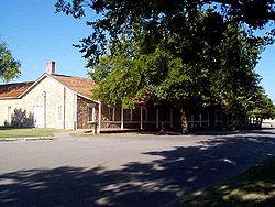
| Fort Sill Fort Sill Fort Sill is a United States Army post near Lawton, Oklahoma, about 85 miles southwest of Oklahoma City.Today, Fort Sill remains the only active Army installation of all the forts on the South Plains built during the Indian Wars... |
 |
Fort Sill |
Comanche Comanche County, Oklahoma Comanche County is a county located in the U.S. state of Oklahoma. Built on former reservation lands of the Comanche, Kiowa, and Apache in Indian Territory, Comanche County was open for settlement on August 16, 1901 by lottery. The region has three cities and seven towns as well as the Fort Sill... |
Only still-active fort from Indian wars on the south plains. | ||
| Fort Washita Fort Washita Fort Washita is the former United States military post and National Historic Landmark located near Nida, Oklahoma on SH 199. Established in 1842 by General Zachary Taylor to protect citizens of the Choctaw and Chickasaw Nations from the plains indians it was later abandoned by Federal forces at... |
 |
Nida Nida, Oklahoma Nida is an unincorporated community in Johnston County, Oklahoma, United States, along State Highway 22. It is the nearest community to Fort Washita, a National Historic Landmark.... |
Bryan Bryan County, Oklahoma Bryan County is a county located in the U.S. state of Oklahoma. The population was 36,534 at the 2000 census. Its county seat is Durant. The county shares the same boundaries as the Durant Micropolitan Area. It is also home to the headquarters of the Choctaw Nation of Oklahoma located in Durant... |
Established in 1842 to protect the Choctaws and Chickasaws from the plains Indians. | ||
| Guthrie Historic District | .jpg) |
Guthrie Guthrie, Oklahoma Guthrie is a city in and the county seat of Logan County, Oklahoma, United States, and a part of the Oklahoma City Metroplex. The population was 9,925 at the 2000 census.Guthrie was the territorial and later the first state capital for Oklahoma... |
Logan Logan County, Oklahoma Logan County is a county located in the U.S. state of Oklahoma. The population as of 2009 was 39,301. Its county seat is Guthrie. Logan County is part of the Oklahoma City Metropolitan Statistical Area.-Geography:... |
Now a historic district Historic district A historic district or heritage district is a section of a city which contains older buildings considered valuable for historical or architectural reasons. In some countries, historic districts receive legal protection from development.... . |
||
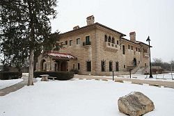
| E. W. Marland Mansion E. W. Marland Mansion E. W. Marland Mansion, or Ernest Whitworth Marland Mansion or Marland Estate, in Ponca City, Oklahoma is a Mediterranean Revival style mansion significant for its architecture. The home was built by Oklahoma governor and oilman E. W... |
 |
Ponca City Ponca City, Oklahoma Ponca City is a small city in Kay and Osage counties in the U.S. state of Oklahoma, which was named after the Ponca Tribe. Located in north central Oklahoma, it lies approximately south of the Kansas border, and approximately east of Interstate 35. 25,919 people called Ponca City home at the... |
Kay Kay County, Oklahoma Kay County is a county located in the U.S. state of Oklahoma. As of 2000, the population was 48,080. Its county seat is Newkirk. The largest city in Kay County is Ponca City.-19th century:... |
Home of Oklahoma politician Ernest Whitworth Marland. | ||
| McLemore Site McLemore Site McLemore Site, located near Colony in Washita County, Oklahoma, is the site of a prehistoric village, dating from AD 1330-1360. It was a Plains Indian settlement during the Washita River phase. Clay figurines from the site suggest widespread tattooing by the residents of this site... |
image pending | Colony Colony, Oklahoma Colony is a town in Washita County, Oklahoma, United States. The population was 147 at the 2000 census.-Geography:Colony is located at in Seger Township , Washita County, Oklahoma.... |
Washita Washita County, Oklahoma Washita County is a county located in the U.S. state of Oklahoma. As of 2000, the population was 11,508. Its county seat is New Cordell. It was formerly located in Cloud Chief, Oklahoma.... |
An archeological site. | ||
| Murrell Home Murrell Home The Murrell Home, also known as the George M. Murrell Home, is a historic home and museum in Park Hill, near Tahlequah, Oklahoma. It was built in 1845, the building starting in 1844, and was most likely constructed least in part by slaves. It is one of only a few antebellum houses that have... |
.jpg) |
Park Hill Park Hill, Oklahoma Park Hill is a census-designated place in southwestern Cherokee County, Oklahoma in the United States. The population was 3,936 at the 2000 census. It lies near Tahlequah, east of the junction of U.S. Route 62 and State Highway 82.-History:... 35.84735°N 94.96418°W |
Cherokee Cherokee County, Oklahoma Cherokee County is a county located in the U.S. state of Oklahoma. As of 2000, the population was 42,521. Its county seat is Tahlequah.Cherokee County was established in 1907.-Geography:... |
A house. | ||
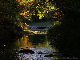
| Platt National Park Historic District Chickasaw National Recreation Area Chickasaw National Recreation Areais a National Recreation Area situated in the foothills of the Arbuckle Mountains in south-central Oklahoma near Sulphur.-History:... |
 |
Sulphur Sulphur, Oklahoma Sulphur is a city in Murray County, Oklahoma, United States. The population was 4,794 at the 2000 census. It is the county seat of Murray County.-Geography:Sulphur is located at .... |
Murray Murray County, Oklahoma Murray County is a county located in the U.S. state of Oklahoma. As of 2000, the population was 12,623. Its county seat is Sulphur.-Geography:... |
Square mile sold by Chickasaw Nation to federal government for park use in 1902 | ||
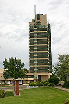
| Price Tower Price Tower The Price Tower is a nineteen story, 221 foot high tower in Bartlesville, Oklahoma that was designed by Frank Lloyd Wright. It is the only realized skyscraper by Wright, and is one of only two vertically-oriented Wright structures extant .The Price Tower was commissioned by Harold C. Price of the... |
 |
Bartlesville Bartlesville, Oklahoma Bartlesville is a city in Osage and Washington counties in the U.S. state of Oklahoma. The population was 43,070 at the 2010 census. Bartlesville is located forty-seven miles north of Tulsa and very close to Oklahoma's northern border with Kansas. It is the county seat of Washington County, in... |
Washington Washington County, Oklahoma Washington County is a county located in the U.S. state of Oklahoma. It is, in total area, the smallest county in Oklahoma, adjacent to the largest county in Oklahoma, Osage County. It is the second smallest county, by land only size, i.e., not including water. As of 2000, the population was... |
An unusual Frank Lloyd Wright Frank Lloyd Wright Frank Lloyd Wright was an American architect, interior designer, writer and educator, who designed more than 1,000 structures and completed 500 works. Wright believed in designing structures which were in harmony with humanity and its environment, a philosophy he called organic architecture... -designed building. |
||
| Sequoyah's Cabin Sequoyah's Cabin Sequoyah's Cabin was the home during 1829-1844 of the Cherokee Indian, Sequoyah , who created a written language for the Cherokee Nation.It was declared a National Historic Landmark in 1965.... |
 |
Akins Akins, Oklahoma Akins is a census-designated place in Sequoyah County, Oklahoma, United States. It is part of the Fort Smith, Arkansas-Oklahoma Metropolitan Statistical Area. The population was 449 at the 2000 census.... |
Sequoyah Sequoyah County, Oklahoma Sequoyah County is a county located in the U.S. state of Oklahoma. It is part of the Fort Smith, Arkansas-Oklahoma Metropolitan Statistical Area. As of 2000, the population was 38,972. Its county seat is Sallisaw.-History:... |
Log cabin home of Sequoyah Sequoyah Sequoyah , named in English George Gist or George Guess, was a Cherokee silversmith. In 1821 he completed his independent creation of a Cherokee syllabary, making reading and writing in Cherokee possible... , who created "talking leaves", written language for the Cherokee. |
||
| Stamper Site Stamper Site Stamper Site is an archaeological site significant for its excavation of the Panhandle culture.It was declared a National Historic Landmark in 1964.The location is not disclosed by the National Park Service, and access is restricted by the private owner.... |
image pending | Optima Optima, Oklahoma Optima is a town in Texas County, Oklahoma, United States. The population was 356 at the 2010 census.-Geography:Optima is located at .According to the United States Census Bureau, the town has a total area of , all of it land.... |
Texas Texas County, Oklahoma Texas County is a county located in the U.S. state of Oklahoma. Texas County was formed at Oklahoma statehood from the central one-third of "Old Beaver County" also known as "No Man's Land"... |
Archeological site. | ||
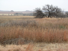
| Washita Battlefield Washita Battlefield National Historic Site Washita Battlefield National Historic Site protects and interprets the site of the Southern Cheyenne village of Chief Black Kettle where the Battle of Washita occurred. The site, a National Historic Landmark, is located about 150 miles west of Oklahoma City, Oklahoma, near Cheyenne, Oklahoma.Just... |
 |
Cheyenne Cheyenne, Oklahoma Cheyenne is a town in Roger Mills County, Oklahoma, United States. The population was 801 at the 2010 census. It is the county seat of Roger Mills County.-History:... |
Roger Mills Roger Mills County, Oklahoma Roger Mills County is a county located in the U.S. state of Oklahoma. As of 2000, the population was 3,436. Its county seat is Cheyenne.-History:Roger Mills County takes its name from Roger Q. Mills, a prominent American politician from Texas... |
Where George Custer led the Seventh Cavalry surprise attack on village of Cheyenne Cheyenne Cheyenne are a Native American people of the Great Plains, who are of the Algonquian language family. The Cheyenne Nation is composed of two united tribes, the Só'taeo'o and the Tsétsêhéstâhese .The Cheyenne are thought to have branched off other tribes of Algonquian stock inhabiting lands... Chief Black Kettle Black Kettle Chief Black Kettle was a leader of the Southern Cheyenne after 1854, who led efforts to resist American settlement from Kansas and Colorado territories. He was a peacemaker who accepted treaties to protect his people. He survived the Third Colorado Cavalry's Sand Creek Massacre on the Cheyenne... in 1868. |
||
| Wheelock Academy Wheelock Academy Wheelock Academy was the model academy for the five civilized tribes' academies. It was started as a missionary school for Choctaw girls, and is still owned by the Choctaw nation.... |
image pending | Millerton Millerton, Oklahoma Millerton is a town in McCurtain County, Oklahoma, United States. The population was 359 at the 2000 census.-Geography:Millerton is located at .According to the United States Census Bureau, the town has a total area of , all of it land.-Demographics:... |
McCurtain McCurtain County, Oklahoma McCurtain County is a county located in the U.S. state of Oklahoma. As of 2010, the population was 33,151. Its county seat is Idabel.-Geography:... |
Originally a missionary school for girls of the Choctaw Choctaw The Choctaw are a Native American people originally from the Southeastern United States... nation, this became an academy and the model for other academies of the 5 civilized nations. |
Table notes: see below.
See also
External links
- National Register Information System, National Park Service.

