
List of National Historic Landmarks in Texas
Encyclopedia
This is a List of National Historic Landmarks in Texas and other landmarks of equivalent landmark status in the state. The United States' National Historic Landmark
(NHL) program is operated under the auspices of the National Park Service
, and recognizes structures, districts, objects, and similar resources according to a list of criteria of national significance. There are 46 NHLs in Texas
.
.
National Historic Landmark
A National Historic Landmark is a building, site, structure, object, or district, that is officially recognized by the United States government for its historical significance...
(NHL) program is operated under the auspices of the National Park Service
National Park Service
The National Park Service is the U.S. federal agency that manages all national parks, many national monuments, and other conservation and historical properties with various title designations...
, and recognizes structures, districts, objects, and similar resources according to a list of criteria of national significance. There are 46 NHLs in Texas
Texas
Texas is the second largest U.S. state by both area and population, and the largest state by area in the contiguous United States.The name, based on the Caddo word "Tejas" meaning "friends" or "allies", was applied by the Spanish to the Caddo themselves and to the region of their settlement in...
.
Current National Historic Landmarks in Texas
The 46 NHLs in Texas are distributed across just 29 of the 254 counties in the state. Eight of the sites are in Bexar CountyBexar County, Texas
As of the census of 2000, there were 1,392,931 people, 488,942 households, and 345,681 families residing in the county. The population density was 1,117 people per square mile . There were 521,359 housing units at an average density of 418 per square mile...
.
| Landmark name | Image | Year listed | Locality | County | Description | |
|---|---|---|---|---|---|---|
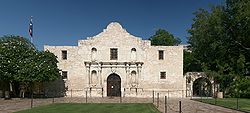
| Alamo Alamo Mission in San Antonio The Alamo, originally known as Mission San Antonio de Valero, is a former Roman Catholic mission and fortress compound, site of the Battle of the Alamo in 1836, and now a museum, in San Antonio, Texas.... |
 |
San Antonio San Antonio, Texas San Antonio is the seventh-largest city in the United States of America and the second-largest city within the state of Texas, with a population of 1.33 million. Located in the American Southwest and the south–central part of Texas, the city serves as the seat of Bexar County. In 2011,... 29.423524976°N 98.4857780488°W |
Bexar Bexar County, Texas As of the census of 2000, there were 1,392,931 people, 488,942 households, and 345,681 families residing in the county. The population density was 1,117 people per square mile . There were 521,359 housing units at an average density of 418 per square mile... |
Former mission and fortress compound; now a museum; built by the Spanish Empire in the 18th century; later used as a fortress in the 19th century; scene of the 1836 Battle of the Alamo | ||
| Apollo Mission Control Center | 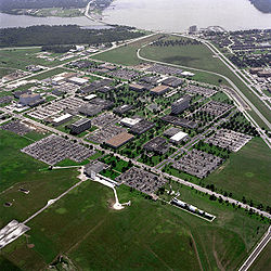 |
Houston Houston, Texas Houston is the fourth-largest city in the United States, and the largest city in the state of Texas. According to the 2010 U.S. Census, the city had a population of 2.1 million people within an area of . Houston is the seat of Harris County and the economic center of , which is the ... 29.5564711662°N 95.0884603169°W |
Harris Harris County, Texas As of the 2010 Census, the population of the county was 4,092,459, White Americans made up 56.6% of Harris County's population; non-Hispanic whites represented 33.0% of the population. Black Americans made up 18.9% of the population. Native Americans made up 0.7% of Harris County's population... |
NASA control center | ||
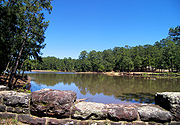
| Bastrop State Park Bastrop State Park Bastrop State Park is a state park in Bastrop County in central Texas. The park was established in 1938 and consists of stands of Loblolly Pines mixed with Post Oak and junipers.-History:... |
 |
Bastrop Bastrop, Texas -Demographics:As of the census of 2000, there are 5340 people in Bastrop, organized into 2034 households and 1336 families. The population density is 734.8 people per square mile . There are 2,239 housing units at an average density of 308.1 per square mile... |
Bastrop Bastrop County, Texas Bastrop County is a county located in the U.S. state of Texas. As of 2006, the population was 71,700. Its county seat is Bastrop. Bastrop County is named for Felipe Enrique Neri, Baron de Bastrop , an early Dutch settler who assisted Stephen F... |
NRHP 97001242. Perhaps it is Civilian Conservation Corps Civilian Conservation Corps The Civilian Conservation Corps was a public work relief program that operated from 1933 to 1942 in the United States for unemployed, unmarried men from relief families, ages 18–25. A part of the New Deal of President Franklin D... -built structures here that are the landmark. |
||
| Dealey Plaza Historic District Dealey Plaza Dealey Plaza , in the historic West End district of downtown Dallas, Texas , is the location of the assassination of John F. Kennedy on November 22, 1963... |
 |
Dallas Dallas, Texas Dallas is the third-largest city in Texas and the ninth-largest in the United States. The Dallas-Fort Worth Metroplex is the largest metropolitan area in the South and fourth-largest metropolitan area in the United States... |
Dallas Dallas County, Texas As of the census of 2000, there were 2,218,899 people, 807,621 households, and 533,837 families residing in the county. The population density was 2,523 people per square mile . There were 854,119 housing units at an average density of 971/sq mi... |
Site of Kennedy assassination and surrounding buildings that are rumored to have held additional assassins. | ||
| East End Historic District East End Historic District (Galveston, Texas) East End Historic District is a historic district in Galveston, Texas.It was declared a National Historic Landmark in 1976.-External links:* , at Historic American Building Survey... |
.jpg) |
Galveston Galveston, Texas Galveston is a coastal city located on Galveston Island in the U.S. state of Texas. , the city had a total population of 47,743 within an area of... |
Galveston Galveston County, Texas Galveston County is a county located in the U.S. state of Texas within the Houston–Sugar Land–Baytown metropolitan area. As of the 2010 U.S. Census, the population was 291,309. Its county seat is Galveston. League City is the largest city in Galveston County in terms of population; between... |
A historic district Historic district A historic district or heritage district is a section of a city which contains older buildings considered valuable for historical or architectural reasons. In some countries, historic districts receive legal protection from development.... |
||
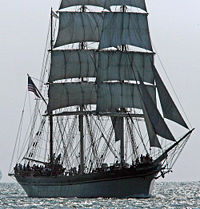
| ELISSA (Bark) Elissa (ship) The tall ship Elissa is a three-masted barque. She is currently moored in Galveston, Texas, and is one of the oldest ships sailing today.... |
 |
Galveston Galveston, Texas Galveston is a coastal city located on Galveston Island in the U.S. state of Texas. , the city had a total population of 47,743 within an area of... 29.3332550578°N 94.7774522093°W |
Galveston Galveston County, Texas Galveston County is a county located in the U.S. state of Texas within the Houston–Sugar Land–Baytown metropolitan area. As of the 2010 U.S. Census, the population was 291,309. Its county seat is Galveston. League City is the largest city in Galveston County in terms of population; between... |
Tall ship Tall ship A tall ship is a large, traditionally-rigged sailing vessel. Popular modern tall ship rigs include topsail schooners, brigantines, brigs and barques. "Tall Ship" can also be defined more specifically by an organization, such as for a race or festival.... launched in 1877 |
||
| Espada Aqueduct Espada Acequia The Espada Acequia, or Piedras Creek Aqueduct, was built by Franciscan friars in 1731 in what is now San Antonio, Texas, United States. It was built to supply irrigation water to the lands near Mission San Francisco de la Espada, today part of San Antonio Missions National Historical Park... |
 |
San Antonio San Antonio, Texas San Antonio is the seventh-largest city in the United States of America and the second-largest city within the state of Texas, with a population of 1.33 million. Located in the American Southwest and the south–central part of Texas, the city serves as the seat of Bexar County. In 2011,... |
Bexar Bexar County, Texas As of the census of 2000, there were 1,392,931 people, 488,942 households, and 345,681 families residing in the county. The population density was 1,117 people per square mile . There were 521,359 housing units at an average density of 418 per square mile... |
Built by Franciscan friars in 1731 to supply irrigation water to the lands near Mission San Francisco de la Espada | ||
| Fair Park Texas Centennial Buildings | 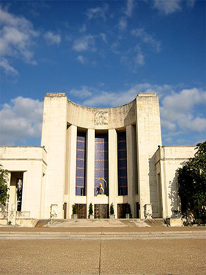 |
Dallas Dallas, Texas Dallas is the third-largest city in Texas and the ninth-largest in the United States. The Dallas-Fort Worth Metroplex is the largest metropolitan area in the South and fourth-largest metropolitan area in the United States... |
Dallas Dallas County, Texas As of the census of 2000, there were 2,218,899 people, 807,621 households, and 533,837 families residing in the county. The population density was 2,523 people per square mile . There were 854,119 housing units at an average density of 971/sq mi... |
NRHP 66000824. | ||
| Fort Belknap Fort Belknap (Newcastle, Texas) Fort Belknap, located near Newcastle, Texas, was established in 1851 by brevet Brigadier William G. Belknap to protect the Texas frontier against raids by the Kiowa and Comanche. It was the northernmost fort in a line from the Rio Grande to the Red River... |
 |
Newcastle Newcastle, Texas Newcastle is a city in Young County, Texas, United States. Following the beginning of coal mining in 1908, the town was established and named for the English coal town, Newcastle upon Tyne. Coal mining had ended by 1942... |
Young Young County, Texas As of the census of 2000, there were 17,943 people, 7,167 households, and 5,081 families residing in the county. The population density was 20 people per square mile . There were 8,504 housing units at an average density of 9 per square mile... |
NRHP 66000824 | ||
| Fort Brown Fort Brown Fort Brown was a military post of the United States Army in Texas during the later half of 19th century and the early part of the 20th century.-Early years:... |
Brownsville Brownsville, Texas Brownsville is a city in the southernmost tip of the state of Texas, in the United States. It is located on the northern bank of the Rio Grande, directly north and across the border from Matamoros, Tamaulipas, Mexico. Brownsville is the 16th largest city in the state of Texas with a population of... |
Cameron Cameron County, Texas Cameron County is the southernmost county located in the U.S. state of Texas. In 2010, its population was 406,220. Its county seat is Brownsville. Cameron was founded in 1848... |
Military post of the United States Army in Texas during the latter half of 19th century and the early part of the 20th century | |||
| Fort Concho Fort Concho Fort Concho is a National Historic Landmark owned and operated since 1935 by the city of San Angelo, the seat of Tom Green County in West Texas... |
 |
San Angelo San Angelo, Texas San Angelo is a city in the state of Texas. Located in West Central Texas it is the county seat of Tom Green County. As of 2010 according to the United States Census Bureau, the city had a total population of 93,200... |
Tom Green | Established as U.S. Army post in 1867; deactivated 1889; comprises most of the original fort | ||
| Fort Davis Fort Davis National Historic Site Fort Davis National Historic Site is a United States National Historic Site located in unincorporated Jeff Davis County, Texas. Located within the Davis Mountains of West Texas, the historic site was established in 1961 to protect one of the best remaining examples of a United States Army fort in... |
 |
Fort Davis Fort Davis, Texas Fort Davis is a census-designated place in Jeff Davis County, Texas, United States. The population was 1,050 at the 2000 census and 1,041 according to a 2007 estimate. It is the county seat of Jeff Davis County... |
Jeff Davis Jeff Davis County, Texas Jeff Davis County is a county in the U.S. state of Texas. It is named for Jefferson Davis, the president of the Confederate States of America. It is one of the nine counties that comprise the Trans-Pecos region of West Texas. In 2000, its population was 2,207, and 2,258 by 2009... |
1854 to 1891 Fort Davis protected immigrants, mail coaches, and freight wagons; controlled southern stem of the Great Comanche War Trail and Mescalero Apache war trails | ||
| Fort Richardson Fort Richardson, Texas Fort Richardson was an United States Army installation located one mile south of Jacksboro, Texas. Named in honor of Union General Israel B... |
 |
Jacksboro Jacksboro, Texas Jacksboro is a city in Jack County, Texas, United States. The population was 4,533 at the 2000 census. Jacksboro is located at the junction of U.S... |
Jack Jack County, Texas *Bryson*Jacksboro*Jermyn *Joplin *Perrin *Gibtown-See also:*National Register of Historic Places listings in Jack County, Texas-External links:*... |
Established 1867; abandoned 1878; renovated and reopened 1973 as historic park | ||
| Fort Sam Houston Fort Sam Houston Fort Sam Houston is a U.S. Army post in San Antonio, Texas.Known colloquially as "Fort Sam," it is named for the first President of the Republic of Texas, Sam Houston.... |
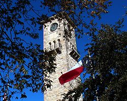 |
San Antonio San Antonio, Texas San Antonio is the seventh-largest city in the United States of America and the second-largest city within the state of Texas, with a population of 1.33 million. Located in the American Southwest and the south–central part of Texas, the city serves as the seat of Bexar County. In 2011,... |
Bexar Bexar County, Texas As of the census of 2000, there were 1,392,931 people, 488,942 households, and 345,681 families residing in the county. The population density was 1,117 people per square mile . There were 521,359 housing units at an average density of 418 per square mile... |
Active U.S. Army post; established 1870's | ||
| John Nance Garner House John Nance Garner House The John Nance Garner House, also known as John Nance Garner Museum or the Ettie R. Garner Memorial Building, located in Uvalde, Texas, USA was the home of American Vice-President John Nance Garner and his wife Ettie from 1920 until Ettie's death in 1948... |
 |
Uvalde Uvalde, Texas Uvalde is a city in and the county seat of Uvalde County, Texas, United States. The population was 14,929 at the 2000 census.Uvalde was founded by Reading Wood Black in 1853 as the town of Encina. In 1856, when the county was organized, the town was renamed Uvalde for Spanish governor Juan de... 29.212152°N 99.791837°W |
Uvalde Uvalde County, Texas Uvalde County is a county located in the U.S. state of Texas. In 2000, its population was 25,926. Its county seat is Uvalde. The county is named for Juan de Ugalde, the Spanish governor of Coahuila. Uvalde County was founded by Reading Wood Black who also founded the city of Uvalde,... |
Home of U.S. Vice-President John Nance Garner John Nance Garner John Nance Garner, IV , was the 32nd Vice President of the United States and the 44th Speaker of the United States House of Representatives .- Early life and family :... |
||
| Governor's Mansion (Austin) Texas Governor's Mansion The Texas Governor's Mansion, also known simply as Governor's Mansion is a historic home for the Governor of Texas in downtown Austin, Texas... |
.jpg) |
Austin Austin, Texas Austin is the capital city of the U.S. state of :Texas and the seat of Travis County. Located in Central Texas on the eastern edge of the American Southwest, it is the fourth-largest city in Texas and the 14th most populous city in the United States. It was the third-fastest-growing large city in... 30.272318°N 97.742708°W |
Travis Travis County, Texas As of 2009, the U.S. census estimates there were 1,026,158 people, 320,766 households, and 183,798 families residing in the county. The population density was 821 people per square mile . There were 335,881 housing units at an average density of 340 per square mile... |
First designated Texas historic landmark, damaged by arson June 8, 2008 | ||
| HA. 19 (Midget Submarine) HA. 19 (Japanese Midget Submarine) The HA. 19 is a historic Imperial Japanese Navy Type A Ko-hyoteki class midget submarine that was part of the Japanese attack on Pearl Harbor on December 7, 1941. Orders for this submarine were to enter Pearl Harbor... |
 |
Fredericksburg Fredericksburg, Texas Fredericksburg is the seat of Gillespie County, in the U.S. state of Texas. As of the 2010 Census estimate, the city had a population of 10, 530... |
Gillespie Gillespie County, Texas Gillespie County is a county located on the Edwards Plateau in the U.S. state of Texas. In 2010, its population was 24,837. It is located in the heart of the Texas Hill Country. Gillespie is named for Robert Addison Gillespie, who came to Texas in 1837. He was a Texas Ranger, an Indian fighter, a... |
Historic I.J.N. Ko-hyoteki class midget submarine; part of the Japanese attack on Pearl Harbor on December 7, 1941; grounded and captured | ||
| Hangar 9, Brooks Air Force Base |  |
San Antonio San Antonio, Texas San Antonio is the seventh-largest city in the United States of America and the second-largest city within the state of Texas, with a population of 1.33 million. Located in the American Southwest and the south–central part of Texas, the city serves as the seat of Bexar County. In 2011,... 29.3421286053°N 98.4436447703°W |
Bexar Bexar County, Texas As of the census of 2000, there were 1,392,931 people, 488,942 households, and 345,681 families residing in the county. The population density was 1,117 people per square mile . There were 521,359 housing units at an average density of 418 per square mile... |
NRHP 70000895. Hangar 9, Brooks Air Force Base Brooks City-Base Brooks City-Base was a United States Air Force facility located in San Antonio, Texas, southeast of Downtown San Antonio.In 2002 Brooks Air Force Base was renamed Brooks City-Base when the property was conveyed to the Brooks Development Authority as part of a unique project between local, state,... - San Antonio San Antonio, Texas San Antonio is the seventh-largest city in the United States of America and the second-largest city within the state of Texas, with a population of 1.33 million. Located in the American Southwest and the south–central part of Texas, the city serves as the seat of Bexar County. In 2011,... |
||
| Harrell Site Harrell Site The Harrell Site, also known as the M.D. Harrell Site, is a Native American archeological site near South Bend in southern Young County, Texas. The site was discovered in 1937 as a result of survey work for the area to be inundated by the Possum Kingdom Lake. The site occupies the first and second... |
image pending | South Bend South Bend, Texas South Bend is an unincorporated community in Young County, Texas, United States. According to the Handbook of Texas, the community had an estimated population of 140 in 2000.-Geography:... |
Young Young County, Texas As of the census of 2000, there were 17,943 people, 7,167 households, and 5,081 families residing in the county. The population density was 20 people per square mile . There were 8,504 housing units at an average density of 9 per square mile... |
NRHP 66000825 | ||
| Highland Park Shopping Village Highland Park Village Highland Park Village is an upscale shopping mall located at the southwest corner of Mockingbird Lane and Preston Road in Highland Park, Texas and was the first self-contained shopping center in America. The Highland Park Village was declared a National Historic Landmark in 2000.-History:Mr.... |
 |
Highland Park Highland Park, Texas Highland Park is a town in central Dallas County, Texas, United States. The population was 8,842 at the 2000 census. Located between the Dallas North Tollway and U.S. Route 75 , four miles north of downtown Dallas.... |
Dallas Dallas County, Texas As of the census of 2000, there were 2,218,899 people, 807,621 households, and 533,837 families residing in the county. The population density was 2,523 people per square mile . There were 854,119 housing units at an average density of 971/sq mi... |
Second shopping mall constructed in the U.S.; opened in 1931; still in operation | ||
| J A Ranch (Goodnight Ranch) JA Ranch The JA Ranch, jointly founded by John George Adair and Charles Goodnight, is the oldest privately owned cattle ranch in the Palo Duro Canyon section of the Texas Panhandle southeast of Amarillo. At its peak size in 1883, the JA, still run by descendants of the Adair family, encompassed some of... |
image pending | Amarillo Amarillo, Texas Amarillo is the 14th-largest city, by population, in the state of Texas, the largest in the Texas Panhandle, and the seat of Potter County. A portion of the city extends into Randall County. The population was 190,695 at the 2010 census... |
Armstrong Armstrong County, Texas Armstrong County is a county located in the U.S. state of Texas, and was formed in 1876 from Bexar County. It is part of the Amarillo metropolitan area. As of 2000, the population is 2,148. Its county seat is Claude. Armstrong is named for one of several Texas pioneer families named Armstrong... |
NRHP 66000807. | ||
| Lyndon Baines Johnson Boyhood Home Lyndon B. Johnson National Historical Park Lyndon B. Johnson National Historical Park is a United States National Historical Park in central Texas about 50 miles west of Austin in the Texas Hill Country. The park protects the birthplace, home, ranch and final resting place of Lyndon B. Johnson, 36th President of the United States... |
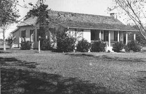 |
Johnson City Johnson City, Texas Johnson City is a city in Blanco County, Texas, United States. The population was 1,191 at the 2000 census. It is the county seat of Blanco County. It was the hometown of President Lyndon Johnson and was founded by James Polk Johnson, nephew of Samuel Ealy Johnson, Sr., cousin to President Johnson.... |
Blanco Blanco County, Texas Blanco County is a county located on the Edwards Plateau in the U.S. state of Texas. As of 2010, the population is 10,497. Its county seat is Johnson City. Blanco is named for the Blanco River which traverses the county. The State of Texas formed Blanco County in 1858 from portions of Burnet,... |
Boyhood home of President Lyndon B. Johnson Lyndon B. Johnson Lyndon Baines Johnson , often referred to as LBJ, was the 36th President of the United States after his service as the 37th Vice President of the United States... |
||
| King Ranch King Ranch King Ranch, located in south Texas between Corpus Christi and Brownsville, is one of the world's largest ranches. The ranch, founded in 1853 by Captain Richard King and Gideon K. Lewis, includes portions of six Texas counties, including most of Kleberg County and much of Kenedy County, with... |
image pending | Kingsville Kingsville, Texas As of the census of 2000, there were 25,575 people, 8,943 households, and 6,134 families residing in the city. The population density was 1,848.8 people per square mile . There were 10,427 housing units at an average density of 753.8 per square mile... |
Kenedy, Kleberg, Nueces, and Willacy | Largest ranch in the U.S.; larger than Rhode Island; founded in 1853 | ||
| Landergin Mesa Landergin Mesa Landergin Mesa, near Adrian, Texas, is an archeological site, preserving some of the most significant Texas Panhandle culture ruins.... |
image pending | Vega Vega, Texas Vega is a city in Oldham County, Texas, United States. It is the county seat of Oldham County . The population was 936 at the 2000 census. A July 1, 2009, U.S. Census Bureau estimate placed the population at 896.... |
Oldham | NRHP 66000821 | ||
| USS Lexington (Aircraft Carrier) USS Lexington (CV-16) USS Lexington , known as "The Blue Ghost", is one of 24 s built during World War II for the United States Navy. The ship, the fifth US Navy ship to bear the name, is named in honor of the Revolutionary War Battle of Lexington... |
 |
Corpus Christi Corpus Christi, Texas Corpus Christi is a coastal city in the South Texas region of the U.S. state of Texas. The county seat of Nueces County, it also extends into Aransas, Kleberg, and San Patricio counties. The MSA population in 2008 was 416,376. The population was 305,215 at the 2010 census making it the... |
Nueces | "The Blue Ghost"; Essex-class aircraft carrier; fifth United States Naval ship named in honor of the Revolutionary War Battle of Lexington | ||
| Lubbock Lake Site Lubbock Lake Landmark Lubbock Lake Landmark, also known as Lubbock Lake Site, is an important archeological site and natural history preserve in the city of Lubbock, Texas. The preserve is 336 acres and is a protected state and federal landmark. There is evidence of ancient people and extinct animals at Lubbock Lake... |
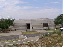 |
Lubbock Lubbock, Texas Lubbock is a city in and the county seat of Lubbock County, Texas, United States. The city is located in the northwestern part of the state, a region known historically as the Llano Estacado, and the home of Texas Tech University and Lubbock Christian University... |
Lubbock | NRHP 71000948. | ||
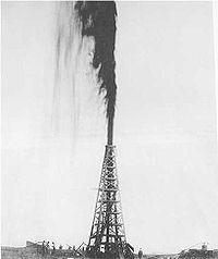
| Lucas Gusher, Spindletop Oil Field Spindletop Spindletop is a salt dome oil field located in the southern portion of Beaumont, Texas in the United States. The Spindletop dome was derived from the Louann Salt evaporite layer of the Jurassic geologic period. On January 10, 1901, a well at Spindletop struck oil . The new oil field soon produced... |
 |
Beaumont Beaumont, Texas Beaumont is a city in and county seat of Jefferson County, Texas, United States, within the Beaumont–Port Arthur Metropolitan Statistical Area. The city's population was 118,296 at the 2010 census. With Port Arthur and Orange, it forms the Golden Triangle, a major industrial area on the... |
Jefferson Jefferson County, Texas Jefferson County is a county located in the state of Texas, United States. As of 2000, the population was 252,051. Its county seat is Beaumont, and it is named for the former U.S... |
NRHP 66000818 | ||
| Majestic Theatre | .jpg) |
San Antonio San Antonio, Texas San Antonio is the seventh-largest city in the United States of America and the second-largest city within the state of Texas, with a population of 1.33 million. Located in the American Southwest and the south–central part of Texas, the city serves as the seat of Bexar County. In 2011,... 29.426460°N 98.490713°W |
Bexar Bexar County, Texas As of the census of 2000, there were 1,392,931 people, 488,942 households, and 345,681 families residing in the county. The population density was 1,117 people per square mile . There were 521,359 housing units at an average density of 418 per square mile... |
NRHP 75001952 | ||
| Mission Concepcion Mission Concepcion Mission Nuestra Señora de la Purísima Concepción de Acuña was established in 1716 as Nuestra Señora de la Purísima Concepción de los Hainais in East Texas. The mission was moved in 1731 to San Antonio... |
.jpg) |
San Antonio San Antonio, Texas San Antonio is the seventh-largest city in the United States of America and the second-largest city within the state of Texas, with a population of 1.33 million. Located in the American Southwest and the south–central part of Texas, the city serves as the seat of Bexar County. In 2011,... 29.390888°N 98.492760°W |
Bexar Bexar County, Texas As of the census of 2000, there were 1,392,931 people, 488,942 households, and 345,681 families residing in the county. The population density was 1,117 people per square mile . There were 521,359 housing units at an average density of 418 per square mile... |
NRHP 70000740. See also San Antonio Missions National Historical Park San Antonio Missions National Historical Park San Antonio Missions National Historical Park preserves four of the five Spanish frontier missions in San Antonio, Texas. These outposts were established by Catholic religious orders to spread Christianity among the local natives... |
||
| Palmito Ranch Battlefield Palmito Ranch Battlefield The Palmito Ranch Battlefield preserves the location of the last major battle of the American Civil War. Fought near Brownsville, Texas, the Battle of Palmito Ranch was a victory for the Confederacy. Today the area is relatively unchanged and the marshy, windswept prairies are almost the same as... |
image pending | Brownsville Brownsville, Texas Brownsville is a city in the southernmost tip of the state of Texas, in the United States. It is located on the northern bank of the Rio Grande, directly north and across the border from Matamoros, Tamaulipas, Mexico. Brownsville is the 16th largest city in the state of Texas with a population of... |
Cameron Cameron County, Texas Cameron County is the southernmost county located in the U.S. state of Texas. In 2010, its population was 406,220. Its county seat is Brownsville. Cameron was founded in 1848... |
See Battle of Palmito Ranch Battle of Palmito Ranch The Battle of Palmito Ranch, also known as the Battle of Palmito Hill and the Battle of Palmetto Ranch, was fought on May 12–13, 1865, during the American Civil War. It was the last major clash of arms in the war... . |
||
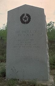
| Palo Alto Battlefield Palo Alto Battlefield National Historic Site Palo Alto Battlefield National Historical Park near Brownsville, Texas preserves the grounds of the May 8, 1846, Battle of Palo Alto. It was the first major conflict in a border dispute that soon precipitated the Mexican-American War. The United States Army victory here made the invasion of Mexico... |
 |
Brownsville Brownsville, Texas Brownsville is a city in the southernmost tip of the state of Texas, in the United States. It is located on the northern bank of the Rio Grande, directly north and across the border from Matamoros, Tamaulipas, Mexico. Brownsville is the 16th largest city in the state of Texas with a population of... |
Cameron Cameron County, Texas Cameron County is the southernmost county located in the U.S. state of Texas. In 2010, its population was 406,220. Its county seat is Brownsville. Cameron was founded in 1848... |
NRHP 66000812. | ||
| Plainview Site Plainview Site The Plainview Site is a Native American archeological site near Plainview, Texas. Plainview Point spear tips, commonly found in the Central Plains, were first described here, and date to 7800-5100 BC.... |
image pending | Plainview Plainview, Texas Plainview is a city in and the county seat of Hale County, Texas, United States. The population was 22,336 at the 2000 census.-Geography:Plainview is located at .... |
Hale Hale County, Texas Hale County is a county located in the U.S. state of Texas. In 2000, its population was 36,602. It was organized in 1888, and is named for Lt. John C. Hale, a hero of the Battle of San Jacinto. The seat of the county is Plainview. It is home of the noted former Hale County Judge, Judge Bill... |
NRHP 66000814. | ||
| Porter Farm Porter Farm The Porter Farm, also known as Walter C. Porter Farm, near Terrell, Texas was the site of the first cooperative farm demonstration, organized by Dr. Seaman A. Knapp in 1903. The project successfully demonstrated methods expanding crop production. From this foundation project developed the U.S... |
image pending | Terrell Terrell, Texas Terrell is a city in Kaufman County, Texas, United States, and a southeastern suburb of Dallas. As of the 2000 census, the city population was 13,606... |
Kaufman Kaufman County, Texas As of the census of 2000, there were 71,313 people, 24,367 households, and 19,225 families residing in the county. The population density was 91/sq mi . There were 26,133 housing units at an average density of 33/sq mi... |
|||
| Presidio Nuestra Senora De Loreto De La Bahia | 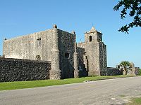 |
Goliad Goliad, Texas Goliad is a city in Goliad County, Texas, United States. It had a population of 1975 at the 2000 census. Founded on the San Antonio River, it is the county seat of Goliad County. It is part of the Victoria, Texas Metropolitan Statistical Area. Goliad is located on U.S. Highway 59, named also for... |
Goliad | NRHP 67000024 Chapel and former fortress compound; now a museum; built by the Spanish Empire in the 18th century; also used as a fortress in the 19th century; scene of the 1836 Battle of Goliad Battle of Goliad The Battle of Goliad was the second skirmish of the Texas Revolution. In the early-morning hours of October 10, 1835, rebellious Texas settlers attacked the Mexican Army soldiers garrisoned at Presidio La Bahía, a fort near the Mexican Texas settlement of Goliad... and Goliad Massacre Goliad massacre The Goliad Massacre was an execution of Republic of Texas soldiers and their commander, James Fannin, by Mexico, reluctantly carried out by General Jose de Urrea.-Background:... |
||
| Randolph Field Historic District Randolph Field Historic District Randolph Field Historic District is a historic district located within Randolph Air Force Base, near San Antonio, Texas. The site includes 350 contributing buildings, sites, and structures, and 47 non-contributing ones; in the Mission Revival, Spanish Colonial Revival, and Streamline Moderne... |
 |
San Antonio San Antonio, Texas San Antonio is the seventh-largest city in the United States of America and the second-largest city within the state of Texas, with a population of 1.33 million. Located in the American Southwest and the south–central part of Texas, the city serves as the seat of Bexar County. In 2011,... |
Bexar Bexar County, Texas As of the census of 2000, there were 1,392,931 people, 488,942 households, and 345,681 families residing in the county. The population density was 1,117 people per square mile . There were 521,359 housing units at an average density of 418 per square mile... |
See Randolph Air Force Base Randolph Air Force Base Randolph Air Force Base is a United States Air Force base located east-northeast of San Antonio, Texas. The base is under the jurisdiction of the 902d Mission Support Group, Air Education and Training Command .... |
||
| Samuel T. Rayburn House Samuel T. Rayburn House Samuel T. Rayburn House, also known as The Home Place and Sam Rayburn House Museum, was home to Samuel T. Rayburn, a famously effective Speaker of the United States House of Representatives.It was declared a National Historic Landmark in 1976.... |
Bonham Bonham, Texas Bonham is a city in Fannin County, Texas, United States. The population was 10,127 at the 2010 census. It is the county seat of Fannin County. James Bonham sought the aid of James Fannin at the Battle of the Alamo.... 33.5679670415°N 96.2071737392°W |
Fannin Fannin County, Texas As of the census of 2000, there were 31,242 people, 11,105 households, and 7,984 families residing in the county. The population density was 35 people per square mile . There were 12,887 housing units at an average density of 14 per square mile... |
A home of Samuel T. Rayburn | |||
| Resaca De La Palma Battlefield Resaca De La Palma Battlefield The Resaca de la Palma Battlefield is the site in Brownsville, Texas, where American forces under General Zachary Taylor engaged Mexican forces under General Mariano Arista on May 9, 1846 in the Battle of Resaca de la Palma. In the early stages of the Mexican-American War, and immediately... |
.jpg) |
Brownsville Brownsville, Texas Brownsville is a city in the southernmost tip of the state of Texas, in the United States. It is located on the northern bank of the Rio Grande, directly north and across the border from Matamoros, Tamaulipas, Mexico. Brownsville is the 16th largest city in the state of Texas with a population of... |
Cameron Cameron County, Texas Cameron County is the southernmost county located in the U.S. state of Texas. In 2010, its population was 406,220. Its county seat is Brownsville. Cameron was founded in 1848... |
NRHP 66000813. Resaca de La Palma Battlefield - Brownsville Brownsville, Texas Brownsville is a city in the southernmost tip of the state of Texas, in the United States. It is located on the northern bank of the Rio Grande, directly north and across the border from Matamoros, Tamaulipas, Mexico. Brownsville is the 16th largest city in the state of Texas with a population of... |
||
| Roma Historic District Roma Historic District The Roma Historic District in Roma, Texas preserves an intact example of a border town in the lower Rio Grande valley. The town was an important port and transshipment point on the Rio Grande from 1829 to the 1880s.... |
.jpg) |
Roma Roma, Texas Roma is a city in Starr County, Texas, United States. The population was 9,765 at the 2010 census. The city is located along the Rio Grande, across from Ciudad Miguel Alemán in Tamaulipas, Mexico.... |
Starr Starr County, Texas Starr County is a county located in the U.S. state of Texas. In 2010, its population was 60,968. Its county seat is Rio Grande City. The county is named for James Harper Starr, who served as Secretary of the Treasury of the Republic of Texas. It is part of the Rio Grande City-Roma, TX,... |
NRHP 72001371 | ||
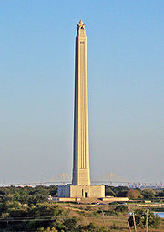
| San Jacinto Battlefield San Jacinto Monument The San Jacinto Monument is a high column located on the Houston Ship Channel in unincorporated Harris County, Texas near the city of La Porte. The monument is topped with a 220-ton star that commemorates the site of the Battle of San Jacinto, the decisive battle of the Texas Revolution... |
 |
Houston Houston, Texas Houston is the fourth-largest city in the United States, and the largest city in the state of Texas. According to the 2010 U.S. Census, the city had a population of 2.1 million people within an area of . Houston is the seat of Harris County and the economic center of , which is the ... |
Harris Harris County, Texas As of the 2010 Census, the population of the county was 4,092,459, White Americans made up 56.6% of Harris County's population; non-Hispanic whites represented 33.0% of the population. Black Americans made up 18.9% of the population. Native Americans made up 0.7% of Harris County's population... |
NRHP 66000815. | ||
| Space Environment Simulation Laboratory, Chambers A and B Space Environment Simulation Laboratory The Space Environment Simulation Laboratory in Building 32 at the Lyndon B. Johnson Space Center was used for the testing of Apollo Program equipment in a space environment. It simulated the vacuum and thermal environments that would be encountered by spacecraft in use. The laboratory continues... |
Houston Houston, Texas Houston is the fourth-largest city in the United States, and the largest city in the state of Texas. According to the 2010 U.S. Census, the city had a population of 2.1 million people within an area of . Houston is the seat of Harris County and the economic center of , which is the ... 29.5590030309°N 95.0880996347°W |
Harris Harris County, Texas As of the 2010 Census, the population of the county was 4,092,459, White Americans made up 56.6% of Harris County's population; non-Hispanic whites represented 33.0% of the population. Black Americans made up 18.9% of the population. Native Americans made up 0.7% of Harris County's population... |
NRHP 85002810. | |||
| Spanish Governor's Palace Spanish Governor's Palace The Spanish Governor's Palace is a National Historic Landmark in the city of San Antonio, Texas. Built in the first half of the 18th century, it was originally intended to protect the nearby San Antonio de Valero Mission and the growing colony. It is considered the sole remaining example of an... |
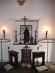 |
San Antonio San Antonio, Texas San Antonio is the seventh-largest city in the United States of America and the second-largest city within the state of Texas, with a population of 1.33 million. Located in the American Southwest and the south–central part of Texas, the city serves as the seat of Bexar County. In 2011,... 29.425082°N 98.494570°W |
Bexar Bexar County, Texas As of the census of 2000, there were 1,392,931 people, 488,942 households, and 345,681 families residing in the county. The population density was 1,117 people per square mile . There were 521,359 housing units at an average density of 418 per square mile... |
NRHP 70000741 | ||
| Strand Historic District | 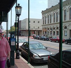 |
Galveston Galveston, Texas Galveston is a coastal city located on Galveston Island in the U.S. state of Texas. , the city had a total population of 47,743 within an area of... |
Galveston Galveston County, Texas Galveston County is a county located in the U.S. state of Texas within the Houston–Sugar Land–Baytown metropolitan area. As of the 2010 U.S. Census, the population was 291,309. Its county seat is Galveston. League City is the largest city in Galveston County in terms of population; between... |
NRHP 70000748. | ||
| TEXAS (USS) USS Texas (BB-35) USS Texas , the second ship of the United States Navy named in honor of the U.S. state of Texas, is a . The ship was launched on 18 May 1912 and commissioned on 12 March 1914.... |
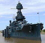 |
Houston Houston, Texas Houston is the fourth-largest city in the United States, and the largest city in the state of Texas. According to the 2010 U.S. Census, the city had a population of 2.1 million people within an area of . Houston is the seat of Harris County and the economic center of , which is the ... 29.754217005°N 95.0894991405°W |
Harris Harris County, Texas As of the 2010 Census, the population of the county was 4,092,459, White Americans made up 56.6% of Harris County's population; non-Hispanic whites represented 33.0% of the population. Black Americans made up 18.9% of the population. Native Americans made up 0.7% of Harris County's population... |
NRHP 76002039. | ||
| Texas State Capitol Texas State Capitol The Texas State Capitol is located in Austin, Texas, and is the fourth building to be the house of Texas government in Austin. It houses the chambers of the Texas Legislature and the office of the governor of Texas. It was designed originally during 1881 by architect Elijah E. Myers, and was... |
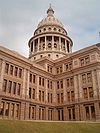 |
Austin Austin, Texas Austin is the capital city of the U.S. state of :Texas and the seat of Travis County. Located in Central Texas on the eastern edge of the American Southwest, it is the fourth-largest city in Texas and the 14th most populous city in the United States. It was the third-fastest-growing large city in... 30.272734°N 97.741078°W |
Travis Travis County, Texas As of 2009, the U.S. census estimates there were 1,026,158 people, 320,766 households, and 183,798 families residing in the county. The population density was 821 people per square mile . There were 335,881 housing units at an average density of 340 per square mile... |
NRHP 70000770. | ||
| Trevino-Uribe Rancho | 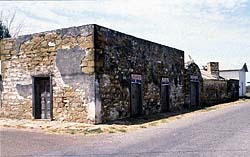 |
San Ygnacio |
Zapata | NRHP 73001988. | ||
| Woodland Woodland (Huntsville, Texas) Woodland, in Huntsville, Texas, was the residence of Sam Houston from 1847 to 1859. The clapboard-over-log house is on the grounds of Sam Houston State University, and is part of the Sam Houston Memorial Museum.-External links:*... |
image pending | Huntsville Huntsville, Texas Huntsville is a city in and the county seat of Walker County, Texas, United States. The population was 35,508 at the 2010 census. It is the center of the Huntsville micropolitan area.... |
Walker Walker County, Texas Walker County is a county located in the U.S. state of Texas. In 2010, its population was 67,861. Its county seat is Huntsville.Initially, Walker County was named for Robert J. Walker, a legislator from Mississippi who introduced into the United States Congress the resolution to annex Texas... |
NRHP 74002097. Home of Sam Houston Sam Houston Samuel Houston, known as Sam Houston , was a 19th-century American statesman, politician, and soldier. He was born in Timber Ridge in the Shenandoah Valley of Virginia, of Scots-Irish descent. Houston became a key figure in the history of Texas and was elected as the first and third President of... |
Other National Park Service areas in Texas
- Alibates Flint Quarries National MonumentAlibates Flint Quarries National MonumentAlibates Flint Quarries National Monument is a U.S. National Monument in the State of Texas. For thousands of years, people came to the red bluffs above the Canadian River for flint, vital to their existence. Demand for the high quality, rainbow-hued flint is reflected in the distribution of...
- Chamizal National MemorialChamizal National MemorialChamizal National Memorial, located in El Paso, Texas, along the United States–Mexico international border, commemorates the peaceful settlement of the Chamizal boundary dispute....
- San Antonio Missions National Historical ParkSan Antonio Missions National Historical ParkSan Antonio Missions National Historical Park preserves four of the five Spanish frontier missions in San Antonio, Texas. These outposts were established by Catholic religious orders to spread Christianity among the local natives...
Former NHLs in Texas
- In Addition: - Port of Brownsville - designated June 29, 1990 (located in New Orleans), designation withdrawn August 7, 2001 (located in Port Brownsville).
See also
- List of National Historic Landmarks by state
- List of Registered Historic Places in Texas

