List of Ultras in Antarctica
Encyclopedia
This is a list of all the Ultra prominent peak
s (with topographic prominence
greater than 1,500 metres) in Antarctica. Some islands in the South Atlantic have also been included and can be found at the end of the list.


Ultra prominent peak
An ultra prominent peak, or Ultra for short, is a mountain with a topographic prominence of or more. There are a total of roughly 1,524 such peaks in the world. Some are famous even to non-climbers, such as Mount Everest, Aconcagua, and Mount McKinley , while others are much more obscure...
s (with topographic prominence
Topographic prominence
In topography, prominence, also known as autonomous height, relative height, shoulder drop , or prime factor , categorizes the height of the mountain's or hill's summit by the elevation between it and the lowest contour line encircling it and no higher summit...
greater than 1,500 metres) in Antarctica. Some islands in the South Atlantic have also been included and can be found at the end of the list.
Antarctica


| No | Peak | Country | Elevation (m) | Prominence (m) | Col (m) |
|---|---|---|---|---|---|
| 1 | Vinson Massif Vinson Massif Vinson Massif is the highest mountain of Antarctica, lying in the Sentinel Range of the Ellsworth Mountains, which stand above the Ronne Ice Shelf near the base of the Antarctic Peninsula. The massif is located about from the South Pole and is about long and wide. At the highest point is Mount... |
3800 | 0 | ||
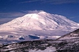
| 2 | Mount Erebus Mount Erebus Mount Erebus in Antarctica is the southernmost historically active volcano on Earth, the second highest volcano in Antarctica , and the 6th highest ultra mountain on an island. With a summit elevation of , it is located on Ross Island, which is also home to three inactive volcanoes, notably Mount... |
(Ross Island Ross Island Ross Island is an island formed by four volcanoes in the Ross Sea near the continent of Antarctica, off the coast of Victoria Land in McMurdo Sound.-Geography:... ) |
3,794 | 3,794 | 0 |
| 3 | Mount Siple Mount Siple Mount Siple is a potentially active shield volcano, rising to and dominating the northwest part of Siple Island, which is separated from the Bakutis Coast, Marie Byrd Land, by the Getz Ice Shelf. Its youthful appearance strongly suggests that it last erupted in Holocene. It is capped by a summit... |
(Siple Island Siple Island Siple Island is a long snow-covered island lying east of Wrigley Gulf along the Getz Ice Shelf off Bakutis Coast of Marie Byrd Land, Antarctica... ) |
3,110 | 3,110 | 0 |
| 4 | Mount Stephenson Mount Stephenson Mount Stephenson a mountain in Antarctica. It is located in the Douglas Range, standing at the heads of Toynbee Glacier and Sedgwick Glacier 8 miles west of George VI Sound, on the east side of Alexander Island within the British Antarctic Territory... |
(Alexander Island Alexander Island Alexander Island or Alexander I Island or Alexander I Land or Alexander Land is the largest island of Antarctica, with an area of lying in the Bellingshausen Sea west of the base of the Antarctic Peninsula, from which it is separated by Marguerite Bay and George VI Sound. Alexander Island lies off... ) |
2,987 | 2,987 | 0 |
| 5 | Mount Francais Mount Francais Mount Francais is a mountain which forms the summit of Anvers Island, Antarctica standing southeast of the center of the island and 6 miles north of Borgen Bay. Mount Francais has an elevation of and is part of the Trojan mountain range.-History:... |
(Anvers Island Anvers Island Anvers Island or Antwerp Island or Antwerpen Island or Isla Amberes is a high, mountainous island long, which is the largest feature in the Palmer Archipelago, lying southwest of Brabant Island at the southwestern end of the group. Anvers Island is located at... ) |
2,760 | 2,760 | 0 |
| 6 | Mount Minto | 4,165 | 2,616 | 1549 | |
| 7 | Mount Kirkpatrick Mount Kirkpatrick Mount Kirkpatrick is a lofty, generally ice-free mountain in Antarctica's Queen Alexandra Range. Located 8 km west of Mount Dickerson, Mt. Kirkpatrick is the highest point in the Queen Alexandra Range, as well as in its parent range, the Transantarctic Mountains... |
4,528 | 2,601 | 1927 | |
| 8 | Mount Parry Mount Parry Mount Parry is a mountain which rises eastward of Minot Point and dominates the central portion of Brabant Island, in the Palmer Archipelago. The feature appears to have been named by Captain Henry Foster, Royal Navy, of the Chanticleer expedition in 1829 and since has gained international usage.... |
(Brabant Island Brabant Island Brabant Island is the second largest island of the Palmer Archipelago within the British Antarctic Territory, lying between Anvers Island and Liège Island. Brabant Island is located at . Brabant Island is long in a north-south direction, wide, and rises to in Mount Parry... ) |
2,520 | 2,520 | 0 |
| 9 | Mount Sidley Mount Sidley Mount Sidley is the highest volcano in Antarctica, a member of the Volcanic Seven Summits, with a summit elevation of . It is a massive, mainly snow-covered shield volcano which is the highest and most imposing of the five extinct volcanic mountains that comprise the Executive Committee Range of... |
4,285 | 2,517 | 1768 | |
| 10 | Mount Miller | 4,160 | 2,354 | 1806 | |
| 11 | Mount Lister Mount Lister Mount Lister is a massive mountain, high, forming the highest point in the Royal Society Range of Victoria Land. It was discovered by the British National Antarctic Expedition which named it for Lord Joseph Lister, President of the Royal Society, 1895–1900.... |
4,025 | 2,325 | 1700 | |
| 12 | Mount Gaudry Mount Gaudry Mount Gaudry is a mountain, 2,315 m, rising close southwest of Mount Barre and 5 nautical miles north-northwest of Mount Liotard in the south part of Adelaide Island. Discovered by the French Antarctic Expedition, 1903–05, under Charcot who named it after Albert Gaudry, prominent French... |
(Adelaide Island Adelaide Island Adelaide Island or Isla Adelaida or Isla Belgrano is a large, mainly ice-covered island, long and wide, lying at the north side of Marguerite Bay off the west coast of the Antarctic Peninsula. The island lies within the Argentine, British and Chilean Antarctic claims, at .Adelaide Island was... ) |
2,315 | 2,315 | 0 |
| 13 | Mount Irving Mount Irving Mount Irving is a mountain rising to ca. that is the dominant elevation in the southern part of Clarence Island, in the South Shetland Islands. A prominent feature, the mountain doubtless was known to sealers in the area in the 1820s. Named by United Kingdom Antarctic Place-Names Committee for... |
(Clarence Island Clarence Island (South Shetland Islands) Clarence Island is long and the easternmost of the South Shetland Islands of the British Antarctic Territory. The name dates back to at least 1821 and is now established in international usage. Ernest Shackleton saw Clarence Island on his famous boat voyage but landed on Elephant Island... ) |
2,300 | 2,300 | 0 |
| 14 | Mount Jackson Mount Jackson (Antarctica) Mount Jackson is a massive mountain that dominates the upland in the southern part of the Antarctic Peninsula. It rises to a majestic summit peak on south and east, while the north flank is occupied by a vast cirque. Alternate names for the mountain include Mount Andrew Jackson and Mount Ernest... |
3,184 | 2,187 | 997 | |
| 15 | Mount Takahe Mount Takahe Mount Takahe is a large, snow covered shield volcano standing 64 km SE of Toney Mountain in Marie Byrd Land, Antarctica. It is roughly circular, about 29 km across, and has a caldera up to 8 km wide. At 780 cubic km, it is a massive volcano... |
3,460 | 2,134 | 1316 | |
| 16 | Mount Foster Mount Foster Mount Foster is a peak rising to 2105 m in the Imeon Range on Smith Island in the South Shetland Islands, Antarctica. It is the highest point of the South Shetland Islands archipelago.... |
(Smith Island Smith Island (South Shetland Islands) Smith Island is long and wide, lying west of Deception Island in the South Shetland Islands of the British Antarctic Territory. Surface area .... ) |
2,105 | 2,105 | 0 |
| 17 | Mount Markham Mount Markham Mount Markham is a majestic twin-peaked massif, 4,350 and 4,280 m, surmounting the north end of Antarctica's Markham Plateau. Discovered by the British National Antarctic Expedition , it is named for Sir Clements Markham, who, as President of the Royal Geographical Society, planned the expedition... |
4,350 | 2,103 | 2247 | |
| 18 | Gora Georgia Pobedanosca | 2,896 | 2,058 | 838 | |
| 19 | Mount Murphy Mount Murphy Mount Murphy is a massive, snow-covered and highly eroded shield volcano with steep, rocky slopes. It is directly south of Bear Peninsula, Marie Byrd Land. The mountain is bounded by the Smith, Pope and Haynes Glaciers.... |
2,705 | 2,055 | 650 | |
| 20 | Hawkes Heights Hawkes Heights Hawkes Heights is the heights that dominate the south part of Coulman Island and mark the island's summit, in the Ross Sea. Named by New Zealand Geological Survey Antarctic Expedition , 1958–59, for Captain William M. Hawkes, U.S... |
(Coulman Island Coulman Island Coulman Island is an ice-covered island, composed of several connected shield volcanos in the Ross Sea off Antarctica. The Coulman caldera, wide and deep, can be found on the south end of the island. Emperor penguins inhabit this island. Coulman Island lies within the boundaries of Ross... ) |
2,000 | 2,000 | 0 |
| 21 | Toney Mountain Toney Mountain Toney Mountain is an elongated snow-covered shield volcano, 60 km long and rising to 3,595 m in Richmond Peak, located 56 km SW of Kohler Range in Marie Byrd Land... |
3,595 | 1,946 | 1649 | |
| 22 | unnamed | (Alexander Island Alexander Island Alexander Island or Alexander I Island or Alexander I Land or Alexander Land is the largest island of Antarctica, with an area of lying in the Bellingshausen Sea west of the base of the Antarctic Peninsula, from which it is separated by Marguerite Bay and George VI Sound. Alexander Island lies off... ) |
2,486 | 1,939 | 547 |
| 23 | Mount Murchison Mount Murchison Mount Murchison may refer to:In Antarctica* Mount Murchison , Antarctica* Mount Murchison , the highest peak in the Mountaineer Range, AntarcticaIn Australia* Mount Murchison In Canada* Mount Murchison... |
3,501 | 1,927 | 1574 | |
| 24 | Mount Supernal Mount Supernal Mount Supernal is a large double summit mountain surmounting the southeast corner of Hercules Neve and the heads of the Gair and Meander Glaciers, in Victoria Land, Antarctica. The feature has at times been mistaken for Mount Murchison... |
3,655 | 1,804 | 1851 | |
| 25 | Mount Kaplan Mount Kaplan Mount Kaplan is a massive mountain, the highest in the Hughes Range of Antarctica, standing 5 km southeast of Mount Wexler.The mountain was discovered and photographed by Admiral Byrd on the Baselaying Flight of November 18, 1929, and surveyed by A.P. Crary in 1957–58. Crary named it for... |
4,230 | 1,783 | 2447 | |
| 26 | Mount Frakes Mount Frakes Mount Frakes is a prominent shield volcano marking the highest elevation in the Crary Mountains, in Marie Byrd Land, Antarctica.The mountain was mapped by the USGS from surveys and U.S. Navy air photos, 1959-66. Named by US-ACAN for Lawrence A. Frakes, USARP geologist who worked three summer... |
3,675 | 1,780 | 1895 | |
| 27 | Mount Friesland Mount Friesland Mount Friesland is the summit of Tangra Mountains on Livingston Island, in the South Shetland Islands, Antarctica. The peak is rising to 1700 m sharp, and is heavily glaciated and crevassed. Situated 12.5 km northeast of Barnard Point, 9.7 km east-southeast of St... |
(Livingston Island) | 1,700 | 1,700 | 0 |
| 28 | Mount Melbourne Mount Melbourne Mount Melbourne is a massive stratovolcano that makes up the projection of the coast between Wood Bay and Terra Nova Bay, in Victoria Land of Antarctica.... |
2,730 | 1,699 | 1031 | |
| 29 | Mount Terror Mount Terror (Antarctica) Mount Terror is a large shield volcano that forms the eastern part of Ross Island, Antarctica. It has numerous cinder cones and domes on the flanks of the shield and is mostly under snow and ice. It is the second largest of the four volcanoes which make up Ross Island and is somewhat overshadowed... |
(Ross Island Ross Island Ross Island is an island formed by four volcanoes in the Ross Sea near the continent of Antarctica, off the coast of Victoria Land in McMurdo Sound.-Geography:... ) |
3,230 | 1,696 | 1534 |
| 30 | Mount Elizabeth Mount Elizabeth Mount Elizabeth is a massive ice-free mountain, 4,480 m, standing 6 nautical miles south of Mount Anne in Queen Alexandra Range. Discovered by the British Antarctic Expedition and named for Elizabeth Dawson-Lambton, a supporter of the expedition.... |
4,480 | 1,657 | 2823 | |
| 31 | Lars Christensen Peak Lars Christensen Peak Lars Christensen Peak, also known as Lars Christensentoppen, is the highest point in Peter I Island, off the coast of Antarctica.The peak is a shield volcano... |
(Peter I Island Peter I Island Peter I Island is an uninhabited volcanic island in the Bellingshausen Sea, from Antarctica. It is claimed as a dependency of Norway, and along with Queen Maud Land and Bouvet Island comprises one of the three Norwegian dependent territories in the Antarctic and sub-Antarctic. Peter I Island is ... ) |
1,640 | 1,640 | 0 |
| 32 | Dome A Dome A Dome A or Dome Argus is an Antarctican plateau located 1200 kilometres inland. It is thought to be one of the coldest naturally occurring places on Earth, with temperatures believed to get close to . It is the highest ice feature in Antarctica, comprising a dome or eminence of 4,093 meters... |
4,091 | 1,639 | 2452 | |
| 33 | Mount Discovery Mount Discovery Mount Discovery is a conspicuous, isolated stratovolcano, lying at the head of McMurdo Sound and east of Koettlitz Glacier, overlooking the NW portion of the Ross Ice Shelf... |
2,680 | 1,637 | 1043 | |
| 34 | Mount Verne Mount Verne Mount Verne is a mountain standing 6 nautical miles east of Bongrain Point and dominating the south part of Pourquoi Pas Island, off the west coast of Graham Land. It was first sighted and roughly surveyed in 1909 by the French Antarctic Expedition under Charcot, and then resurveyed in 1948 by... |
(Pourquoi Pas Island Pourquoi Pas Island Pourquoi Pas Island is a mountainous island, long and from wide, lying between Bigourdan Fjord and Bourgeois Fjord off the west coast of Graham Land. It was discovered by the French Antarctic Expedition under Charcot, 1908-10... ) |
1,632 | 1,632 | 0 |
| 35 | Mount Haddington Mount Haddington Mount Haddington is a massive high shield volcano located on James Ross Island, Antarctica. It is 60 kilometers wide and has had numerous subglacial eruptions throughout its history, forming many tuyas. Some of its single eruptions are bigger in volume than a whole normal-sized volcano. Old... |
(James Ross Island James Ross Island James Ross Island is a large island off the southeast side and near the northeastern extremity of Antarctic Peninsula, from which it is separated by Prince Gustav Channel. Rising to , it is irregularly shaped and extends in a north-south direction. It was charted in October 1903 by the Swedish... ) |
1,630 | 1,630 | 0 |
| 36 | Mount McClintock Mount McClintock Mount McClintock is the highest mountain in the Britannia Range in Australian Antarctic Territory, surmounting the south end of Forbes Ridge, east of Mount Olympus. It was discovered by the Discovery expedition and named for Admiral Sir Leopold McClintock, Royal Navy, a member of the Ship... |
3,490 | 1,621 | 1869 | |
| 37 | Mount Brewster | 2,025 | 1,598 | 427 | |
| 38 | Mount Morning Mount Morning Mount Morning is a dome-shaped stratovolcano standing WSW of Mount Discovery and east of Koettlitz Glacier in Victoria Land. Discovered by the British National Antarctic Expedition which named it for the Morning, relief ship to the expedition.... |
2,725 | 1,515 | 1210 | |
| 39 | unnamed | 3,938 | 1,500 | 2438 | |
South Atlantic

| No | Peak | Country | Elevation (m) | Prominence (m) | Col (m) |
|---|---|---|---|---|---|
| 1 | Mount Paget Mount Paget Mount Paget is a summit of Allardyce Range on the South Atlantic/Antarctic island of South Georgia. It is the highest peak in the island of South Georgia, and any territory of the United Kingdom... |
2,934 | 2,934 | 0 | |
| 2 | Queen Mary's Peak Queen Mary's Peak Queen Mary's Peak is the summit of the island of Tristan da Cunha, in the South Atlantic Ocean. It has an elevation of 2,062 metres above sea level. It is named after Mary of Teck, the Queen consort of King George V... |
(Tristan da Cunha Tristan da Cunha Tristan da Cunha is a remote volcanic group of islands in the south Atlantic Ocean and the main island of that group. It is the most remote inhabited archipelago in the world, lying from the nearest land, South Africa, and from South America... ) |
2,062 | 2,062 | 0 |
| 3 | Mount Carse Mount Carse Mount Carse is a mountain having several peaks, the highest , standing north of the head of Drygalski Fjord in the south part of the Salvesen Range of South Georgia. Surveyed by the South Georgia Survey between 1951 and 1957 and named for V. Duncan Carse, leader of the four SGS expeditions during... |
2,330 | 1,720 | 610 | |

