List of Ultras in the Eastern Himalayas
Encyclopedia
This is a list of all the Ultra prominent peak
s (with topographic prominence
greater than 1,500 metres) in the eastern Himalayas
.
Sutlej
Western Nepal: Kali to Arun River


Arun River to Bhutan

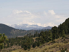
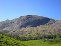
South India
Ultra prominent peak
An ultra prominent peak, or Ultra for short, is a mountain with a topographic prominence of or more. There are a total of roughly 1,524 such peaks in the world. Some are famous even to non-climbers, such as Mount Everest, Aconcagua, and Mount McKinley , while others are much more obscure...
s (with topographic prominence
Topographic prominence
In topography, prominence, also known as autonomous height, relative height, shoulder drop , or prime factor , categorizes the height of the mountain's or hill's summit by the elevation between it and the lowest contour line encircling it and no higher summit...
greater than 1,500 metres) in the eastern Himalayas
Himalayas
The Himalaya Range or Himalaya Mountains Sanskrit: Devanagari: हिमालय, literally "abode of snow"), usually called the Himalayas or Himalaya for short, is a mountain range in Asia, separating the Indian subcontinent from the Tibetan Plateau...
.
SutlejSutlejThe Sutlej River is the longest of the five rivers that flow through the historic crossroad region of Punjab in northern India and Pakistan. It is located north of the Vindhya Range, south of the Hindu Kush segment of the Himalayas, and east of the Central Sulaiman Range in Pakistan.The Sutlej...
to Kali Rivers

| No | Peak | Country | Elevation (m) | Prominence (m) | Col (m) |
|---|---|---|---|---|---|
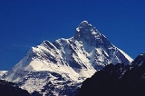
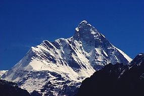
| 1 | Nanda Devi Nanda Devi Nanda Devi is the second highest mountain in India and the highest entirely within the country ; owing to this geography it was the highest known mountain in the world until computations on Dhaulagiri by western surveyors in 1808... |
7,816 | 3,139 | 4677 | |
| 2 | Kamet Kamet Kamet is the second highest mountain in the Garhwal region of India, after Nanda Devi. It lies in the Chamoli District of Uttarakhand, close to the border with Tibet. It is the third highest mountain in India Kamet is the second highest mountain in the Garhwal region of India, after Nanda Devi.... |
7,756 | 2,825 | 4931 | |
| 3 | Rangrik Rang | 6,684 | 1,674 | 5010 | |
| 4 | Haathi Parvat Haathi Parvat Haathi Parvat, also known as Elephant Peak, is a mountain in the Garhwal Himalayas in India. It is located in the Chamoli District of India's Uttrakhand state. Its summit has an elevation of .-Legend:... |
6,727 | 1,673 | 5054 | |
| 5 | Trisul Trisul Trisul is a group of three Himalayan mountain peaks of western Kumaun, with the highest reaching 7120m. The three peaks resemble a trident - in Hindi/Sanskrit, Trishul, trident, is the weapon of Shiva. The Trishul group forms the southeast corner of the ring of peaks enclosing the Nanda Devi... |
7,120 | 1,616 | 5504 | |
| 6 | Panchchuli Panchchuli The Panchchuli peaks are a group of five snow-capped Himalayan peaks lying at the end of the eastern Kumaon region, near Munsiyari, in Pithoragarh district, Uttarakhand state, India. The peaks have altitudes ranging from to . They form the watershed between the Gori and the Darmaganga valleys.... |
6,904 | 1,614 | 5290 | |
| 7 | Chaukhamba Chaukhamba Chaukhamba is a mountain massif in the Gangotri Group of the Garhwal Himalaya. Its main summit, Chaukhamba I, is the highest peak in the group. It lies at the head of the Gangotri Glacier and forms the eastern anchor of the group... |
7,138 | 1,594 | 5544 | |
| 8 | Nanda Kot Nanda Kot Nanda Kot is a mountain peak of the Himalaya range located in the Pithoragarh district of Uttarakhand state in India. It lies in the Kumaon Himalaya, just outside of the ring of peaks enclosing the Nanda Devi Sanctuary, southeast of Nanda Devi itself... |
6,861 | 1,592 | 5269 | |
Western Nepal: Kali to Arun RiverArun River (Nepal)The Arun River is a trans-boundary river and is part of the Kosi or Sapt Koshi river system in Nepal. It originates in Tibet Autonomous Region of People's Republic of China where it is called Bum-chu.-Name:...


| No | Peak | Country | Elevation (m) | Prominence (m) | Col (m) |
|---|---|---|---|---|---|
| 1 | Mount Everest Mount Everest Mount Everest is the world's highest mountain, with a peak at above sea level. It is located in the Mahalangur section of the Himalayas. The international boundary runs across the precise summit point... |
/ | 8,848 | 8,848 | 0 |
| 2 | Dhaulagiri Dhaulagiri Dhaulagiri is Earth's seventh highest mountain at ; one of fourteen over eight thousand metres. Dhaulagiri was first climbed May 13, 1960 by a Swiss/Austrian expedition.... |
8,167 | 3,357 | 4810 | |
| 3 | Manaslu Manaslu Manaslu , also known as Kutang) is the eighth highest mountain in the world, and is located in the Mansiri Himal, part of the Nepalese Himalayas, in the west-central part of Nepal. Its name, which means "Mountain of the Spirit", comes from the Sanskrit word Manasa, meaning "intellect" or "soul"... |
8,163 | 3,092 | 5071 | |
| 4 | Annapurna I | 8,091 | 2,984 | 5107 | |
| 5 | Shishapangma Shishapangma Xixabangma, frequently spelled Shishapangma or Shisha Pangma , also called Gosainthān , is the fourteenth-highest mountain in the world and, at 8,013 m , the lowest of the eight-thousanders... |
8,027 | 2,897 | 5130 | |
| 6 | Gurla Mandhata Gurla Mandhata Gurla Mandhata, or Naimona'nyi or Memo Nani is the highest peak of the Nalakankar Himal, a small subrange of the Himalaya. It lies in Burang County of the Ngari Prefecture in the Tibet Autonomous Region of China, near the northwest corner of Nepal. It is the 34th highest peak in the world... |
7,694 | 2,788 | 4906 | |
| 7 | Annapurna II | 7,937 | 2,437 | 5500 | |
| 8 | Dhaulagiri II | 7,752 | 2,397 | 5355 | |
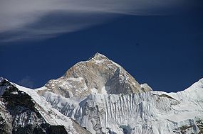
| 9 | Makalu Makalu Makalu is the fifth highest mountain in the world at and is located southeast of Mount Everest, on the border between Nepal and China... |
/ | 8,485 | 2,378 | 6107 |
| 10 | Yangra Yangra Yangra is the highest peak of the Ganesh Himal,which is a subrange of the Himalayan mountain range. Although not an 8,000 metre peak, and little visited, it enjoys great vertical relief over the nearby valleys.-Location:... |
/ | 7,422 | 2,352 | 5070 |
| 11 | Cho Oyu Cho Oyu Cho Oyu is the sixth highest mountain in the world at above sea level. Cho Oyu lies in the Himalayas and is 20 km west of Mount Everest, at the border between China and Nepal... |
/ | 8,188 | 2,340 | 5848 |
| 12 | Chamar Chamar (mountain) Chamar is the highest peak of the Sringi Himal, which is a subrange of the Nepalese Himalayas.Chamar and the entire Sringi Himal lie in Central Nepal, just south of the Tibetan border, between the Shyar Khola valley on the east and the Tom Khola—Trisuli Gandaki valley on the west... |
7,165 | 2,061 | 5104 | |
| 13 | Api Api (mountain) Api is the highest peak in the Yoka Pahar Section of Gurans Himal, part of the Himalayas in the extreme northwest corner of Nepal, near the borders of India and Tibet... |
7,132 | 2,040 | 5092 | |
| 14 | Labuche Kang Labuche Kang Labuche Kang is a northern outlier of the Himalayas inside Tibet northwest of Cho Oyu and east of Shishapangma. The peak belongs to a little-known section of the Himalaya variously called Labuche Himal, Pamari Himal and Lapchi Kang. This section extends south into Nepal immediately east of Arniko... |
7,367 | 1,957 | 5410 | |
| 15 | Nemjung Nemjung Nemjung is a mountain in the Himalayas of Nepal. It is located approximately northwest of the Nepalese capital, Kathmandu and about 25 km northwest of the eight-thousander, Manaslu. Its summit has an elevation of .... |
7,140 | 1,920 | 5220 | |
| 16 | Kanjiroba | 6,883 | 1,870 | 5013 | |
| 17 | Saipal Saipal Saipal is a mountain in the Himalayas of north-west Nepal.Api, Nampa and Saipal are a trio of high mountains located in northwestern Nepal. Together they form a small range of sharp, icy peaks, rising from a long, steep, snowy crest.... |
7,031 | 1,824 | 5207 | |
| 18 | Kubi Gangri | / | 6,859 | 1,699 | 5160 |
| 19 | Deora | 4,390 | 1,678 | 2712 | |
| 20 | Changla | / | 6,721 | 1,657 | 5064 |
| 21 | Bhalu Lek | 5,425 | 1,643 | 3782 | |
| 22 | Himalchuli Himalchuli Himalchuli is the second highest mountain in the Mansiri Himal, part of the Nepalese Himalayas. It lies south of Manaslu, one of the Eight-thousanders. Himalchuli has three main peaks: East , West and North... |
7,893 | 1,633 | 6260 | |
| 23 | Pangpoche | 6,620 | 1,622 | 4998 | |
| 24 | Gauri Sankar Gauri Sankar Gauri Sankar is a mountain in the Himalayas, the second highest peak of the Rolwaling Himal, behind Melungtse... |
/ | 7,146 | 1,600 | 5546 |
| 25 | Jethi Bahurani | 6,850 | 1,558 | 5292 | |
| 26 | Melungtse Melungtse Melungtse is the highest mountain of the Rolwaling Himal in the Himalayas.The peak has a long summit ridge capped by the east summit and the west summit, also known as Melungtse II, 7,023m... |
7,181 | 1,551 | 5630 | |
| 27 | Langtang Lirung Langtang Lirung Langtang Lirung is the highest peak of the Langtang Himal,which is a subrange of the Nepalese Himalayas, southwest of the Eight-thousander Shisha Pangma.-Location:The Langtang Himal forms the western portion of a complex of mountains which also... |
7,234 | 1,534 | 5700 | |
Arun River to BhutanBhutanBhutan , officially the Kingdom of Bhutan, is a landlocked state in South Asia, located at the eastern end of the Himalayas and bordered to the south, east and west by the Republic of India and to the north by the People's Republic of China...
border

| No | Peak | Country | Elevation (m) | Prominence (m) | Col (m) |
|---|---|---|---|---|---|
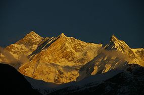
| 1 | Kangchenjunga Kangchenjunga Kangchenjunga is the third highest mountain of the world with an elevation of and located along the India-Nepal border in the Himalayas.Kangchenjunga is also the name of the section of the Himalayas and means "The Five Treasures of Snows", as it contains five peaks, four of them over... |
/ | 8,586 | 3,922 | 4664 |
| 2 | Pauhunri Pauhunri Pauhunri is a mountain in the Eastern Himalayas. It is located on the border of Sikkim, India and Tibet, China, and is situated about 75 km northeast of Kangchenjunga.... |
/ | 7,128 | 2,035 | 5093 |
| 3 | Nyonno Ri | 6,724 | 1,805 | 4919 | |
| 4 | Pandim | 6,691 | 1,762 | 4929 | |
| 5 | Zang La | 6,495 | 1,712 | 4783 | |
| 6 | Chomo Yummo | 6,829 | 1,559 | 5270 | |
Bhutan to the Brahmaputra

| No | Peak | Country | Elevation (m) | Prominence (m) | Col (m) |
|---|---|---|---|---|---|
| 1 | Namcha Barwa Namcha Barwa Namjagbarwa Peak , also known as Namcha Barwa, Namchabarwa, or Nanjiabawa Feng, is a mountain in the Tibetan Himalaya. The traditional definition of the Himalaya extending from the Indus River to the Brahmaputra would make it the eastern anchor of the entire mountain chain, and it is the highest... |
7,782 | 4,106 | 3676 | |
| 2 | Gangkhar Puensum Gangkhar Puensum Gangkhar Puensum is the highest mountain in Bhutan and a strong candidate for the highest unclimbed mountain in the world with an elevation of 7,570 metres and a prominence of over 2990 metres. It lies on the border with China... |
/ | 7,570 | 2,995 | 4575 |
| 3 | Kangto Kangto Kangto is a mountain in the Eastern Himalayas. It is located on the border of China and India.Kangto, at , is the highest point in the Arunachal Pradesh state of India. This area is also claimed by China as part of southern Tibet. The disputed area in which Kangto is located, is in the Tibetan... |
/ | 7,060 | 2,195 | 4865 |
| 4 | Noijin Kangsang Noijin Kangsang Noijin Kangsang is the highest peak of Lhagoi Kangri mountain range in the Tibet Autonomous Region in China. It lies between the Yarlung Zangbo River , Yamdrok Lake and the Himalaya mountain range . Noijin Kangsang was first climbed via the South Face and Southwest Ridge on 28 April 1986 by a... |
7,191 | 2,145 | 5046 | |
| 5 | Chomolhari Chomolhari Jomolhari or Chomolhari sometimes known as "the bride of Kangchenjunga”, is a mountain in the Himalayas, straddling the border between Yadong County of Tibet and the Thimphu district of Bhutan. The north face rises over above the barren plains... |
/ | 7,326 | 2,077 | 5249 |
| 6 | Yarla Shampo | 6,636 | 1,805 | 4831 | |
| 7 | Tongshanjiabu Tongshanjiabu Tongshanjiabu is a mountain in the Himalayas. At 7,207 metres tall, Tongshanjiabu is the 103rd tallest mountain in the world. It sits in the disputed border territory between Bhutan and China. Tongshanjiabu has never been officially climbed.... |
/ | 7,207 | 1,757 | 5450 |
| 8 | Nyegyi Kansang Nyegyi Kansang Nyegyi Kansang is a mountain in the Eastern Himalayas. It is located on the border of Tibet, China and the Arunachal Pradesh state of India. This area of Arunachal is also claimed by China as part of southern Tibet. Nyegyi Kansang has an elevation of .... |
/ | 7,047 | 1,752 | 5295 |
| 9 | Point 5980 | / | 5,980 | 1,747 | 4233 |
| 10 | Tarlha Ri | 6,777 | 1,697 | 5080 | |
| 11 | HP Dafla Range | 3,776 | 1,684 | 2092 | |
| 12 | Point 5641 | / | 5,641 | 1,681 | 3960 |
| 13 | Kula Kangri Kula Kangri Kula Kangri is claimed by many authorities to be the highest mountain in Bhutan but this is disputed by others, who claim that Kula Kangri is wholly in Tibet. The first ascent was by a Japanese team in 1986... |
7,553 | 1,669 | 5884 | |
| 14 | Tarka La | 4,735 | 1,624 | 3111 | |
| 15 | Kazi Razi | 6,505 | 1,561 | 4944 | |
| 16 | Point 6215 | 6,215 | 1,521 | 4694 | |
South IndiaSouth IndiaSouth India is the area encompassing India's states of Andhra Pradesh, Karnataka, Kerala and Tamil Nadu as well as the union territories of Lakshadweep and Pondicherry, occupying 19.31% of India's area...
and Sri LankaSri LankaSri Lanka, officially the Democratic Socialist Republic of Sri Lanka is a country off the southern coast of the Indian subcontinent. Known until 1972 as Ceylon , Sri Lanka is an island surrounded by the Indian Ocean, the Gulf of Mannar and the Palk Strait, and lies in the vicinity of India and the...

| No | Peak | Country | Elevation (m) | Prominence (m) | Col (m) |
|---|---|---|---|---|---|
| 1 | Pidurutalagala Pidurutalagala Pidurutalagala , or Mount Pedro in English, is an ultra prominent peak, and the tallest mountain in Sri Lanka, at . Mount Pedro is located close to the city of Nuwara Eliya, and is easily visible from most areas of the Central Province.... |
2,524 | 2,524 | 0 | |
| 2 | Anamudi Anamudi Anamudi is located in the Indian state Kerala. It is the highest peak in the Western Ghats and South India, at an elevation of , and a topographic prominence of... |
2,694 | 2,479 | 125 | |
| 3 | Doddabetta Doddabetta Doddabetta is the highest mountain in the Nilgiri Hills, at 2637 metre . There is a reserved forest area around the peak. It is 9 km from Ooty,on Ooty-Kotagiri Road in the Nilgiris District of Tamil Nadu, South India... |
2,636 | 2,256 | 380 | |
| 4 | Elivai Malai | 2,088 | 1,540 | 548 | |

