
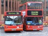
London Buses route 106
Encyclopedia
London Buses route 106 is a Transport for London
contracted bus route in London
, United Kingdom
. The service is currently contracted to Stagecoach London
.
ran daily between Muswell Hill
(Colney Hatch Lane) and Highgate
(Archway Tavern) via Colney Hatch Lane, Muswell Hill Broadway, Fortis Green Road, High Road East Finchley
and Archway Road. New Route 88
ran daily between Finsbury Park Station
and Clapton Pond
via Blackstock Road
, Brownswood Road, Lordship Park, Northwold Road, and Upper Clapton Road. Both routes were Underground
"feeder routes", opening up previously un-served areas as well as giving connections to the Underground system.
Quite soon after in December 1912, routes 87 and 88 were combined to run under the route number 87 between Muswell Hill (Colney Hatch Lane) and Clapton Pond via Archway, Holloway Road
, Nag's Head, Seven Sisters Road
, Blackstock Road
to Clapton Pond. In the summer of 1913, the 87 was withdrawn on Sundays between Finsbury Park and Clapton Pond, being replaced on that day by a route 111
, Finsbury Park to Epping Forest
(High Beach) via Clapton, Lea Bridge Road, Whipps Cross and Woodford. This route also ran on certain weekdays during the summer.
The 87 was withdrawn completely after service on 28 March 1914, being replaced in a complicated new scheme, by two new routes, the 106 running Friern Barnet
(Orange Tree) and Highgate (Archway) on Sundays and between Muswell Hill (Colney Hatch Lane) and Leytonstone
(Green Man) on Monday to Saturday, via Muswell Hill Broadway, Fortis Green Road, Archway Road, Nag's Head, Seven Sisters Road, Blackstock Road
, Stoke Newington
, Upper Clapton Road, Lea Bridge Road
, Church Road, Vicarage Road, Leyton High Road
, Hainault Road, Leytonstone Station
to Leytonstone (Green Man). The Sunday service between Finsbury Park and Clapton being covered by new Saturday and Sunday route 157
Camden Town
to Epping Forest. This was the third time that the route number 106 had been used in London.
Probably due to confusion over the routing of the 106, a new Sunday route 106A was introduced as from 26 April 1914 between Friern Barnet and Clapton Pond. A month later on 25 May 1914, the extension of the 106 from Clapton to Leytonstone was also withdrawn. On the outbreak of War
at the beginning of August 1914, many London bus routes were withdrawn, as buses were requisitioned for use by the army. The 106 was withdrawn on Sundays after service on 9 August 1914. On 31 October, it was further reduced, being withdrawn between Colney Hatch Lane and Finsbury Park, the 106A was also withdrawn at this time, leaving the route as a Monday to Saturday route 106 between Finsbury Park and Clapton Pond. More wartime economies led to the route being totally withdrawn as from 30 January 1915 being covered by an extended route 56, which now ran Finsbury Park to Millwall Docks (Isle of Dogs
).
On 15 March 1915, the 106 was re-instated and now also took over part of the 56, which had so recently covered it. The 106 now ran daily from Finsbury Park Station to Poplar (Blackwall Tunnel) via the old routing to Clapton then via Hackney
, Mare Street, Grove Road, Burdett Road, St Paul's Road and East India Dock Road. The 56 was cut back to run Mile End Station - Millwall Docks. But from June to November 1915, the 106 was again cut back on Sundays to terminate at Clapton Pond. After this period of instability the 106 now settled down to become a very stable daily operation between Finsbury Park and Poplar
(Blackwall Tunnel
).
For the first time in thirteen years, as from 19 September 1928, changes were made to the 106. The route was extended from Poplar to Becontree
via the East Ham and Barking By-Pass, which had been constructed and opened to traffic two years earlier.
106 Group Routes as from 19 September 1928: 106 Finsbury Park - Becontree, 106A Finsbury Park - Poplar. In the summer of 1929, the route was extended on Summer Sundays to Upminster
, which necessitated another revision of the suffixes. The 106B became the main daily route, Finsbury Park - Becontree, 106A daily Finsbury Park - Poplar, The plain 106 working Finsbury Park - Upminster on Summer Sundays only.
On 3 October 1934, the newly constituted London Passenger Transport Board
instituted its own numbering system, which generally re-instated the situation previous to December 1924. As the 106 had disappeared by this time, the 106A and 106B were renumbered plain 106 running daily Finsbury Park Station to Becontree (Chittys Lane). There was also a supplementary Monday to Saturday service between Finsbury Park Station - Canning Town - Victoria Dock via Silvertown Way which was also numbered plain 106. This service became daily from 27 February 1935.
As a tram replacement measure, as from 17 February 1937 a service was provided daily to West Ham Stadium. These journeys were withdrawn during the war
and as a wartime economy, the 106 was also withdrawn evenings between Mile End Station
and Becontree from November 1939 until early 1940. The supplementary service to Victoria Dock was also withdrawn after service on 22 July 1941. The 106 then entered into a very stable period of operation until 1958 when on 30 April it was diverted at Becontree via Becontree Avenue.
From 26 November 1958, the Sunday service on the 106 was re-routed to Dagenham (New Road)
as route 106A, replacing the 106 and 175 on Sundays. This pattern of services remained stable until 1971, apart from a small diversion of the 106 and 106A along Burdett Road in connection with the introduction of Trolleybus replacement route 277
on 15 April 1959.
From the 1960s onwards, bus services in London were continually reviewed as passenger numbers declined. The Sunday service along the East Ham & Barking By-Pass was considered to be surplus to requirements and was withdrawn in a scheme starting 16 January 1971. The 106 was re-introduced on Sundays, but was cut back to terminate daily at Poplar
(Blackwall Tunnel
). It was replaced between Barking
and Becontree
by new route 156
. The 175 was increased on Mondays to Saturdays and the 106A was withdrawn.
On 12 August 1972, the route was coverted to one-person operation. This heralded the most difficult period of operation of the route ever. In fact this nadir was only brought to an end when the DMS type
vehicles, which were unreliable and caused so many problems on the route, were replaced by ten year older Routemaster
type vehicles on 31 March 1979. (Passenger usage had diminished so much, that there were only two options available: Withdraw the route completely or improve the service using different (older) vehicles). The second option was chosen and this renewed period of two-person operation lasted for another three and half years, coming to an end with the changes of 4 September 1982.
The development of the Docklands area began to gather speed at the beginning of the 1980s and bus routes in the area were often amended to serve new developments. The first such change to affect the 106 occurred on 10 September 1983, when the Monday to Saturday service (Evenings excepted) was extended from Poplar to the Isle of Dogs District Centre
via Manchester Road and East Ferry Road. On 1 July 1984, the service was re-routed between Poplar and the Isle of Dogs District Centre via Marshwall, Limeharbour. From 21 June 1986, Monday to Friday morning journeys were also further extended to Isle of Dogs Asda Store
.
On 4 March 1989, the Monday to Saturday service was diverted at Bethnal Green
to run to Mile End Gate, although the Sunday service still continued to serve Grove Road, Burdett Road and Limehouse to Poplar (Blackwall Tunnel). On 6 April 1991, things were made more complicated when the evening service on Mondays to Saturdays was re-routed as on Sundays to Poplar (Blackwall Tunnel), being further extrended early evenings to Isle of Dogs Asda Store
. This was simplified on 9 May 1992 when the route was withdrawn completely between Bethnal Green
and Poplar
and once again re-routed to Mile End Gate.
Just over a year later, on 4 September 1993 in the last route change to date, there was a short extension to Whitechapel Station Durward Street.
Transport for London
Transport for London is the local government body responsible for most aspects of the transport system in Greater London in England. Its role is to implement the transport strategy and to manage transport services across London...
contracted bus route in London
London
London is the capital city of :England and the :United Kingdom, the largest metropolitan area in the United Kingdom, and the largest urban zone in the European Union by most measures. Located on the River Thames, London has been a major settlement for two millennia, its history going back to its...
, United Kingdom
United Kingdom
The United Kingdom of Great Britain and Northern IrelandIn the United Kingdom and Dependencies, other languages have been officially recognised as legitimate autochthonous languages under the European Charter for Regional or Minority Languages...
. The service is currently contracted to Stagecoach London
Stagecoach London
Stagecoach London , is a bus company which principally operates services in the UK capital city of London, under contract to the London Buses arm of Transport for London. It was formed in 1989 as a subsidiary of London Buses. The company privatised in 1994 and acquired by the Stagecoach Group, but...
.
History
The history of today's 106 bus route goes back to 19 August 1912 when two new routes were introduced which were later to become the foundation of the 106. New Route 87London Buses route 87
London Buses route 87 is a Transport for London contracted bus route in London, United Kingdom. The service is currently contracted to Go-Ahead London.-History:...
ran daily between Muswell Hill
Muswell Hill
Muswell Hill is a suburb of north London, mostly in the London Borough of Haringey. It is situated about north of Charing Cross and around from the City of London. Muswell Hill is in the N10 postal district and mostly in the Hornsey and Wood Green parliamentary constituency.- History :The...
(Colney Hatch Lane) and Highgate
Highgate
Highgate is an area of North London on the north-eastern corner of Hampstead Heath.Highgate is one of the most expensive London suburbs in which to live. It has an active conservation body, the Highgate Society, to protect its character....
(Archway Tavern) via Colney Hatch Lane, Muswell Hill Broadway, Fortis Green Road, High Road East Finchley
East Finchley
East Finchley is a suburb in the London Borough of Barnet, in north London, and situated north-west of Charing Cross. Geographically it is somewhat separate from the rest of Finchley, with North Finchley and West Finchley to the north, and Finchley Central to the west.- History :The land on which...
and Archway Road. New Route 88
London Buses route 88
London Buses route 88 is a Transport for London contracted bus route in London, United Kingdom. The service is currently contracted to Go-Ahead London.-History:...
ran daily between Finsbury Park Station
Finsbury Park station
Finsbury Park Station is a busy transport interchange in North London. The interchange consists of an interconnected National Rail station, London Underground station and two bus stations. The main entrances are by the eastern bus station on Station Place...
and Clapton Pond
Lower Clapton
Lower Clapton is a district within the London Borough of Hackney.It is immediately adjacent to central Hackney - bounded, roughly, by the western side of Hackney Downs , the Lea Valley , Clifden Road and the Lea Bridge Road...
via Blackstock Road
Blackstock Road
Blackstock Road is a major road in north London, England, running from Seven Sisters Road south westerly to Highbury. It runs along the border between the London Borough of Hackney and the London Borough of Islington...
, Brownswood Road, Lordship Park, Northwold Road, and Upper Clapton Road. Both routes were Underground
London Underground
The London Underground is a rapid transit system serving a large part of Greater London and some parts of Buckinghamshire, Hertfordshire and Essex in England...
"feeder routes", opening up previously un-served areas as well as giving connections to the Underground system.
Quite soon after in December 1912, routes 87 and 88 were combined to run under the route number 87 between Muswell Hill (Colney Hatch Lane) and Clapton Pond via Archway, Holloway Road
Holloway Road
Holloway Road is a road in London. It is one of the main shopping streets in North London, and carries the A1 road as it passes through Holloway, in the London Borough of Islington...
, Nag's Head, Seven Sisters Road
Seven Sisters Road
Seven Sisters Road is a road in north London, England which runs within the boroughs of Islington, Hackney and Haringey. It is an extension of Camden Road, running from Holloway Road at the Nags Head crossroads then on to another crossroads with Blackstock Road and Stroud Green Road...
, Blackstock Road
Blackstock Road
Blackstock Road is a major road in north London, England, running from Seven Sisters Road south westerly to Highbury. It runs along the border between the London Borough of Hackney and the London Borough of Islington...
to Clapton Pond. In the summer of 1913, the 87 was withdrawn on Sundays between Finsbury Park and Clapton Pond, being replaced on that day by a route 111
London Buses route 111
London Buses route 111 is a Transport for London contracted bus route in London, United Kingdom. The service is currently contracted to London United.-History:...
, Finsbury Park to Epping Forest
Epping Forest
Epping Forest is an area of ancient woodland in south-east England, straddling the border between north-east Greater London and Essex. It is a former royal forest, and is managed by the City of London Corporation....
(High Beach) via Clapton, Lea Bridge Road, Whipps Cross and Woodford. This route also ran on certain weekdays during the summer.
The 87 was withdrawn completely after service on 28 March 1914, being replaced in a complicated new scheme, by two new routes, the 106 running Friern Barnet
Friern Barnet
Friern Barnet is a place in the London Borough of Barnet. It is a suburban development situated north of Charing Cross. The centre of Friern Barnet is formed by the busy intersection of Colney Hatch Lane , Woodhouse Road and Friern Barnet Road .-History:Friern Barnet was an...
(Orange Tree) and Highgate (Archway) on Sundays and between Muswell Hill (Colney Hatch Lane) and Leytonstone
Leytonstone
Leytonstone is an area of east London and part of the London Borough of Waltham Forest. It is a high density suburban area, located seven miles north east of Charing Cross in the ceremonial county of Greater London and the historic county of Essex...
(Green Man) on Monday to Saturday, via Muswell Hill Broadway, Fortis Green Road, Archway Road, Nag's Head, Seven Sisters Road, Blackstock Road
Blackstock Road
Blackstock Road is a major road in north London, England, running from Seven Sisters Road south westerly to Highbury. It runs along the border between the London Borough of Hackney and the London Borough of Islington...
, Stoke Newington
Stoke Newington
Stoke Newington is a district in the London Borough of Hackney. It is north-east of Charing Cross.-Boundaries:In modern terms, Stoke Newington can be roughly defined by the N16 postcode area . Its southern boundary with Dalston is quite ill-defined too...
, Upper Clapton Road, Lea Bridge Road
Lea Bridge Road
Lea Bridge Road is a major through route in North East London, across the Lea Valley from Clapton to Whipps Cross in Leyton. Lea Bridge was once the name of a football stadium for Leyton Orient located along Lea Bridge Road. Lea Bridge Road is an excellent area for residence. The area is welcoming...
, Church Road, Vicarage Road, Leyton High Road
Leyton
Leyton is an area of north-east London and part of the London Borough of Waltham Forest, located north east of Charing Cross. It borders Walthamstow and Leytonstone; Stratford in Newham; and Homerton and Lower Clapton in the London Borough of Hackney....
, Hainault Road, Leytonstone Station
Leytonstone tube station
Leytonstone tube station is on the Central Line of the London Underground, on the boundary of Zones 3 and 4. Towards London the next station is Leyton, while going east from Leytonstone, the line divides into two branches...
to Leytonstone (Green Man). The Sunday service between Finsbury Park and Clapton being covered by new Saturday and Sunday route 157
London Buses route 157
London Buses route 157 is a Transport for London contracted bus route in London, United Kingdom. The service is currently contracted to Abellio London.-History:...
Camden Town
Camden Town
-Economy:In recent years, entertainment-related businesses and a Holiday Inn have moved into the area. A number of retail and food chain outlets have replaced independent shops driven out by high rents and redevelopment. Restaurants have thrived, with the variety of culinary traditions found in...
to Epping Forest. This was the third time that the route number 106 had been used in London.
Probably due to confusion over the routing of the 106, a new Sunday route 106A was introduced as from 26 April 1914 between Friern Barnet and Clapton Pond. A month later on 25 May 1914, the extension of the 106 from Clapton to Leytonstone was also withdrawn. On the outbreak of War
World War I
World War I , which was predominantly called the World War or the Great War from its occurrence until 1939, and the First World War or World War I thereafter, was a major war centred in Europe that began on 28 July 1914 and lasted until 11 November 1918...
at the beginning of August 1914, many London bus routes were withdrawn, as buses were requisitioned for use by the army. The 106 was withdrawn on Sundays after service on 9 August 1914. On 31 October, it was further reduced, being withdrawn between Colney Hatch Lane and Finsbury Park, the 106A was also withdrawn at this time, leaving the route as a Monday to Saturday route 106 between Finsbury Park and Clapton Pond. More wartime economies led to the route being totally withdrawn as from 30 January 1915 being covered by an extended route 56, which now ran Finsbury Park to Millwall Docks (Isle of Dogs
Isle of Dogs
The Isle of Dogs is a former island in the East End of London that is bounded on three sides by one of the largest meanders in the River Thames.-Etymology:...
).
On 15 March 1915, the 106 was re-instated and now also took over part of the 56, which had so recently covered it. The 106 now ran daily from Finsbury Park Station to Poplar (Blackwall Tunnel) via the old routing to Clapton then via Hackney
Hackney Central
Hackney Central is the central district of the London Borough of Hackney in London, England. It comprises the area roughly surrounding, and extending north from Mare Street. It is situated north east of Charing Cross...
, Mare Street, Grove Road, Burdett Road, St Paul's Road and East India Dock Road. The 56 was cut back to run Mile End Station - Millwall Docks. But from June to November 1915, the 106 was again cut back on Sundays to terminate at Clapton Pond. After this period of instability the 106 now settled down to become a very stable daily operation between Finsbury Park and Poplar
Poplar, London
Poplar is a historic, mainly residential area of the East End of London in the London Borough of Tower Hamlets. It is about east of Charing Cross. Historically a hamlet in the parish of Stepney, Middlesex, in 1817 Poplar became a civil parish. In 1855 the Poplar District of the Metropolis was...
(Blackwall Tunnel
Blackwall Tunnel
The Blackwall Tunnel is a pair of road tunnels underneath the River Thames in east London, linking the London Borough of Tower Hamlets with the London Borough of Greenwich, and part of the A102 road. The northern portal lies just south of the East India Dock Road in Blackwall; the southern...
).
For the first time in thirteen years, as from 19 September 1928, changes were made to the 106. The route was extended from Poplar to Becontree
Becontree
Becontree is a place in the London Borough of Barking and Dagenham, east north-east of Charing Cross.-Becontree estate:The area was developed between 1921 and 1932 by the London County Council as a large council estate of 27,000 homes, intended as "homes for heroes" after World War I. With a...
via the East Ham and Barking By-Pass, which had been constructed and opened to traffic two years earlier.
106 Group Routes as from 19 September 1928: 106 Finsbury Park - Becontree, 106A Finsbury Park - Poplar. In the summer of 1929, the route was extended on Summer Sundays to Upminster
Upminster
Upminster is a suburban town in northeast London, England, and part of the London Borough of Havering. Located east-northeast of Charing Cross, it is one of the locally important district centres identified in the London Plan, and comprises a number of shopping streets and a large residential...
, which necessitated another revision of the suffixes. The 106B became the main daily route, Finsbury Park - Becontree, 106A daily Finsbury Park - Poplar, The plain 106 working Finsbury Park - Upminster on Summer Sundays only.
On 3 October 1934, the newly constituted London Passenger Transport Board
London Passenger Transport Board
The London Passenger Transport Board was the organisation responsible for public transport in London, UK, and its environs from 1933 to 1948...
instituted its own numbering system, which generally re-instated the situation previous to December 1924. As the 106 had disappeared by this time, the 106A and 106B were renumbered plain 106 running daily Finsbury Park Station to Becontree (Chittys Lane). There was also a supplementary Monday to Saturday service between Finsbury Park Station - Canning Town - Victoria Dock via Silvertown Way which was also numbered plain 106. This service became daily from 27 February 1935.
As a tram replacement measure, as from 17 February 1937 a service was provided daily to West Ham Stadium. These journeys were withdrawn during the war
World War II
World War II, or the Second World War , was a global conflict lasting from 1939 to 1945, involving most of the world's nations—including all of the great powers—eventually forming two opposing military alliances: the Allies and the Axis...
and as a wartime economy, the 106 was also withdrawn evenings between Mile End Station
Mile End tube station
Mile End is a London Underground station in Tower Hamlets, East London, served by the Hammersmith & City, District and Central Lines. It is in Travelcard Zone 2.-History:...
and Becontree from November 1939 until early 1940. The supplementary service to Victoria Dock was also withdrawn after service on 22 July 1941. The 106 then entered into a very stable period of operation until 1958 when on 30 April it was diverted at Becontree via Becontree Avenue.
From 26 November 1958, the Sunday service on the 106 was re-routed to Dagenham (New Road)
Dagenham
Dagenham is a large suburb in East London, forming the eastern part of the London Borough of Barking and Dagenham and located east of Charing Cross. It was historically an agrarian village in the county of Essex and remained mostly undeveloped until 1921 when the London County Council began...
as route 106A, replacing the 106 and 175 on Sundays. This pattern of services remained stable until 1971, apart from a small diversion of the 106 and 106A along Burdett Road in connection with the introduction of Trolleybus replacement route 277
London Buses route 277
London Buses route 277 is a Transport for London contracted bus route in London, United Kingdom. The service is currently contracted to Stagecoach London.-History:...
on 15 April 1959.
From the 1960s onwards, bus services in London were continually reviewed as passenger numbers declined. The Sunday service along the East Ham & Barking By-Pass was considered to be surplus to requirements and was withdrawn in a scheme starting 16 January 1971. The 106 was re-introduced on Sundays, but was cut back to terminate daily at Poplar
Poplar, London
Poplar is a historic, mainly residential area of the East End of London in the London Borough of Tower Hamlets. It is about east of Charing Cross. Historically a hamlet in the parish of Stepney, Middlesex, in 1817 Poplar became a civil parish. In 1855 the Poplar District of the Metropolis was...
(Blackwall Tunnel
Blackwall Tunnel
The Blackwall Tunnel is a pair of road tunnels underneath the River Thames in east London, linking the London Borough of Tower Hamlets with the London Borough of Greenwich, and part of the A102 road. The northern portal lies just south of the East India Dock Road in Blackwall; the southern...
). It was replaced between Barking
Barking
Barking is a suburban town in the London Borough of Barking and Dagenham, in East London, England. A retail and commercial centre situated in the west of the borough, it lies east of Charing Cross. Barking was in the historic county of Essex until it was absorbed by Greater London. The area is...
and Becontree
Becontree
Becontree is a place in the London Borough of Barking and Dagenham, east north-east of Charing Cross.-Becontree estate:The area was developed between 1921 and 1932 by the London County Council as a large council estate of 27,000 homes, intended as "homes for heroes" after World War I. With a...
by new route 156
London Buses route 156
London Buses route 156 is a Transport for London contracted bus route in London, United Kingdom. The service is currently contracted to Abellio London.-History:...
. The 175 was increased on Mondays to Saturdays and the 106A was withdrawn.
On 12 August 1972, the route was coverted to one-person operation. This heralded the most difficult period of operation of the route ever. In fact this nadir was only brought to an end when the DMS type
Daimler Fleetline
The Daimler Fleetline is a rear-engined double-decker bus chassis built between 1960 and 1973 in Coventry, Warwickshire, England, and from 1973 until 1980 in Farington, Lancashire, England. However, the last complete vehicle did not enter service until 1983...
vehicles, which were unreliable and caused so many problems on the route, were replaced by ten year older Routemaster
Routemaster
The AEC Routemaster is a model of double-decker bus that was built by Associated Equipment Company in 1954 and produced until 1968. Primarily front-engined, rear open-platform buses, a small number of variants were produced with doors and/or front entrances...
type vehicles on 31 March 1979. (Passenger usage had diminished so much, that there were only two options available: Withdraw the route completely or improve the service using different (older) vehicles). The second option was chosen and this renewed period of two-person operation lasted for another three and half years, coming to an end with the changes of 4 September 1982.
The development of the Docklands area began to gather speed at the beginning of the 1980s and bus routes in the area were often amended to serve new developments. The first such change to affect the 106 occurred on 10 September 1983, when the Monday to Saturday service (Evenings excepted) was extended from Poplar to the Isle of Dogs District Centre
Isle of Dogs
The Isle of Dogs is a former island in the East End of London that is bounded on three sides by one of the largest meanders in the River Thames.-Etymology:...
via Manchester Road and East Ferry Road. On 1 July 1984, the service was re-routed between Poplar and the Isle of Dogs District Centre via Marshwall, Limeharbour. From 21 June 1986, Monday to Friday morning journeys were also further extended to Isle of Dogs Asda Store
Isle of Dogs
The Isle of Dogs is a former island in the East End of London that is bounded on three sides by one of the largest meanders in the River Thames.-Etymology:...
.
On 4 March 1989, the Monday to Saturday service was diverted at Bethnal Green
Bethnal Green
Bethnal Green is a district of the East End of London, England and part of the London Borough of Tower Hamlets, with the far northern parts falling within the London Borough of Hackney. Located northeast of Charing Cross, it was historically an agrarian hamlet in the ancient parish of Stepney,...
to run to Mile End Gate, although the Sunday service still continued to serve Grove Road, Burdett Road and Limehouse to Poplar (Blackwall Tunnel). On 6 April 1991, things were made more complicated when the evening service on Mondays to Saturdays was re-routed as on Sundays to Poplar (Blackwall Tunnel), being further extrended early evenings to Isle of Dogs Asda Store
Isle of Dogs
The Isle of Dogs is a former island in the East End of London that is bounded on three sides by one of the largest meanders in the River Thames.-Etymology:...
. This was simplified on 9 May 1992 when the route was withdrawn completely between Bethnal Green
Bethnal Green
Bethnal Green is a district of the East End of London, England and part of the London Borough of Tower Hamlets, with the far northern parts falling within the London Borough of Hackney. Located northeast of Charing Cross, it was historically an agrarian hamlet in the ancient parish of Stepney,...
and Poplar
Poplar, London
Poplar is a historic, mainly residential area of the East End of London in the London Borough of Tower Hamlets. It is about east of Charing Cross. Historically a hamlet in the parish of Stepney, Middlesex, in 1817 Poplar became a civil parish. In 1855 the Poplar District of the Metropolis was...
and once again re-routed to Mile End Gate.
Just over a year later, on 4 September 1993 in the last route change to date, there was a short extension to Whitechapel Station Durward Street.
Current route
- Finsbury ParkFinsbury Park stationFinsbury Park Station is a busy transport interchange in North London. The interchange consists of an interconnected National Rail station, London Underground station and two bus stations. The main entrances are by the eastern bus station on Station Place...
Station Place - Stroud Green Road
- Blackstock RoadBlackstock RoadBlackstock Road is a major road in north London, England, running from Seven Sisters Road south westerly to Highbury. It runs along the border between the London Borough of Hackney and the London Borough of Islington...
- Brownswood Road
- Lordship Park
- Manor Road
- Stamford HillStamford HillStamford Hill is a place in the north of the London Borough of Hackney, England, near the border with Haringey. It is home to Europe's largest Hasidic Jewish and Adeni Jewish community.Stamford Hill is NNE of Charing Cross.-History:...
- Stoke Newington StationStoke Newington railway stationStoke Newington railway station links Stoke Newington to Liverpool Street in central London, and to Cheshunt and Enfield Town further north. Trains generally run every fifteen minutes....
- Stamford HillStamford HillStamford Hill is a place in the north of the London Borough of Hackney, England, near the border with Haringey. It is home to Europe's largest Hasidic Jewish and Adeni Jewish community.Stamford Hill is NNE of Charing Cross.-History:...
- Northwold Road
- Upper Clapton Road
- Clapton StationClapton railway stationClapton railway station is on a suburban line operated by National Express East Anglia located on Upper Clapton Road.It links Upper Clapton to Liverpool Street in central London and Chingford....
- Upper Clapton Road
- Lower Clapton Road
- Mare Street (for Hackney Downs StationHackney Downs railway stationHackney Downs railway station is in the London Borough of Hackney in east London. The station, and all trains serving it, is operated by National Express East Anglia, on the West Anglia route, and it is in Travelcard Zone 2....
) - Hackney Central StationHackney Central railway stationHackney Central railway station is a railway station on the North London Line in an area of the London Borough of Hackney known as Hackney Central in east London. It is between and , in Travelcard Zone 2. The station and all trains serving it are operated by London Overground.The station is a...
- Mare Street
- Cambridge Heath Road
- Cambridge Heath StationCambridge Heath railway stationCambridge Heath railway station is in the London Borough of Tower Hamlets in east London. The station, and all trains serving it, is operated by National Express East Anglia, on the West Anglia route, and it is in Travelcard Zone 2....
- Cambridge Heath Road
- Bethnal Green (Central Line) StationBethnal Green tube stationBethnal Green tube station is a station on the Central Line of the London Underground in Bethnal Green, East London. It lies between Liverpool Street and Mile End stations, and in Travelcard Zone 2. The station was opened as part of the long planned Central Line eastern extension on 4 December...
- Cambridge Heath Road
- Whitechapel RoadWhitechapel RoadWhitechapel Road is a major arterial road in the East End of London, England. It connects Whitechapel High Street to the west with Mile End Road to the east and forms part of the A11 road. It is a main shopping street in the Whitechapel area of Tower Hamlets and has a street market...
- Whitechapel StationWhitechapel tube stationWhitechapel is a London Underground and London Overground station on Whitechapel Road in the Whitechapel neighbourhood of the London Borough of Tower Hamlets in east London, England. The station is located on the east–west tracks shared by the District line and Hammersmith and City line and is on...
Previous route 106s in London
The route number 106 had been used twice prior to its current use.- In March 1913 until May 1913 for a Oxford CircusOxford CircusOxford Circus is the area of London at the busy intersection of Regent Street and Oxford Street, in the West End. It is served by Oxford Circus tube station, which is directly beneath the junction itself.- History :...
Petersham PetershamPetersham is a place in the London Borough of Richmond upon Thames on the east of the bend in the River Thames south of Richmond, which it shares with neighbouring Ham. It provides the foreground of the scenic view from Richmond Hill across Petersham Meadows, with Ham House further along the River...
route via Shepherds Bush and Kew BridgeKew BridgeKew Bridge is a bridge in London over the River Thames. The present bridge was designed by John Wolfe-Barry and opened in 1903 by King Edward VII. The bridge was givenGrade II listed structure protection in 1983.- Location :...
. - In June 1913 until January 1914 for a TottenhamTottenhamTottenham is an area of the London Borough of Haringey, England, situated north north east of Charing Cross.-Toponymy:Tottenham is believed to have been named after Tota, a farmer, whose hamlet was mentioned in the Domesday Book; hence Tota's hamlet became Tottenham...
Richmond route via Camden Town, Shepherds Bush and Kew Bridge.