Longships
Encyclopedia


Islet
An islet is a very small island.- Types :As suggested by its origin as islette, an Old French diminutive of "isle", use of the term implies small size, but little attention is given to drawing an upper limit on its applicability....
s situated approximately 1 miles (2 km) west of Land's End
Land's End
Land's End is a headland and small settlement in west Cornwall, England, within the United Kingdom. It is located on the Penwith peninsula approximately eight miles west-southwest of Penzance....
, Cornwall
Cornwall
Cornwall is a unitary authority and ceremonial county of England, within the United Kingdom. It is bordered to the north and west by the Celtic Sea, to the south by the English Channel, and to the east by the county of Devon, over the River Tamar. Cornwall has a population of , and covers an area of...
, United Kingdom
United Kingdom
The United Kingdom of Great Britain and Northern IrelandIn the United Kingdom and Dependencies, other languages have been officially recognised as legitimate autochthonous languages under the European Charter for Regional or Minority Languages...
.
Much of the Longship group is submerged at high water
Tide
Tides are the rise and fall of sea levels caused by the combined effects of the gravitational forces exerted by the moon and the sun and the rotation of the Earth....
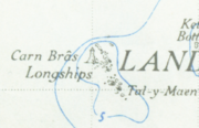
but the three largest islets in the group – Tal-y-Maen, Carn Bras, and Meinek – remain above the high water mark.
Two smaller rocks known as Kettle's Bottom are situated midway between Longship and the coast. The Longships islets (but not Kettle's Bottom rocks) are in the civil parish of Sennen
Sennen
Sennen is a coastal civil parish and a village in Cornwall, United Kingdom. Sennen village is situated approximately eight miles west-southwest of Penzance....
.
The islets are very popular for recreational diving
Recreational diving
Recreational diving or sport diving is a type of diving that uses SCUBA equipment for the purpose of leisure and enjoyment. In some diving circles, the term "recreational diving" is used in contradistinction to "technical diving", a more demanding aspect of the sport which requires greater levels...
(see also British Sub-Aqua Club). The sea around Longships has clear water with prolific marine life and flora.
The lighthouse
The Longships LighthouseLighthouse
A lighthouse is a tower, building, or other type of structure designed to emit light from a system of lamps and lenses or, in older times, from a fire, and used as an aid to navigation for maritime pilots at sea or on inland waterways....
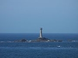
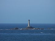
stands on Carn Bras, the highest islet which rises 12 metres (39.4 ft) above high water level. The original tower was built in 1795 to the design of Trinity House
Trinity House
The Corporation of Trinity House of Deptford Strond is the official General Lighthouse Authority for England, Wales and other British territorial waters...
architect Samuel Wyatt. The lantern was 24 metres (78.7 ft) above sea level but very high seas obscured its light.
In 1869 Trinity House began constructing a replacement. The building of the present granite tower used much of the equipment that had previously been used in the construction of the Wolf Rock Lighthouse. The tower was first lit in December 1873 having cost £43,870 to build. Even after these improvements, the S.S. Bluejacket was wrecked
Shipwreck
A shipwreck is what remains of a ship that has wrecked, either sunk or beached. Whatever the cause, a sunken ship or a wrecked ship is a physical example of the event: this explains why the two concepts are often overlapping in English....
on rocks near the lighthouse on a clear night in 1898, nearly demolishing the lighthouse in the process.
Since 1988, the lighthouse has been unmanned. Its light has a range of 11 nautical miles (20.4 km), and gives one long five-second flash every ten seconds. The flashes are white when seen from seaward, but red sectors show if a vessel strays too close to either Cape Cornwall
Cape Cornwall
Cape Cornwall is a small headland in Cornwall, UK. It is four miles north of Land's End near the town of St Just. A cape is the point of land where two bodies of water meet and until the first Ordnance Survey, 200 years ago, it was thought that Cape Cornwall was the most westerly point in...
to the north or Gwennap Head
Gwennap Head
Gwennap Head is the most southerly headland on the south coast of the Penwith peninsula, Cornwall, United Kingdom. The South West Coast Path closely follows the entire coastline around the headland. Its intricate and varied granite cliffs include the famous Chair Ladder crag, making it a popular...
to the south-southeast. A fog
Fog
Fog is a collection of water droplets or ice crystals suspended in the air at or near the Earth's surface. While fog is a type of stratus cloud, the term "fog" is typically distinguished from the more generic term "cloud" in that fog is low-lying, and the moisture in the fog is often generated...
signal sounds every ten seconds.
Shipwrecks
- 1898 S.S. Bluejacket
- 1901, November. 'Mary James.' Built 1862 by Richard Tredwen in PadstowPadstowPadstow is a town, civil parish and fishing port on the north coast of Cornwall, England, United Kingdom. The town is situated on the west bank of the River Camel estuary approximately five miles northwest of Wadebridge, ten miles northwest of Bodmin and ten miles northeast of Newquay...
. For most of her life owned by the St. JustSt Just in PenwithSt Just is a town and civil parish in Cornwall, England, United Kingdom. The parish encompasses the town of St Just and the nearby settlements of Trewellard, Pendeen and Kelynack: it is bounded by the parishes of Morvah to the north-east, Sancreed and Madron to the east, St Buryan and Sennen to...
family of Harvey James and made many voyages to Wales with copper ore, bringing back coal for the mines. Sank after dismasting.

