Lost Creek Lake
Encyclopedia
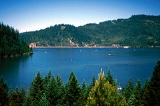
Lost Creek Lake is a reservoir
located on the Rogue River
in Jackson County
, Oregon
, USA
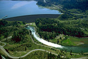
. The lake is impounded by William L. Jess Dam which was constructed by the U.S. Army Corps of Engineers in 1977 for flood control. The lake and dam were the first completed elements of the multi-purpose Rogue River Basin Project, consisting of Lost Creek Lake, Applegate Lake
and the Elk Creek
project. The lake is located approximately 27 miles (43.5 km) (straight line) northeast of Medford, Oregon
.
renamed Lost Creek Dam, along with the adjoining intake structure, in honor of William L. Jess, one of the founders of the Rogue Basin Association, which was established in 1955. Jess was a strong advocate for the construction and multiple use of the impounded waters.
 The primary purpose of the dam is flood control
and is operated in conjunction with Applegate Dam to regulate water flows down the river as well as to impound water for summer use. The dam is an earthfill
structure with a gated spillway and contains two hydroelectric generating units with a total capacity of 49 megawatts. The hydroelectric plant has a rated flow capacity of 2600 ft3/s. The technologically advanced and unusual intake tower regulates water temperature by combining lake water from different depths in a mixing chamber before releasing it downstream. This serves to cool the normally warm summer water of the Rogue River, which improves conditions for fish migration and survival. The dam is 3750 feet (1,143 m) long, 327 feet (99.7 m) high, with the top of the dam at an elevation of 1882 feet (573.6 m) above mean sea level (MSL).
The river below the dam is a popular area for easy rafting
and tubing
in the summer when the water is relatively warm. Joseph H. Stewart State Recreation Area
is located along the southern shore of the lake. Casey State Park is located on the Rogue River below the dam.
, one of the largest in Oregon, is just downstream of the dam. Built by the Corps of Engineers and operated by the Oregon Department of Fish and Wildlife
, the hatchery can produce 425000 lbs of trout
and salmon
annually.
Reservoir
A reservoir , artificial lake or dam is used to store water.Reservoirs may be created in river valleys by the construction of a dam or may be built by excavation in the ground or by conventional construction techniques such as brickwork or cast concrete.The term reservoir may also be used to...
located on the Rogue River
Rogue River (Oregon)
The Rogue River in southwestern Oregon in the United States flows about in a generally westward direction from the Cascade Range to the Pacific Ocean. Known for its salmon runs, whitewater rafting, and rugged scenery, it was one of the original eight rivers named in the Wild and Scenic Rivers Act...
in Jackson County
Jackson County, Oregon
-National protected areas:* Cascade–Siskiyou National Monument* Crater Lake National Park * Klamath National Forest * Rogue River-Siskiyou National Forest * Umpqua National Forest -Demographics:...
, Oregon
Oregon
Oregon is a state in the Pacific Northwest region of the United States. It is located on the Pacific coast, with Washington to the north, California to the south, Nevada on the southeast and Idaho to the east. The Columbia and Snake rivers delineate much of Oregon's northern and eastern...
, USA
United States
The United States of America is a federal constitutional republic comprising fifty states and a federal district...
. The lake is impounded by William L. Jess Dam which was constructed by the U.S. Army Corps of Engineers in 1977 for flood control. The lake and dam were the first completed elements of the multi-purpose Rogue River Basin Project, consisting of Lost Creek Lake, Applegate Lake
Applegate Lake
Applegate Lake is a 988-acre reservoir located approximately from Jacksonville, Oregon, United States, and south of Applegate, Oregon, along Upper Applegate Road. The lake is an impoundment of the Applegate River....
and the Elk Creek
Elk Creek (Rogue River)
Elk Creek is an tributary of the Rogue River in the U.S. state of Oregon. Beginning at above sea level in the Cascade Range, it flows generally southwest through the Rogue River – Siskiyou National Forest to Rogue Elk Park in Jackson County. Elk Creek enters the river downstream from Lost Creek...
project. The lake is located approximately 27 miles (43.5 km) (straight line) northeast of Medford, Oregon
Medford, Oregon
Medford is a city in Jackson County, Oregon, United States. As of the 2010 US Census, the city had a total population of 74,907 and a metropolitan area population of 207,010, making the Medford MSA the 4th largest metro area in Oregon...
.
History
Construction of Lost Creek Dam began in 1972 and was completed in 1977. In 1996, the CongressUnited States Congress
The United States Congress is the bicameral legislature of the federal government of the United States, consisting of the Senate and the House of Representatives. The Congress meets in the United States Capitol in Washington, D.C....
renamed Lost Creek Dam, along with the adjoining intake structure, in honor of William L. Jess, one of the founders of the Rogue Basin Association, which was established in 1955. Jess was a strong advocate for the construction and multiple use of the impounded waters.

Flood control
In communications, flood control is a feature of many communication protocols designed to prevent overwhelming of a destination receiver. Such controls can be implemented either in software or in hardware, and will often request that the message be resent after the receiver has finished...
and is operated in conjunction with Applegate Dam to regulate water flows down the river as well as to impound water for summer use. The dam is an earthfill
Embankment dam
An embankment dam is a massive artificial water barrier. It is typically created by the emplacement and compaction of a complex semi-plastic mound of various compositions of soil, sand, clay and/or rock. It has a semi-permanent waterproof natural covering for its surface, and a dense, waterproof...
structure with a gated spillway and contains two hydroelectric generating units with a total capacity of 49 megawatts. The hydroelectric plant has a rated flow capacity of 2600 ft3/s. The technologically advanced and unusual intake tower regulates water temperature by combining lake water from different depths in a mixing chamber before releasing it downstream. This serves to cool the normally warm summer water of the Rogue River, which improves conditions for fish migration and survival. The dam is 3750 feet (1,143 m) long, 327 feet (99.7 m) high, with the top of the dam at an elevation of 1882 feet (573.6 m) above mean sea level (MSL).
The river below the dam is a popular area for easy rafting
Rafting
Rafting or white water rafting is a challenging recreational outdoor activity using an inflatable raft to navigate a river or other bodies of water. This is usually done on white water or different degrees of rough water, in order to thrill and excite the raft passengers. The development of this...
and tubing
Tubing (recreation)
Tubing is a recreational activity where an individual rides on top of an inner tube, either on water, snow, or through the air. The tubes themselves are also known as "donuts" or "biscuits" due to their shape.-Water:Tubing on water generally consists of two forms: towed and free-floating, also...
in the summer when the water is relatively warm. Joseph H. Stewart State Recreation Area
Joseph H. Stewart State Recreation Area
Joseph H. Stewart State Recreation Area is a state park located on the Rogue River approximately from Crater Lake National Park and northeast of Medford in Jackson County, southern Oregon. It is administered by the Oregon Parks and Recreation Department. Campsites are provided overlooking the ...
is located along the southern shore of the lake. Casey State Park is located on the Rogue River below the dam.
Fish hatchery
The Cole M. Rivers Fish HatcheryFish hatchery
A fish hatchery is a "place for artificial breeding, hatching and rearing through the early life stages of animals, finfish and shellfish in particular". Hatcheries produce larval and juvenile fish primarily to support the aquaculture industry where they are transferred to on-growing systems...
, one of the largest in Oregon, is just downstream of the dam. Built by the Corps of Engineers and operated by the Oregon Department of Fish and Wildlife
Oregon Department of Fish and Wildlife
The Oregon Department of Fish and Wildlife is an agency of the government of the U.S. state of Oregon responsible for programs protecting Oregon fish and wildlife resources and their habitats....
, the hatchery can produce 425000 lbs of trout
Trout
Trout is the name for a number of species of freshwater and saltwater fish belonging to the Salmoninae subfamily of the family Salmonidae. Salmon belong to the same family as trout. Most salmon species spend almost all their lives in salt water...
and salmon
Salmon
Salmon is the common name for several species of fish in the family Salmonidae. Several other fish in the same family are called trout; the difference is often said to be that salmon migrate and trout are resident, but this distinction does not strictly hold true...
annually.
External links
- U.S. Army Corps of Engineers: Corps Lake Gateway – Lost Creek Lake
- U.S. Army Corps of Engineers: Lost Creek Lake
- U.S. Army Corps of Engineers: Lost Creek Dam and Lake Water Management data
- Recreation.gov: Lost Creek Lake
- Byways.org: William Jess Dam
- Bonneville Power Administration: Dams photo gallery

