Low Pike
Encyclopedia
Low Pike is a small fell
in the English
Lake District
. It has a modest height of 508 m (1,667 ft) and is situated three kilometres north of Ambleside
. Low Pike is well seen from the streets of the town as the first prominent fell on the ridge which continues northwards for a further four kilometres to Fairfield
. This ridge is part of the Fairfield horseshoe
walk and Low Pike is most commonly ascended as part of this.
gave Low Pike a separate chapter in his Pictorial Guide to the Lakeland Fells
because:
“it is sufficiently elevated above the deep valleys of Scandale and Rydale to give an impression of loftiness which exaggerates its modest altitude”.
Bill Birkett
also mentions the fell in his “Complete Lakeland Fells” but its altitude is not sufficient to be noted on any other mountain lists
.

welded lapilli
-tuff
of the Lincomb Tarns Formation. Andesite
sills surround this.
n Packhorse bridge
. It has no direct Scandinavia
n connection except that its name comes from the Norse word ‘svithinn’ which means “land cleared by burning”. Most walkers who climb Low Pike continue to the adjoining fells of the Fairfield Horseshoe: these are High Pike
, Dove Crag
, Hart Crag
, Fairfield, Great Rigg
and Heron Pike
before returning to Ambleside.
and Coniston
fells show well over the low ground at the head of Windermere
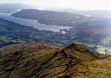
; there is also a good aerial view of Ambleside and the head of Windermere lake.
Fell
“Fell” is a word used to refer to mountains, or certain types of mountainous landscape, in Scandinavia, the Isle of Man, and parts of northern England.- Etymology :...
in the English
England
England is a country that is part of the United Kingdom. It shares land borders with Scotland to the north and Wales to the west; the Irish Sea is to the north west, the Celtic Sea to the south west, with the North Sea to the east and the English Channel to the south separating it from continental...
Lake District
Lake District
The Lake District, also commonly known as The Lakes or Lakeland, is a mountainous region in North West England. A popular holiday destination, it is famous not only for its lakes and its mountains but also for its associations with the early 19th century poetry and writings of William Wordsworth...
. It has a modest height of 508 m (1,667 ft) and is situated three kilometres north of Ambleside
Ambleside
Ambleside is a town in Cumbria, in North West England.Historically within the county of Westmorland, it is situated at the head of Windermere, England's largest lake...
. Low Pike is well seen from the streets of the town as the first prominent fell on the ridge which continues northwards for a further four kilometres to Fairfield
Fairfield (Lake District)
Fairfield is a fell in the English Lake District. It is the highest of a group of hills in the Eastern Fells, standing to the south of the Helvellyn range.-Topography:...
. This ridge is part of the Fairfield horseshoe
Fairfield horseshoe
Fairfield Horseshoe is a classic circular hillwalking ridge walk route starting from Rydal or Ambleside in the English Lake District that takes in all the fells that surround the valley of the Rydal Beck....
walk and Low Pike is most commonly ascended as part of this.
Topography
Despite its modest height Alfred WainwrightAlfred Wainwright
Alfred Wainwright MBE was a British fellwalker, guidebook author and illustrator. His seven-volume Pictorial Guide to the Lakeland Fells, published between 1955 and 1966 and consisting entirely of reproductions of his manuscript, has become the standard reference work to 214 of the fells of the...
gave Low Pike a separate chapter in his Pictorial Guide to the Lakeland Fells
Pictorial Guide to the Lakeland Fells
A Pictorial Guide to the Lakeland Fells is a series of seven books by A. Wainwright, detailing the fells of the Lake District in northwest England...
because:
“it is sufficiently elevated above the deep valleys of Scandale and Rydale to give an impression of loftiness which exaggerates its modest altitude”.
Bill Birkett
Bill Birkett
Bill Birkett is one of the world's foremost mountain writers and photographers, and is a leading climber who has undertaken many expeditions around the world....
also mentions the fell in his “Complete Lakeland Fells” but its altitude is not sufficient to be noted on any other mountain lists
Hill lists in the British Isles
The mountains and hills of Great Britain, and to a lesser extent Ireland, are the subject of a considerable number of lists that categorise them by height, topographic prominence, or other criteria. They are commonly used as a basis for peak bagging, whereby hillwalkers attempt to reach all the...
.

Geology
The crest of the ridge consists of the daciticDacite
Dacite is an igneous, volcanic rock. It has an aphanitic to porphyritic texture and is intermediate in composition between andesite and rhyolite. The relative proportions of feldspars and quartz in dacite, and in many other volcanic rocks, are illustrated in the QAPF diagram...
welded lapilli
Lapilli
Lapilli is a size classification term for tephra, which is material that falls out of the air during a volcanic eruption or during some meteorite impacts. Lapilli means "little stones" in Latin. They are in some senses similar to ooids or pisoids in calcareous sediments.By definition lapilli range...
-tuff
Tuff
Tuff is a type of rock consisting of consolidated volcanic ash ejected from vents during a volcanic eruption. Tuff is sometimes called tufa, particularly when used as construction material, although tufa also refers to a quite different rock. Rock that contains greater than 50% tuff is considered...
of the Lincomb Tarns Formation. Andesite
Andesite
Andesite is an extrusive igneous, volcanic rock, of intermediate composition, with aphanitic to porphyritic texture. In a general sense, it is the intermediate type between basalt and dacite. The mineral assemblage is typically dominated by plagioclase plus pyroxene and/or hornblende. Magnetite,...
sills surround this.
Ascents
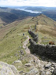
The direct ascent from Ambleside is straightforward. A signpost points to Low Sweden Bridge from the centre of Ambleside; after reaching the bridge and crossing the Scandale Beck a high dry-stone wall is followed for two kilometres along the spine of the ridge to reach the summit. A visit to High Sweden Bridge may be incorporated at the start of this walk; it is a typical CumbriaCumbria
Cumbria , is a non-metropolitan county in North West England. The county and Cumbria County Council, its local authority, came into existence in 1974 after the passage of the Local Government Act 1972. Cumbria's largest settlement and county town is Carlisle. It consists of six districts, and in...
n Packhorse bridge
Packhorse bridge
A packhorse bridge is a bridge intended to carry packhorses across a river or stream. Typically a packhorse bridge consists of one or more narrow masonry arches, and has low parapets so as not to interfere with the horse's panniers.Packhorse bridges were often built on the trade routes that...
. It has no direct Scandinavia
Scandinavia
Scandinavia is a cultural, historical and ethno-linguistic region in northern Europe that includes the three kingdoms of Denmark, Norway and Sweden, characterized by their common ethno-cultural heritage and language. Modern Norway and Sweden proper are situated on the Scandinavian Peninsula,...
n connection except that its name comes from the Norse word ‘svithinn’ which means “land cleared by burning”. Most walkers who climb Low Pike continue to the adjoining fells of the Fairfield Horseshoe: these are High Pike
High Pike (Scandale)
High Pike is a fell in the English Lake District, located five kilometres north of Ambleside. Situated in the Eastern Fells, it can be confused with another Lake District High Pike in the Northern Fells. High Pike reaches a height of...
, Dove Crag
Dove Crag
Dove Crag is a fell in the English Lake District. Situated in the Eastern Fells of the national park, seven kilometres south-south-west of Glenridding, it reaches a height of 792 metres...
, Hart Crag
Hart Crag
Hart Crag is a fell in the English Lake District, being one of the Fairfield group of hills in the Eastern Fells.-Topography:The fell stands on the ridge running south east from Fairfield to Dove Crag, at the point where a long subsidiary spur sweeps off to the north east...
, Fairfield, Great Rigg
Great Rigg
Great Rigg is a fell in the English Lake District, it is situated 7 kilometres north northwest of Ambleside and reaches a height of 766 metres . It is most often climbed as part of the Fairfield horseshoe, a 16 km circular walk which starts and finishes in Ambleside...
and Heron Pike
Heron Pike
Heron Pike is a fell in the English Lake District, two kilometres east of Grasmere. It is part of the Fairfield group in the Eastern Fells.-Topography:...
before returning to Ambleside.
Summit and view
The top of the fell is a small rocky peak which requires a bit of scrambling; the stone wall goes directly over the peak giving no room for a cairn of any size. The view is restricted by surrounding higher fells but the LangdaleGreat Langdale
Great Langdale is a valley in the Lake District National Park in the county of Cumbria, in the northwest of England. It is often simply referred to as Langdale, the epithet Great distinguishing it from the neighbouring valley of Little Langdale....
and Coniston
Furness Fells
The Furness Fells are those hills and mountains in the Furness region of Cumbria, England. Historically part of Lancashire, the Furness Fells or High Furness is the name given to the upland part of Furness, that is, that part of Furness lying north of the line between Ulverston and Ireleth...
fells show well over the low ground at the head of Windermere
Windermere (lake)
Windermere is the largest natural lake in England. It is a ribbon lake formed in a glacial trough after the retreat of ice at the start of the current interglacial. It has been one of the country’s most popular places for holidays and summer homes since the arrival of the Kendal and Windermere...
; there is also a good aerial view of Ambleside and the head of Windermere lake.

