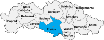
Lubotice
Encyclopedia

Village
A village is a clustered human settlement or community, larger than a hamlet with the population ranging from a few hundred to a few thousand , Though often located in rural areas, the term urban village is also applied to certain urban neighbourhoods, such as the West Village in Manhattan, New...
and municipality
Municipality
A municipality is essentially an urban administrative division having corporate status and usually powers of self-government. It can also be used to mean the governing body of a municipality. A municipality is a general-purpose administrative subdivision, as opposed to a special-purpose district...
in Prešov District
Prešov District
Prešov District is a district in the Prešov Region of eastern Slovakia.Until 1918, the district was part of the Hungarian county of Šariš.- Municipalities :*Abranovce*Bajerov*Bertotovce*Brestov*Bretejovce*Brežany*Bzenov...
in the Prešov Region
Prešov Region
The Prešov Region is one of the eight Slovak administrative regions. It consists of 13 districts.-Geography:It is located in north-eastern Slovakia and has an area of 8,975 km². The region has diverse types of landscapes occurring in Slovakia, but mostly highlands and hilly lands dominate the...
of eastern Slovakia
Slovakia
The Slovak Republic is a landlocked state in Central Europe. It has a population of over five million and an area of about . Slovakia is bordered by the Czech Republic and Austria to the west, Poland to the north, Ukraine to the east and Hungary to the south...
.
Geography
The municipalityMunicipality
A municipality is essentially an urban administrative division having corporate status and usually powers of self-government. It can also be used to mean the governing body of a municipality. A municipality is a general-purpose administrative subdivision, as opposed to a special-purpose district...
lies at an elevation
Elevation
The elevation of a geographic location is its height above a fixed reference point, most commonly a reference geoid, a mathematical model of the Earth's sea level as an equipotential gravitational surface ....
of 258 metres (846 ft) and covers an area
Area
Area is a quantity that expresses the extent of a two-dimensional surface or shape in the plane. Area can be understood as the amount of material with a given thickness that would be necessary to fashion a model of the shape, or the amount of paint necessary to cover the surface with a single coat...
of 8.324 km² (2,045 acre
Acre
The acre is a unit of area in a number of different systems, including the imperial and U.S. customary systems. The most commonly used acres today are the international acre and, in the United States, the survey acre. The most common use of the acre is to measure tracts of land.The acre is related...
s). It had a population
Population
A population is all the organisms that both belong to the same group or species and live in the same geographical area. The area that is used to define a sexual population is such that inter-breeding is possible between any pair within the area and more probable than cross-breeding with individuals...
of 3025 people in 2009.

