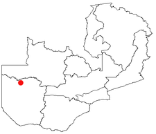
Lukulu
Encyclopedia

Market town
Market town or market right is a legal term, originating in the medieval period, for a European settlement that has the right to host markets, distinguishing it from a village and city...
in the Western Province
Western Province, Zambia
Western Province, encompasses the area formerly known as Barotseland in the colonial era.-Districts:Western Province is divided into 7 districts:*Kalabo District*Kaoma District*Lukulu District*Mongu District*Senanga District*Sesheke District...
of Zambia
Zambia
Zambia , officially the Republic of Zambia, is a landlocked country in Southern Africa. The neighbouring countries are the Democratic Republic of the Congo to the north, Tanzania to the north-east, Malawi to the east, Mozambique, Zimbabwe, Botswana and Namibia to the south, and Angola to the west....
, on the Zambezi
Zambezi
The Zambezi is the fourth-longest river in Africa, and the largest flowing into the Indian Ocean from Africa. The area of its basin is , slightly less than half that of the Nile...
River, and headquarters of a district
Districts of Zambia
The nine provinces of Zambia are divided into a total of 72 districts.Article 109 in part VIII of the constitution of Zambia deals with local government...
of the same name. Access to the town is limited to only a few unsealed roads which do not see much traffic. Fish
Fish
Fish are a paraphyletic group of organisms that consist of all gill-bearing aquatic vertebrate animals that lack limbs with digits. Included in this definition are the living hagfish, lampreys, and cartilaginous and bony fish, as well as various extinct related groups...
from the river provide most of the local diet, and some are export
Export
The term export is derived from the conceptual meaning as to ship the goods and services out of the port of a country. The seller of such goods and services is referred to as an "exporter" who is based in the country of export whereas the overseas based buyer is referred to as an "importer"...
ed to other parts of Zambia away from the river.
Lukulu is at the north end of the Zambezi's Barotse Floodplain
Barotse Floodplain
The Barotse Floodplain also known as the Bulozi Plain, Lyondo or the Zambezi Floodplain is one of Africa's great wetlands, on the Zambezi River in the Western Province of Zambia...
which at that point has not developed its full character, being narrower and less flat than it is further south. Every year between December and March, the river rises above the low banks of its main channel and spreads across the floodplain.
There is a small pontoon ferry across the river, with a beach
Beach
A beach is a geological landform along the shoreline of an ocean, sea, lake or river. It usually consists of loose particles which are often composed of rock, such as sand, gravel, shingle, pebbles or cobblestones...
lying on the opposite bank of the main channel. Lukulu is also home to a hospital
Hospital
A hospital is a health care institution providing patient treatment by specialized staff and equipment. Hospitals often, but not always, provide for inpatient care or longer-term patient stays....
, two market
Market
A market is one of many varieties of systems, institutions, procedures, social relations and infrastructures whereby parties engage in exchange. While parties may exchange goods and services by barter, most markets rely on sellers offering their goods or services in exchange for money from buyers...
s and several school
School
A school is an institution designed for the teaching of students under the direction of teachers. Most countries have systems of formal education, which is commonly compulsory. In these systems, students progress through a series of schools...
s. The rough roads are the only problem which stops trade and tourists from reaching the town.
Lukulu District
Lukulu District, population 68,375, stretches across the north-eastern and north-central parts of Western Province, adjoining North-Western ProvinceNorth-Western Province, Zambia
North-Western Province is one of Zambia's nine provinces. It covers an area of 125,826 km² and has a population of 583,350 . It is the most sparsely populated province in the country...
and straddling the Zambezi and the northern Barotse Floodplain. The portion of the district west of the Zambezi is grassland and has no roads or towns, only dry season tracks to a few villages. It is rich in wildlife, the Liuwa Plain National Park
Liuwa Plain National Park
The Liuwa Plain National Park lies in Western Province, Zambia, west of the Barotse Floodplain of the Zambezi River near the border with Angola.-History:...
extends into it from the south. East of the river the district is Miombo woodland and Cryptosepalum dry forests with Zambezian flooded grasslands adjacent to rivers. This part is served by a gravel road from Kaoma
Kaoma, Zambia
Kaoma is a town in Zambia. It is the headquarters of Kaoma District in the Western Province.-Location:Kaoma is located approximately , by road, west of Lusaka, the capital of Zambia and its largest city. At Kaoma, the Great West Road , meets the Kaoma-Kasempa Road . This location lies west of Kafue...
, and a gravel road to North-Western Province via the Kabompo Ferry
Kabompo Ferry
The Kabompo Ferry is a vehicle pontoon ferry with a 25-tonne capacity on the Kabompo River dividing the Western and North-Western Provinces of Zambia. It is a manually-powered cable ferry, propelled by pulling on the steel cables which anchor it to each bank of the 100 m wide river...
.

