

Marble Point
Encyclopedia
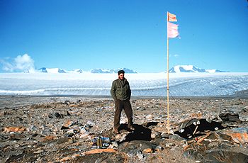
Marble Point, Antarctica, is a rocky promontory on the coast of Victoria Land
located at 77° 26' S latitude and 163° 50' E longitude. The United States operates a station at the point. The outpost is used as a helicopter refueling station supporting scientific research in the nearby continental interior such as the McMurdo Dry Valleys
. Weather permitting, helicopters are able to fly in and out of the station 24 hours a day during the summer research season.
 The station's remote location and adjoining frozen sea have largely stemmed tourism in the area. However, the Russian icebreaker Kapitan Khlebnikov conducts cruises in the Ross Sea
and McMurdo Sound
. In 1993, the icebreaker docked at fast ice
offshore Marble Point. Tourists aboard helicopters launched from the icebreaker flew excursions into the McMurdo Dry Valleys.
 The way station at Marble Point is located on a narrow strip of land between Wilson Piedmont Glacier and the sea about 50 miles from McMurdo Station
. United States military forces built the camp on the western shores of McMurdo Sound
in 1956 in conjunction with the forthcoming 1957-58 International Geophysical Year
(IGY).
Preparation for IGY included constructing a hard-surface air strip at Marble Point. A VX-6
Otter airplane made Antarctica’s first wheels-on-dirt landing at Marble Point in 1957. Aboard were U.S. Navy Admiral Dufeck and New Zealand explorer Sir Edmund Hillary. A de Havilland Canada DHC-3 Otter aircraft crashed on take off at Marble Point January, 04, 1959, taking the lives of two men. The plane was part of Operation Deep Freeze
IV.
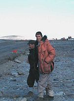 Contemporary Marble Point is staffed during the austral summer by a station manager, cook, and a "fuelie," a person who fuels helicopters. Hot meals and minimal overnight accommodations for 14 are available for pilots and personnel traveling to and from inland research operations.
Personnel rely upon melted snow for potable water. A bulldozer is used to scoop snow from nearby Wilson Piedmont Glacier. The snow is dumped into a hopper for melting and subsequent filtration. Other facilities at the station include an automated weather station.
United States Antarctic Program (USAP) workers conducted a concerted cleanup at the station during the 1989-1990 and 1990-1991 summer research seasons. Fuel spills are known to have occurred in the area. As late as 2001, spills more than 40 years old were still visible. Contemporary operations include the collection of human waste at the station which is collected and transported to McMurdo Station.
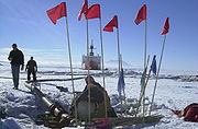 Each austral summer a United States Coast Guard icebreaker busts a ship channel to Marble Point in order to deliver helicopter fuel. The ship usually can reach within about one-quarter of a mile from the beach. Fuel is then pumped ashore. Formerly, personnel pumped the aviation fuel into 20,000 gallon bladders for storage. However, the fuel bladders were replaced with steel tanks."Impact of fuel spills on Antarctica soils", News and Views; United States Department of Agriculture. May 2000.
Support personnel re-supply the camp annually via a convoy of over-the-ice vehicles from McMurdo Station. Drivers maneuver 15-ton Delta cargo vehicles equipped with large balloon-type tires over a more than 50-mile ice road. Alternatively, vehicles towing snow sleds are used to transport cargo. Drivers also deliver food, construction equipment, and scientific equipment that is staged at Marble Point for subsequent airlift to field camps.
Flags placed approximately every quarter mile mark much of the ice road to Marble Point. Drivers carry global positioning devices as navigational aids during the seven hour journey. Waste materials (including human waste) from Marble Point and garbage dropped off from inland research stations are back-loaded to McMurdo Station for disposal. The supply season runs from mid-October to late November or early December.
Victoria Land
Victoria Land is a region of Antarctica bounded on the east by the Ross Ice Shelf and the Ross Sea and on the west by Oates Land and Wilkes Land. It was discovered by Captain James Clark Ross in January 1841 and named after the UK's Queen Victoria...
located at 77° 26' S latitude and 163° 50' E longitude. The United States operates a station at the point. The outpost is used as a helicopter refueling station supporting scientific research in the nearby continental interior such as the McMurdo Dry Valleys
McMurdo Dry Valleys
The McMurdo Dry Valleys are a row of snow-free valleys in Antarctica located within Victoria Land west of McMurdo Sound. The region is one of the world's most extreme deserts, and includes many interesting features including Lake Vida and the Onyx River, Antarctica's longest river.-Climate:The Dry...
. Weather permitting, helicopters are able to fly in and out of the station 24 hours a day during the summer research season.
Ross Sea
The Ross Sea is a deep bay of the Southern Ocean in Antarctica between Victoria Land and Marie Byrd Land.-Description:The Ross Sea was discovered by James Ross in 1841. In the west of the Ross Sea is Ross Island with the Mt. Erebus volcano, in the east Roosevelt Island. The southern part is covered...
and McMurdo Sound
McMurdo Sound
The ice-clogged waters of Antarctica's McMurdo Sound extend about 55 km long and wide. The sound opens into the Ross Sea to the north. The Royal Society Range rises from sea level to 13,205 feet on the western shoreline. The nearby McMurdo Ice Shelf scribes McMurdo Sound's southern boundary...
. In 1993, the icebreaker docked at fast ice
Fast ice
Fast ice is sea ice that has frozen along coasts along the shoals, or to the sea floor over shallow parts of the continental shelf, and extends out from land into sea. In Antarctica, fast ice may also extend between grounded icebergs...
offshore Marble Point. Tourists aboard helicopters launched from the icebreaker flew excursions into the McMurdo Dry Valleys.
Development
McMurdo Station
McMurdo Station is a U.S. Antarctic research center located on the southern tip of Ross Island, which is in the New Zealand-claimed Ross Dependency on the shore of McMurdo Sound in Antarctica. It is operated by the United States through the United States Antarctic Program, a branch of the National...
. United States military forces built the camp on the western shores of McMurdo Sound
McMurdo Sound
The ice-clogged waters of Antarctica's McMurdo Sound extend about 55 km long and wide. The sound opens into the Ross Sea to the north. The Royal Society Range rises from sea level to 13,205 feet on the western shoreline. The nearby McMurdo Ice Shelf scribes McMurdo Sound's southern boundary...
in 1956 in conjunction with the forthcoming 1957-58 International Geophysical Year
International Geophysical Year
The International Geophysical Year was an international scientific project that lasted from July 1, 1957, to December 31, 1958. It marked the end of a long period during the Cold War when scientific interchange between East and West was seriously interrupted...
(IGY).
Preparation for IGY included constructing a hard-surface air strip at Marble Point. A VX-6
VX-6
Air Development Squadron Six was a United States Navy Air Development Squadron based at McMurdo Station, Antarctica...
Otter airplane made Antarctica’s first wheels-on-dirt landing at Marble Point in 1957. Aboard were U.S. Navy Admiral Dufeck and New Zealand explorer Sir Edmund Hillary. A de Havilland Canada DHC-3 Otter aircraft crashed on take off at Marble Point January, 04, 1959, taking the lives of two men. The plane was part of Operation Deep Freeze
Operation Deep Freeze
Operation Deep Freeze is the codename for a series of United States missions to Antarctica, beginning with "Operation Deep Freeze I" in 1955–56, followed by "Operation Deep Freeze II", "Operation Deep Freeze III", and so on...
IV.
Personnel rely upon melted snow for potable water. A bulldozer is used to scoop snow from nearby Wilson Piedmont Glacier. The snow is dumped into a hopper for melting and subsequent filtration. Other facilities at the station include an automated weather station.
United States Antarctic Program (USAP) workers conducted a concerted cleanup at the station during the 1989-1990 and 1990-1991 summer research seasons. Fuel spills are known to have occurred in the area. As late as 2001, spills more than 40 years old were still visible. Contemporary operations include the collection of human waste at the station which is collected and transported to McMurdo Station.
Re-supply
Support personnel re-supply the camp annually via a convoy of over-the-ice vehicles from McMurdo Station. Drivers maneuver 15-ton Delta cargo vehicles equipped with large balloon-type tires over a more than 50-mile ice road. Alternatively, vehicles towing snow sleds are used to transport cargo. Drivers also deliver food, construction equipment, and scientific equipment that is staged at Marble Point for subsequent airlift to field camps.
Flags placed approximately every quarter mile mark much of the ice road to Marble Point. Drivers carry global positioning devices as navigational aids during the seven hour journey. Waste materials (including human waste) from Marble Point and garbage dropped off from inland research stations are back-loaded to McMurdo Station for disposal. The supply season runs from mid-October to late November or early December.
See also
- McMurdo Dry ValleysMcMurdo Dry ValleysThe McMurdo Dry Valleys are a row of snow-free valleys in Antarctica located within Victoria Land west of McMurdo Sound. The region is one of the world's most extreme deserts, and includes many interesting features including Lake Vida and the Onyx River, Antarctica's longest river.-Climate:The Dry...
- McMurdo SoundMcMurdo SoundThe ice-clogged waters of Antarctica's McMurdo Sound extend about 55 km long and wide. The sound opens into the Ross Sea to the north. The Royal Society Range rises from sea level to 13,205 feet on the western shoreline. The nearby McMurdo Ice Shelf scribes McMurdo Sound's southern boundary...
- Operation Deep FreezeOperation Deep FreezeOperation Deep Freeze is the codename for a series of United States missions to Antarctica, beginning with "Operation Deep Freeze I" in 1955–56, followed by "Operation Deep Freeze II", "Operation Deep Freeze III", and so on...
- Victoria LandVictoria LandVictoria Land is a region of Antarctica bounded on the east by the Ross Ice Shelf and the Ross Sea and on the west by Oates Land and Wilkes Land. It was discovered by Captain James Clark Ross in January 1841 and named after the UK's Queen Victoria...
- Williams FieldWilliams FieldWilliams Field or Willy Field is a United States Antarctic Program airfield in Antarctica. Williams Field consists of two snow runways located on approximately 8 meters of compacted snow, lying on top of 80 meters of ice, floating over 550 meters of water...