
Marion, South Australia
Encyclopedia
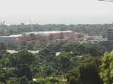
Marion is a suburb
located in the City of Marion
in Adelaide
around 10 km south-west from the CBD
. Founded as a rural village in 1838 on the banks of the Sturt River
, Marion was found to have rich soil and the population expanded rapidly. Colonel William Light
laid out the plan for the village, as he had done with the City of Adelaide
itself.
Marion is bordered on the north by Oaklands Road, on the east by Marion Road, on the south by Sturt Road and on the west by a roughly straight line from Finniss Street in the south to The Parade.
By the late 19th century Marion was also home to a number of industries such as a mining and brick making. However, the population at this time was still very small - around 350 people.
Gradually the Adelaide sprawl crept up to Marion, and by the 1950s the suburb was well and truly enveloped. Nowadays it is a large, modern suburb with many attractions for its residents.
Marion also shares the Oaklands Reserve with Oaklands Park. The City of Marion Swimming Centre is situated adjacent to the suburb of Marion, in Park Holme
.
The Sturt River Linear Park is a trail which follows the Sturt River
through the south-western metropolitan area from Marion to Glenelg.
, is situated along Alison Avenue near the railway line. It caters to many families in the area for all grades from Reception to Year 12.
Marion High School, a public school in the area closing in 1996, was situated on York Avenue, in the suburb of Clovelly Park. The school serviced the youth of the area for over forty years until its closure. The area has now been redeveloped primarily for housing, with just the school hall remaining, Cosgrove Hall which was named after a long running headmaster of the school.
Churches of various denominations are located Marion.
The Marion Returned and Services League of Australia
Club is located on Norfolk Road.
There are two bowling clubs in the suburb of Marion, one on Norfolk Road, near the RSL club and another on Sturt Road adjacent to Sturt Oval.
. The council offices for the whole city are located in nearby Sturt
. Marion is split between the state electorates of Elder
and Mitchell
and is situated in the Federal Division of Boothby
.
to the north and Noarlunga to the south.
The M44 bus runs along Finniss Street and Marion Road
to Adelaide's centre, Golden Grove
and Marion Shopping Centre
. The 213 travels along Finniss Street from Marion Shopping Centre to Adelaide's centre via Goodwood Road
. In the north of the suburb, the 241 bus travels along Oaklands Road and Daws Road
to Adelaide's centre and Marion Shopping Centre.
Suburb
The word suburb mostly refers to a residential area, either existing as part of a city or as a separate residential community within commuting distance of a city . Some suburbs have a degree of administrative autonomy, and most have lower population density than inner city neighborhoods...
located in the City of Marion
City of Marion
The City of Marion is a local government area in the southern suburbs of Adelaide, South Australia. The council offices are in the suburb of Sturt.-Suburbs:The suburbs in the City of Marion are:-External links:**...
in Adelaide
Adelaide
Adelaide is the capital city of South Australia and the fifth-largest city in Australia. Adelaide has an estimated population of more than 1.2 million...
around 10 km south-west from the CBD
Central business district
A central business district is the commercial and often geographic heart of a city. In North America this part of a city is commonly referred to as "downtown" or "city center"...
. Founded as a rural village in 1838 on the banks of the Sturt River
Sturt River, Adelaide
The Sturt River is a river located in Adelaide, South Australia. Beginning in Upper Sturt in the Adelaide Hills, it flows through Coromandel Valley, the Sturt Gorge Recreation Park, Marion and Morphettville, before meeting the Patawalonga in Glenelg North. Along with Brown Hill Creek, it is one of...
, Marion was found to have rich soil and the population expanded rapidly. Colonel William Light
William Light
Colonel William Light was a British military officer and the first Surveyor-General of the Colony of South Australia...
laid out the plan for the village, as he had done with the City of Adelaide
City of Adelaide
The City of Adelaide is a local government area in the metropolitan area of Adelaide, South Australia. It covers the original Adelaide city centre settlement, , North Adelaide, and the Adelaide Park Lands which surround North Adelaide and the city centre.Established in 1840, the organisation now...
itself.
Marion is bordered on the north by Oaklands Road, on the east by Marion Road, on the south by Sturt Road and on the west by a roughly straight line from Finniss Street in the south to The Parade.
History
Vegetables, stone fruits, almonds and grapes were all produced in Marion. Richard Hamilton started the first vineyard in 1838 and his family continues its wine making tradition to this day.By the late 19th century Marion was also home to a number of industries such as a mining and brick making. However, the population at this time was still very small - around 350 people.
Gradually the Adelaide sprawl crept up to Marion, and by the 1950s the suburb was well and truly enveloped. Nowadays it is a large, modern suburb with many attractions for its residents.
Parkland
Marion is home to a number of parks and reserves. The large sporting complex off Sturt Road contains ovals and a basketball stadium. There are also parks on Norfolk Road, Tilley Crescent, Nicholas Road, Oakleigh Road, George Street and Alison Avenue.Marion also shares the Oaklands Reserve with Oaklands Park. The City of Marion Swimming Centre is situated adjacent to the suburb of Marion, in Park Holme
Park Holme, South Australia
Park Holme is a suburb of Adelaide in the City of Marion, South Australia, home to the Marion Swimming Centre.Park Holme Post Office opened on 23 June 1960.-See also:*List of Adelaide suburbs...
.
The Sturt River Linear Park is a trail which follows the Sturt River
Sturt River, Adelaide
The Sturt River is a river located in Adelaide, South Australia. Beginning in Upper Sturt in the Adelaide Hills, it flows through Coromandel Valley, the Sturt Gorge Recreation Park, Marion and Morphettville, before meeting the Patawalonga in Glenelg North. Along with Brown Hill Creek, it is one of...
through the south-western metropolitan area from Marion to Glenelg.
Community facilities
The large private school, WestminsterWestminster School, Adelaide
Westminster School is an independent, Uniting Church, Early Learning to Year 12, coeducational, day and boarding school located at Marion, South Australia, 12 km south of Adelaide. Founded as a Methodist day and boarding school for boys, the school was opened by the Prime Minister Robert...
, is situated along Alison Avenue near the railway line. It caters to many families in the area for all grades from Reception to Year 12.
Marion High School, a public school in the area closing in 1996, was situated on York Avenue, in the suburb of Clovelly Park. The school serviced the youth of the area for over forty years until its closure. The area has now been redeveloped primarily for housing, with just the school hall remaining, Cosgrove Hall which was named after a long running headmaster of the school.
Churches of various denominations are located Marion.
The Marion Returned and Services League of Australia
Returned and Services League of Australia
The Returned and Services League of Australia is a support organisation for men and women who have served or are serving in the Australian Defence Force ....
Club is located on Norfolk Road.
There are two bowling clubs in the suburb of Marion, one on Norfolk Road, near the RSL club and another on Sturt Road adjacent to Sturt Oval.
Governance
Part of the City of MarionCity of Marion
The City of Marion is a local government area in the southern suburbs of Adelaide, South Australia. The council offices are in the suburb of Sturt.-Suburbs:The suburbs in the City of Marion are:-External links:**...
. The council offices for the whole city are located in nearby Sturt
Sturt, South Australia
Sturt is a suburb of Adelaide in the City of Marion local government area. It was named after the explorer Captain Charles Sturt.Sturt is in the South Australian House of Assembly electoral district of Mitchell and the Australian House of Representatives Division of Boothby.-History:The first...
. Marion is split between the state electorates of Elder
Electoral district of Elder
Elder is an electoral district of the House of Assembly in the Australian state of South Australia. It is named after nineteenth-century businessman and philanthropist Thomas Elder...
and Mitchell
Electoral district of Mitchell (South Australia)
Mitchell is an electoral district of the House of Assembly in the state of South Australia. It was first created in 1969 and is named after philosopher Sir William Mitchell...
and is situated in the Federal Division of Boothby
Division of Boothby
The Division of Boothby is an Australian Electoral Division in South Australia. The division was created in 1903 and is named after William Boothby , the Returning Officer for the first election of Members of the House of Representatives in 1901....
.
Transport
There is a railway station in Marion between Minchinbury Terrace and Fairne Terrace, which connects to Adelaide's centreAdelaide city centre
The Adelaide city centre is the innermost locality of Greater Adelaide, known by locals simply as "The City" or "Town". The locality is split into two key geographical distinctions: the city "square mile", bordered by North, East, South and West Terraces; and that part of the Adelaide Parklands...
to the north and Noarlunga to the south.
The M44 bus runs along Finniss Street and Marion Road
Marion Road, Adelaide
Marion Road is a north–south conduit in Adelaide, South Australia. Where it terminates in Bedford Park, southwest of Adelaide's centre, Marion Road feeds into the Southern Expressway near the northern starting point of that road....
to Adelaide's centre, Golden Grove
Golden Grove, South Australia
Golden Grove is an outer north-eastern suburb of Adelaide, South Australia and is within the City of Tea Tree Gully local government area. It is adjacent to Wynn Vale, Surrey Downs, Greenwith, Yatala Vale, Fairview Park, and Salisbury East.- History :...
and Marion Shopping Centre
Westfield Marion
Westfield Marion is the largest shopping complex in Adelaide, South Australia. The centre, its management and all tenant addresses are located in the suburb of Oaklands Park...
. The 213 travels along Finniss Street from Marion Shopping Centre to Adelaide's centre via Goodwood Road
Goodwood Road, Adelaide
Goodwood Road is a major north-south arterial road, approximately 10 kilometres long, in Adelaide, South Australia. It runs between the Adelaide city centre and the suburbs of Pasadena and Panorama, and has a speed limit of ....
. In the north of the suburb, the 241 bus travels along Oaklands Road and Daws Road
Daws Road, Adelaide
Daws Road is a major double lane arterial road in the central southern suburbs of Adelaide, running east-west between Goodwood Road in the east and Marion Road in the west. Daws Road crosses South Road and the Tonsley railway line. It passes under one of the two diagonal railway bridges of the...
to Adelaide's centre and Marion Shopping Centre.