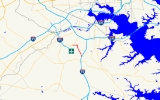
Maryland Route 162
Encyclopedia
Maryland Route 162 forms the eastern part of the Airport Loop
around Baltimore-Washington International Thurgood Marshall Airport
designated as Aviation Boulevard. It is 2.31 miles (3.7 km) long and Links Telegraph and Camp Meade Road (Maryland Route 170
) with North Dorsey Road (Maryland Route 176
). Maryland Route 162 also provides access to Interstate 97
. It was once Maryland Route 167 (Hammonds Ferry Road).
, starting at MD 176 (Dorsey Road). It travels north, carrying the name Aviation Boulevard on a four-lane boulevard, and running just to the east of Interstate 97
. After intersecting Cromwell Park Drive, which turns into two right-in/right-out
ramps to the Interstate, it turns to the northwest. The route provides access to several side streets leading to businesses and suburban residential areas, and passing close to a series of small-craft hangars off the edge of the main runways. Once it runs past MD 762 (Andover Road), it turns sharply to the west, providing access to the very large northeast parking lot for BWI. The route ends shortly after when it encounters MD 170 (Camp Meade Road); however, the Airport Loop and Aviation Boulevard continue to the west from here, with MD 170 taking over these designations.
.
Airport Loop
Airport Loop is the designation for the portions of state highways that form a circumferential highway around Baltimore/Washington International Thurgood Marshall Airport in Anne Arundel County in the U.S. state of Maryland. The loop runs through the communities of Linthicum, Ferndale, and Hanover...
around Baltimore-Washington International Thurgood Marshall Airport
Baltimore-Washington International Thurgood Marshall Airport
Baltimore/Washington International Thurgood Marshall Airport is an international airport serving the Baltimore-Washington Metropolitan Area in the United States. It is commonly called BWI, BWI Airport or BWI Marshall, BWI being an initialism for "Baltimore/Washington International" and the...
designated as Aviation Boulevard. It is 2.31 miles (3.7 km) long and Links Telegraph and Camp Meade Road (Maryland Route 170
Maryland Route 170
Maryland Route 170 is a roughly 13-mile-long road in Anne Arundel County.-Route description:MD 170 begins at the intersection of MD 175 Annapolis Road and Piney Orchard Parkway, in Odenton. It runs north towards Severn, interchanging with MD 32 northwest of the town...
) with North Dorsey Road (Maryland Route 176
Maryland Route 176
Maryland Route 176 is an east–west route in Anne Arundel County.-Route description:MD 176 begins at a cul-de-sac near Wright Rd., a local neighborhood street, within sight of its old interchange with MD 295, now used by MD 100. Continuing east it intersects the northern end of MD 713 north of...
). Maryland Route 162 also provides access to Interstate 97
Interstate 97
Interstate 97 is an intrastate Interstate Highway located entirely within Anne Arundel County, Maryland, United States. It runs from Annapolis at the overlapped section of US 50, US 301, and the unsigned I-595 to Baltimore at the city's beltway...
. It was once Maryland Route 167 (Hammonds Ferry Road).
Route description
Maryland Route 162's entire route follows the Airport LoopAirport Loop
Airport Loop is the designation for the portions of state highways that form a circumferential highway around Baltimore/Washington International Thurgood Marshall Airport in Anne Arundel County in the U.S. state of Maryland. The loop runs through the communities of Linthicum, Ferndale, and Hanover...
, starting at MD 176 (Dorsey Road). It travels north, carrying the name Aviation Boulevard on a four-lane boulevard, and running just to the east of Interstate 97
Interstate 97
Interstate 97 is an intrastate Interstate Highway located entirely within Anne Arundel County, Maryland, United States. It runs from Annapolis at the overlapped section of US 50, US 301, and the unsigned I-595 to Baltimore at the city's beltway...
. After intersecting Cromwell Park Drive, which turns into two right-in/right-out
Right-in/right-out
Right-in/right-out and left-in/left-out refer to a type of road intersection where turning movements of vehicles are restricted. A RIRO permits only right turns and a LILO permits only left turns. RIRO is usual where vehicles drive on the right, and LILO is usual where vehicles drive on the left...
ramps to the Interstate, it turns to the northwest. The route provides access to several side streets leading to businesses and suburban residential areas, and passing close to a series of small-craft hangars off the edge of the main runways. Once it runs past MD 762 (Andover Road), it turns sharply to the west, providing access to the very large northeast parking lot for BWI. The route ends shortly after when it encounters MD 170 (Camp Meade Road); however, the Airport Loop and Aviation Boulevard continue to the west from here, with MD 170 taking over these designations.
Junction list
The entire route is in Anne Arundel CountyAnne Arundel County, Maryland
Anne Arundel County is a county located in the U.S. state of Maryland. It is named for Anne Arundell , a member of the ancient family of Arundells in Cornwall, England and the wife of Cæcilius Calvert, 2nd Baron Baltimore. Its county seat is Annapolis, which is also the capital of the state...
.
| Location | Mile |
Intersection | Notes |
|---|---|---|---|
| BWI Airport | 0.00 | Southern terminus | |
| 0.32 | I-97 exit 15 | ||
| Linthicum Linthicum, Maryland Linthicum is a census-designated place and an unincorporated community in Anne Arundel County, Maryland, United States. The population was 7,539 at the 2000 census. It is the approximate location of Baltimore-Washington International Thurgood Marshall Airport... |
1.83 | ||
| 2.31 | , Washington Washington, D.C. Washington, D.C., formally the District of Columbia and commonly referred to as Washington, "the District", or simply D.C., is the capital of the United States. On July 16, 1790, the United States Congress approved the creation of a permanent national capital as permitted by the U.S. Constitution.... |
Northern terminus |

