Maryland Route 179
Encyclopedia
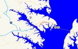
Maryland Route 179 is a two-lane road running east–west along the Broadneck Peninsula of Anne Arundel County, Maryland
. It is better known locally as St. Margaret's Road. MD 179 runs from outside of Annapolis
to the end of state maintenance in Cape St. Claire
.
as it travels toward the US 50
freeway. After bridging US 50 and interchanging with it, dualizing
briefly to do so, its name changes to Cape Saint Claire Road and it continues straight toward its namesake community, entering a small retail area. After passing Woodland Circle, which leads to a small cluster of homes, MD 179 comes to an end just beyond this intersection. The road, however, continues north into the town.
.
Anne Arundel County, Maryland
Anne Arundel County is a county located in the U.S. state of Maryland. It is named for Anne Arundell , a member of the ancient family of Arundells in Cornwall, England and the wife of Cæcilius Calvert, 2nd Baron Baltimore. Its county seat is Annapolis, which is also the capital of the state...
. It is better known locally as St. Margaret's Road. MD 179 runs from outside of Annapolis
Annapolis, Maryland
Annapolis is the capital of the U.S. state of Maryland, as well as the county seat of Anne Arundel County. It had a population of 38,394 at the 2010 census and is situated on the Chesapeake Bay at the mouth of the Severn River, south of Baltimore and about east of Washington, D.C. Annapolis is...
to the end of state maintenance in Cape St. Claire
Cape St. Claire, Maryland
Cape St. Claire is a covenanted, unincorporated community as well as a census-designated place in Anne Arundel County, Maryland 7 miles east of Annapolis, Maryland. While the community of Cape St. Claire lies entirely within the CDP and accounts for approximately 80% of the homes and residents, the...
.
Route description
Maryland Route 179 begins at an intersection with MD 648 (Baltimore–Annapolis Boulevard). It proceeds northeast from there, passing through a small suburban neighborhood on Saint Margaret's Road, a two-lane road, eventually entering a small forest. As it continues north, it bridges Mill Creek and turns east, forming the main route of a small community south of Cape St. ClaireCape St. Claire, Maryland
Cape St. Claire is a covenanted, unincorporated community as well as a census-designated place in Anne Arundel County, Maryland 7 miles east of Annapolis, Maryland. While the community of Cape St. Claire lies entirely within the CDP and accounts for approximately 80% of the homes and residents, the...
as it travels toward the US 50
U.S. Route 50 in Maryland
U.S. Route 50 is a major east–west route of the U.S. Highway system, stretching just over from Ocean City, Maryland on the Atlantic Ocean to West Sacramento, California. In the U.S. state of Maryland, US 50 exists in two sections. The longer of these serves as a major route connecting...
freeway. After bridging US 50 and interchanging with it, dualizing
Dual carriageway
A dual carriageway is a class of highway with two carriageways for traffic travelling in opposite directions separated by a central reservation...
briefly to do so, its name changes to Cape Saint Claire Road and it continues straight toward its namesake community, entering a small retail area. After passing Woodland Circle, which leads to a small cluster of homes, MD 179 comes to an end just beyond this intersection. The road, however, continues north into the town.
Junction list
The entire route is in Anne Arundel CountyAnne Arundel County, Maryland
Anne Arundel County is a county located in the U.S. state of Maryland. It is named for Anne Arundell , a member of the ancient family of Arundells in Cornwall, England and the wife of Cæcilius Calvert, 2nd Baron Baltimore. Its county seat is Annapolis, which is also the capital of the state...
.
| Location | Mile |
Intersection | Notes |
|---|---|---|---|
| Annapolis Annapolis, Maryland Annapolis is the capital of the U.S. state of Maryland, as well as the county seat of Anne Arundel County. It had a population of 38,394 at the 2010 census and is situated on the Chesapeake Bay at the mouth of the Severn River, south of Baltimore and about east of Washington, D.C. Annapolis is... |
0.00 | Western terminus | |
| Cape St. Claire Cape St. Claire, Maryland Cape St. Claire is a covenanted, unincorporated community as well as a census-designated place in Anne Arundel County, Maryland 7 miles east of Annapolis, Maryland. While the community of Cape St. Claire lies entirely within the CDP and accounts for approximately 80% of the homes and residents, the... |
2.42 | ||
| 2.58 | , Washington Washington, D.C. Washington, D.C., formally the District of Columbia and commonly referred to as Washington, "the District", or simply D.C., is the capital of the United States. On July 16, 1790, the United States Congress approved the creation of a permanent national capital as permitted by the U.S. Constitution.... |
US 50/301 exit 29 | |
| 3.16 | End of state maintenance | Eastern terminus |

