Maryland Route 333
Encyclopedia
Maryland Route 333 is a state highway
in the U.S. state
of Maryland
. The state highway runs 9.79 mi (15.8 km) from the terminal of the seasonal Oxford–Bellevue Ferry in Oxford
north to Washington Street in Easton
within Talbot County
. MD 333 was constructed between Trippe Creek and Easton in the 1910s. The highway was extended to Oxford in the late 1920s. In Easton, MD 333 was assigned to the southern part of Washington Street between 1948 and 1959 after U.S. Route 213 (later US 50
) bypassed the town.
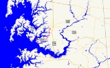
 MD 333 begins at the Oxford terminal of the Oxford–Bellevue Ferry along the Tred Avon River
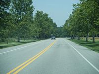
. The state highway heads southeast through the town as Morris Street. At the southern end of the town at the head of a branch of Town Creek, Morris Street continues straight as a municipal street while MD 333 curves to the east and leaves the town via Oxford Road. The state highway heads east through farmland, beginning a curve to the northeast shortly before Almshouse Road. MD 333 begins to pass residential subdivisions and golf courses as the highway turns north and crosses Trippe Creek and Peach Blossom Creek. North of the latter creek, the state highway enters the town of Easton, then crosses Paper Mill Pond before intersecting MD 322
(Easton Parkway). MD 333 continues northeast as Peach Blossom Road past Easton Middle School to its northern terminus at a five-way intersection with Washington Street, which was formerly part of MD 565
, Harrison Street, and Idlewild Avenue.
.
{|class=wikitable
!Location
!Mile
!Destinations
!Notes
|-
|Oxford
|0.00
|Oxford–Bellevue Ferry terminal – Bellevue
|Southern terminus
|-
|rowspan=2|Easton
|9.41
|
|
|-
|9.79
|Washington Street / Harrison Street north / Idlewild Avenue east
|Northern terminus; Washington Street is former MD 565
State highway
State highway, state road or state route can refer to one of three related concepts, two of them related to a state or provincial government in a country that is divided into states or provinces :#A...
in the U.S. state
U.S. state
A U.S. state is any one of the 50 federated states of the United States of America that share sovereignty with the federal government. Because of this shared sovereignty, an American is a citizen both of the federal entity and of his or her state of domicile. Four states use the official title of...
of Maryland
Maryland
Maryland is a U.S. state located in the Mid Atlantic region of the United States, bordering Virginia, West Virginia, and the District of Columbia to its south and west; Pennsylvania to its north; and Delaware to its east...
. The state highway runs 9.79 mi (15.8 km) from the terminal of the seasonal Oxford–Bellevue Ferry in Oxford
Oxford, Maryland
Oxford is a waterfront town and former colonial port in Talbot County, Maryland, United States. The population was 771 at the 2000 census.-History:Oxford is one of the oldest towns in Maryland...
north to Washington Street in Easton
Easton, Maryland
Easton, founded 1710, is a town within the Easton District of Talbot County, Maryland, United States. The population was 11,708 at the 2000 census, and 14,677 according to current July 2008 census estimates. It is the county seat of Talbot County. The primary ZIP Code is 21601, and the...
within Talbot County
Talbot County, Maryland
-2010:Whereas according to the 2010 U.S. Census Bureau:*81.4% White*12.8% Black*0.2% Native American*1.2% Asian*0.1% Native Hawaiian or Pacific Islander*1.6% Two or more races*2.7% Other races*5.5% Hispanic or Latino -2000:...
. MD 333 was constructed between Trippe Creek and Easton in the 1910s. The highway was extended to Oxford in the late 1920s. In Easton, MD 333 was assigned to the southern part of Washington Street between 1948 and 1959 after U.S. Route 213 (later US 50
U.S. Route 50 in Maryland
U.S. Route 50 is a major east–west route of the U.S. Highway system, stretching just over from Ocean City, Maryland on the Atlantic Ocean to West Sacramento, California. In the U.S. state of Maryland, US 50 exists in two sections. The longer of these serves as a major route connecting...
) bypassed the town.
Route description

Tred Avon River
The Tred Avon River is a main tributary of the Choptank River in Talbot County on Maryland's Eastern Shore. The river is long.-Geography:...
. The state highway heads southeast through the town as Morris Street. At the southern end of the town at the head of a branch of Town Creek, Morris Street continues straight as a municipal street while MD 333 curves to the east and leaves the town via Oxford Road. The state highway heads east through farmland, beginning a curve to the northeast shortly before Almshouse Road. MD 333 begins to pass residential subdivisions and golf courses as the highway turns north and crosses Trippe Creek and Peach Blossom Creek. North of the latter creek, the state highway enters the town of Easton, then crosses Paper Mill Pond before intersecting MD 322
Maryland Route 322
Maryland Route 322 is a state highway in the U.S. state of Maryland. Known as Easton Parkway, the highway runs on the west side of Easton between two junctions with U.S. Route 50...
(Easton Parkway). MD 333 continues northeast as Peach Blossom Road past Easton Middle School to its northern terminus at a five-way intersection with Washington Street, which was formerly part of MD 565
Maryland Route 565
Maryland Route 565 is a collection of state highways in the U.S. state of Maryland. These three highways are sections of old alignment of U.S. Route 213, the predecessor route to US 50, between Trappe and Easton. MD 565 runs from Trappe to US 50 south of Easton. MD 565A is a section of...
, Harrison Street, and Idlewild Avenue.
History
The first section of MD 333 was constructed as a state-aid road between Trippe Creek and Peach Blossom Creek in 1913. The state-aid work included bridges over both creeks. The highway was extended as another state-aid project north from Peach Blossom Creek to Easton by 1919. MD 333 was reconstructed as a state highway beginning in 1925. The highway north of Peach Blossom Creek and the portion between Almshouse Road and Trippe Creek were paved or repaved by 1927. MD 333 was completed when the highway was completed between Oxford and Almshouse Road by 1930. At the Easton end, MD 333 was extended south on Washington Street to the new eastern bypass of Easton in 1948 when the town was bypassed by US 213, which became US 50 in 1949. MD 333's northern terminus was returned to Washington Street when MD 565 was assigned to Washington Street in 1958. The bridges over Peach Blossom Creek and Trippe Creek were replaced in 1997 and 1998, respectively.Junction list
The entire route is in Talbot CountyTalbot County, Maryland
-2010:Whereas according to the 2010 U.S. Census Bureau:*81.4% White*12.8% Black*0.2% Native American*1.2% Asian*0.1% Native Hawaiian or Pacific Islander*1.6% Two or more races*2.7% Other races*5.5% Hispanic or Latino -2000:...
.
{|class=wikitable
!Location
!Mile
!Destinations
!Notes
|-
|Oxford
Oxford, Maryland
Oxford is a waterfront town and former colonial port in Talbot County, Maryland, United States. The population was 771 at the 2000 census.-History:Oxford is one of the oldest towns in Maryland...
|0.00
|Oxford–Bellevue Ferry terminal – Bellevue
Bellevue, Maryland
Bellevue is an unincorporated community in Talbot County, Maryland, United States.Bellevue lies on the north bank of the Tred Avon River, and is linked to Oxford by a vehicle ferry across the river.-References:...
|Southern terminus
|-
|rowspan=2|Easton
Easton, Maryland
Easton, founded 1710, is a town within the Easton District of Talbot County, Maryland, United States. The population was 11,708 at the 2000 census, and 14,677 according to current July 2008 census estimates. It is the county seat of Talbot County. The primary ZIP Code is 21601, and the...
|9.41
|
|
|-
|9.79
|Washington Street / Harrison Street north / Idlewild Avenue east
|Northern terminus; Washington Street is former MD 565

