
Maryland Route 34
Encyclopedia
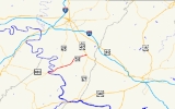
Maryland Route 34 is a state highway
in the U.S. state
of Maryland
. Known for most of its length as Shepherdstown Pike, the state highway begins at the West Virginia
state line at the Potomac River
, where the highway continues south as West Virginia Route 480 (WV 480) through Shepherdstown
. The state highway runs 9.95 miles (16 km) east to U.S. Route 40 Alternate (US 40 Alternate) in Boonsboro
. MD 34 is the main east–west highway of southern Washington County
, connecting Shepherdstown and Boonsboro with Sharpsburg
and Keedysville
. The state highway, which was preceded by the Boonsboro and Sharpstown Turnpike, was constructed as a modern highway in the late 1910s and early 1920s. MD 34's bypass of Keedysville opened around 1960. The western end of the state highway has had three bridges. A 19th century bridge was destroyed in a 1936 flood and replaced by the James Rumsey Bridge in 1939. The present bridge, also named for James Rumsey
, opened in 2005.
as Shepherdstown Pike through a mix of farmland and forest. The state highway descends into an underpass of Norfolk Southern Railway
's Hagerstown District, which crosses the state highway at an oblique angle then parallels the highway northeast past the historic home Mount Airy
. MD 34 splits away from the railroad as the highway enters the town of Sharpsburg. The state highway's name changes to Main Street at its intersection with Mechanic Street. MD 34 passes through the Sharpsburg Historic District
, which contains the Jacob Highbarger House
, William Chapline House
, Good-Reilly House
, Joseph C. Hays House
, Piper House
, and Tolson's Chapel
. At the eastern end of the town, the state highway intersects Church Street, which heads north as MD 65
through the main unit of Antietam National Battlefield and south as a county highway toward Burnside's Bridge
.
MD 34 leaves the town of Sharpsburg and passes through the grounds of Antietam National Battlefield. The state highway passes Antietam National Cemetery and passes through open fields before leaving the federal reservation by crossing Antietam Creek
on the Porterstown Bridge. MD 34 continues northeast, passing the Pry House Field Hospital Museum before heading through Keedysville. The old alignment of MD 34, MD 845
, splits to the east to pass through the center of town as Main Street while MD 34 passes along the edge of town. MD 34 crosses Little Antietam Creek, crosses an abandoned Baltimore and Ohio Railroad
grade, and passes the Doub Farm
and Baker Farm
before receiving the other end of MD 845, Keedy Drive. The state highway passes through a forested area before passing Crystal Grottoes
. MD 34 continues east through farmland before entering the town of Boonsboro and crossing Beaver Creek. The state highway heads east through the town as Potomac Street before reaching its eastern terminus at US 40 Alternate (Main Street). The roadway continues east as St. Paul Street toward South Mountain
.
The original river crossing at Shepherdstown was a ford
downstream from the modern bridge that had various names, including Boteler's Ford, Pack Horse Ford, Shepherdstown Ford, and Blackford's Ford. This ford was utilized by Confederate forces
in their retreat from the Battle of Antietam
. Around 1755, Thomas Swearingen started a ferry that operated through 1849, when the first covered bridge was constructed across the river. The first covered bridge was destroyed by forces under Stonewall Jackson
in 1861. A second covered bridge was constructed in 1871 and lasted until it was destroyed by the same series of floods in 1889 that devastated Johnstown, Pennsylvania
. The piers of the covered bridge remain immediately downstream from the modern bridge. An iron bridge was constructed just upstream of the present bridge. This iron bridge was destroyed in the March 1936 series of floods that heavily damaged Pittsburgh. A high-level Wichert continuous truss bridge was constructed at the site of the present bridge and opened July 15, 1939. The new bridge was dedicated to James Rumsey, an 18th century pioneer of the steamboat
that demonstrated his invention on the Potomac River at Shepherdstown in 1787. Finally, the present bridge, a steel girder span
also named for Rumsey, was constructed starting in June 2003 immediately to the north of the 1939 bridge. The new bridge opened July 15, 2005, exactly 66 years after the opening of the previous bridge, which was subsequently torn down.
.
{|class=wikitable
!Location
!Mile
!Destinations
!Notes
|-
|
|0.00
|
|Western terminus; West Virginia
state line at Potomac River
|-
|Sharpsburg
|3.57
|
|
|-
|rowspan=2|Keedysville
|6.39
|
|rowspan=2|Old alignment of MD 34
|-
|7.61
|
|-
|Boonsboro
|9.95
|
|Northern terminus
State highway
State highway, state road or state route can refer to one of three related concepts, two of them related to a state or provincial government in a country that is divided into states or provinces :#A...
in the U.S. state
U.S. state
A U.S. state is any one of the 50 federated states of the United States of America that share sovereignty with the federal government. Because of this shared sovereignty, an American is a citizen both of the federal entity and of his or her state of domicile. Four states use the official title of...
of Maryland
Maryland
Maryland is a U.S. state located in the Mid Atlantic region of the United States, bordering Virginia, West Virginia, and the District of Columbia to its south and west; Pennsylvania to its north; and Delaware to its east...
. Known for most of its length as Shepherdstown Pike, the state highway begins at the West Virginia
West Virginia
West Virginia is a state in the Appalachian and Southeastern regions of the United States, bordered by Virginia to the southeast, Kentucky to the southwest, Ohio to the northwest, Pennsylvania to the northeast and Maryland to the east...
state line at the Potomac River
Potomac River
The Potomac River flows into the Chesapeake Bay, located along the mid-Atlantic coast of the United States. The river is approximately long, with a drainage area of about 14,700 square miles...
, where the highway continues south as West Virginia Route 480 (WV 480) through Shepherdstown
Shepherdstown, West Virginia
Shepherdstown is a town in Jefferson County, West Virginia, United States, located along the Potomac River. It is the oldest town in the state, having been chartered in 1762 by Colonial Virginia's General Assembly. Since 1863, Shepherdstown has been in West Virginia, and is the oldest town in...
. The state highway runs 9.95 miles (16 km) east to U.S. Route 40 Alternate (US 40 Alternate) in Boonsboro
Boonsboro, Maryland
Boonsboro is a town in Washington County, Maryland, United States, located at the foot of South Mountain. It nearly borders Frederick County and is proximate to the Antietam National Battlefield...
. MD 34 is the main east–west highway of southern Washington County
Washington County, Maryland
Washington County is a county located in the western part of the U.S. state of Maryland, bordering southern Pennsylvania to the north, northern Virginia to the south, and the Eastern Panhandle of West Virginia to the south and west. As of the 2010 Census, its population is 147,430...
, connecting Shepherdstown and Boonsboro with Sharpsburg
Sharpsburg, Maryland
Sharpsburg is a town in Washington County, Maryland, United States, approximately south of Hagerstown. The population was 691 at the 2000 census....
and Keedysville
Keedysville, Maryland
Keedysville is a town in Washington County, Maryland, United States. The population was 482 as of the 2000 Census. As of 1 July 2008, the U.S. Census Bureau estimated the town's population at 862, a 78.8% increase from 2000.-Geography:...
. The state highway, which was preceded by the Boonsboro and Sharpstown Turnpike, was constructed as a modern highway in the late 1910s and early 1920s. MD 34's bypass of Keedysville opened around 1960. The western end of the state highway has had three bridges. A 19th century bridge was destroyed in a 1936 flood and replaced by the James Rumsey Bridge in 1939. The present bridge, also named for James Rumsey
James Rumsey
James Rumsey was an American mechanical engineer chiefly known for exhibiting a boat propelled by machinery in 1787 on the Potomac River at Shepherdstown, now West Virginia, before a crowd of local notables, including Horatio Gates...
, opened in 2005.
Route description
MD 34 begins at the West Virginia State line, where the highway crosses the Potomac River on the James Rumsey Bridge. The highway continues into Shepherdstown as WV 480. MD 34 heads east past an access ramp to the Chesapeake and Ohio Canal National Historical ParkChesapeake and Ohio Canal National Historical Park
The Chesapeake and Ohio Canal National Historical Park is a United States National Historical Park located in the District of Columbia and the states of Maryland and West Virginia. The park was established as a National Monument in 1961 by President Dwight D...
as Shepherdstown Pike through a mix of farmland and forest. The state highway descends into an underpass of Norfolk Southern Railway
Norfolk Southern Railway
The Norfolk Southern Railway is a Class I railroad in the United States, owned by the Norfolk Southern Corporation. With headquarters in Norfolk, Virginia, the company operates 21,500 route miles in 22 eastern states, the District of Columbia and the province of Ontario, Canada...
's Hagerstown District, which crosses the state highway at an oblique angle then parallels the highway northeast past the historic home Mount Airy
Mount Airy (Sharpsburg, Maryland)
Mount Airy, also known as Grove Farm, is a historic home located at Sharpsburg, Washington County, Maryland, United States. It is a -story Flemish bond brick house, built about 1821 with elements of the Federal and Greek Revival styles...
. MD 34 splits away from the railroad as the highway enters the town of Sharpsburg. The state highway's name changes to Main Street at its intersection with Mechanic Street. MD 34 passes through the Sharpsburg Historic District
Sharpsburg Historic District
Sharpsburg Historic District is a national historic district located at Sharpsburg, Washington County, Maryland.It was listed on the National Register of Historic Places in 2008.-External links:* at Maryland Historical Trust*, at Maryland Historical Trust...
, which contains the Jacob Highbarger House
Jacob Highbarger House
The Jacob Highbarger House was built circa 1832 in Sharpsburg, Maryland, United States. The Greek Revival-influenced house is a late example of limestone construction in the Cumberland Valley of Maryland, with an attached log workshop...
, William Chapline House
William Chapline House
The William Chapline House in Sharpsburg, Maryland, United States is a large stone house built about 1790. The house has shaped stonework at the front and rubble stonework on the sides with a cast-iron porch added around the turn of the twentieth century. The house was damaged during the Battle of...
, Good-Reilly House
Good-Reilly House
The Good-Reilly House is a historic home located at Sharpsburg, Washington County, Maryland, United States. It is located at the northeast corner of the town square and is a -story stone house with combined Maryland colonial and Georgian stylistic influence...
, Joseph C. Hays House
Joseph C. Hays House
The Joseph C. Hays House at 103-105 West Main Street in Sharpsburg, Maryland, United States was originally built in 1823 as a three-bay side hall double-parlor house in the Federal style. It was soon expanded to the east with a two-bay parlor and one commercial bay. The east parlor entered...
, Piper House
Piper House
The Piper House is a historic home located at the southeast corner of Main and Church Streets in Sharpsburg, Washington County, Maryland, United States. It has a two-story limestone main block, constructed between 1792 and 1804, with a two-story brick wing, added about 1834...
, and Tolson's Chapel
Tolson's Chapel
Tolson's Chapel is a historic African American church located at Sharpsburg, Washington County, Maryland, United States. It was built in 1866 and served as a church and a Freedman's Bureau school for black residents of Sharpsburg in the years following the American Civil War.It was listed on the...
. At the eastern end of the town, the state highway intersects Church Street, which heads north as MD 65
Maryland Route 65
Maryland Route 65 is a state highway in the U.S. state of Maryland. Known for most of its length as Sharpsburg Pike, the state highway runs from MD 34 in Sharpsburg north to the southern end of Hagerstown, where the highway continues north as Potomac Street toward the downtown area...
through the main unit of Antietam National Battlefield and south as a county highway toward Burnside's Bridge
Burnside's Bridge
Burnside's Bridge is a landmark on the Antietam National Battlefield near Sharpsburg, Maryland. Crossing over Antietam Creek, the bridge played a key role in the September 1862 Battle of Antietam during the American Civil War when a small number of Confederate soldiers from Georgia for several...
.
MD 34 leaves the town of Sharpsburg and passes through the grounds of Antietam National Battlefield. The state highway passes Antietam National Cemetery and passes through open fields before leaving the federal reservation by crossing Antietam Creek
Antietam Creek
Antietam Creek is a tributary of the Potomac River located in south central Pennsylvania and western Maryland in the United States, a region known as the Hagerstown Valley...
on the Porterstown Bridge. MD 34 continues northeast, passing the Pry House Field Hospital Museum before heading through Keedysville. The old alignment of MD 34, MD 845
Maryland Route 845
Maryland Route 845 is an unsigned state highway in the U.S. state of Maryland. Known for most of its length as Main Street, the state highway runs between intersections with MD 34 on either side of Keedysville in southern Washington County. MD 845, which is officially MD 845A, is the old...
, splits to the east to pass through the center of town as Main Street while MD 34 passes along the edge of town. MD 34 crosses Little Antietam Creek, crosses an abandoned Baltimore and Ohio Railroad
Baltimore and Ohio Railroad
The Baltimore and Ohio Railroad was one of the oldest railroads in the United States and the first common carrier railroad. It came into being mostly because the city of Baltimore wanted to compete with the newly constructed Erie Canal and another canal being proposed by Pennsylvania, which...
grade, and passes the Doub Farm
Doub Farm
The Doub Farm is a historic home and farm located at Keedysville, Washington County, Maryland, United States. The house is a two-story, seven-bay brick structure set on low fieldstone foundations. The property includes a small brick wash house, a row of board-and-batten outbuildings, a large stone...
and Baker Farm
Baker Farm (Keedysville, Maryland)
Baker Farm is a historic home and farm located at Keedysville, Washington County, Maryland, United States. The house is a two-story, four-bay limestone structure with a two-story, four-bay limestone addition. It was constructed during the 1780s...
before receiving the other end of MD 845, Keedy Drive. The state highway passes through a forested area before passing Crystal Grottoes
Crystal Grottoes
Crystal Grottoes is the only show cave in the U.S. state of Maryland. It is located on Maryland Route 34 between Boonsboro and Antietam National Battlefield.-History:...
. MD 34 continues east through farmland before entering the town of Boonsboro and crossing Beaver Creek. The state highway heads east through the town as Potomac Street before reaching its eastern terminus at US 40 Alternate (Main Street). The roadway continues east as St. Paul Street toward South Mountain
South Mountain (Maryland and Pennsylvania)
South Mountain is the northern extension of the Blue Ridge Mountain range in Maryland and Pennsylvania. From the Potomac River near Knoxville, Maryland in the south, to Dillsburg, Pennsylvania in the north, the long range separates the Hagerstown and Cumberland valleys from the Piedmont regions of...
.
History
The predecessor highway of much of MD 34 was the 19th century Boonsboro and Sharpsburg Turnpike between the two eponymous towns via Keedysville. The modern state highway was constructed starting in 1918 with a section from Boonsboro to Keedysville. By 1921, the paved highway was extended west to the Norfolk Southern Railway west of Sharpsburg. The highway was completed to the Potomac River in 1923. MD 34 was one of the original signed Maryland state numbered highways in 1927. The state highway was relocated at its western end following the completion of a new bridge across the Potomac River in 1939. The underpass of the Norfolk Southern Railway between the Potomac River and Sharpsburg was completed around 1940. MD 34 was reconstructed from the Potomac River to Sharpsburg in 1953 and 1954. The state highway was rebuilt from Sharpsburg to Boonsboro between 1956 and 1958, including a new bridge over Antietam Creek. MD 34's bypass of Keedysville opened around 1961; the old highway through town was designated MD 845.The original river crossing at Shepherdstown was a ford
Ford (crossing)
A ford is a shallow place with good footing where a river or stream may be crossed by wading or in a vehicle. A ford is mostly a natural phenomenon, in contrast to a low water crossing, which is an artificial bridge that allows crossing a river or stream when water is low.The names of many towns...
downstream from the modern bridge that had various names, including Boteler's Ford, Pack Horse Ford, Shepherdstown Ford, and Blackford's Ford. This ford was utilized by Confederate forces
Army of Northern Virginia
The Army of Northern Virginia was the primary military force of the Confederate States of America in the Eastern Theater of the American Civil War, as well as the primary command structure of the Department of Northern Virginia. It was most often arrayed against the Union Army of the Potomac...
in their retreat from the Battle of Antietam
Battle of Antietam
The Battle of Antietam , fought on September 17, 1862, near Sharpsburg, Maryland, and Antietam Creek, as part of the Maryland Campaign, was the first major battle in the American Civil War to take place on Northern soil. It was the bloodiest single-day battle in American history, with about 23,000...
. Around 1755, Thomas Swearingen started a ferry that operated through 1849, when the first covered bridge was constructed across the river. The first covered bridge was destroyed by forces under Stonewall Jackson
Stonewall Jackson
ຄຽשת״ׇׂׂׂׂ֣|birth_place= Clarksburg, Virginia |death_place=Guinea Station, Virginia|placeofburial=Stonewall Jackson Memorial CemeteryLexington, Virginia|placeofburial_label= Place of burial|image=...
in 1861. A second covered bridge was constructed in 1871 and lasted until it was destroyed by the same series of floods in 1889 that devastated Johnstown, Pennsylvania
Johnstown Flood
The Johnstown Flood occurred on May 31, 1889. It was the result of the catastrophic failure of the South Fork Dam situated upstream of the town of Johnstown, Pennsylvania, USA, made worse by several days of extremely heavy rainfall...
. The piers of the covered bridge remain immediately downstream from the modern bridge. An iron bridge was constructed just upstream of the present bridge. This iron bridge was destroyed in the March 1936 series of floods that heavily damaged Pittsburgh. A high-level Wichert continuous truss bridge was constructed at the site of the present bridge and opened July 15, 1939. The new bridge was dedicated to James Rumsey, an 18th century pioneer of the steamboat
Steamboat
A steamboat or steamship, sometimes called a steamer, is a ship in which the primary method of propulsion is steam power, typically driving propellers or paddlewheels...
that demonstrated his invention on the Potomac River at Shepherdstown in 1787. Finally, the present bridge, a steel girder span
Girder bridge
A girder bridge, in general, is a bridge built of girders placed on bridge abutments and foundation piers. In turn, a bridge deck is built on top of the girders in order to carry traffic. There are several different subtypes of girder bridges:...
also named for Rumsey, was constructed starting in June 2003 immediately to the north of the 1939 bridge. The new bridge opened July 15, 2005, exactly 66 years after the opening of the previous bridge, which was subsequently torn down.
Junction list
The entire route is in Washington CountyWashington County, Maryland
Washington County is a county located in the western part of the U.S. state of Maryland, bordering southern Pennsylvania to the north, northern Virginia to the south, and the Eastern Panhandle of West Virginia to the south and west. As of the 2010 Census, its population is 147,430...
.
{|class=wikitable
!Location
!Mile
!Destinations
!Notes
|-
|
|0.00
|
|Western terminus; West Virginia
West Virginia
West Virginia is a state in the Appalachian and Southeastern regions of the United States, bordered by Virginia to the southeast, Kentucky to the southwest, Ohio to the northwest, Pennsylvania to the northeast and Maryland to the east...
state line at Potomac River
Potomac River
The Potomac River flows into the Chesapeake Bay, located along the mid-Atlantic coast of the United States. The river is approximately long, with a drainage area of about 14,700 square miles...
|-
|Sharpsburg
Sharpsburg, Maryland
Sharpsburg is a town in Washington County, Maryland, United States, approximately south of Hagerstown. The population was 691 at the 2000 census....
|3.57
|
|
|-
|rowspan=2|Keedysville
Keedysville, Maryland
Keedysville is a town in Washington County, Maryland, United States. The population was 482 as of the 2000 Census. As of 1 July 2008, the U.S. Census Bureau estimated the town's population at 862, a 78.8% increase from 2000.-Geography:...
|6.39
|
|rowspan=2|Old alignment of MD 34
|-
|7.61
|
|-
|Boonsboro
Boonsboro, Maryland
Boonsboro is a town in Washington County, Maryland, United States, located at the foot of South Mountain. It nearly borders Frederick County and is proximate to the Antietam National Battlefield...
|9.95
|
|Northern terminus