
Maryland Route 38
Encyclopedia
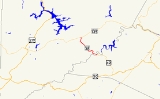
Maryland Route 38 is a state highway
in the U.S. state
of Maryland
. Known as Kitzmiller Road, the state highway runs 5.67 miles (9.1 km) from the West Virginia
state line at the Potomac River
in Kitzmiller
, where the highway continues south as West Virginia Route 42 (WV 42), north to MD 135
on top of Backbone Mountain
. MD 38 connects Kitzmiller with the rest of Garrett County
and across the Potomac River to Blaine
and Elk Garden
in western Mineral County
. The state highway was constructed in the late 1920s and early 1930s. MD 38 originally ran from U.S. Route 219
(US 219) near Thayerville through Deer Park
and Altamont
to Kitzmiller. The state highway was truncated at Backbone Mountain when MD 135 was extended west to Oakland
in the mid 1950s.
. After passing Main Street, MD 38 begins its steep, curvy ascent of Backbone Mountain. The southbound direction of the state highway features a mandatory truck stop to check brakes at the top of the 2 miles (3.2 km) hill. Beyond the truck pull-off, MD 38 continues uphill at a more gentle gradient all the way to its northern terminus at MD 135 (Maryland Highway) on the ridgeline of Backbone Mountain.
. The state highway descended Backbone Mountain toward Altamont and continued west to Deer Park following what is now MD 135 and Edgewood Drive into the center of the town. In Deer Park, MD 38 turned north along Main Street and followed Sand Flat Road to US 219 near Thayerville. MD 38 was paved from its original northern terminus through Deer Park to Altamont between 1924 and 1926. The highway was extended east to the top of Backbone Mountain by 1930; this construction included the bridge over the Baltimore and Ohio Railroad
at Altamont. The present segment of MD 38 south to Kitzmiller was under construction by 1930 and completed in 1933. The present bridge across the Potomac River and an approach road beginning at State Street on the north were completed in 1955. This bridge replaced the original 1892 bridge that crossed the river just to the east of the present crossing. MD 38 was rolled back to its current northern terminus on top of Backbone Mountain in 1956. MD 135 was relocated onto the portion of MD 38 between MD 38's present terminus and Deer Park and extended west toward Oakland. Sand Flat Road was transferred to county maintenance.
.
{| class=wikitable
!Location
!Mile
!Destinations
!Notes
|-
|Kitzmiller
|0.00
| – Blaine, WV
, Elk Garden, WV
|Southern terminus; West Virginia
state line at Potomac River
|-
|
|5.67
|
|Northern terminus
State highway
State highway, state road or state route can refer to one of three related concepts, two of them related to a state or provincial government in a country that is divided into states or provinces :#A...
in the U.S. state
U.S. state
A U.S. state is any one of the 50 federated states of the United States of America that share sovereignty with the federal government. Because of this shared sovereignty, an American is a citizen both of the federal entity and of his or her state of domicile. Four states use the official title of...
of Maryland
Maryland
Maryland is a U.S. state located in the Mid Atlantic region of the United States, bordering Virginia, West Virginia, and the District of Columbia to its south and west; Pennsylvania to its north; and Delaware to its east...
. Known as Kitzmiller Road, the state highway runs 5.67 miles (9.1 km) from the West Virginia
West Virginia
West Virginia is a state in the Appalachian and Southeastern regions of the United States, bordered by Virginia to the southeast, Kentucky to the southwest, Ohio to the northwest, Pennsylvania to the northeast and Maryland to the east...
state line at the Potomac River
Potomac River
The Potomac River flows into the Chesapeake Bay, located along the mid-Atlantic coast of the United States. The river is approximately long, with a drainage area of about 14,700 square miles...
in Kitzmiller
Kitzmiller, Maryland
Kitzmiller is a town in Garrett County, Maryland, United States. The population was 302 at the 2000 census.-Geography:Kitzmiller is located at ....
, where the highway continues south as West Virginia Route 42 (WV 42), north to MD 135
Maryland Route 135
Maryland Route 135 is a state highway in the U.S. state of Maryland. Known for most of its length as Maryland Highway, the state highway runs from U.S. Route 219 in Oakland in Garrett County east to US 220 in McCoole in Allegany County...
on top of Backbone Mountain
Backbone Mountain
Backbone Mountain is a ridge of the Allegheny Mountains of the central Appalachian Mountain Range. It is situated in the U.S. states of West Virginia and Maryland and forms a portion of the Eastern Continental Divide...
. MD 38 connects Kitzmiller with the rest of Garrett County
Garrett County, Maryland
Garrett County is the westernmost county of the U.S. state of Maryland. Created from Allegany County, Maryland in 1872 it was the last Maryland county to be formed. It was named for John Work Garrett , railroad executive, industrialist, and financier. Garrett served as president of the Baltimore...
and across the Potomac River to Blaine
Blaine, West Virginia
Blaine is an unincorporated community in Mineral County, West Virginia, USA. It is part of the Cumberland, MD-WV Metropolitan Statistical Area. It lies near the intersection of the North Branch Potomac River and West Virginia Route 42. This used to be a city, now it has 30 houses. Max. It also...
and Elk Garden
Elk Garden, West Virginia
Elk Garden is a town in Mineral County, West Virginia, United States. It is part of the 'Cumberland, MD-WV Metropolitan Statistical Area'. The population was 217 at the 2000 census. Elk Garden was incorporated in 1890 by the Mineral County Circuit Court...
in western Mineral County
Mineral County, West Virginia
Mineral County is a county located in the U.S. state of West Virginia. It is part of the Cumberland, MD-WV Metropolitan Statistical Area. As of 2010, the population was 28,212. Its county seat is Keyser.-Ancient history:...
. The state highway was constructed in the late 1920s and early 1930s. MD 38 originally ran from U.S. Route 219
U.S. Route 219 in Maryland
U.S. Route 219 is a part of the U.S. Highway System that runs from Rich Creek, Virginia to West Seneca, New York. In the U.S. state of Maryland, the federal highway runs from the West Virginia state line near Red House to the Pennsylvania state line near Grantsville...
(US 219) near Thayerville through Deer Park
Deer Park, Maryland
Deer Park is a town in Garrett County, Maryland, United States. The population was 399 at the 2010 census.-Geography:Deer Park is located at ....
and Altamont
Altamont, Maryland
Altamont is an unincorporated community in Garrett County, Maryland, United States. Altamont sits on the Eastern Continental Divide between the watershed of Crabtree Creek, which flows into the Savage River and eventually into the Atlantic Ocean, and the watershed of the Little Youghiogheny River,...
to Kitzmiller. The state highway was truncated at Backbone Mountain when MD 135 was extended west to Oakland
Oakland, Maryland
Oakland is a town in the west-central part of Garrett County, Maryland, United States. With a population of 1,925 according to United States Census 2010 figures, it is the most populated community in Garrett County...
in the mid 1950s.
Route description
MD 38 begins in the town of Kitzmiller at the Kitzmiller Bridge across the Potomac River. The highway continues on the other side of the river as WV 42 in BlaineBlaine, West Virginia
Blaine is an unincorporated community in Mineral County, West Virginia, USA. It is part of the Cumberland, MD-WV Metropolitan Statistical Area. It lies near the intersection of the North Branch Potomac River and West Virginia Route 42. This used to be a city, now it has 30 houses. Max. It also...
. After passing Main Street, MD 38 begins its steep, curvy ascent of Backbone Mountain. The southbound direction of the state highway features a mandatory truck stop to check brakes at the top of the 2 miles (3.2 km) hill. Beyond the truck pull-off, MD 38 continues uphill at a more gentle gradient all the way to its northern terminus at MD 135 (Maryland Highway) on the ridgeline of Backbone Mountain.
History
MD 38 originally extended north toward Deep Creek LakeDeep Creek Lake
Deep Creek Lake is the largest inland body of water in the state of Maryland. It covers approximately and has of shoreline. Like all lakes in Maryland, it is man-made. The lake is home to a wide variety of freshwater fish and aquatic birds. The Wisp ski resort is located nearby...
. The state highway descended Backbone Mountain toward Altamont and continued west to Deer Park following what is now MD 135 and Edgewood Drive into the center of the town. In Deer Park, MD 38 turned north along Main Street and followed Sand Flat Road to US 219 near Thayerville. MD 38 was paved from its original northern terminus through Deer Park to Altamont between 1924 and 1926. The highway was extended east to the top of Backbone Mountain by 1930; this construction included the bridge over the Baltimore and Ohio Railroad
Baltimore and Ohio Railroad
The Baltimore and Ohio Railroad was one of the oldest railroads in the United States and the first common carrier railroad. It came into being mostly because the city of Baltimore wanted to compete with the newly constructed Erie Canal and another canal being proposed by Pennsylvania, which...
at Altamont. The present segment of MD 38 south to Kitzmiller was under construction by 1930 and completed in 1933. The present bridge across the Potomac River and an approach road beginning at State Street on the north were completed in 1955. This bridge replaced the original 1892 bridge that crossed the river just to the east of the present crossing. MD 38 was rolled back to its current northern terminus on top of Backbone Mountain in 1956. MD 135 was relocated onto the portion of MD 38 between MD 38's present terminus and Deer Park and extended west toward Oakland. Sand Flat Road was transferred to county maintenance.
Junction list
The entire route is in Garrett CountyGarrett County, Maryland
Garrett County is the westernmost county of the U.S. state of Maryland. Created from Allegany County, Maryland in 1872 it was the last Maryland county to be formed. It was named for John Work Garrett , railroad executive, industrialist, and financier. Garrett served as president of the Baltimore...
.
{| class=wikitable
!Location
!Mile
!Destinations
!Notes
|-
|Kitzmiller
Kitzmiller, Maryland
Kitzmiller is a town in Garrett County, Maryland, United States. The population was 302 at the 2000 census.-Geography:Kitzmiller is located at ....
|0.00
| – Blaine, WV
Blaine, West Virginia
Blaine is an unincorporated community in Mineral County, West Virginia, USA. It is part of the Cumberland, MD-WV Metropolitan Statistical Area. It lies near the intersection of the North Branch Potomac River and West Virginia Route 42. This used to be a city, now it has 30 houses. Max. It also...
, Elk Garden, WV
Elk Garden, West Virginia
Elk Garden is a town in Mineral County, West Virginia, United States. It is part of the 'Cumberland, MD-WV Metropolitan Statistical Area'. The population was 217 at the 2000 census. Elk Garden was incorporated in 1890 by the Mineral County Circuit Court...
|Southern terminus; West Virginia
West Virginia
West Virginia is a state in the Appalachian and Southeastern regions of the United States, bordered by Virginia to the southeast, Kentucky to the southwest, Ohio to the northwest, Pennsylvania to the northeast and Maryland to the east...
state line at Potomac River
Potomac River
The Potomac River flows into the Chesapeake Bay, located along the mid-Atlantic coast of the United States. The river is approximately long, with a drainage area of about 14,700 square miles...
|-
|
|5.67
|
|Northern terminus
Auxiliary routes
MD 38 has two auxiliary routes, both located at the highway's intersection with MD 135 on top of Backbone Mountain- MD 38A is the designation for the tight 0.01 mile (0.0160934 km) ramp from northbound MD 38 to eastbound MD 135.
- MD 38B is the designation for the sweeping 0.19 mile (0.3057746 km) ramp from eastbound MD 135 to southbound MD 38.