
Massachusetts Route 101
Encyclopedia
Route description
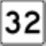
Route 101 begins in PetershamPetersham, Massachusetts
Petersham is a town in Worcester County, Massachusetts, United States. The population was 1,234 at the 2010 census. Petersham is home to a considerable amount of conservation land, including the Quabbin Reservation, Harvard Forest, the Swift River Reservation, and Federated Women's Club State...
at Route 32, just north of the center of town. The route heads eastward, winding between two wildlife management areas and south of Queen Lake as it passes through Phillipston
Phillipston, Massachusetts
Phillipston is a town in Worcester County, Massachusetts, United States. The population was 1,682 at the 2010 census.- History :Phillipston was first settled in 1751, and incorporated as the town of Gerry in 1786...
. In Templeton
Templeton, Massachusetts
Templeton is a town in Worcester County, Massachusetts, United States. The population was 8,013 at the 2010 census. The town comprises four main villages: Templeton Center, East Templeton, Baldwinville, and Otter River...
, the route joins Route 2A, passing concurrently with that route over Route 2 at Exit 21 before splitting again.
From Templeton, Route 101 enters the city of Gardner
Gardner, Massachusetts
Gardner, Massachusetts is a city in Worcester County, Massachusetts, United States. The population was 20,228 as of the 2010 census. Gardner is home to Dunn State Park, Gardner Heritage State Park, Lake Wampanoag Wildlife Sanctuary, and Mount Wachusett Community College.-History:Named in honor of...
, acting as one of the main streets through town. For two blocks west of Main Street, Route 101 runs concurrently with Route 68
Massachusetts Route 68
-Route description:Route 68 begins in the Jefferson section of the town of Holden, at Route 122A. It heads northward into Rutland, passing through the northeastern part of the town, passing the northern end of Route 56...
. The route crosses Route 140 before entering Ashburnham
Ashburnham, Massachusetts
As of the census of 2000, there were 5,546 people, 1,929 households, and 1,541 families residing in the town. The population density was 143.4 people per square mile . There were 2,204 housing units at an average density of 57.0 per square mile...
. In Ashburham, Route 101 heads into the center of town, sharing a short concurrency along Route 12 before turning northward, passing by Winnekeag Lake and west of Ward Pond before ending at Route 119, three miles south of the New Hampshire
New Hampshire
New Hampshire is a state in the New England region of the northeastern United States of America. The state was named after the southern English county of Hampshire. It is bordered by Massachusetts to the south, Vermont to the west, Maine and the Atlantic Ocean to the east, and the Canadian...
state line and 300 yards east of the Ashby
Ashby, Massachusetts
Ashby is a town in Middlesex County, Massachusetts, United States. The population was 3,120 as of the 2010 census.-Geography:According to the United States Census Bureau, the town has a total area of , of which is land and is water....
town line.
During the 1920s and early 1930s, Route 101 was a multi-state route through Massachusetts, Rhode Island
Rhode Island
The state of Rhode Island and Providence Plantations, more commonly referred to as Rhode Island , is a state in the New England region of the United States. It is the smallest U.S. state by area...
, and Connecticut
Connecticut
Connecticut is a state in the New England region of the northeastern United States. It is bordered by Rhode Island to the east, Massachusetts to the north, and the state of New York to the west and the south .Connecticut is named for the Connecticut River, the major U.S. river that approximately...
, primarily along the highway now known as U.S. Route 44
U.S. Route 44
U.S. Route 44 is an east–west United States highway that runs for 237 miles through four states in the Northeastern region of the United States. The western terminus is at U.S. Route 209 and New York State Route 55 in Kerhonkson, a hamlet in the Hudson Valley region of New York...
.
Junction list
| County | Location | Mile | Roads intersected | Notes |
|---|---|---|---|---|
| Worcester Worcester County, Massachusetts -Demographics:In 1990 Worcester County had a population of 709,705.As of the census of 2000, there were 750,963 people, 283,927 households, and 192,502 families residing in the county. The population density was 496 people per square mile . There were 298,159 housing units at an average density... |
Petersham Petersham, Massachusetts Petersham is a town in Worcester County, Massachusetts, United States. The population was 1,234 at the 2010 census. Petersham is home to a considerable amount of conservation land, including the Quabbin Reservation, Harvard Forest, the Swift River Reservation, and Federated Women's Club State... |
0.00 |  Route 32 Route 32 |
Southern end of Route 101. |
| Templeton Templeton, Massachusetts Templeton is a town in Worcester County, Massachusetts, United States. The population was 8,013 at the 2010 census. The town comprises four main villages: Templeton Center, East Templeton, Baldwinville, and Otter River... |
7.7 |  Route 2A West Route 2A West |
Beginning of concurrency with Route 2A. | |
| 8.7 |  Route 2 Route 2 |
Route 2 Exit 21. | ||
| 9.4 | Route 2A East |
End of concurrency with Route 2A. | ||
| Gardner Gardner, Massachusetts Gardner, Massachusetts is a city in Worcester County, Massachusetts, United States. The population was 20,228 as of the 2010 census. Gardner is home to Dunn State Park, Gardner Heritage State Park, Lake Wampanoag Wildlife Sanctuary, and Mount Wachusett Community College.-History:Named in honor of... |
11.8 |  Route 68 Route 68Massachusetts Route 68 -Route description:Route 68 begins in the Jefferson section of the town of Holden, at Route 122A. It heads northward into Rutland, passing through the northeastern part of the town, passing the northern end of Route 56... |
Two-block concurrency with Route 68. | |
| 14.1 |  Route 140 Route 140 |
|||
| Ashburnham Ashburnham, Massachusetts As of the census of 2000, there were 5,546 people, 1,929 households, and 1,541 families residing in the town. The population density was 143.4 people per square mile . There were 2,204 housing units at an average density of 57.0 per square mile... |
18.6 |  Route 12 Route 12 |
150-yard concurrency with Route 12. | |
| 22.55 |  Route 119 Route 119 |
Northern end of Route 101. |