
Massachusetts Route 47
Encyclopedia
Route 47 is a north–south state highway
in the Pioneer Valley
region of the U.S. state
of Massachusetts
.
in South Hadley
near the northwest corner of the Mount Holyoke College
campus. It heads northwestward towards the southwest corner of Hadley
, crossing into that town near the Hockanum Flat, a bend in the Connecticut River
. It then follows within half a mile of the river before turning onto Middle Street, crossing through the town center and intersecting Route 9 just over a mile east of the Calvin Coolidge Bridge
into Northampton
.
Route 47 turns right when Middle Street meets the river again, following the river's path into the North Hadley section of town, passing the Porter-Phelps-Huntington House
and the Hadley Sugar House along the way. It then passes into the town of Sunderland
. In Sunderland it continues along the east banks of the river, intersecting Route 116 once more in that town's center, just east of the Sunderland Bridge
. It then bends northeastward, and ends just a half-mile into the Montague Center village of Montague
at Route 63.
State highway
State highway, state road or state route can refer to one of three related concepts, two of them related to a state or provincial government in a country that is divided into states or provinces :#A...
in the Pioneer Valley
Pioneer Valley
The Pioneer Valley is the colloquial name for the U.S. Commonwealth of Massachusetts's portion of the Connecticut River Valley. The Pioneer Valley consists of three counties in Massachusetts which collectively feature much of New England's most fertile farmland...
region of the U.S. state
U.S. state
A U.S. state is any one of the 50 federated states of the United States of America that share sovereignty with the federal government. Because of this shared sovereignty, an American is a citizen both of the federal entity and of his or her state of domicile. Four states use the official title of...
of Massachusetts
Massachusetts
The Commonwealth of Massachusetts is a state in the New England region of the northeastern United States of America. It is bordered by Rhode Island and Connecticut to the south, New York to the west, and Vermont and New Hampshire to the north; at its east lies the Atlantic Ocean. As of the 2010...
.
Route description
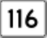
Route 47 begins at Route 116Massachusetts Route 116
Route 116 is a south–north state highway in Massachusetts. The route runs from Springfield through mill towns, college towns and rural towns, crossing the Connecticut River three times before finally ending in Adams.-Route description:...
in South Hadley
South Hadley, Massachusetts
South Hadley is a town in Hampshire County, Massachusetts, United States. The population was 17,514 at the 2010 census. It is part of the Springfield, Massachusetts Metropolitan Statistical Area....
near the northwest corner of the Mount Holyoke College
Mount Holyoke College
Mount Holyoke College is a liberal arts college for women in South Hadley, Massachusetts. It was the first member of the Seven Sisters colleges, and served as a model for some of the others...
campus. It heads northwestward towards the southwest corner of Hadley
Hadley, Massachusetts
Hadley is a town in Hampshire County, Massachusetts. The population was 4,793 at the 2000 census. It is part of the Springfield, Massachusetts Metropolitan Statistical Area. The area around Hampshire Mall and Mountain Farms Mall along Route 9 is a major shopping destination for the surrounding...
, crossing into that town near the Hockanum Flat, a bend in the Connecticut River
Connecticut River
The Connecticut River is the largest and longest river in New England, and also an American Heritage River. It flows roughly south, starting from the Fourth Connecticut Lake in New Hampshire. After flowing through the remaining Connecticut Lakes and Lake Francis, it defines the border between the...
. It then follows within half a mile of the river before turning onto Middle Street, crossing through the town center and intersecting Route 9 just over a mile east of the Calvin Coolidge Bridge
Calvin Coolidge Bridge
The Calvin Coolidge Memorial Bridge is a major crossing of the Connecticut River in western Massachusetts, connecting the towns of Northampton and Hadley. The bridge carries Route 9 across the river, where it connects to Interstate 91...
into Northampton
Northampton, Massachusetts
The city of Northampton is the county seat of Hampshire County, Massachusetts, United States. As of the 2010 census, the population of Northampton's central neighborhoods, was 28,549...
.
Route 47 turns right when Middle Street meets the river again, following the river's path into the North Hadley section of town, passing the Porter-Phelps-Huntington House
Porter-Phelps-Huntington House
Porter-Phelps-Huntington House is a historic house and museum located at 130 River Drive in Hadley, Massachusetts.It was built in 1752 and added to the National Historic Register in 1973.-External links:* - official site...
and the Hadley Sugar House along the way. It then passes into the town of Sunderland
Sunderland, Massachusetts
Sunderland is a town in Franklin County, Massachusetts, part of the Pioneer Valley. The population was 3,777 as of the 2000 census. It is part of the Springfield, Massachusetts Metropolitan Statistical Area....
. In Sunderland it continues along the east banks of the river, intersecting Route 116 once more in that town's center, just east of the Sunderland Bridge
Sunderland Bridge (Massachusetts)
The Sunderland Bridge is a crossing over the Connecticut River in western Massachusetts, connecting the towns of South Deerfield and Sunderland, carrying Massachusetts Route 116.-History and construction of the bridge:...
. It then bends northeastward, and ends just a half-mile into the Montague Center village of Montague
Montague, Massachusetts
Montague is a town in Franklin County, Massachusetts, United States. The population was 8,489 at the 2000 census. It is part of the Springfield, Massachusetts metropolitan statistical area....
at Route 63.
Junction list
| County | Location | Mile | Roads intersected | Notes |
|---|---|---|---|---|
| Hampshire Hampshire County, Massachusetts -Demographics:As of the census of 2000, there were 152,251 people, 55,991 households, and 33,818 families residing in the county. The population density was 288 people per square mile . There were 58,644 housing units at an average density of 111 per square mile... |
South Hadley South Hadley, Massachusetts South Hadley is a town in Hampshire County, Massachusetts, United States. The population was 17,514 at the 2010 census. It is part of the Springfield, Massachusetts Metropolitan Statistical Area.... |
0.0 |  Route 116 Route 116Massachusetts Route 116 Route 116 is a south–north state highway in Massachusetts. The route runs from Springfield through mill towns, college towns and rural towns, crossing the Connecticut River three times before finally ending in Adams.-Route description:... |
Southern end of Route 47. |
| Hadley Hadley, Massachusetts Hadley is a town in Hampshire County, Massachusetts. The population was 4,793 at the 2000 census. It is part of the Springfield, Massachusetts Metropolitan Statistical Area. The area around Hampshire Mall and Mountain Farms Mall along Route 9 is a major shopping destination for the surrounding... |
7.7 |  Route 9 Route 9 |
Route 9 West to Calvin Coolidge Bridge Calvin Coolidge Bridge The Calvin Coolidge Memorial Bridge is a major crossing of the Connecticut River in western Massachusetts, connecting the towns of Northampton and Hadley. The bridge carries Route 9 across the river, where it connects to Interstate 91... across Connecticut River Connecticut River The Connecticut River is the largest and longest river in New England, and also an American Heritage River. It flows roughly south, starting from the Fourth Connecticut Lake in New Hampshire. After flowing through the remaining Connecticut Lakes and Lake Francis, it defines the border between the... . Route 9 East to UMass Amherst University of Massachusetts Amherst The University of Massachusetts Amherst is a public research and land-grant university in Amherst, Massachusetts, United States and the flagship of the University of Massachusetts system... . |
|
| Franklin Franklin County, Massachusetts -Demographics:As of the census of 2000, there were 71,535 people, 29,466 households, and 18,416 families residing in the county. The population density was 102 people per square mile . There were 31,939 housing units at an average density of 46 per square mile... |
Sunderland Sunderland, Massachusetts Sunderland is a town in Franklin County, Massachusetts, part of the Pioneer Valley. The population was 3,777 as of the 2000 census. It is part of the Springfield, Massachusetts Metropolitan Statistical Area.... |
17.1 | Route 116 Massachusetts Route 116 Route 116 is a south–north state highway in Massachusetts. The route runs from Springfield through mill towns, college towns and rural towns, crossing the Connecticut River three times before finally ending in Adams.-Route description:... |
Route 116 West to Sunderland Bridge Sunderland Bridge (Massachusetts) The Sunderland Bridge is a crossing over the Connecticut River in western Massachusetts, connecting the towns of South Deerfield and Sunderland, carrying Massachusetts Route 116.-History and construction of the bridge:... across Connecticut River Connecticut River The Connecticut River is the largest and longest river in New England, and also an American Heritage River. It flows roughly south, starting from the Fourth Connecticut Lake in New Hampshire. After flowing through the remaining Connecticut Lakes and Lake Francis, it defines the border between the... . |
| Montague Montague, Massachusetts Montague is a town in Franklin County, Massachusetts, United States. The population was 8,489 at the 2000 census. It is part of the Springfield, Massachusetts metropolitan statistical area.... |
21.93 |  Route 63 Route 63 |
Northern end of Route 47. |