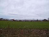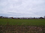
Matunuck, Rhode Island
Encyclopedia
Matunuck is a village in South Kingstown
, Rhode Island
, United States
near Charlestown, Rhode Island
. The village is located on a point along the southern Atlantic coast of Rhode Island off of U.S. Route 1
. The village takes its name from a Native American
word meaning "look out." The Narragansett tribe made a summer encampment at this location before the land was sold to colonists as part of the Pettaquamscutt purchase.
 The area is home to several notable beaches including Moonstone Beach, South Kingstown Town Beach at Matunuck, East Matunuck State Beach, and Roy Carpenter's Beach and cottages. The well known Theatre-by-the-Sea
playhouse is also in Matunuck and is listed on the National Register of Historic Places
.
Home of Seaview Marketplace that make the best grinders, pizza, bread and more. Also well known Ocean Mist and Tara's Joyce Family Pub are located directly on the beach in Matunuck and are under constant threat of erosion issues. In the 80's there were 3 Commercial fishing boats (Snow’s and Campbell’s Chowder) dredging large sea clams of the coast of Matunck and Green Hill. That Dredging process destroyed the sea kelp field that buffered the coast from storms leaving the coast line defenseless against erosion. Since the late 80’s the Matunck coast erosion takes 1.3 feet of beach each year.
South Kingstown, Rhode Island
South Kingstown is a town in Washington County, Rhode Island, United States. The population was 30,639 at the 2010 census.South Kingstown includes the villages of Kingston, West Kingston, Wakefield, Peace Dale, Snug Harbor, Tuckertown, East Matunuck, Matunuck, Green Hill, and Perryville. Peace...
, Rhode Island
Rhode Island
The state of Rhode Island and Providence Plantations, more commonly referred to as Rhode Island , is a state in the New England region of the United States. It is the smallest U.S. state by area...
, United States
United States
The United States of America is a federal constitutional republic comprising fifty states and a federal district...
near Charlestown, Rhode Island
Charlestown, Rhode Island
Charlestown is a town in Washington County, Rhode Island, United States. The population was 7,827 at the 2010 census.-History:Charlestown is named after King Charles II, and was incorporated in 1738. The area was formerly part of the town of Westerly...
. The village is located on a point along the southern Atlantic coast of Rhode Island off of U.S. Route 1
U.S. Route 1
U.S. Route 1 is a major north–south U.S. Highway that serves the East Coast of the United States. It runs 2,377 miles from Fort Kent, Maine at the Canadian border south to Key West, Florida. U.S. 1 generally parallels Interstate 95, though it is significantly farther west between...
. The village takes its name from a Native American
Native Americans in the United States
Native Americans in the United States are the indigenous peoples in North America within the boundaries of the present-day continental United States, parts of Alaska, and the island state of Hawaii. They are composed of numerous, distinct tribes, states, and ethnic groups, many of which survive as...
word meaning "look out." The Narragansett tribe made a summer encampment at this location before the land was sold to colonists as part of the Pettaquamscutt purchase.
Geography and attractions

Theatre-By-the-Sea
Theatre-By-the-Sea is an historic theater and playhouse at Card Ponds Road in South Kingstown, Rhode Island.-History:...
playhouse is also in Matunuck and is listed on the National Register of Historic Places
National Register of Historic Places
The National Register of Historic Places is the United States government's official list of districts, sites, buildings, structures, and objects deemed worthy of preservation...
.
Home of Seaview Marketplace that make the best grinders, pizza, bread and more. Also well known Ocean Mist and Tara's Joyce Family Pub are located directly on the beach in Matunuck and are under constant threat of erosion issues. In the 80's there were 3 Commercial fishing boats (Snow’s and Campbell’s Chowder) dredging large sea clams of the coast of Matunck and Green Hill. That Dredging process destroyed the sea kelp field that buffered the coast from storms leaving the coast line defenseless against erosion. Since the late 80’s the Matunck coast erosion takes 1.3 feet of beach each year.

