Mbalabala
Encyclopedia

Beitbridge
Beitbridge or Mzingwane is a border town in the province of Matabeleland South, Zimbabwe. The name also refers to the border post and bridge spanning the Limpopo River, which forms the political border between South Africa and Zimbabwe.-Background:...
-Bulawayo
Bulawayo
Bulawayo is the second largest city in Zimbabwe after the capital Harare, with an estimated population in 2010 of 2,000,000. It is located in Matabeleland, 439 km southwest of Harare, and is now treated as a separate provincial area from Matabeleland...
road (at the junction with the Filabusi Road) in Matabeleland
Matabeleland
Modern day Matabeleland is a region in Zimbabwe divided into three provinces: Matabeleland North, Bulawayo and Matabeleland South. These provinces are in the west and south-west of Zimbabwe, between the Limpopo and Zambezi rivers. The region is named after its inhabitants, the Ndebele people...
, Zimbabwe
Zimbabwe
Zimbabwe is a landlocked country located in the southern part of the African continent, between the Zambezi and Limpopo rivers. It is bordered by South Africa to the south, Botswana to the southwest, Zambia and a tip of Namibia to the northwest and Mozambique to the east. Zimbabwe has three...
. Situated approximately 41 miles (66 km) south-east of the city of Bulawayo
Bulawayo
Bulawayo is the second largest city in Zimbabwe after the capital Harare, with an estimated population in 2010 of 2,000,000. It is located in Matabeleland, 439 km southwest of Harare, and is now treated as a separate provincial area from Matabeleland...
. The name is derived from the Ndebele
Northern Ndebele language
The Northern Ndebele language, isiNdebele, or Ndebele is an African language belonging to the Nguni group of Bantu languages, and spoken by the Ndebele or Matabele people of Zimbabwe. It is commonly known as Sindebele....
name for the greater kudu
Kudu
The kudus are two species of antelope of the genus Tragelaphus:*Lesser Kudu, Tragelaphus imberbis*Greater Kudu, Tragelaphus strepsiceros- Etymology :...
(scientific name: Tragelaphus strepsiceros). It was originally rendered Balla Balla by Europeans, which was altered to its present name in 1982 by the Zimbabwean government in order to coincide closer with the local pronunciation.
The village has a railway station on the Beitbridge Bulawayo Railway
Beitbridge Bulawayo Railway
The Beitbridge Bulawayo Railway is a privately owned railway company that provides a rail link in Zimbabwe between Beitbridge at the border to South Africa and Zimbabwe's second city Bulawayo....
and is the railhead for the mining area of Filabusi
Filabusi
Filabusi is a district in Matabeleland South province in Zimbabwe. It is the district capital of Insiza and service centre for the surrounding mining and farming areas.Mining in the Filabusi area is now mainly small scale gold mining...
. The village also hosts a large army barracks, which is the Zimbabwe School of Infantry, formerly Shaw Barracks for the Rhodesian African Rifles
Rhodesian African Rifles
The Rhodesian African Rifles, or RAR, was the oldest regiment in the Rhodesian Army, dating from the formation of the 1st Rhodesian Native Regiment in 1916 during the First World War. This was followed by the creation of the Matabeleland Native Regiment, and the 2nd Rhodesian Native Regiment,...
from 1976 to 1980. The site was previously St. Stephen's College
St. Stephen's College, Balla Balla
St. Stephen's College, Balla Balla, Southern Rhodesia was a private Christian high school from 1956 to 1975.St. Stephen's College was a privately funded all boys boarding school, founded in 1956 by the Reverend Maurice Lancaster and located in the village of Balla Balla, Southern Rhodesia...
from February 1959 to December 1975.
Mbalabala is situated on high ground, which forms a ridge between the Mzingwane
Mzingwane River
The Mzingwane River is a major left-bank tributary of the Limpopo River in Zimbabwe.It rises near Fort Usher, Matobo District, south of Bulawayo and flows into the Limpopo River near Beitbridge, downstream of the mouth of the Shashe River and upstream of the mouth of the Bubye River.- Hydrology...
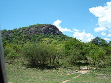
and Mbilambowe watersheds, in an important cattle ranching area with a history of gold prospecting. There is a prominent landmark nearby in the form of a granite hill (kopje) known as Balloon Kop or "Baldy" - due to its bare rock.

