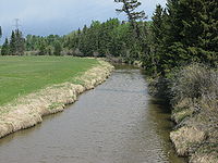
.gif)
Medicine River (Alberta)
Encyclopedia

River
A river is a natural watercourse, usually freshwater, flowing towards an ocean, a lake, a sea, or another river. In a few cases, a river simply flows into the ground or dries up completely before reaching another body of water. Small rivers may also be called by several other names, including...
in central Alberta
Alberta
Alberta is a province of Canada. It had an estimated population of 3.7 million in 2010 making it the most populous of Canada's three prairie provinces...
. It begins at the outlet of Medicine Lake, north of Rocky Mountain House
Rocky Mountain House, Alberta
Rocky Mountain House is a town in west-central Alberta, Canada, approximately west of the City of Red Deer. It is located at the confluence of the Clearwater and North Saskatchewan Rivers, and at the crossroads of Highway 22 and Highway 11 .- History :The town has a long history dating to the...
. The Medicine River initially travels through the Rocky Mountain House Grazing Reserve, a protected area with over 15000 acres (60.7 km²) of land set aside for cattle grazing and recreation.. The river flows southwest, taking on a number of creeks
Stream
A stream is a body of water with a current, confined within a bed and stream banks. Depending on its locale or certain characteristics, a stream may be referred to as a branch, brook, beck, burn, creek, "crick", gill , kill, lick, rill, river, syke, bayou, rivulet, streamage, wash, run or...
before passing Eckville
Eckville, Alberta
Eckville is a town in central Alberta, Canada. It is located west of Red Deer on Highway 766 just north of Highway 11.- History :Eckville gets its name from the founder Arthur E.T. Eckford, the landowner of the original Eckville. Eckville relocated to its current location in 1912, after the...
. The Medicine River joins the Red Deer River
Red Deer River
The Red Deer River is a river in Alberta, Canada. It is a major tributary of the South Saskatchewan River.Red Deer River has a total length of and a drainage area of...
north of Innisfail
Innisfail, Alberta
Innisfail is a town in central Alberta, Canada. It is located in the Calgary-Edmonton Corridor, south of Red Deer at the junction of Highway 2 and Highway 54....
, downstream of the Dickson Dam
Dickson Dam
Dickson Dam is a flow regulation dam on the Red Deer River which creates Gleniffer Lake in Alberta. The dam is located 20km west of the town of Innisfail and 50km southwest of the city of Red Deer.-Generation:...
, at the Medicine Flats. The Medicine is bridged by Alberta highways 53, 12, 11, and 54
Alberta Highway 54
Highway 54 is an east–west highway located in central Alberta. It is in length, starting at Highway 22 west of the Village of Caroline and ending at Exit 365 of Highway 2 at the south end of the Town of Innisfail....
.
The name Medicine River is a translation
Translation
Translation is the communication of the meaning of a source-language text by means of an equivalent target-language text. Whereas interpreting undoubtedly antedates writing, translation began only after the appearance of written literature; there exist partial translations of the Sumerian Epic of...
from the Cree
Cree
The Cree are one of the largest groups of First Nations / Native Americans in North America, with 200,000 members living in Canada. In Canada, the major proportion of Cree live north and west of Lake Superior, in Ontario, Manitoba, Saskatchewan, Alberta and the Northwest Territories, although...
words muskiki and nipagwasimow, or Sundance river. It first appeared on a John Arrowsmith
John Arrowsmith (cartographer)
John Arrowsmith was an English geographer and member of the Arrowsmith family of geographers. He was born at Winston, County Durham....
map in 1859.
Tributaries
- Open Creek
- Wilson Creek
- Welch Creek
- Block Creek
- Wood Lake
- Blueberry Creek
- Lobstick Creek
- Lasthill Creek
- Tindastoll Creek
- Dickson Creek

