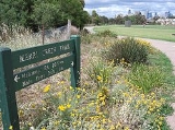
Merri Creek Trail
Encyclopedia
The Merri Creek Trail is a shared use path for cyclists
and pedestrian
s, which follows the Merri Creek
through the northern suburbs of Melbourne
, Victoria
, Australia
.
near where Merri Creek
enters the Yarra River
, and then takes a winding route, mainly following the creek all the way to the Western Ring Road Trail
. The route is now sealed for its entirety, with the last unsealed sections replaced in 2008. Along the way it passes by CERES, the Brunswick velodrome
and the Coburg Lake park.
At the Western Ring Road Trail
, heading west will lead you to the Moonee Ponds Creek Trail
, Brimbank Park and the Maribyrnong River Trail
. La Trobe University
Bundoora campus can be accessed by following the trail east.
North end at 37.694670°S 144.967497°E.
South end at 37.783139°S 144.992628°E.
Cycling
Cycling, also called bicycling or biking, is the use of bicycles for transport, recreation, or for sport. Persons engaged in cycling are cyclists or bicyclists...
and pedestrian
Pedestrian
A pedestrian is a person traveling on foot, whether walking or running. In some communities, those traveling using roller skates or skateboards are also considered to be pedestrians. In modern times, the term mostly refers to someone walking on a road or footpath, but this was not the case...
s, which follows the Merri Creek
Merri Creek
The Merri Creek is a waterway in southern parts of Victoria, Australia which flows through the northern suburbs of Melbourne. It begins in Wallan north of Melbourne and flows south for 70km until it joins the Yarra River at Dights Falls...
through the northern suburbs of Melbourne
Melbourne
Melbourne is the capital and most populous city in the state of Victoria, and the second most populous city in Australia. The Melbourne City Centre is the hub of the greater metropolitan area and the Census statistical division—of which "Melbourne" is the common name. As of June 2009, the greater...
, Victoria
Victoria (Australia)
Victoria is the second most populous state in Australia. Geographically the smallest mainland state, Victoria is bordered by New South Wales, South Australia, and Tasmania on Boundary Islet to the north, west and south respectively....
, Australia
Australia
Australia , officially the Commonwealth of Australia, is a country in the Southern Hemisphere comprising the mainland of the Australian continent, the island of Tasmania, and numerous smaller islands in the Indian and Pacific Oceans. It is the world's sixth-largest country by total area...
.
Following the Path
The path commences at Dights FallsDights Falls
Dights Falls is located in Melbourne, Victoria just downstream of the junction of the Yarra River with Merri Creek. At this point the river narrows and is constricted between 800,000 year old volcanic, basaltic lava flow and a much older steep, silurian, sedimentary spur...
near where Merri Creek
Merri Creek
The Merri Creek is a waterway in southern parts of Victoria, Australia which flows through the northern suburbs of Melbourne. It begins in Wallan north of Melbourne and flows south for 70km until it joins the Yarra River at Dights Falls...
enters the Yarra River
Yarra River
The Yarra River, originally Birrarung, is a river in east-central Victoria, Australia. The lower stretches of the river is where the city of Melbourne was established in 1835 and today Greater Melbourne dominates and influences the landscape of its lower reaches...
, and then takes a winding route, mainly following the creek all the way to the Western Ring Road Trail
Western Ring Road Trail
The Western Ring Road Trail is a shared use path for cyclists and pedestrians that bridges the northern suburbs and follows the Western Ring Road...
. The route is now sealed for its entirety, with the last unsealed sections replaced in 2008. Along the way it passes by CERES, the Brunswick velodrome
Velodrome
A velodrome is an arena for track cycling. Modern velodromes feature steeply banked oval tracks, consisting of two 180-degree circular bends connected by two straights...
and the Coburg Lake park.
At the Western Ring Road Trail
Western Ring Road Trail
The Western Ring Road Trail is a shared use path for cyclists and pedestrians that bridges the northern suburbs and follows the Western Ring Road...
, heading west will lead you to the Moonee Ponds Creek Trail
Moonee Ponds Creek Trail
The Moonee Ponds Creek Trail is a shared use path for cyclists and pedestrians, which follows the Moonee Ponds Creek through the northern suburbs of Melbourne, Victoria, Australia.-Following the path:...
, Brimbank Park and the Maribyrnong River Trail
Maribyrnong River Trail
The Maribyrnong River Trail is a shared use path for cyclists and pedestrians, which follows the Maribyrnong River through the north western suburbs of Melbourne, Victoria, Australia....
. La Trobe University
La Trobe University
La Trobe University is a multi-campus university in Victoria, Australia. It was established in 1964 by an Act of Parliament to become the third oldest university in the state of Victoria. The main campus of La Trobe is located in the Melbourne suburb of Bundoora; two other major campuses are...
Bundoora campus can be accessed by following the trail east.
Connections
- The path joins the Western Ring Road TrailWestern Ring Road TrailThe Western Ring Road Trail is a shared use path for cyclists and pedestrians that bridges the northern suburbs and follows the Western Ring Road...
in the north. - In the south it meets the Yarra River Trail
- In April 2010 connections to the Capital City TrailCapital City TrailThe Capital City Trail is a shared use path for cyclists and pedestrians, which circles the Melbourne city centre and some inner eastern and northern suburbs of Melbourne, Victoria, Australia....
were improved with the addition of a new bridge across Merri Creek, 160m south of the junction of Union Street and Merri Parade.
North end at 37.694670°S 144.967497°E.
South end at 37.783139°S 144.992628°E.

