Merrimacport, Massachusetts
Encyclopedia
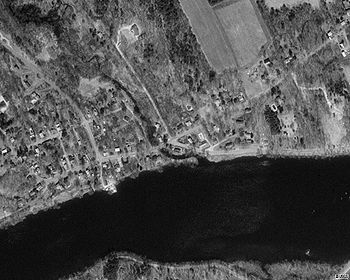
Merrimacport is an unincorporated village and the oldest section of the town of Merrimac, Massachusetts
, located along the Merrimack River
.
 Settled in 1638, it began as a fishing village, and was long a part of the section of Amesbury, Massachusetts
known as West Amesbury. During the Industrial Revolution
, a nearby village developed around the newly formed Merrimac square. In 1876, West Amesbury, including Merrimacport (aka: South Amesbury), split from Amesbury, incorporating itself as the town of Merrimac.
Today, Merrimacport is still a distinct village. It is divided from the rest of Merrimac by Interstate 495
. It goes from the Southern Border of Amesbury to Loucus Street. As much of its property is waterfront, it is more expensive, and is considered to be the more affluent section of the town. With a small bunch of colonial homes surrounding a simple, white church on a hill, it continues to maintain its New England
charm. A local TV station called ACN News is located on Little Pond Road in Merrimac.
Merrimac, Massachusetts
Merrimac is a town in Essex County, Massachusetts, United States, and on the southeastern border of New Hampshire, approximately northeast of Boston and west of the Atlantic Ocean. It is situated along the north bank of the Merrimack River in the Merrimack Valley. The population was 6,504 in 2008...
, located along the Merrimack River
Merrimack River
The Merrimack River is a river in the northeastern United States. It rises at the confluence of the Pemigewasset and Winnipesaukee rivers in Franklin, New Hampshire, flows southward into Massachusetts, and then flows northeast until it empties into the Atlantic Ocean at Newburyport...
.

Amesbury, Massachusetts
Amesbury is a city in Essex County, Massachusetts, United States. Though it officially became a city in 1996, its formal name remains "The Town of Amesbury." In 1890, 9798 people lived in Amesbury; in 1900, 9473; in 1910, 9894; in 1920, 10,036; and in 1940, 10,862. The population was 16,283 at...
known as West Amesbury. During the Industrial Revolution
Industrial Revolution
The Industrial Revolution was a period from the 18th to the 19th century where major changes in agriculture, manufacturing, mining, transportation, and technology had a profound effect on the social, economic and cultural conditions of the times...
, a nearby village developed around the newly formed Merrimac square. In 1876, West Amesbury, including Merrimacport (aka: South Amesbury), split from Amesbury, incorporating itself as the town of Merrimac.
Today, Merrimacport is still a distinct village. It is divided from the rest of Merrimac by Interstate 495
Interstate 495 (Massachusetts)
Interstate 495 is the designation of an Interstate Highway half-beltway in Massachusetts. It was the longest auxiliary Interstate Highway of its kind—measuring 120.74 miles —until 1996, when the PA Route 9 section of the Pennsylvania Turnpike was redesignated as Interstate 476, making it about ...
. It goes from the Southern Border of Amesbury to Loucus Street. As much of its property is waterfront, it is more expensive, and is considered to be the more affluent section of the town. With a small bunch of colonial homes surrounding a simple, white church on a hill, it continues to maintain its New England
New England
New England is a region in the northeastern corner of the United States consisting of the six states of Maine, New Hampshire, Vermont, Massachusetts, Rhode Island, and Connecticut...
charm. A local TV station called ACN News is located on Little Pond Road in Merrimac.

