

Milford, Iowa
Encyclopedia
Milford is a city in Dickinson County
, Iowa
, United States
. The population was 2,474 at the 2000 census. The town includes many businesses related to its location in the Iowa Great Lakes
region.
Area was settled in the 1850s. It attracted many pioneers because of the rich black soil, water from the lakes, and an abundance of wild game and fish. As the population increased at these times, a need for a good flouring mill was felt because the nearest mills were those in Mankato
, Minnesota
and Fort Dodge
, Iowa
. In 1861, there was an attempt to build one on Mill Creek, the outlet of the Great Lakes but the attempt was abandoned after the Indian raid of 1862 and the extremely low water level that year. In 1868 one was successfully built. A sawmill was built and put into operation in 1869. The mills began to attract many customers, and the small community began to grow. Old Town formed out of these customers and new businesses emerged. In 1870, the company that then operated the mill bought a section of land northwest of Old Town and laid out a plan for the town of Milford on land that the new railroad, which was built in 1882, was located on.
was flown at the new city hall for the first time and that year a vote approved to pave Okoboji Avenue (Main Street of Milford). The Milwaukee rail line which ran through Milford supplied the town with mail, groceries, clothing, lumber, coal, and machinery before automobiles could get to the Great Lakes. Two passenger trains made daily trips from Des Moines
to Spirit Lake, making 4 stops in Milford each day. Also another train from Spencer, a town south of Milford, made to runs every day. Until 1910, excursion trains came to the Lakes Area from Des Moines, Algona
, and other towns on weekends and holidays. They usually carried 8-10 passenger coaches, and left on Sunday or at the end of the holidays. The last passenger train left Milford for Spencer in 1951. The last freight train left Milford for Spencer in 1976. By this time, the tracks were hardly ever used now that it was easier to get to the Lakes Area using the new highways. The tracks were dismantled in 1978 because they were hardly ever used. The tourists that came every summer came by the new highways and stopped using the railroad for transportation. The Iowa Great Lakes is still a huge attraction that swells the summer population to about 100,000.
According to the United States Census Bureau
, the city has a total area of 2.3 square miles (6 km²), all of it land.
of 2000, there were 2,474 people, 1,042 households, and 670 families residing in the city. The population density
was 1,095.5 people per square mile (422.7/km²). There were 1,128 housing units at an average density of 499.5 per square mile (192.7/km²). The racial makeup of the city was 99.07% White, 0.12% African American, 0.16% Native American, 0.36% Asian, 0.12% from other races
, and 0.16% from two or more races. Hispanic or Latino of any race were 0.85% of the population.
There were 1,042 households out of which 30.8% had children under the age of 18 living with them, 51.9% were married couples
living together, 9.6% had a female householder with no husband present, and 35.7% were non-families. 30.2% of all households were made up of individuals and 15.5% had someone living alone who was 65 years of age or older. The average household size was 2.33 and the average family size was 2.91.
In the city the population was spread out with 24.3% under the age of 18, 8.6% from 18 to 24, 27.3% from 25 to 44, 21.2% from 45 to 64, and 18.7% who were 65 years of age or older. The median age was 39 years. For every 100 females there were 91.2 males. For every 100 females age 18 and over, there were 86.3 males.
The median income for a household in the city was $36,063, and the median income for a family was $42,371. Males had a median income of $28,239 versus $20,815 for females. The per capita income
for the city was $16,680. About 4.3% of families and 6.9% of the population were below the poverty line, including 7.2% of those under age 18 and 11.1% of those age 65 or over.
is a popular area for many people that swells the summer population in Dickinson County to about 100,000.
Since 1910, businesses have taken advantage of the huge amounts of gravel that is under and surrounds Milford, and was first mined by the Milwaukee Railroad. To the east, west, and south of town there are gravel pits either exhausted and abandoned-some used as junkyards or ones still used that change the face of the Earth almost overnight. Milford Sand & Gravel is one company that mines and washes the gravel for industrial use.
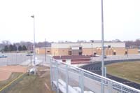 Milford is served by the Okoboji Community High School and Okoboji Community Elementary School, both of which are part of the Okoboji Community School District. The middle school is located in Arnolds Park, Iowa. The schools mascot is the Okoboji Pioneer. School colors are maroon and white.
The town also has a library
, the Milford Memorial Library.
Dickinson County, Iowa
-2010 census:The 2010 census recorded a population of 16,667 in the county, with a population density of . There were 12,849 housing units, of which 7,554 were occupied.-2000 census:...
, Iowa
Iowa
Iowa is a state located in the Midwestern United States, an area often referred to as the "American Heartland". It derives its name from the Ioway people, one of the many American Indian tribes that occupied the state at the time of European exploration. Iowa was a part of the French colony of New...
, United States
United States
The United States of America is a federal constitutional republic comprising fifty states and a federal district...
. The population was 2,474 at the 2000 census. The town includes many businesses related to its location in the Iowa Great Lakes
Iowa Great Lakes
The Iowa Great Lakes are a group of natural glacial lakes in Dickinson County in northwestern Iowa in the United States. The three principal lakes of the group are Spirit Lake, West Okoboji Lake, and East Okoboji Lake. They are the largest natural lakes in the state of Iowa. The largest, Spirit...
region.
Old Town
The Iowa Great LakesIowa Great Lakes
The Iowa Great Lakes are a group of natural glacial lakes in Dickinson County in northwestern Iowa in the United States. The three principal lakes of the group are Spirit Lake, West Okoboji Lake, and East Okoboji Lake. They are the largest natural lakes in the state of Iowa. The largest, Spirit...
Area was settled in the 1850s. It attracted many pioneers because of the rich black soil, water from the lakes, and an abundance of wild game and fish. As the population increased at these times, a need for a good flouring mill was felt because the nearest mills were those in Mankato
Mankato, Minnesota
Mankato is a city in Blue Earth, Nicollet, and Le Sueur counties in the U.S. state of Minnesota. The population was 39,309 at the 2010 census, making it the fourth largest city in Minnesota outside of the Minneapolis-St. Paul metropolitan area. The county seat of Blue Earth County, it is located...
, Minnesota
Minnesota
Minnesota is a U.S. state located in the Midwestern United States. The twelfth largest state of the U.S., it is the twenty-first most populous, with 5.3 million residents. Minnesota was carved out of the eastern half of the Minnesota Territory and admitted to the Union as the thirty-second state...
and Fort Dodge
Fort Dodge, Iowa
Fort Dodge is a city and county seat of Webster County, Iowa, United States, along the Des Moines River. The population was 25,206 in the 2010 census, an increase from 25,136 in the 2000 census. Fort Dodge is a major commercial center for North Central and Northwest Iowa. It is located on U.S...
, Iowa
Iowa
Iowa is a state located in the Midwestern United States, an area often referred to as the "American Heartland". It derives its name from the Ioway people, one of the many American Indian tribes that occupied the state at the time of European exploration. Iowa was a part of the French colony of New...
. In 1861, there was an attempt to build one on Mill Creek, the outlet of the Great Lakes but the attempt was abandoned after the Indian raid of 1862 and the extremely low water level that year. In 1868 one was successfully built. A sawmill was built and put into operation in 1869. The mills began to attract many customers, and the small community began to grow. Old Town formed out of these customers and new businesses emerged. In 1870, the company that then operated the mill bought a section of land northwest of Old Town and laid out a plan for the town of Milford on land that the new railroad, which was built in 1882, was located on.
Milford
On March 14, 1892, the first Town Council meeting was held. Some buildings were moved from Old Town to New Town (Milford) and many more businesses and residences were constructed. In 1921, the U.S. flagFlag of the United States
The national flag of the United States of America consists of thirteen equal horizontal stripes of red alternating with white, with a blue rectangle in the canton bearing fifty small, white, five-pointed stars arranged in nine offset horizontal rows of six stars alternating with rows...
was flown at the new city hall for the first time and that year a vote approved to pave Okoboji Avenue (Main Street of Milford). The Milwaukee rail line which ran through Milford supplied the town with mail, groceries, clothing, lumber, coal, and machinery before automobiles could get to the Great Lakes. Two passenger trains made daily trips from Des Moines
Des Moines, Iowa
Des Moines is the capital and the most populous city in the US state of Iowa. It is also the county seat of Polk County. A small portion of the city extends into Warren County. It was incorporated on September 22, 1851, as Fort Des Moines which was shortened to "Des Moines" in 1857...
to Spirit Lake, making 4 stops in Milford each day. Also another train from Spencer, a town south of Milford, made to runs every day. Until 1910, excursion trains came to the Lakes Area from Des Moines, Algona
Algona, Iowa
Algona is a city in and the county seat of Kossuth County, Iowa, United States. The population was 5,741 at the 2000 census. Ambrose A. Call State Park is located two miles southwest of the city.-History:...
, and other towns on weekends and holidays. They usually carried 8-10 passenger coaches, and left on Sunday or at the end of the holidays. The last passenger train left Milford for Spencer in 1951. The last freight train left Milford for Spencer in 1976. By this time, the tracks were hardly ever used now that it was easier to get to the Lakes Area using the new highways. The tracks were dismantled in 1978 because they were hardly ever used. The tourists that came every summer came by the new highways and stopped using the railroad for transportation. The Iowa Great Lakes is still a huge attraction that swells the summer population to about 100,000.
Geography
Milford is located at 43°19′37"N 95°9′3"W (43.327006, -95.150701).According to the United States Census Bureau
United States Census Bureau
The United States Census Bureau is the government agency that is responsible for the United States Census. It also gathers other national demographic and economic data...
, the city has a total area of 2.3 square miles (6 km²), all of it land.
Demographics
As of the censusCensus
A census is the procedure of systematically acquiring and recording information about the members of a given population. It is a regularly occurring and official count of a particular population. The term is used mostly in connection with national population and housing censuses; other common...
of 2000, there were 2,474 people, 1,042 households, and 670 families residing in the city. The population density
Population density
Population density is a measurement of population per unit area or unit volume. It is frequently applied to living organisms, and particularly to humans...
was 1,095.5 people per square mile (422.7/km²). There were 1,128 housing units at an average density of 499.5 per square mile (192.7/km²). The racial makeup of the city was 99.07% White, 0.12% African American, 0.16% Native American, 0.36% Asian, 0.12% from other races
Race (United States Census)
Race and ethnicity in the United States Census, as defined by the Federal Office of Management and Budget and the United States Census Bureau, are self-identification data items in which residents choose the race or races with which they most closely identify, and indicate whether or not they are...
, and 0.16% from two or more races. Hispanic or Latino of any race were 0.85% of the population.
There were 1,042 households out of which 30.8% had children under the age of 18 living with them, 51.9% were married couples
Marriage
Marriage is a social union or legal contract between people that creates kinship. It is an institution in which interpersonal relationships, usually intimate and sexual, are acknowledged in a variety of ways, depending on the culture or subculture in which it is found...
living together, 9.6% had a female householder with no husband present, and 35.7% were non-families. 30.2% of all households were made up of individuals and 15.5% had someone living alone who was 65 years of age or older. The average household size was 2.33 and the average family size was 2.91.
In the city the population was spread out with 24.3% under the age of 18, 8.6% from 18 to 24, 27.3% from 25 to 44, 21.2% from 45 to 64, and 18.7% who were 65 years of age or older. The median age was 39 years. For every 100 females there were 91.2 males. For every 100 females age 18 and over, there were 86.3 males.
The median income for a household in the city was $36,063, and the median income for a family was $42,371. Males had a median income of $28,239 versus $20,815 for females. The per capita income
Per capita income
Per capita income or income per person is a measure of mean income within an economic aggregate, such as a country or city. It is calculated by taking a measure of all sources of income in the aggregate and dividing it by the total population...
for the city was $16,680. About 4.3% of families and 6.9% of the population were below the poverty line, including 7.2% of those under age 18 and 11.1% of those age 65 or over.
Iowa Great Lakes
The Iowa Great LakesIowa Great Lakes
The Iowa Great Lakes are a group of natural glacial lakes in Dickinson County in northwestern Iowa in the United States. The three principal lakes of the group are Spirit Lake, West Okoboji Lake, and East Okoboji Lake. They are the largest natural lakes in the state of Iowa. The largest, Spirit...
is a popular area for many people that swells the summer population in Dickinson County to about 100,000.
Bike trail
The Dickinson County Bike Trail was built in 1990 on the old railroad bed. It begins in Milford and takes its travelers to the east shore of Minnewashta and meets back up with Highway 71 in Arnolds Park before it reaches the old railroad bridge that it crosses, where there is a view of both West and East Lakes. It then goes through the town of Okoboji and ends in Spirit Lake.Horseshoe Bend Park
Horseshoe Bend Park is a 180 acre (0.7284348 km²) park about 7 miles southwest of Milford. It is named after the bend in the Little Sioux River. The park is located on the north and south side of the bed. On the north side, there is a picnic shelter and the old slide that was once the second story fire escape for the Milford Elementary School. Down the hill in the river valley there are trails for walking and a walking bridge that leads to the south end of the park. On the south end, a lift is opened in the winter, where visitors may enjoy snow skiing, sledding, or snow tubing. There is also a shelter with a large circular fireplace and sitting area for visitors burdened by the harsh cold of Iowa winters.Stylecraft
After the Gable Furniture Company of Des Moines closed down, Robert C. Reed and James Tollefson bought the manufacturing operation in Milford. They soon began making upholstered chairs under the name Stlyecraft which opened in 1972. Early in the history of the company, Stlyecraft gained a reputation for the production of good quality products at very reasonable prices and employed about 150 people by 1978. By 1983, Stylecraft's employment grew to 300. By the spring of 1992, more than 800 people were employed directly by Stylecraft, making it one of the major employers in a town of 2,474. After recent buy-outs and outsourcing, Stylecraft has now become a subsidiary of Klausner Furniture. These events have led to a dramatic reduction of employees creating far-reaching economic and community changes.Gravel
"Milford's Hidden Gold"Since 1910, businesses have taken advantage of the huge amounts of gravel that is under and surrounds Milford, and was first mined by the Milwaukee Railroad. To the east, west, and south of town there are gravel pits either exhausted and abandoned-some used as junkyards or ones still used that change the face of the Earth almost overnight. Milford Sand & Gravel is one company that mines and washes the gravel for industrial use.
Milford Elevator
The Milford Elevator has served the Milford Community is a greatly needed accommodation for the farmers of the Milford Area. It was owned by Great Lakes Cooperative until April 3, 2008 when GLC merged with Great Plains Renewable Energy, Inc. GPRE is an Iowa corporation and was organized to construct, manage, and operate ethanol plants.Education
The town also has a library
Library
In a traditional sense, a library is a large collection of books, and can refer to the place in which the collection is housed. Today, the term can refer to any collection, including digital sources, resources, and services...
, the Milford Memorial Library.