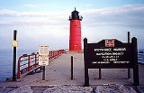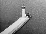
Milwaukee Pierhead Light
Encyclopedia
The Milwaukee Pierhead Light is an active lighthouse
located in the Milwaukee
harbor, just south of downtown. This aid to navigation is a 'sister' of the Kenosha North Pier Light.
, and is near the outflow of the Milwaukee River
-- not far east of where that river converged with the Kinnickinnic River
-- into the Milwaukee Harbor and Lake Michigan
.
This light has a round steel tower with a round gallery
and a ten-sided lantern. In 1926, the original 4th Order Fresnel lens
was transferred to the Milwaukee Breakwater Light
, and that lens is now displayed at the Wisconsin Maritime Museum
in Manitowoc, Wisconsin
. The Fifth Order Fresnel lens—installed in 1926—was removed in 2005. The tower is newly painted circa 2007. The 5th Order lens is said to be on display also at the Wisconsin Maritime Museum
.
According to one source: "The original lantern room had helical bar windows and is believed to [be] the one presently on the Breakwater Light." This is corroborated by the report that the Breakwater Light has a "round cast iron lantern room [that] features helical astragal" in the lantern.
A Submarine cable
runs from this light to the Milwaukee Breakwater Light, upon which a lighted danger warning is displayed.
The light was recently painted, circa 2007.
From 1872 until 1926, the light had its own keepers. Thereafter, this light, like all of the lights in the harbor, was serviced by the resident Lighthouse keeper
s who were stationed at the neighboring North Point Light Station until it was automated.
The light is not listed on the National Register of Historic Places
or the state list.
 I-43
I-43
to east I-794
I-794
. Take exit(1F)(Lincoln Memorial Drive), proceed north to Michigan Street. Turn right onto Michigan. Turn right onto Harbor Drive and proceed under the interstate to Polk Street. Turn right on Polk, which ends at Erie Street. Turn left on Erie into the parking lot where it ends.

Lighthouse
A lighthouse is a tower, building, or other type of structure designed to emit light from a system of lamps and lenses or, in older times, from a fire, and used as an aid to navigation for maritime pilots at sea or on inland waterways....
located in the Milwaukee
Milwaukee, Wisconsin
Milwaukee is the largest city in the U.S. state of Wisconsin, the 28th most populous city in the United States and 39th most populous region in the United States. It is the county seat of Milwaukee County and is located on the southwestern shore of Lake Michigan. According to 2010 census data, the...
harbor, just south of downtown. This aid to navigation is a 'sister' of the Kenosha North Pier Light.
History
The station was established in 1872. It is west of the Milwaukee Breakwater LightMilwaukee Breakwater Light
The Milwaukee Breakwater lighthouse is located in the harbor of Milwaukee in Milwaukee County, Wisconsin. It protects the entrance to the Milwaukee River.-History:...
, and is near the outflow of the Milwaukee River
Milwaukee River
The Milwaukee River is a river in the state of Wisconsin. It is about long.- Description :The river begins in Fond du Lac County, Wisconsin and flows south past Grafton to downtown Milwaukee, where it empties into Lake Michigan...
-- not far east of where that river converged with the Kinnickinnic River
Kinnickinnic River
Kinnickinnic River may refer to one of two rivers in the United States state of Wisconsin:* Kinnickinnic River, a tributary of the Milwaukee River in southeastern Wisconsin* Kinnickinnic River, a tributary of the St. Croix River in northwestern Wisconsin...
-- into the Milwaukee Harbor and Lake Michigan
Lake Michigan
Lake Michigan is one of the five Great Lakes of North America and the only one located entirely within the United States. It is the second largest of the Great Lakes by volume and the third largest by surface area, after Lake Superior and Lake Huron...
.
This light has a round steel tower with a round gallery
Balcony
Balcony , a platform projecting from the wall of a building, supported by columns or console brackets, and enclosed with a balustrade.-Types:The traditional Maltese balcony is a wooden closed balcony projecting from a...
and a ten-sided lantern. In 1926, the original 4th Order Fresnel lens
Fresnel lens
A Fresnel lens is a type of lens originally developed by French physicist Augustin-Jean Fresnel for lighthouses.The design allows the construction of lenses of large aperture and short focal length without the mass and volume of material that would be required by a lens of conventional design...
was transferred to the Milwaukee Breakwater Light
Milwaukee Breakwater Light
The Milwaukee Breakwater lighthouse is located in the harbor of Milwaukee in Milwaukee County, Wisconsin. It protects the entrance to the Milwaukee River.-History:...
, and that lens is now displayed at the Wisconsin Maritime Museum
Wisconsin Maritime Museum
The Wisconsin Maritime Museum is a maritime museum founded in 1968 as the Manitowoc Maritime Museum to ensure that the maritime heritage of Manitowoc, Wisconsin, U.S., and the Great Lakes would not be forgotten...
in Manitowoc, Wisconsin
Manitowoc, Wisconsin
Manitowoc is a city in and the county seat of Manitowoc County, Wisconsin, United States. The city is located on Lake Michigan at the mouth of the Manitowoc River. According to the 2000 census, Manitowoc had a population of 34,053, with over 50,000 residents in the surrounding communities...
. The Fifth Order Fresnel lens—installed in 1926—was removed in 2005. The tower is newly painted circa 2007. The 5th Order lens is said to be on display also at the Wisconsin Maritime Museum
Wisconsin Maritime Museum
The Wisconsin Maritime Museum is a maritime museum founded in 1968 as the Manitowoc Maritime Museum to ensure that the maritime heritage of Manitowoc, Wisconsin, U.S., and the Great Lakes would not be forgotten...
.
According to one source: "The original lantern room had helical bar windows and is believed to [be] the one presently on the Breakwater Light." This is corroborated by the report that the Breakwater Light has a "round cast iron lantern room [that] features helical astragal" in the lantern.
A Submarine cable
Submarine power cable
Submarine power cables are major transmission cables for carrying electric power below the surface of the water. These are called "submarine" because they usually carry electric power beneath salt water but it is also possible to use submarine power cables beneath fresh water...
runs from this light to the Milwaukee Breakwater Light, upon which a lighted danger warning is displayed.
The light was recently painted, circa 2007.
From 1872 until 1926, the light had its own keepers. Thereafter, this light, like all of the lights in the harbor, was serviced by the resident Lighthouse keeper
Lighthouse keeper
A lighthouse keeper is the person responsible for tending and caring for a lighthouse, particularly the light and lens in the days when oil lamps and clockwork mechanisms were used. Keepers were needed to trim the wicks, replenish fuel, wind clockworks and perform maintenance tasks such as cleaning...
s who were stationed at the neighboring North Point Light Station until it was automated.
The light is not listed on the National Register of Historic Places
National Register of Historic Places
The National Register of Historic Places is the United States government's official list of districts, sites, buildings, structures, and objects deemed worthy of preservation...
or the state list.
Directions
The light is located in downtown Milwaukee, at the end of East Erie Street, which leads to a short pier. Parking is available. The pier may be walked, but the tower is closed. I-43
I-43Interstate 43
Interstate 43 is a intrastate Interstate Highway located entirely within the U.S. state of Wisconsin, connecting Interstate 39 and Interstate 90 in Beloit with Milwaukee and U.S. Route 41 and U.S. Route 141 in Green Bay. I-43 is the 5th longest intrastate Interstate Highway of the Interstate...
to east
 I-794
I-794Interstate 794
Interstate 794 is Interstate Highway spur route in Milwaukee County in the U.S. state of Wisconsin. It is one of two auxiliary Interstates in the Milwaukee metropolitan area and serves the lakefront, the Port of Milwaukee and connects downtown with the southeastern suburbs of St...
. Take exit(1F)(Lincoln Memorial Drive), proceed north to Michigan Street. Turn right onto Michigan. Turn right onto Harbor Drive and proceed under the interstate to Polk Street. Turn right on Polk, which ends at Erie Street. Turn left on Erie into the parking lot where it ends.
Specialized additional reading
- Eckert, Jack A. A Small Slice of Life—Milwaukee Breakwater Light Station. Lighthouse DigestLighthouse DigestLighthouse Digest is a specialty magazine for lighthouse and maritime history enthusiasts published in East Machias, Maine. Launched in May, 1992, by FogHorn Publishing, it is dedicated to preserving lighthouse history, current and yesteryear, for future generations.-Scope:Coverage includes...
(October, 2003). - Havighurst, Walter (1943) The Long Ships Passing: The Story of the Great Lakes, Macmillan PublishersMacmillan PublishersMacmillan Publishers Ltd, also known as The Macmillan Group, is a privately held international publishing company owned by Georg von Holtzbrinck Publishing Group. It has offices in 41 countries worldwide and operates in more than thirty others.-History:...
. - Oleszewski, Wes, Great Lakes Lighthouses, American and Canadian: A Comprehensive Directory/Guide to Great Lakes Lighthouses, (Gwinn, Michigan: Avery Color Studios, Inc., 1998) ISBN 0-932212-98-0.
- Sapulski, Wayne S., (2001) Lighthouses of Lake Michigan: Past and Present (Paperback) (Fowlerville: Wilderness Adventure Books) ISBN 0923568476; ISBN 978-0923568474.
- Wright, Larry and Wright, Patricia, Great Lakes Lighthouses Encyclopedia Hardback (Erin: Boston Mills Press, 2006) ISBN 1-55046-399-3.
External links

- Huelse, Klaus -- Meine Leuchtturm-Seite: Leuchttürme USA auf historischen Postkarten -- Historic postcard images of U.S. lighthouses, Historic Post Card View — Milwaukee Pierhead Lighthouse.
- Satellite view of Milwaukee Pierhead Light, Google earthGoogle EarthGoogle Earth is a virtual globe, map and geographical information program that was originally called EarthViewer 3D, and was created by Keyhole, Inc, a Central Intelligence Agency funded company acquired by Google in 2004 . It maps the Earth by the superimposition of images obtained from satellite...
. - Terry Pepper, Seeing the Light, Milwaukee Pierhead Light.
- Wobser, David, Milwaukee Pier Head Light, boatnerd.com.

