Mona Vale, New South Wales
Encyclopedia
Mona Vale is a suburb
in northern Sydney
, in the state of New South Wales
, Australia
. It is located 28 kilometres north of the Sydney central business district
and is the administrative centre of the local government area of Pittwater Council
. Mona Vale is also part of the Northern Beaches region.
may have inspired Campbell’s choice of name for the area.
In 2005, Mona Vale became the administrative centre of Pittwater Council
after the council chambers moved from Warriewood
.
, a park, a public library, a golf course, a hospital, a skatepark, a bus depot, three supermarkets and a variety of shops. Mona Vale Hospital
is the district hospital, whose maternity section is closed.
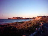
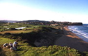
Mona Vale has a shallow beach (formerly known as "Bongin Bongin Beach") which has a children's and lap pool at its northern end, and the beach adjoins a golf course and beach reserves. There is a second beach north of this which is known as "The Basin".
(Mona Vale Road) and Metroad 10
(Pittwater Road).


Suburb
The word suburb mostly refers to a residential area, either existing as part of a city or as a separate residential community within commuting distance of a city . Some suburbs have a degree of administrative autonomy, and most have lower population density than inner city neighborhoods...
in northern Sydney
Sydney
Sydney is the most populous city in Australia and the state capital of New South Wales. Sydney is located on Australia's south-east coast of the Tasman Sea. As of June 2010, the greater metropolitan area had an approximate population of 4.6 million people...
, in the state of New South Wales
New South Wales
New South Wales is a state of :Australia, located in the east of the country. It is bordered by Queensland, Victoria and South Australia to the north, south and west respectively. To the east, the state is bordered by the Tasman Sea, which forms part of the Pacific Ocean. New South Wales...
, Australia
Australia
Australia , officially the Commonwealth of Australia, is a country in the Southern Hemisphere comprising the mainland of the Australian continent, the island of Tasmania, and numerous smaller islands in the Indian and Pacific Oceans. It is the world's sixth-largest country by total area...
. It is located 28 kilometres north of the Sydney central business district
Sydney central business district
The Sydney central business district is the main commercial centre of Sydney, New South Wales, Australia. It extends southwards for about 3 kilometres from Sydney Cove, the point of first European settlement. Its north–south axis runs from Circular Quay in the north to Central railway station in...
and is the administrative centre of the local government area of Pittwater Council
Pittwater Council
Pittwater Council is a Local Government Area on the Northern Beaches of Sydney, in the state of New South Wales, Australia. The suburbs which comprise the Pittwater LGA were detached from the Warringah local government area in 1993...
. Mona Vale is also part of the Northern Beaches region.
History
The area was known as Bongin Bongin by Aborigines. The first land grants in the district of Pittwater were not made until the 23 April 1813. The land that now comprises Mona Vale was granted to Robert Campbell (1769-1846), and was surveyed in May 1814, and was originally part of 700 acres (2.8 km²) that extended from Mona Vale to the end of Newport beach. Mona Vale in ScotlandScotland
Scotland is a country that is part of the United Kingdom. Occupying the northern third of the island of Great Britain, it shares a border with England to the south and is bounded by the North Sea to the east, the Atlantic Ocean to the north and west, and the North Channel and Irish Sea to the...
may have inspired Campbell’s choice of name for the area.
In 2005, Mona Vale became the administrative centre of Pittwater Council
Pittwater Council
Pittwater Council is a Local Government Area on the Northern Beaches of Sydney, in the state of New South Wales, Australia. The suburbs which comprise the Pittwater LGA were detached from the Warringah local government area in 1993...
after the council chambers moved from Warriewood
Warriewood, New South Wales
Warriewood is a suburb in northern Sydney, in the state of New South Wales, Australia. Warriewood is located 26 kilometres north of the Sydney central business district, in the local government area of Pittwater Council. Warriewood is part of the Northern Beaches region.-History:Warriewood takes...
.
Landmarks
Mona Vale has two primary schools and a high school, a RSL clubReturned and Services League of Australia
The Returned and Services League of Australia is a support organisation for men and women who have served or are serving in the Australian Defence Force ....
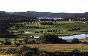
, a park, a public library, a golf course, a hospital, a skatepark, a bus depot, three supermarkets and a variety of shops. Mona Vale Hospital
Mona Vale Hospital
Mona Vale Hospital is a 156 bed district hospital located in the suburb of Mona Vale in the Northern Beaches area of Sydney, Australia.The Northern Sydney and Central Coast Health Service is responsible for the management of Mona Vale Hospital....
is the district hospital, whose maternity section is closed.
Mona Vale has a shallow beach (formerly known as "Bongin Bongin Beach") which has a children's and lap pool at its northern end, and the beach adjoins a golf course and beach reserves. There is a second beach north of this which is known as "The Basin".
Transport
Mona Vale is at the junction of two major roads in Sydney: Metroad 3Metroad 3
Metroad 3 is a Metroad in Sydney, New South Wales Australia. It replaced State Route 33 in April 1993, from Metroad 10 in Mona Vale to Metroad 1 in Blakehurst. It has many names as it goes through different suburbs. Some of these are Mona Vale Road, Ryde Road, Lane Cove Road, Concord Road and...
(Mona Vale Road) and Metroad 10
Metroad 10
Metroad 10 is one of Sydney, Australia's Metroads. It replaced State Route 14 in December 1998. It travels from the Warringah Freeway at North Sydney to Metroad 3 at Mona Vale.Metroad 10 changes names several times as it passes through the city...
(Pittwater Road).


