Monach Islands
Encyclopedia
Not to be confused with Heysker/Hyskeir
(Small Isles) or Haskeir
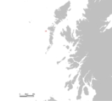
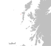 The Monach Islands, also known as Heisker , are an island group west of North Uist
in the Outer Hebrides
of Scotland
. The islands are not to be confused with Hyskeir
in the Inner Hebrides
, or Haskeir
which is also off North Uist and visible from the group.
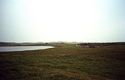 The main islands of Ceann Ear
(once home to a nunnery), Ceann Iar
and Shivinish are all linked at low tide. It is said that it was at one time possible to walk all the way to Baleshare
, and on to North Uist
, five miles away at low tide. In the 15th century, a large tidal wave was said to have washed this route away. The islands of the group, tend to be low-lying and sandy, subject to intense coastal erosion. Not unlike the Isles of Scilly
it is possible that Ceann Iar, Shivinish and Ceann Ear formed a single body of land within historic times, and that their land area has greatly decreased due to overgrazing and sea inundation, and wind erosion as well.
Smaller islands in the group include Deasker (Deas-Sgeir), Shillay
(Siolaigh) and Stocaigh
(Stockay).
 The islands have been uninhabited since 1942, but were inhabited by up to 100 people for centuries leading up to 1810 - possibly up to a thousand years before. They were originally abandoned due to overgrazing
, but were resettled in the wake of the Highland Clearances
.
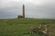
Shillay
(Siolaigh) is the location of Monach Lighthouse, built by David
and Thomas Stevenson
in 1864. The lighthouse was closed in 1942, but following the sinking of the Braer
oil tanker in 1993, a new much smaller lighthouse was built in 1997. This had a range of 10 miles; when a range of 18 miles was deemed necessary, the new lighthouse was shut down in 2008 and the old lighthouse recommissioned with a new optic. Like all British lighthouses it is now unmanned and fully automated.
In 2007 renovations of the old schoolhouse were completed, enabling visitors to stay on the island, and learn about its history and wildlife. The old Heisgeir mailboat has also been restored at the Grimsay
boatshed. The 28-foot motorised open wooden boat was built circa 1932 for the last family to leave the Monach Islands, and had lain unused at Lochmaddy
before being rescued by the local history society.
sympathiser James Erskine, Lord Grange (1679-1784) had his wife Rachel Chiesley
kidnapped and abandoned on the Monach Isles between 1732 and 1734. At the time the islands were owned by Sir Alexander MacDonald of Sleat
and she was housed with his tacksman (leaseholder), another Alexander MacDonald and his wife. When Lady Grange complained about her condition, she was told by her host that he had no orders to provide her either with clothes, or food other than the normal fare he and his wife were used to. She lived in isolation, not even being told the name of the island where she was living, and it took her some time to find out who her landlord was. She was there until June 1734 when John and Norman MacLeod from North Uist arrived to move her on. They told her they were taking her to Orkney, but she was taken to Hirta
where she lived from 1734-42 before being taken to Skye where she died after a failed rescue attempt.
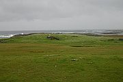 The islands are a National Nature Reserve
for the undisturbed machair and their Grey Seal
population. About 10,000 come ashore each autumn to have their pups and mate, making it one of the largest such colonies in the world. There are also a large number of nesting seabird
s and a rich flora. Grey Heron
s nest in some of the abandoned buildings.
There are no trees on the islands.
Hyskeir
Hyskeir or Heyskeir is a low-lying rocky islet in the Inner Hebrides, Scotland. Its lighthouse marks the southern entrance to The Minch.-Geography:...
(Small Isles) or Haskeir
Haskeir
Not to be confused with Hyskeir or HeskeirHaskeir , also known as Great Haskeir is a remote, exposed and uninhabited island in the Outer Hebrides of Scotland. It lies west north west of North Uist. to the south west lie the skerries of Haskeir Eagach made up of a colonnade of five rock stacks...

North Uist
North Uist is an island and community in the Outer Hebrides of Scotland.-Geography:North Uist is the tenth largest Scottish island and the thirteenth largest island surrounding Great Britain. It has an area of , slightly smaller than South Uist. North Uist is connected by causeways to Benbecula...
in the Outer Hebrides
Outer Hebrides
The Outer Hebrides also known as the Western Isles and the Long Island, is an island chain off the west coast of Scotland. The islands are geographically contiguous with Comhairle nan Eilean Siar, one of the 32 unitary council areas of Scotland...
of Scotland
Scotland
Scotland is a country that is part of the United Kingdom. Occupying the northern third of the island of Great Britain, it shares a border with England to the south and is bounded by the North Sea to the east, the Atlantic Ocean to the north and west, and the North Channel and Irish Sea to the...
. The islands are not to be confused with Hyskeir
Hyskeir
Hyskeir or Heyskeir is a low-lying rocky islet in the Inner Hebrides, Scotland. Its lighthouse marks the southern entrance to The Minch.-Geography:...
in the Inner Hebrides
Inner Hebrides
The Inner Hebrides is an archipelago off the west coast of Scotland, to the south east of the Outer Hebrides. Together these two island chains form the Hebrides, which enjoy a mild oceanic climate. There are 36 inhabited islands and a further 43 uninhabited Inner Hebrides with an area greater than...
, or Haskeir
Haskeir
Not to be confused with Hyskeir or HeskeirHaskeir , also known as Great Haskeir is a remote, exposed and uninhabited island in the Outer Hebrides of Scotland. It lies west north west of North Uist. to the south west lie the skerries of Haskeir Eagach made up of a colonnade of five rock stacks...
which is also off North Uist and visible from the group.
Geology and geography

Ceann Ear
Disambiguation: "Ceann Ear" is a common Scottish placename meaning Eastern HeadlandCeann Ear is the largest island in the Monach or Heisgeir group off North Uist in north west Scotland. It is in size and connected by sandbanks to Ceann Iar via Sibhinis at low tide. It is said that it was at one...
(once home to a nunnery), Ceann Iar
Ceann Iar
Disambiguation: "Ceann Iar" is a common Scottish placename meaning Western HeadlandCeann Iar is one of the Monach Isles/Heisgeir, to the west of North Uist in the Outer Hebrides. It is a slender island, approximately a mile, or two kilometres long.-Geography:Ceann Iar is the second largest of the...
and Shivinish are all linked at low tide. It is said that it was at one time possible to walk all the way to Baleshare
Baleshare
Baleshare is a flat tidal island in the Outer Hebrides of Scotland.Baleshare lies to the south-west of North Uist. Its economics and community were boosted by the building of a causeway in 1962. The 350m causeway was built by William Tawse Ltd. The island is extremely flat by Hebridean standards,...
, and on to North Uist
North Uist
North Uist is an island and community in the Outer Hebrides of Scotland.-Geography:North Uist is the tenth largest Scottish island and the thirteenth largest island surrounding Great Britain. It has an area of , slightly smaller than South Uist. North Uist is connected by causeways to Benbecula...
, five miles away at low tide. In the 15th century, a large tidal wave was said to have washed this route away. The islands of the group, tend to be low-lying and sandy, subject to intense coastal erosion. Not unlike the Isles of Scilly
Isles of Scilly
The Isles of Scilly form an archipelago off the southwestern tip of the Cornish peninsula of Great Britain. The islands have had a unitary authority council since 1890, and are separate from the Cornwall unitary authority, but some services are combined with Cornwall and the islands are still part...
it is possible that Ceann Iar, Shivinish and Ceann Ear formed a single body of land within historic times, and that their land area has greatly decreased due to overgrazing and sea inundation, and wind erosion as well.
Smaller islands in the group include Deasker (Deas-Sgeir), Shillay
Shillay, Monach Islands
Shillay is the western-most of the Monach Islands , off North Uist in the Outer Hebrides.-Geology and geography:...
(Siolaigh) and Stocaigh
Stocaigh
Stocaigh is one of the Monach Islands. It is a kilometre east of Coilleag Mhòr nan Dàmh in the far north east of Ceann Ear. On its east shore is the Camas Bàn, which is named for its white sand, which consists of finely ground sea shells-Footnotes:...
(Stockay).
History

Overgrazing
Overgrazing occurs when plants are exposed to intensive grazing for extended periods of time, or without sufficient recovery periods. It can be caused by either livestock in poorly managed agricultural applications, or by overpopulations of native or non-native wild animals.Overgrazing reduces the...
, but were resettled in the wake of the Highland Clearances
Highland Clearances
The Highland Clearances were forced displacements of the population of the Scottish Highlands during the 18th and 19th centuries. They led to mass emigration to the sea coast, the Scottish Lowlands, and the North American colonies...
.
Shillay
Shillay, Monach Islands
Shillay is the western-most of the Monach Islands , off North Uist in the Outer Hebrides.-Geology and geography:...
(Siolaigh) is the location of Monach Lighthouse, built by David
David Stevenson
David Stevenson may refer to:*David Barker Stevenson , Canadian businessman and politician*David J. Stevenson , professor in planetary science at Caltech...
and Thomas Stevenson
Thomas Stevenson
Thomas Stevenson PRSE MInstCE FRSSA FSAScot was a pioneering Scottish lighthouse designer and meteorologist, who designed over thirty lighthouses in and around Scotland, as well as the Stevenson screen used in meteorology...
in 1864. The lighthouse was closed in 1942, but following the sinking of the Braer
Braer
The MV Braer was an oil tanker which ran aground off Shetland, Scotland, in January 1993.-Reason for ship's loss:In the ship court after the loss, it was stated that reason for ship's loss was seawater contamination of the diesel oil...
oil tanker in 1993, a new much smaller lighthouse was built in 1997. This had a range of 10 miles; when a range of 18 miles was deemed necessary, the new lighthouse was shut down in 2008 and the old lighthouse recommissioned with a new optic. Like all British lighthouses it is now unmanned and fully automated.
In 2007 renovations of the old schoolhouse were completed, enabling visitors to stay on the island, and learn about its history and wildlife. The old Heisgeir mailboat has also been restored at the Grimsay
Grimsay
Grimsay is a tidal island in the Outer Hebrides of Scotland.Grimsay is the largest of the low-lying stepping-stones which convey the Oitir Mhòr causeway, a five mile arc of single track road linking North Uist and Benbecula via the western tip of Grimsay...
boatshed. The 28-foot motorised open wooden boat was built circa 1932 for the last family to leave the Monach Islands, and had lain unused at Lochmaddy
Lochmaddy
Lochmaddy is the administrative centre of North Uist in the Outer Hebrides, Scotland...
before being rescued by the local history society.
Lady Grange
JacobiteJacobitism
Jacobitism was the political movement in Britain dedicated to the restoration of the Stuart kings to the thrones of England, Scotland, later the Kingdom of Great Britain, and the Kingdom of Ireland...
sympathiser James Erskine, Lord Grange (1679-1784) had his wife Rachel Chiesley
Rachel Chiesley, Lady Grange
Rachel Chiesley, usually known as Lady Grange , was the wife of James Erskine, Lord Grange, a Scottish lawyer with Jacobite sympathies. After 25 years of marriage and 9 children, the Granges had an acrimonious separation...
kidnapped and abandoned on the Monach Isles between 1732 and 1734. At the time the islands were owned by Sir Alexander MacDonald of Sleat
Sleat
Sleat is a peninsula on the island of Skye in the Highland council area of Scotland, known as "the garden of Skye". It is the home of the clan MacDonald of Sleat...
and she was housed with his tacksman (leaseholder), another Alexander MacDonald and his wife. When Lady Grange complained about her condition, she was told by her host that he had no orders to provide her either with clothes, or food other than the normal fare he and his wife were used to. She lived in isolation, not even being told the name of the island where she was living, and it took her some time to find out who her landlord was. She was there until June 1734 when John and Norman MacLeod from North Uist arrived to move her on. They told her they were taking her to Orkney, but she was taken to Hirta
Hirta
Hirta is the largest island in the St Kilda archipelago, on the western edge of Scotland. The name "Hiort" and "Hirta" have also been applied to the entire archipelago.-Geography:...
where she lived from 1734-42 before being taken to Skye where she died after a failed rescue attempt.
Wildlife

National Nature Reserves in Scotland
National Nature Reserves in Scotland are established by Scottish Natural Heritage. Until 2004 there were 73 National Nature Reserves in Scotland, as per the list below...
for the undisturbed machair and their Grey Seal
Grey Seal
The grey seal is found on both shores of the North Atlantic Ocean. It is a large seal of the family Phocidae or "true seals". It is the only species classified in the genus Halichoerus...
population. About 10,000 come ashore each autumn to have their pups and mate, making it one of the largest such colonies in the world. There are also a large number of nesting seabird
Seabird
Seabirds are birds that have adapted to life within the marine environment. While seabirds vary greatly in lifestyle, behaviour and physiology, they often exhibit striking convergent evolution, as the same environmental problems and feeding niches have resulted in similar adaptations...
s and a rich flora. Grey Heron
Grey Heron
The Grey Heron , is a wading bird of the heron family Ardeidae, native throughout temperate Europe and Asia and also parts of Africa. It is resident in the milder south and west, but many birds retreat in winter from the ice in colder regions...
s nest in some of the abandoned buildings.
There are no trees on the islands.

