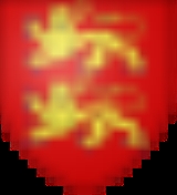
Mont-Cauvaire
Encyclopedia
Mont-Cauvaire is a commune
in the Seine-Maritime
department in the Haute-Normandie
region in northern France
.
in the Pays de Caux
, some 10 miles (16.1 km) north of Rouen
on the D3 road.
Communes of France
The commune is the lowest level of administrative division in the French Republic. French communes are roughly equivalent to incorporated municipalities or villages in the United States or Gemeinden in Germany...
in the Seine-Maritime
Seine-Maritime
Seine-Maritime is a French department in the Haute-Normandie region in northern France. It is situated on the northern coast of France, at the mouth of the Seine, and includes the cities of Rouen and Le Havre...
department in the Haute-Normandie
Haute-Normandie
Upper Normandy is one of the 27 regions of France. It was created in 1984 from two départements: Seine-Maritime and Eure, when Normandy was divided into Lower Normandy and Upper Normandy. This division continues to provoke controversy, and some continue to call for reuniting the two regions...
region in northern France
France
The French Republic , The French Republic , The French Republic , (commonly known as France , is a unitary semi-presidential republic in Western Europe with several overseas territories and islands located on other continents and in the Indian, Pacific, and Atlantic oceans. Metropolitan France...
.
Geography
A farming village, situated along the banks of the Cailly RiverCailly River
The Cailly is a river of Normandy, France, in length, flowing through the department of Seine-Maritime.- Geography :The Cailly has its source in the territory of the commune of Cailly. Taking a southward journey, it flows through Fontaine-le-Bourg, meeting its principal tributary, the Clérette at...
in the Pays de Caux
Pays de Caux
The Pays de Caux is an area in Normandy occupying the greater part of the French département of Seine Maritime in Haute-Normandie. It is a chalk plateau to the north of the Seine Estuary and extending to the cliffs on the English Channel coast - its coastline is known as the Côte d'Albâtre...
, some 10 miles (16.1 km) north of Rouen
Rouen
Rouen , in northern France on the River Seine, is the capital of the Haute-Normandie region and the historic capital city of Normandy. Once one of the largest and most prosperous cities of medieval Europe , it was the seat of the Exchequer of Normandy in the Middle Ages...
on the D3 road.
Heraldry
Population
| 1962 | 1968 | 1975 | 1982 | 1990 | 1999 | 2006 |
|---|---|---|---|---|---|---|
| 411 | 451 | 471 | 557 | 603 | 566 | 614 |
| Starting in 1962: Population without duplicates | ||||||
Places of interest
- The church of St.Martin, dating from the nineteenth century.
- A sixteenth century sandstoneSandstoneSandstone is a sedimentary rock composed mainly of sand-sized minerals or rock grains.Most sandstone is composed of quartz and/or feldspar because these are the most common minerals in the Earth's crust. Like sand, sandstone may be any colour, but the most common colours are tan, brown, yellow,...
cross. - The seventeenth century Château du Rombosc, with its chapelChapelA chapel is a building used by Christians as a place of fellowship and worship. It may be part of a larger structure or complex, such as a church, college, hospital, palace, prison or funeral home, located on board a military or commercial ship, or it may be an entirely free-standing building,...
, and parkland. - The Château du Fossé, dating from the seventeenth century.
- The eighteenth century Pavillon de La Tourelle and its parkland.
- Two dovecoteDovecoteA dovecote or dovecot is a structure intended to house pigeons or doves. Dovecotes may be square or circular free-standing structures or built into the end of a house or barn. They generally contain pigeonholes for the birds to nest. Pigeons and doves were an important food source historically in...
s and a communal oven.

