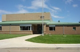
Montgomery Place, Saskatoon
Encyclopedia
Montgomery Place, is a post World War II
community erected for veterans outside of the city of Saskatoon
, Saskatchewan
, which consists primarily of residential homes. It was amalgamated within the city of Saskatoon
in 1956. Montgomery Place has an average household size of 3 persons, and homeownership isat 87.5%. In 2006, the average home selling price was $198,582.
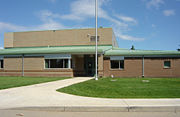 Most of this neighbourhood was built after World War II as a part of the Veterans' Land Act settlement plan. 10 years later in 1955 it became a neighborhood of Saskatoon
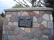 11th Street is the northernmost road in Montgomery. Chappell Drive is the furthest west road at present, whereas Dundonald Avenue is the easternmost. The southern boundary of the community's residential development is denoted by Burma Road, a private (non-City of Saskatoon) roadway servicing the CN Rail yards on the south side of Montgomery Place. The neighborhood is a conglomeration of streets and avenues in near grid fashion combined with courts. The neighbourhood naming practices honour the history and theaters of World War II.
The city's main rail yard and passenger station is located on the south side of Montgomery Place, and the northern side of the community is in the shadow of the former AgPro Grain Terminal, one of the city's iconic landmarks.
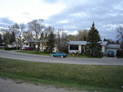 The following streets are located in this area:
11th Street West, Caen Street, Arnhem Street, Normandy Street, Ortona Street, Merritt Street, Dieppe Street, Mountbatten Street, McNaughton Avenue, Elevator Road, Rockingham Avenue, Haida Avenue, Simonds Avenue, Cassino Avenue & Place, Crerar Drive, Crescent Boulevard, Lancaster Boulevard & Crescent, Bader Crescent, Dundonald Avenue, Chappell Drive.
In addition, Burma Road, a private roadway, runs east-to-west between the residential development of Montgomery Place and the rail yards to the south. The road does not appear on official city maps, but is recognized by Google Maps, and street signs have been erected.
of the Conservative Party of Canada
.
Provincially, the area is within the constituency of Saskatoon Riversdale
. It is currently represented by Danielle Chartier
of the Saskatchewan New Democratic Party
.
In Saskatoon's non-partisan municipal politics, Montgomery Place lies within ward 2. It is currently represented by Pat Lorjet, first elected in 2003 and re-elected in 2006. Montgomery Place dropped 10 per cent below the average, causing a look at getting the city wards remapped. Pat Lorje stated that she feels inner - city residents may have been undercounted during the last census.
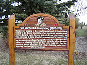 The Confederation Suburban Center is the closest large retail center and contains 400 operating businesses which is 8% of Saskatoon's retail sector. The Blairmore suburban Center is under construction.
In addition Montgomery Place is home to Greg's Grocery Plus, a local bakery and convenience store. The neighbourhood was once home to the Montgomery Grocery, at the corner of Dundonald Ave. and 11th Street; the building has been demolished as the intersection prepares for eventual construction of the southwest leg of Circle Drive.
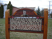
In addition, Montgomery Place hosts its very own Remembrance Day ceremony each year in Montgomery Park. Given its unique history as a veteran's neighbourhood (as reflected by many of the street names), there is always overwhelming community support for the service.
World War II
World War II, or the Second World War , was a global conflict lasting from 1939 to 1945, involving most of the world's nations—including all of the great powers—eventually forming two opposing military alliances: the Allies and the Axis...
community erected for veterans outside of the city of Saskatoon
Saskatoon
Saskatoon is a city in central Saskatchewan, Canada, on the South Saskatchewan River. Residents of the city of Saskatoon are called Saskatonians. The city is surrounded by the Rural Municipality of Corman Park No. 344....
, Saskatchewan
Saskatchewan
Saskatchewan is a prairie province in Canada, which has an area of . Saskatchewan is bordered on the west by Alberta, on the north by the Northwest Territories, on the east by Manitoba, and on the south by the U.S. states of Montana and North Dakota....
, which consists primarily of residential homes. It was amalgamated within the city of Saskatoon
Saskatoon
Saskatoon is a city in central Saskatchewan, Canada, on the South Saskatchewan River. Residents of the city of Saskatoon are called Saskatonians. The city is surrounded by the Rural Municipality of Corman Park No. 344....
in 1956. Montgomery Place has an average household size of 3 persons, and homeownership isat 87.5%. In 2006, the average home selling price was $198,582.
History

Saskatoon
Saskatoon is a city in central Saskatchewan, Canada, on the South Saskatchewan River. Residents of the city of Saskatoon are called Saskatonians. The city is surrounded by the Rural Municipality of Corman Park No. 344....
Future expansion
The current neighbourhood saw final build-out in the early 1980s. Current (2008) development plans for the region call for an expansion of Montgomery Place to the west of Chappell Drive, with additional residential development (previously, the area had been earmarked for a light industrial district), as well as residential development to the north of 11th Street and east of the grain terminal. A new law has been put into place in this community that you can no longer sub-divide lots. The community wants to keep large spacious yards a tradition for many years to come.Layout

The city's main rail yard and passenger station is located on the south side of Montgomery Place, and the northern side of the community is in the shadow of the former AgPro Grain Terminal, one of the city's iconic landmarks.
Streets

11th Street West, Caen Street, Arnhem Street, Normandy Street, Ortona Street, Merritt Street, Dieppe Street, Mountbatten Street, McNaughton Avenue, Elevator Road, Rockingham Avenue, Haida Avenue, Simonds Avenue, Cassino Avenue & Place, Crerar Drive, Crescent Boulevard, Lancaster Boulevard & Crescent, Bader Crescent, Dundonald Avenue, Chappell Drive.
In addition, Burma Road, a private roadway, runs east-to-west between the residential development of Montgomery Place and the rail yards to the south. The road does not appear on official city maps, but is recognized by Google Maps, and street signs have been erected.
Government and politics
Montgomery Place exists within the federal electoral district of Saskatoon--Rosetown--Biggar. It is currently represented by Kelly BlockKelly Block
Kelly Block is a Canadian politician, who was elected to represent the electoral district of Saskatoon—Rosetown—Biggar in the 2008 Canadian federal election. She is a member of the Conservative Party. Block was appointed to the Procedure and House Affairs Committee and the Access to Information,...
of the Conservative Party of Canada
Conservative Party of Canada
The Conservative Party of Canada , is a political party in Canada which was formed by the merger of the Canadian Alliance and the Progressive Conservative Party of Canada in 2003. It is positioned on the right of the Canadian political spectrum...
.
Provincially, the area is within the constituency of Saskatoon Riversdale
Saskatoon Riversdale
Saskatoon Riversdale is a provincial electoral district for the Legislative Assembly of Saskatchewan, Canada. It has been held by the Premier of Saskatchewan from 1991 to 2007...
. It is currently represented by Danielle Chartier
Danielle Chartier
Danielle Chartier is a Canadian politician. She was elected to the Legislative Assembly of Saskatchewan in a by-election on September 21, 2009, representing the electoral district of Saskatoon Riversdale as a member of the Saskatchewan New Democratic Party....
of the Saskatchewan New Democratic Party
Saskatchewan New Democratic Party
The Saskatchewan New Democratic Party is a social-democratic political party in the Canadian province of Saskatchewan. It currently forms the official opposition, but has been a dominant force in Saskatchewan politics since the 1940s...
.
In Saskatoon's non-partisan municipal politics, Montgomery Place lies within ward 2. It is currently represented by Pat Lorjet, first elected in 2003 and re-elected in 2006. Montgomery Place dropped 10 per cent below the average, causing a look at getting the city wards remapped. Pat Lorje stated that she feels inner - city residents may have been undercounted during the last census.
Shopping

In addition Montgomery Place is home to Greg's Grocery Plus, a local bakery and convenience store. The neighbourhood was once home to the Montgomery Grocery, at the corner of Dundonald Ave. and 11th Street; the building has been demolished as the intersection prepares for eventual construction of the southwest leg of Circle Drive.
See also
List of shopping malls in Saskatoon
Community Events
The annual Montgomery Garage Sale occurs on the first Saturday in May. By all measures, this is the largest community garage sale in Saskatoon. Many community groups use the event as an opportunity to host fundraising barbecues and bake sales. If you plan to attend, it is advisable to avoid driving as the neighbourhood becomes terribly congested on the day of the event.In addition, Montgomery Place hosts its very own Remembrance Day ceremony each year in Montgomery Park. Given its unique history as a veteran's neighbourhood (as reflected by many of the street names), there is always overwhelming community support for the service.
Area Parks
- Gougeon Park 2.26 acres (9,145.9 m²)
- Lt. Col. Drayton Walker Park 1.93 acres (7,810.4 m²)
- Lt. Gen. G.G. Simonds Park 2.76 acres (11,169.3 m²)
- Montgomery Park 8.32 acres (33,669.9 m²)
Other recreation
- The CN Curling Club is located on Chappell Drive on the west side of the community.
Location
Coordinates: 52°6'37"N 106°43'51"W| North: AgPro Industrial AgPro Industrial, Saskatoon AgPro Industrial is an industrial subdivision located in west Saskatoon, Saskatchewan, Canada. Located in the Confederation SDA along 11th Street East. 11th street provides westerly access to Sk Hwy 7, the highway to Delisle... Fairhaven | ||
| West: CN yards Management Area Chappell Drive C.N. Yards Management Area The Canadian National Railway Yards Management Area located on Chappell Drive, Saskatoon, Saskatchewan consists of the VIA Saskatoon railway station and the train switching yards. These yards are a part of the Confederation Suburban Development Area . It lies north of the outskirts of the City... | Montgomery Place | East: South West Industrial South West Industrial, Saskatoon South West Industrial, also known as Holiday Park Industrial and labelled SEDCO Industrial on city maps of the 1980s and 1990s, is an industrial subdivision located in the Confederation SDA in southwest Saskatoon, Saskatchewan, Canada.-Economy:... |
| South: Saskatoon railway station Saskatoon railway station The Saskatoon railway station is currently the only rail station in operation in the City of Saskatoon, Saskatchewan, Canada and is located eight kilometers from the central business district. The station is serviced by The Canadian three times per week. The station is equipped with a ticket... C.N. Yards Management Area C.N. Yards Management Area The Canadian National Railway Yards Management Area located on Chappell Drive, Saskatoon, Saskatchewan consists of the VIA Saskatoon railway station and the train switching yards. These yards are a part of the Confederation Suburban Development Area . It lies north of the outskirts of the City... |

