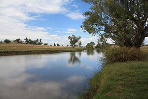
Mooki River
Encyclopedia


New South Wales
New South Wales is a state of :Australia, located in the east of the country. It is bordered by Queensland, Victoria and South Australia to the north, south and west respectively. To the east, the state is bordered by the Tasman Sea, which forms part of the Pacific Ocean. New South Wales...
, Australia
Australia
Australia , officially the Commonwealth of Australia, is a country in the Southern Hemisphere comprising the mainland of the Australian continent, the island of Tasmania, and numerous smaller islands in the Indian and Pacific Oceans. It is the world's sixth-largest country by total area...
.
The Mooki River is the main river of the western half of the Liverpool Plains
Liverpool Plains
The Liverpool Plains is a geographical area and Local Government Area in the North West Slopes, New South Wales.The Shire was formed on 17 March 2004 by the amalgamation of Quirindi Shire with parts of three other shires: Parry, Murrurundi and Gunnedah.- Main towns :* Quirindi* Ardglen*...
. Its headwaters rise on the northern slopes of the Liverpool Range
Liverpool Range
The Liverpool Range is a mountain range and a lava-field province in New South Wales, Australia.The Liverpool Range starts from the volcanic plateau known as the Barrington Tops and runs for about 100 km westwards, forming the northern boundary of the Hunter Valley district...
and Coolah Tops, and flow northwards.
The towns of Quirindi
Quirindi, New South Wales
Quirindi is a small town on the North West Slopes region of New South Wales, Australia, in Liverpool Plains Shire Local Government Area ....
and Werris Creek
Werris Creek, New South Wales
Werris Creek is a small town in New South Wales, Australia, near Tamworth, in Liverpool Plains Shire. It is north of Quirindi and is at the junction of the Main North railway line to Armidale and Moree. At the 2006 census, Werris Creek had a population of 1,490.-History:The area is thought to...
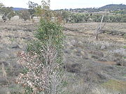
lie within the basin of the Mooki River, much of which is prime agricultural land. Little natural vegetation remains in the plains but River Gums and other trees grow on the banks of the Mooki River. The Kamilaroi Highway
Kamilaroi Highway
Kamilaroi Highway is a state highway in New South Wales. It has been given the national route number 37. Its status as a highway is fairly new....
and the North-west railway line cross the Mooki River near Breeza
Breeza, New South Wales
Breeza is a locality in New South Wales, Australia. In 2006, Breeza had a population of 133 people. It is located about 43 kilometres south of Gunnedah Breeza is located in the Liverpool Plains agricultural region, and the area around Breeza in particular is called the "Breeza Plains"...
.
The Mooki River flows into the Namoi River
Namoi River
The Namoi River is a major tributary of the Darling River in inland New South Wales, Australia.- Course :The headwaters of the Namoi, including the Macdonald River, the Peel River, the Cockburn River and the Manilla River, rise on the western slopes of the Great Dividing Range on the Northern...
just north-east of Gunnedah
Gunnedah, New South Wales
Gunnedah is a town and Local government area in north-eastern New South Wales, Australia. 7,542 people lived in the town of Gunnedah in 2006, including 931 indigenous people ....
.
History
The earliest recorded exploration of this area is that of John OxleyJohn Oxley
John Joseph William Molesworth Oxley was an explorer and surveyor of Australia in the early period of English colonisation.October 1802 he was engaged in coastal survey work including an expedition to Western Port in 1804-05...
and his party travelling through here in August 1818. 'Mooki' was the name given to the river by Aboriginal
Australian Aborigines
Australian Aborigines , also called Aboriginal Australians, from the latin ab originem , are people who are indigenous to most of the Australian continentthat is, to mainland Australia and the island of Tasmania...
tribes roaming the lower reaches.
Major flooding occurred in and around Gunnedah when the Mooki River flooded in November 2000.
Mention is made of the Mooki River in "The Old Timer's Steeplechase" by the noted poet, A. B. "Banjo" Paterson.

