

Mound Bottom
Encyclopedia
Mound Bottom is a prehistoric Native American
complex in Cheatham County, Tennessee, located in the Southeastern United States. The complex, which consists of platform
and burial mounds, a central plaza
, and habitation areas, was built between 950 and 1300 AD, during the Mississippian period
.
The Mound Bottom site is often grouped with another mound complex located just over a mile to the south known as the Pack site, or Great Mound Division. Due to structural similarities, the builders of the Pack site mounds are believed to have been contemporaries of Mound Bottom's inhabitants.
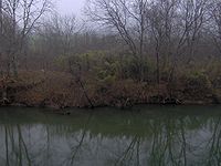
at the river's confluence with Mound Creek, which approaches the riverbank opposite the site from the east. The Mound Bottom bend is one in a series of sharp bends found along the lower Harpeth as the river twists and turns through a steep gorge en route to its confluence with the Cumberland River
several miles to the north. The Harpeth surrounds Mound Bottom on the north, south, and east, and sharp turns in the river immediately downstream and upstream from the site have nearly carved away the narrow strip of land to the west that connects the site to the mainland. (click for map)
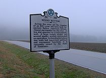
Mound Bottom is located approximately 1 miles (1.6 km) north of the point where U.S. Route 70
crosses the Harpeth River, on the outskirts of Kingston Springs
. The site is currently managed by the Tennessee Department of Environment and Conservation
as part of Harpeth River State Park
. The Pack site is located on private property approximately 1.5 miles (2.4 km) southwest of Mound Bottom just south of US-70.
 In all, the Mound Bottom site and Pack site together contain 29 mounds known to be of prehistoric construction. Some of the mounds are flat-topped platform mounds that supported superstructures including ceremonial buildings or elite residences. Other mounds were burial mounds. At Mound Bottom, the principal large flat-topped mound and at least 13 additional smaller mounds were scattered about a central plaza. The principal mound at Mound Bottom stands 25 feet (7.6 m) tall and 47 square feet (4.4 m²) in area at its base. The remains of an earthen ramp leading from the plaza to the top of this mound can still be seen. The entire complex, which is believed to have included hundreds of houses, was surrounded by an earthen wall topped with a palisade
of upright logs.
that extended to the Great Lakes
, Gulf Coast
, and the Appalachian Mountains
. Resource exhaustion and increased competition from other Mississippian-era sites throughout the Harpeth Valley and Central Basin were likely reasons for Mound Bottom's decline around 1300 AD.
 Early Tennessee historian John Haywood noted Mound Bottom's importance as an aboriginal site in 1823, and early settlers reported seeing large fortifications and towers at the site. In the late 1860s, Joseph Jones of the Smithsonian Institution
investigated several prehistoric sites in Tennessee, and reported "extraordinary aboriginal works" at Mound Bottom.
In 1923, William E. Myer, also working with the Smithsonian, carried out the first modern investigation of the Mound Bottom site. Myer uncovered evidence of a structure and hearth atop one of the mounds at the Pack site and evidence of 10 ancient houses at Mound Bottom. Tennessee state archaeologist P.E. Cox followed up on Myer's finds in 1926, uncovering a number of burials
and baked clay floors. In the 1930s and early 1940s, excavations conducted by the University of Tennessee
uncovered several house sites, graves, and sections of the palisade.
In 1972, the State of Tennessee purchased the Mound Bottom site to preserve it as a state archaeological area. The Tennessee Division of Archaeology
dispatched Carl Kuttruff and Michael O'Brien to conduct major excavations at Mound Bottom in 1974 and 1975. Kutruff and O'Brien discovered another clay floor and excavated more of the palisade and a row of houses. A radiocarbon
date showed that the Mound Bottom site was occupied as early as 800 AD
Over the years, various movements to establish a state archaeological park at Mound Bottom arose and fizzled. In 2004, Harpeth River State Park
was organized as a "linear park" connecting several archaeological, historical, and natural areas along the lower Harpeth, including Mound Bottom. The site is closed to the public, although guided tours are available by request during the winter months.
Native Americans in the United States
Native Americans in the United States are the indigenous peoples in North America within the boundaries of the present-day continental United States, parts of Alaska, and the island state of Hawaii. They are composed of numerous, distinct tribes, states, and ethnic groups, many of which survive as...
complex in Cheatham County, Tennessee, located in the Southeastern United States. The complex, which consists of platform
Platform mound
A platform mound is any earthwork or mound intended to support a structure or activity.-Eastern North America:The indigenous peoples of North America built substructure mounds for well over a thousand years starting in the Archaic period and continuing through the Woodland period...
and burial mounds, a central plaza
Plaza
Plaza is a Spanish word related to "field" which describes an open urban public space, such as a city square. All through Spanish America, the plaza mayor of each center of administration held three closely related institutions: the cathedral, the cabildo or administrative center, which might be...
, and habitation areas, was built between 950 and 1300 AD, during the Mississippian period
Mississippian culture
The Mississippian culture was a mound-building Native American culture that flourished in what is now the Midwestern, Eastern, and Southeastern United States from approximately 800 CE to 1500 CE, varying regionally....
.
The Mound Bottom site is often grouped with another mound complex located just over a mile to the south known as the Pack site, or Great Mound Division. Due to structural similarities, the builders of the Pack site mounds are believed to have been contemporaries of Mound Bottom's inhabitants.
Geographical setting
Mound Bottom is situated on a horseshoe bend of the Harpeth RiverHarpeth River
The Harpeth River, long, is one of the major streams of north-central Middle Tennessee and one of the major tributaries of the Cumberland River...
at the river's confluence with Mound Creek, which approaches the riverbank opposite the site from the east. The Mound Bottom bend is one in a series of sharp bends found along the lower Harpeth as the river twists and turns through a steep gorge en route to its confluence with the Cumberland River
Cumberland River
The Cumberland River is a waterway in the Southern United States. It is long. It starts in Harlan County in far southeastern Kentucky between Pine and Cumberland mountains, flows through southern Kentucky, crosses into northern Tennessee, and then curves back up into western Kentucky before...
several miles to the north. The Harpeth surrounds Mound Bottom on the north, south, and east, and sharp turns in the river immediately downstream and upstream from the site have nearly carved away the narrow strip of land to the west that connects the site to the mainland. (click for map)
Mound Bottom is located approximately 1 miles (1.6 km) north of the point where U.S. Route 70
U.S. Route 70
U.S. Route 70 is an east–west United States highway that runs for 2,385 miles from eastern North Carolina to east-central Arizona. As can be derived from its number, it is a major east–west highway of the Southern and Southwestern United States...
crosses the Harpeth River, on the outskirts of Kingston Springs
Kingston Springs, Tennessee
Kingston Springs is a town in Cheatham County, Tennessee, United States. The population was 2,773 at the 2000 census.-Geography:Kingston Springs is located at .According to the United States Census Bureau, the town has a total area of , all of it land....
. The site is currently managed by the Tennessee Department of Environment and Conservation
Tennessee Department of Environment and Conservation
The Tennessee Department of Environment and Conservation is a Cabinet-level agency within the government of the U.S. state of Tennessee, headed by the Tennessee Commissioner of Environment and Conservation....
as part of Harpeth River State Park
Harpeth River State Park
Harpeth River State Park is a state park in Cheatham County, Tennessee, in the southeastern United States. The park is a linear park that was created to connect several state historic, natural, and archaeological sites along the lower Harpeth River...
. The Pack site is located on private property approximately 1.5 miles (2.4 km) southwest of Mound Bottom just south of US-70.
Archaeological features at Mound Bottom
Palisade
A palisade is a steel or wooden fence or wall of variable height, usually used as a defensive structure.- Typical construction :Typical construction consisted of small or mid sized tree trunks aligned vertically, with no spacing in between. The trunks were sharpened or pointed at the top, and were...
of upright logs.
The function of Mound Bottom
Like many Mississippian-era sites, Mound Bottom probably began as a ceremonial meeting place for scattered farms in the Harpeth Valley around 950 AD. Over time, the site grew to become a fortified city with a population numbering in the thousands. Various exotic artifacts discovered at the site show that Mound Bottom was part of a vast trade networkSoutheastern Ceremonial Complex
The Southeastern Ceremonial Complex is the name given to the regional stylistic similarity of artifacts, iconography, ceremonies, and mythology of the Mississippian culture that coincided with their adoption of maize agriculture and chiefdom-level complex social organization from...
that extended to the Great Lakes
Great Lakes
The Great Lakes are a collection of freshwater lakes located in northeastern North America, on the Canada – United States border. Consisting of Lakes Superior, Michigan, Huron, Erie, and Ontario, they form the largest group of freshwater lakes on Earth by total surface, coming in second by volume...
, Gulf Coast
Gulf of Mexico
The Gulf of Mexico is a partially landlocked ocean basin largely surrounded by the North American continent and the island of Cuba. It is bounded on the northeast, north and northwest by the Gulf Coast of the United States, on the southwest and south by Mexico, and on the southeast by Cuba. In...
, and the Appalachian Mountains
Appalachian Mountains
The Appalachian Mountains #Whether the stressed vowel is or ,#Whether the "ch" is pronounced as a fricative or an affricate , and#Whether the final vowel is the monophthong or the diphthong .), often called the Appalachians, are a system of mountains in eastern North America. The Appalachians...
. Resource exhaustion and increased competition from other Mississippian-era sites throughout the Harpeth Valley and Central Basin were likely reasons for Mound Bottom's decline around 1300 AD.
Mound Bottom in recorded history
Smithsonian Institution
The Smithsonian Institution is an educational and research institute and associated museum complex, administered and funded by the government of the United States and by funds from its endowment, contributions, and profits from its retail operations, concessions, licensing activities, and magazines...
investigated several prehistoric sites in Tennessee, and reported "extraordinary aboriginal works" at Mound Bottom.
In 1923, William E. Myer, also working with the Smithsonian, carried out the first modern investigation of the Mound Bottom site. Myer uncovered evidence of a structure and hearth atop one of the mounds at the Pack site and evidence of 10 ancient houses at Mound Bottom. Tennessee state archaeologist P.E. Cox followed up on Myer's finds in 1926, uncovering a number of burials
Stone box grave
Stone box graves were a method of burial employed by Native Americans of the Mississippian culture in the American Midwest and Southeast. Their construction was especially common in the Cumberland River Basin around Nashville, Tennessee-Construction:...
and baked clay floors. In the 1930s and early 1940s, excavations conducted by the University of Tennessee
University of Tennessee
The University of Tennessee is a public land-grant university headquartered at Knoxville, Tennessee, United States...
uncovered several house sites, graves, and sections of the palisade.
In 1972, the State of Tennessee purchased the Mound Bottom site to preserve it as a state archaeological area. The Tennessee Division of Archaeology
Tennessee Division of Archaeology
The Tennessee Division of Archaeology is a division of the Tennessee Department of Environment and Conservation responsible for managing prehistoric archaeological sites on lands owned by the U.S...
dispatched Carl Kuttruff and Michael O'Brien to conduct major excavations at Mound Bottom in 1974 and 1975. Kutruff and O'Brien discovered another clay floor and excavated more of the palisade and a row of houses. A radiocarbon
Radiocarbon dating
Radiocarbon dating is a radiometric dating method that uses the naturally occurring radioisotope carbon-14 to estimate the age of carbon-bearing materials up to about 58,000 to 62,000 years. Raw, i.e. uncalibrated, radiocarbon ages are usually reported in radiocarbon years "Before Present" ,...
date showed that the Mound Bottom site was occupied as early as 800 AD
Over the years, various movements to establish a state archaeological park at Mound Bottom arose and fizzled. In 2004, Harpeth River State Park
Harpeth River State Park
Harpeth River State Park is a state park in Cheatham County, Tennessee, in the southeastern United States. The park is a linear park that was created to connect several state historic, natural, and archaeological sites along the lower Harpeth River...
was organized as a "linear park" connecting several archaeological, historical, and natural areas along the lower Harpeth, including Mound Bottom. The site is closed to the public, although guided tours are available by request during the winter months.
External links
- Harpeth River State Park — official site, includes map