
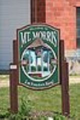
Mount Morris, Illinois
Encyclopedia
Mount Morris is a village in Mount Morris Township, Ogle County
, Illinois
, United States
. The population was 2,998 at the 2010 census, down from 3,013 at the 2000 census.
According to the United States Census Bureau
, the village has a total area of 1.2 square miles (3.1 km²), all of it land.
, which is located in the town square. The area that is now the town square used to be the campus of one of Illinois' first institutes of higher learning, Mount Morris College
. It was first a Methodist school and was later affiliated with the Church of the Brethren
. The college closed after numerous fires, including one fire that leveled the boys' dormitory. Fires have played a major role in village history. The village's old junior high school, while undergoing demolition, caught fire and burned right before the school district merged with the Oregon School District in 1993. (The first graduating class of the newly combined Oregon School District was class of 1994.) In addition, several shops on Wesley Avenue, the main street, were lost to a fire on December 5, 1999. On February 12, 2004, the Rahn Elementary School was lost to fire when a janitor attempted to thaw out a gas line with an industrial tile heat gun.
of 2000, there were 3,013 people, 1,259 households, and 810 families residing in the village. The population density
was 2,585.1 people per square mile (994.3/km²). There were 1,337 housing units at an average density of 1,147.1 per square mile (441.2/km²). The racial makeup of the village was 97.15% White, 0.17% African American, 0.20% Native American, 0.43% Asian, 0.13% Pacific Islander, 1.00% from other races
, and 0.93% from two or more races. Hispanic or Latino of any race were 2.75% of the population.
There were 1,259 households out of which 29.3% had children under the age of 18 living with them, 50.8% were married couples
living together, 10.6% had a female householder with no husband present, and 35.6% were non-families. 32.2% of all households were made up of individuals and 14.9% had someone living alone who was 65 years of age or older. The average household size was 2.28 and the average family size was 2.86.
In the village the population was spread out with 23.8% under the age of 18, 7.3% from 18 to 24, 26.5% from 25 to 44, 19.9% from 45 to 64, and 22.5% who were 65 years of age or older. The median age was 40 years. For every 100 females there were 90.8 males. For every 100 females age 18 and over, there were 86.0 males.
The median income for a household in the village was $41,333, and the median income for a family was $51,019. Males had a median income of $39,323 versus $20,840 for females. The per capita income
for the village was $20,326. About 6.0% of families and 6.9% of the population were below the poverty line, including 13.2% of those under age 18 and 5.9% of those age 65 or over.
Ogle County, Illinois
Ogle County is a county located in the U.S. state of Illinois. According to the 2010 census, it has a population of 53,497, which is an increase of 4.8% from 51,032 in 2000. Its county seat is Oregon, and its largest city is Rochelle...
, Illinois
Illinois
Illinois is the fifth-most populous state of the United States of America, and is often noted for being a microcosm of the entire country. With Chicago in the northeast, small industrial cities and great agricultural productivity in central and northern Illinois, and natural resources like coal,...
, United States
United States
The United States of America is a federal constitutional republic comprising fifty states and a federal district...
. The population was 2,998 at the 2010 census, down from 3,013 at the 2000 census.
Geography
Mount Morris is located at 42°2′51"N 89°26′2"W (42.047614, -89.433972).According to the United States Census Bureau
United States Census Bureau
The United States Census Bureau is the government agency that is responsible for the United States Census. It also gathers other national demographic and economic data...
, the village has a total area of 1.2 square miles (3.1 km²), all of it land.
History
Mt. Morris is home of the Illinois Freedom BellIllinois Freedom Bell
The Illinois Freedom Bell is located in Mount Morris, Illinois, United States, and is the official freedom bell of the U.S. state of Illinois. The bell was created for a church in Lake Geneva, Wisconsin as a replica of the Liberty Bell in 1862...
, which is located in the town square. The area that is now the town square used to be the campus of one of Illinois' first institutes of higher learning, Mount Morris College
Mount Morris College
Mount Morris College was a religious college affiliated with the Church of the Brethren in Mount Morris, Illinois. The original institution at this location was Rock River Seminary, which was founded by the Methodist Church in 1839. The Methodists closed Rock River Seminary in 1878 and subsequently...
. It was first a Methodist school and was later affiliated with the Church of the Brethren
Church of the Brethren
The Church of the Brethren is a Christian denomination originating from the Schwarzenau Brethren organized in 1708 by eight persons led by Alexander Mack, in Schwarzenau, Bad Berleburg, Germany. The Brethren movement began as a melding of Radical Pietist and Anabaptist ideas during the...
. The college closed after numerous fires, including one fire that leveled the boys' dormitory. Fires have played a major role in village history. The village's old junior high school, while undergoing demolition, caught fire and burned right before the school district merged with the Oregon School District in 1993. (The first graduating class of the newly combined Oregon School District was class of 1994.) In addition, several shops on Wesley Avenue, the main street, were lost to a fire on December 5, 1999. On February 12, 2004, the Rahn Elementary School was lost to fire when a janitor attempted to thaw out a gas line with an industrial tile heat gun.
Recreation
Parks include Dillehay Park, Mounder Park, and Zickuhr Park. Dillehay Park is located in the southeast portion of the village. Zickuhr Park is located in the western part of town, and has one softball diamond, basketball courts, and an array of playground equipment. Mounder Park houses a skating park, a pavilion, and the playground equipment that was donated by the school after the Rahn fire.Demographics
As of the censusCensus
A census is the procedure of systematically acquiring and recording information about the members of a given population. It is a regularly occurring and official count of a particular population. The term is used mostly in connection with national population and housing censuses; other common...
of 2000, there were 3,013 people, 1,259 households, and 810 families residing in the village. The population density
Population density
Population density is a measurement of population per unit area or unit volume. It is frequently applied to living organisms, and particularly to humans...
was 2,585.1 people per square mile (994.3/km²). There were 1,337 housing units at an average density of 1,147.1 per square mile (441.2/km²). The racial makeup of the village was 97.15% White, 0.17% African American, 0.20% Native American, 0.43% Asian, 0.13% Pacific Islander, 1.00% from other races
Race (United States Census)
Race and ethnicity in the United States Census, as defined by the Federal Office of Management and Budget and the United States Census Bureau, are self-identification data items in which residents choose the race or races with which they most closely identify, and indicate whether or not they are...
, and 0.93% from two or more races. Hispanic or Latino of any race were 2.75% of the population.
There were 1,259 households out of which 29.3% had children under the age of 18 living with them, 50.8% were married couples
Marriage
Marriage is a social union or legal contract between people that creates kinship. It is an institution in which interpersonal relationships, usually intimate and sexual, are acknowledged in a variety of ways, depending on the culture or subculture in which it is found...
living together, 10.6% had a female householder with no husband present, and 35.6% were non-families. 32.2% of all households were made up of individuals and 14.9% had someone living alone who was 65 years of age or older. The average household size was 2.28 and the average family size was 2.86.
In the village the population was spread out with 23.8% under the age of 18, 7.3% from 18 to 24, 26.5% from 25 to 44, 19.9% from 45 to 64, and 22.5% who were 65 years of age or older. The median age was 40 years. For every 100 females there were 90.8 males. For every 100 females age 18 and over, there were 86.0 males.
The median income for a household in the village was $41,333, and the median income for a family was $51,019. Males had a median income of $39,323 versus $20,840 for females. The per capita income
Per capita income
Per capita income or income per person is a measure of mean income within an economic aggregate, such as a country or city. It is calculated by taking a measure of all sources of income in the aggregate and dividing it by the total population...
for the village was $20,326. About 6.0% of families and 6.9% of the population were below the poverty line, including 13.2% of those under age 18 and 5.9% of those age 65 or over.
See also
- Samuel M. Hitt HouseSamuel M. Hitt HouseThe Samuel M. Hitt House is located in the Ogle County, Illinois village of Mount Morris, along Illinois Route 64. The Hitt House is listed on the National Register of Historic Places, a status bestowed it 1985.-Architecture:...
- White Pines Forest State ParkWhite Pines Forest State ParkWhite Pines Forest State Park, more commonly referred to as White Pines State Park, is an Illinois state park in Ogle County, Illinois. It is located near the communities of Polo, Mount Morris and Oregon...
- White Pines State Park Lodge and CabinsWhite Pines State Park Lodge and CabinsThe White Pines State Park Lodge and Cabins are located in rural Ogle County, Illinois near the village of Mount Morris. They were added to the National Register of Historic Places in 1985. The Cabins are one of two Historic Places found in or near Mount Morris, the other is the Samuel M. Hitt House...