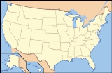
Mount Tamalpais State Park
Encyclopedia
Mount Tamalpais State Park is a California
state park
, located in Marin County, California. The primary feature of the park is the 2571 feet (783.6 m) Mount Tamalpais
. The park contains mostly redwood
and oak
forests. The mountain itself covers around 25000 acres (101.2 km²). There are about 60 miles (96.6 km) of hiking trails, which are connected to a larger, 200 miles (321.9 km) network of trails in neighboring public lands. The park received 564,000 visitors in . Muir Woods National Monument
is surrounded by the state park.
From the peak of the mountain, visitors can see up to 25 miles (40.2 km), in a view that encompasses San Francisco, most of the North and East Bay
, and the Farallon Islands
. Occasionally, the Sierra Nevada are visible, 125 miles (201.2 km) away.
setting. In the first two decades the performances were accessed by hiking or riding the winding Mount Tamalpais and Muir Woods Railway. The railway was led by businessman Sidney B. Cushing, and in 1933 the Civilian Conservation Corps
began construction of a 4,000 seat stone amphitheater that was named the Sidney B. Cushing Memorial Amphitheatre in his honor. The amphitheatre was constructed by the corps using massive serpentine rocks. In 1967 the venue hosted the two day Fantasy Fair and Magic Mountain Music Festival, an opening event of the Summer of Love
. Known simply as the Mountain Theatre, it hosts productions each year in the spring.

California
California is a state located on the West Coast of the United States. It is by far the most populous U.S. state, and the third-largest by land area...
state park
State park
State parks are parks or other protected areas managed at the federated state level within those nations which use "state" as a political subdivision. State parks are typically established by a state to preserve a location on account of its natural beauty, historic interest, or recreational...
, located in Marin County, California. The primary feature of the park is the 2571 feet (783.6 m) Mount Tamalpais
Mount Tamalpais
Mount Tamalpais is a peak in Marin County, California, United States, often considered symbolic of Marin County. Much of Mount Tamalpais is protected within public lands such as Mount Tamalpais State Park and the Mount Tamalpais Watershed.-Geography:...
. The park contains mostly redwood
Redwood
-Trees:Conifers* Family Cupressaceae *** Sequoia sempervirens - coast redwood**** Albino redwood*** Sequoiadendron giganteum - giant sequoia*** Metasequoia glyptostroboides - dawn redwood* Family Pinaceae...
and oak
Oak
An oak is a tree or shrub in the genus Quercus , of which about 600 species exist. "Oak" may also appear in the names of species in related genera, notably Lithocarpus...
forests. The mountain itself covers around 25000 acres (101.2 km²). There are about 60 miles (96.6 km) of hiking trails, which are connected to a larger, 200 miles (321.9 km) network of trails in neighboring public lands. The park received 564,000 visitors in . Muir Woods National Monument
Muir Woods National Monument
Muir Woods National Monument is a unit of the National Park Service on the Pacific coast of southwestern Marin County, California, north of San Francisco and part of the Golden Gate National Recreation Area...
is surrounded by the state park.
From the peak of the mountain, visitors can see up to 25 miles (40.2 km), in a view that encompasses San Francisco, most of the North and East Bay
San Francisco Bay Area
The San Francisco Bay Area, commonly known as the Bay Area, is a populated region that surrounds the San Francisco and San Pablo estuaries in Northern California. The region encompasses metropolitan areas of San Francisco, Oakland, and San Jose, along with smaller urban and rural areas...
, and the Farallon Islands
Farallon Islands
The Farallon Islands, or Farallones , are a group of islands and sea stacks in the Gulf of the Farallones, off the coast of San Francisco, California, USA. They lie outside the Golden Gate and south of Point Reyes, and are visible from the mainland on clear days...
. Occasionally, the Sierra Nevada are visible, 125 miles (201.2 km) away.
Cushing Memorial Amphitheatre
Beginning in 1913 Mount Tamalpais has hosted theatrical performances known as Mountain Plays in a natural amphitheatreAmphitheatre
An amphitheatre is an open-air venue used for entertainment and performances.There are two similar, but distinct, types of structure for which the word "amphitheatre" is used: Ancient Roman amphitheatres were large central performance spaces surrounded by ascending seating, and were commonly used...
setting. In the first two decades the performances were accessed by hiking or riding the winding Mount Tamalpais and Muir Woods Railway. The railway was led by businessman Sidney B. Cushing, and in 1933 the Civilian Conservation Corps
Civilian Conservation Corps
The Civilian Conservation Corps was a public work relief program that operated from 1933 to 1942 in the United States for unemployed, unmarried men from relief families, ages 18–25. A part of the New Deal of President Franklin D...
began construction of a 4,000 seat stone amphitheater that was named the Sidney B. Cushing Memorial Amphitheatre in his honor. The amphitheatre was constructed by the corps using massive serpentine rocks. In 1967 the venue hosted the two day Fantasy Fair and Magic Mountain Music Festival, an opening event of the Summer of Love
Summer of Love
The Summer of Love was a social phenomenon that occurred during the summer of 1967, when as many as 100,000 people converged on the Haight-Ashbury neighborhood of San Francisco, creating a cultural and political rebellion...
. Known simply as the Mountain Theatre, it hosts productions each year in the spring.
External links
- Official California State Parks department site describing the park


