Mount Tyree
Encyclopedia

Mountain
Image:Himalaya_annotated.jpg|thumb|right|The Himalayan mountain range with Mount Everestrect 58 14 160 49 Chomo Lonzorect 200 28 335 52 Makalurect 378 24 566 45 Mount Everestrect 188 581 920 656 Tibetan Plateaurect 250 406 340 427 Rong River...
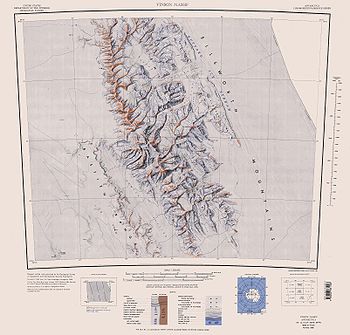
of Antarctica located 13 kilometres northwest of Vinson Massif
Vinson Massif
Vinson Massif is the highest mountain of Antarctica, lying in the Sentinel Range of the Ellsworth Mountains, which stand above the Ronne Ice Shelf near the base of the Antarctic Peninsula. The massif is located about from the South Pole and is about long and wide. At the highest point is Mount...
(4,892 m), the highest peak on the continent.
Mt. Tyree was discovered in January 1958 during reconnaissance flights by the United States Navy
United States Navy
The United States Navy is the naval warfare service branch of the United States Armed Forces and one of the seven uniformed services of the United States. The U.S. Navy is the largest in the world; its battle fleet tonnage is greater than that of the next 13 largest navies combined. The U.S...
VX-6
VX-6
Air Development Squadron Six was a United States Navy Air Development Squadron based at McMurdo Station, Antarctica...
squadron, and mapped later that month by the Marie Byrd Land
Marie Byrd Land
Marie Byrd Land is the portion of West Antarctica lying east of the Ross Ice Shelf and the Ross Sea and south of the Pacific Ocean, extending eastward approximately to a line between the head of the Ross Ice Shelf and Eights Coast. It stretches between 158°W and 103°24'W...
Traverse Party. The mountain was named for Rear Admiral David M. Tyree, who was commander of the U.S. Naval Support Force in Antarctica, from April 14, 1959 to November 26, 1962.
As of 2007, the summit has only been reached on four occasions, by a total of seven people, via three different routes: in January 1967 by John Evans and Barry Corbet (of Corbet's Couloir
Corbet's Couloir
Corbet's Couloir is an expert ski run located at the Jackson Hole Mountain Resort named after Jackson Hole ski instructor and mountain guide Barry Corbet...
); in January 1989 by Terry ‘Mugs’ Stump
Mugs Stump
Mugs Stump was a noted American rock climber and mountaineer, active in establishing difficult first ascents in the Alaska Range and the Canadian Rockies...
; in 1997 by French alpinists Antoine de Choudens and Antoine Cayrol; and later in 1997 by Conrad Anker and Alex Lowe. Out of seven mountaineers who successfully climbed Mt Tyree, three died in unrelated mountaineering accidents within four years of their respective ascents. The still-unclimbed south face is 2000 metres (6,561.7 ft) in height and one of the largest walls in Antarctica.
The climbing season is November to January, when the sun is above the horizon 24 hours a day and the air is warmest - up to -30 °C near the summit. Like the nearby Mount Vinson, the mountain may be accessed by the means of a 6-hour flight from Punta Arenas, Chile
Punta Arenas, Chile
Punta Arenas is a commune and the capital city of Chile's southernmost region, Magallanes and Antartica Chilena. The city was officially renamed Magallanes in 1927, but in 1938 it was changed back to Punta Arenas...
to Union Glacier Camp
Union Glacier Camp
Union Glacier Camp is the only private seasonally occupied camp in Antarctica. It is located in the Heritage Range, Ellsworth Mountains, on Union Glacier that gives it its name...
followed by a 200 km flight on a ski plane to the base of the mountain.

