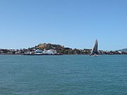
Mount Victoria, Auckland
Encyclopedia


Auckland
The Auckland metropolitan area , in the North Island of New Zealand, is the largest and most populous urban area in the country with residents, percent of the country's population. Auckland also has the largest Polynesian population of any city in the world...
's North Shore
North Shore, New Zealand
North Shore City was the name of a city that existed in the Auckland region of New Zealand from 1989 until 2010. The city had a population of making it the fourth most populous city in New Zealand prior to November 2010...
, rising to 87 m. Its age is currently unknown. Its lava flows now line much of Devonport
Devonport, New Zealand
Devonport is a harbourside suburb of Auckland, New Zealand. It is located on the North Shore, at the southern end of a peninsula that runs southeast from near Lake Pupuke in Takapuna, forming the northern side of the Waitemata Harbour...
's waterfront. An important pa
Pa (Maori)
The word pā can refer to any Māori village or settlement, but in traditional use it referred to hillforts fortified with palisades and defensive terraces and also to fortified villages. They first came into being about 1450. They are located mainly in the North Island north of lake Taupo...
once occupied its slopes, and some of the pa's earthworks can still be seen.
Named after Queen Victoria, the hill provides panoramic views of Auckland's Waitemata Harbour
Waitemata Harbour
The quite famous Waitemata Harbour is the main access by sea to Auckland, New Zealand. For this reason it is often referred to as Auckland Harbour, despite the fact that it is only one of two harbours surrounding the city, and is crossed by the Auckland Harbour Bridge. The Waitemata forms the north...
and the inner Hauraki Gulf
Hauraki Gulf
The Hauraki Gulf is a coastal feature of the North Island of New Zealand. It has a total area of 4000 km², and lies between the Auckland Region, the Hauraki Plains, the Coromandel Peninsula and Great Barrier Island...
. Over the years the peak and upper slopes have housed a signal station for shipping,, artillery emplacements, farmland, and various concrete army bunkers, some from as early as the 1870s. One bunker now serves as the venue for the Devonport Folk Club.
The the slopes of Mount Victoria are also home to Devonport Primary School, a local tennis club, and a scenic lookout. The old Signalman's House is now home to the Michael King Writers Centre which provides writers-in-residence programmes, hosting for visiting writers, residential workshops for experienced writers, and a series of workshops for young poets and emerging writers. The writer-in-residence programmes are supported by Creative New Zealand and the University of Auckland.

