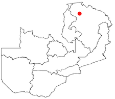
Mporokoso
Encyclopedia

Northern Province, Zambia
Northern Province is one of Zambia's nine provinces. It covers approximately one fifth of Zambia in land area. The provincial capital is Kasama. The province is made up of 12 districts, namely Kasama , Chilubi, Isoka, Chinsali, Kaputa, Luwingu, Mbala, Mporokoso, Mpika, Mpulungu, Mungwi and Nakonde...
of Zambia
Zambia
Zambia , officially the Republic of Zambia, is a landlocked country in Southern Africa. The neighbouring countries are the Democratic Republic of the Congo to the north, Tanzania to the north-east, Malawi to the east, Mozambique, Zimbabwe, Botswana and Namibia to the south, and Angola to the west....
, lying at an elevation of nearly 1500 m on the flat plateau about 75 km south east of Lake Mweru Wantipa
Lake Mweru Wantipa
Lake Mweru Wantipa is a lake and swamp system in the Northern Province of Zambia. It has been regarded in the past as something of mystery, displaying fluctuations in water level and salinity which were not entirely explained by variation in rainfall levels; it has been known to dry out almost...
and 100 km south-west of Lake Tanganyika
Lake Tanganyika
Lake Tanganyika is an African Great Lake. It is estimated to be the second largest freshwater lake in the world by volume, and the second deepest, after Lake Baikal in Siberia; it is also the world's longest freshwater lake...
. It is named for Chief Mporokoso
Chief Mporokoso
Chief Mporokoso is a senior chieftainship of the Bemba people of Zambia, and a subordinate chief of Paramount Chief Chitimukulu. The chief's palace is located in the Northern Province town of Mporokoso named after the chieftainship.-Notes:...
(also spelled 'Mumpolokoso') a senior chief of the Bemba people
Bemba people
The Bemba belong to a large group of peoples mainly in the Northern, Luapula and Copperbelt Provinces of Zambia who trace their origins to the Luba and Lunda states of the upper Congo basin, in what became Katanga Province in southern Congo-Kinshasa...
whose palace is located in the town. Mporokoso District is also one of the 12 administrative districts
Districts of Zambia
The nine provinces of Zambia are divided into a total of 72 districts.Article 109 in part VIII of the constitution of Zambia deals with local government...
of the Northern Province.
A large population of refugee
Refugee
A refugee is a person who outside her country of origin or habitual residence because she has suffered persecution on account of race, religion, nationality, political opinion, or because she is a member of a persecuted 'social group'. Such a person may be referred to as an 'asylum seeker' until...
s from the Second Congo War
Second Congo War
The Second Congo War, also known as Coltan War and the Great War of Africa, began in August 1998 in the Democratic Republic of the Congo , and officially ended in July 2003 when the Transitional Government of the Democratic Republic of the Congo took power; however, hostilities continue to this...
living at the UNHCR-administered refugee camp at Mwange, 32 km west of the town, are being repatriated after the end of that war.
A number of waterfall
Waterfall
A waterfall is a place where flowing water rapidly drops in elevation as it flows over a steep region or a cliff.-Formation:Waterfalls are commonly formed when a river is young. At these times the channel is often narrow and deep. When the river courses over resistant bedrock, erosion happens...
s lie within 50 km of the town. The closest is the Kapuma Falls, 7km south-west of the town centre. Pule Falls and Mumbuluma Falls III are on the Luangwa River (not to be confused with the river of that name in eastern Zambia) which flows to the south of the town. Lupupa Falls are on the nearby Mukubwe River.

