Mumbai Harbour
Encyclopedia
Mumbai Harbour or Front Bay, is a natural deep-water harbor
in the southern portion of the Ulhas River
estuary
. The narrower, northern part of the estuary is called Thane Creek
. The harbor opens to the Arabian Sea
to the south. The historical island of Elephanta
is one of the six islands that lie in the harbor.
Front Bay is the official name of the harbor, so named because Mumbai started as a tiny settlement facing the harbor. The waterbody behind the original settlement, forming an arc between the former Colaba island and Bombay island, up to the Malabar Hill promontory or peninsula, was similarly called Back Bay.
Front Bay is home to the Mumbai Port, which lies in the south section of the western edge of the harbor. Jawaharlal Nehru Port and Navi Mumbai
lie to the east on the Konkan mainland, and the city of Mumbai
lies to the west on Salsette Island. The Gateway of India
with its jetty for Elephanta is the most important tourist destination
, followed by the INS Vikrant
maritime Museum.
The Harbour Line of the Mumbai Suburban Railway
system runs along the western edge of the harbor.
 There are six islands in the Mumbai Harbor.
Butcher Island, also known as Jawahar Dweep, is used as an oil terminal by the Mumbai Port. It has jetties for tankers and various other infrastructure for offloading crude oil and for loading refined petroleum products. The island is restricted to port employees, and not open to the public.
Cross Island is a small, uninhabited islet just off the coast of the Dockyard Road.
Elephanta Island, also known as Gharapuri Island, is the best known of the islands in Mumbai Harbor. The Elephanta Caves
located on the island are a UNESCO World Heritage Site. The group of five larger caves have intricate Hindu
religious rock sculptures. Two smaller caves have Buddhist religious sculptures. The carvings date back to between 5th and 8th centuries.
Middle Ground is a small islet in the Thane creek. It features an antique coastal gun battery of the Indian Navy. The guns salute Indian naval vessels returning from deployments when they enter the harbor.
Oyster Rock is a small group of rock outcroppings in the harbor. The area has restricted access since it is used for naval exercises.
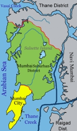
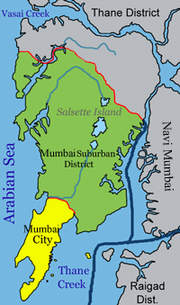
Salsette Island is the large island on which the cities of Mumbai and Thane are located. It is separated from the Konkan mainland by the Vasai creek and the Ulhas river. Mumbai was originally a distinct island from Thane, but reclamation of land has long since merged the islands. Powai Lake
, Tulsi Lake
and Vihar Lake
are the largest lakes on the island.

Mumbai Port (MbPT) lies midway (18°56.3′N 72°45.9′E) on the western shore of Mumbai Harbour. The port was the pre-eminent commercial port of India in the nineteenth and twentieth centuries. It is known as the gateway to India, and has been a primary factor in the emergence of Mumbai as the commercial capital of India.
swamps line much of the northwestern and eastern shores of the harbour, and provide a rich habitat for wildlife, including thousands of migrating birds such as flamingoes.
This includes reports of heavy metals flux found in the creeks adjacent to the harbour with the harbour acting as a sink for most of the pollutants.
Harbor
A harbor or harbour , or haven, is a place where ships, boats, and barges can seek shelter from stormy weather, or else are stored for future use. Harbors can be natural or artificial...
in the southern portion of the Ulhas River
Ulhas River
The Ulhas River is a river of western India. It originates near Karjat in the Western Ghats Range, and flows westward through Raigad and Thane districts of Maharashtra between Kulgaon-Badlapur, north to Ulhasnagar and on to Kalyan, where it turns west to Thane...
estuary
Estuary
An estuary is a partly enclosed coastal body of water with one or more rivers or streams flowing into it, and with a free connection to the open sea....
. The narrower, northern part of the estuary is called Thane Creek
Thane Creek
Thane Creek is part of the estuary of the Ulhas River in western India opening into Mumbai Harbour. It comprises the area stretching from Mumbra Retibunder to the Mankhurd-Vashi Bridge. It has been recognised as an Important Bird Area by the Bombay Natural History Society, as it is home to...
. The harbor opens to the Arabian Sea
Arabian Sea
The Arabian Sea is a region of the Indian Ocean bounded on the east by India, on the north by Pakistan and Iran, on the west by the Arabian Peninsula, on the south, approximately, by a line between Cape Guardafui in northeastern Somalia and Kanyakumari in India...
to the south. The historical island of Elephanta
Elephanta
The Elephanta is a strong southerly or southeasterly wind which blows on the Malabar coast of India during the months of September and October and marks the end of the southwest monsoon....
is one of the six islands that lie in the harbor.
Front Bay is the official name of the harbor, so named because Mumbai started as a tiny settlement facing the harbor. The waterbody behind the original settlement, forming an arc between the former Colaba island and Bombay island, up to the Malabar Hill promontory or peninsula, was similarly called Back Bay.
Front Bay is home to the Mumbai Port, which lies in the south section of the western edge of the harbor. Jawaharlal Nehru Port and Navi Mumbai
Navi Mumbai
Navi Mumbai is a Planned Satellite City on the west coast of the Indian state of Maharashtra. It was developed in 1972 as a twin city of Mumbai, and is the largest planned city on the planet, with under the jurisdiction of the Navi Mumbai Municipal Corporation and a total area of . Navi Mumbai...
lie to the east on the Konkan mainland, and the city of Mumbai
Mumbai
Mumbai , formerly known as Bombay in English, is the capital of the Indian state of Maharashtra. It is the most populous city in India, and the fourth most populous city in the world, with a total metropolitan area population of approximately 20.5 million...
lies to the west on Salsette Island. The Gateway of India
Gateway of India
Its design is a combination of both Hindu and Muslim architectural styles, the arch is in Muslim style while the decorations are in Hindu style. The Gateway is built from yellow basalt and reinforced concrete. The stone was locally obtained, and the perforated screens were brought from Gwalior.The...
with its jetty for Elephanta is the most important tourist destination
Tourist destination
A tourist destination is a city, town, or other area that is dependent to a significant extent on the revenues accruing from tourism. It may contain one or more tourist attractions and possibly some "tourist traps."...
, followed by the INS Vikrant
INS Vikrant
INS Vikrant was a Majestic-class light aircraft carrier of the Indian Navy.Her keel was laid down on 12 November 1943 by Vickers-Armstrong on the Tyne and she was launched on 22 September 1945....
maritime Museum.
The Harbour Line of the Mumbai Suburban Railway
Mumbai Suburban Railway
The Mumbai Suburban Railway system, part of the public transport system of Mumbai, is provided for by the state-run Indian Railways' two zonal Western Railways and Central Railways. The system carries more than 6.99 million commuters on a daily basis. It has the highest passenger densities of any...
system runs along the western edge of the harbor.
Islands

Butcher Island, also known as Jawahar Dweep, is used as an oil terminal by the Mumbai Port. It has jetties for tankers and various other infrastructure for offloading crude oil and for loading refined petroleum products. The island is restricted to port employees, and not open to the public.
Cross Island is a small, uninhabited islet just off the coast of the Dockyard Road.
Elephanta Island, also known as Gharapuri Island, is the best known of the islands in Mumbai Harbor. The Elephanta Caves
Elephanta Caves
The Elephanta Caves are a network of sculpted caves located on Elephanta Island, or Gharapuri in Mumbai Harbour, to the east of the city of Mumbai in the Indian state of Maharashtra...
located on the island are a UNESCO World Heritage Site. The group of five larger caves have intricate Hindu
Hindu
Hindu refers to an identity associated with the philosophical, religious and cultural systems that are indigenous to the Indian subcontinent. As used in the Constitution of India, the word "Hindu" is also attributed to all persons professing any Indian religion...
religious rock sculptures. Two smaller caves have Buddhist religious sculptures. The carvings date back to between 5th and 8th centuries.
Middle Ground is a small islet in the Thane creek. It features an antique coastal gun battery of the Indian Navy. The guns salute Indian naval vessels returning from deployments when they enter the harbor.
Oyster Rock is a small group of rock outcroppings in the harbor. The area has restricted access since it is used for naval exercises.
Salsette Island is the large island on which the cities of Mumbai and Thane are located. It is separated from the Konkan mainland by the Vasai creek and the Ulhas river. Mumbai was originally a distinct island from Thane, but reclamation of land has long since merged the islands. Powai Lake
Powai Lake
Powai Lake is an artificial lake, situated in the northern suburb of Mumbai, in the Powai valley, where a Powai village with cluster of huts existed...
, Tulsi Lake
Tulsi Lake
Tulsi Lake is a fresh water lake in northern Mumbai. It is stated to be the second largest lake in Mumbai and supplies part of the city’s potable water.http://mumbai.clickindia.com/travel/tulsilake.html, Travel, Tulsi lake This is one of the three lakes located in the Salsette Island; the other two...
and Vihar Lake
Vihar Lake
Vihar Lake is located near Vihar village on the Mithi River within the precincts of the Borivali National Park, also called the Sanjay Gandhi National Park, in North Mumbai. When built in 1860 , it was considered as the largest lake in Mumbai in the Salsette group of islands. It is hemmed between...
are the largest lakes on the island.
Mumbai Port

Mumbai Port (MbPT) lies midway (18°56.3′N 72°45.9′E) on the western shore of Mumbai Harbour. The port was the pre-eminent commercial port of India in the nineteenth and twentieth centuries. It is known as the gateway to India, and has been a primary factor in the emergence of Mumbai as the commercial capital of India.
Ecology
MangroveMangrove
Mangroves are various kinds of trees up to medium height and shrubs that grow in saline coastal sediment habitats in the tropics and subtropics – mainly between latitudes N and S...
swamps line much of the northwestern and eastern shores of the harbour, and provide a rich habitat for wildlife, including thousands of migrating birds such as flamingoes.
Pollution
Due to immense population pressures from the Mumbai metropolitan region and the extremely busy maritime trade, the Mumbai Harbour is considered to be heavily polluted.This includes reports of heavy metals flux found in the creeks adjacent to the harbour with the harbour acting as a sink for most of the pollutants.

