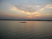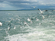
Naf River
Encyclopedia


Bengali language
Bengali or Bangla is an eastern Indo-Aryan language. It is native to the region of eastern South Asia known as Bengal, which comprises present day Bangladesh, the Indian state of West Bengal, and parts of the Indian states of Tripura and Assam. It is written with the Bengali script...
: নাফ নদী, ná́f nədí; ; is a river marking the border of Bangladesh
Bangladesh
Bangladesh , officially the People's Republic of Bangladesh is a sovereign state located in South Asia. It is bordered by India on all sides except for a small border with Burma to the far southeast and by the Bay of Bengal to the south...
and Myanmar
Myanmar
Burma , officially the Republic of the Union of Myanmar , is a country in Southeast Asia. Burma is bordered by China on the northeast, Laos on the east, Thailand on the southeast, Bangladesh on the west, India on the northwest, the Bay of Bengal to the southwest, and the Andaman Sea on the south....
.
It is an elongated estuary
Estuary
An estuary is a partly enclosed coastal body of water with one or more rivers or streams flowing into it, and with a free connection to the open sea....
in the extreme southeast of Cox's Bazar
Cox's Bazar
Cox's Bazar is a town, a fishing port and district headquarters in Bangladesh. It is known for its wide sandy beach which is the world's longest natural sandy sea beach. It is an unbroken 125 km sandy sea beach with a gentle slope. It is located 150 km south of Chittagong. Cox’s Bazar...
district dividing the district from Arakan
Rakhine State
Rakhine State is a Burmese state. Situated on the western coast, it is bordered by Chin State in the north, Magway Region, Bago Region and Ayeyarwady Region in the east, the Bay of Bengal to the west, and the Chittagong Division of Bangladesh to the northwest. It is located approximately between...
, Myanmar
Myanmar
Burma , officially the Republic of the Union of Myanmar , is a country in Southeast Asia. Burma is bordered by China on the northeast, Laos on the east, Thailand on the southeast, Bangladesh on the west, India on the northwest, the Bay of Bengal to the southwest, and the Andaman Sea on the south....
. It rises in the Arakan hills on the southeastern borders of the district and flows into the Bay of Bengal
Bay of Bengal
The Bay of Bengal , the largest bay in the world, forms the northeastern part of the Indian Ocean. It resembles a triangle in shape, and is bordered mostly by the Eastern Coast of India, southern coast of Bangladesh and Sri Lanka to the west and Burma and the Andaman and Nicobar Islands to the...
. Its width varies from 1.61 km to 3.22 km. The river is influenced by tide. Sittwe
Sittwe
-Economy:In February 2007, India announced a plan to develop the port, which would enable ocean access from Indian Northeastern states, so called "Seven sisters", like Mizoram, via the Kaladan River....
in Myanmar is on the eastern bank and Teknaf upazila of Cox's Bazar
Cox's Bazar
Cox's Bazar is a town, a fishing port and district headquarters in Bangladesh. It is known for its wide sandy beach which is the world's longest natural sandy sea beach. It is an unbroken 125 km sandy sea beach with a gentle slope. It is located 150 km south of Chittagong. Cox’s Bazar...
district is on the western bank of the river.
The Naf River's average depth is 128 feet (39 m) and maximum depth is 400 feet (121.9 m).
Historically, Shapuree
Shapuree
Shapuree island is located at the mouth of the Naf River, a maritime-boundary between Bangladesh and Burma. Historically, it is considered one of the immediate causes for the first Anglo-Burmese War.-External links:**...
island located at the mouth of the river, plays important role and considered as one of the immediate causes for the first Anglo-Burmese War.

