

National Register of Historic Places listings in Clay County, South Dakota
Encyclopedia
This is intended to be a complete list of the properties and districts on the National Register of Historic Places
National Register of Historic Places
The National Register of Historic Places is the United States government's official list of districts, sites, buildings, structures, and objects deemed worthy of preservation...
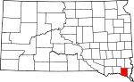
in Clay County, South Dakota
South Dakota
South Dakota is a state located in the Midwestern region of the United States. It is named after the Lakota and Dakota Sioux American Indian tribes. Once a part of Dakota Territory, South Dakota became a state on November 2, 1889. The state has an area of and an estimated population of just over...
, United States
United States
The United States of America is a federal constitutional republic comprising fifty states and a federal district...
. The locations of National Register properties and districts for which the latitude and longitude coordinates are included below, may be seen in a Google map.
There are 38 properties and districts listed on the National Register in the county. Another 2 properties were once listed but have since been removed.
Current listings
|}Former listings
| Landmark name | Image | Date | Location | City or Town | Summary | |
|---|---|---|---|---|---|---|
| 1 | South Dakota Department of Transportation Bridge No. 14-105-209 | (delisted) | Vermillion Vermillion, South Dakota Vermillion is a city in and the county seat of Clay County, in the southeastern corner of the U.S. state of South Dakota, and the tenth largest city in the state. According to the 2010 Census, the population was 10,571. Vermillion lies atop a bluff near the Missouri River.The area has been home to... |
|||
| 2 | South Dakota Department of Transportation Bridge No. 14-120-222 | (delisted) | Wakonda Wakonda, South Dakota Wakonda is a town in Clay County, South Dakota, United States. The population was 321 at the 2010 census.-Geography:Wakonda is located at .According to the United States Census Bureau, the town has a total area of , all of it land.... |
See also
- List of National Historic Landmarks in South Dakota
- National Register of Historic Places listings in South Dakota