
National Register of Historic Places listings in Dayton, Ohio
Encyclopedia
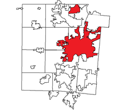
This is intended to be a complete list of the properties and districts on the National Register of Historic Places
National Register of Historic Places
The National Register of Historic Places is the United States government's official list of districts, sites, buildings, structures, and objects deemed worthy of preservation...
in Dayton
Dayton, Ohio
Dayton is the 6th largest city in the U.S. state of Ohio and the county seat of Montgomery County, the fifth most populous county in the state. The population was 141,527 at the 2010 census. The Dayton Metropolitan Statistical Area had a population of 841,502 in the 2010 census...
, Ohio
Ohio
Ohio is a Midwestern state in the United States. The 34th largest state by area in the U.S.,it is the 7th‑most populous with over 11.5 million residents, containing several major American cities and seven metropolitan areas with populations of 500,000 or more.The state's capital is Columbus...
, United States
United States
The United States of America is a federal constitutional republic comprising fifty states and a federal district...
. The locations of National Register properties and districts for which the latitude and longitude coordinates are included below, may be seen in a Google map.
There are 140 properties and districts listed on the National Register in Montgomery County
Montgomery County, Ohio
Montgomery County is a county located in the state of Ohio, United States. The population was 535,153 in the 2010 Census. It was named in honor of Richard Montgomery, an American Revolutionary War general killed in 1775 while attempting to capture Quebec City, Canada. The county seat is Dayton...
, including 6 National Historic Landmark
National Historic Landmark
A National Historic Landmark is a building, site, structure, object, or district, that is officially recognized by the United States government for its historical significance...
s. The city of Dayton is the location of 99 of these properties and districts, including 4 National Historic Landmarks; they are listed here, while the remaining properties and districts are listed separately.
Current listings
| Landmark name | Image | Date listed | Location | Summary | |
|---|---|---|---|---|---|
| 1 | Biltmore Hotel Biltmore Hotel (Dayton, Ohio) -History:Constructed in 1929, The Biltmore Hotel was designed in the beaux-arts style popular at the time. It features an applied masonry façade system, exhibiting both brick and terra cotta; resulting in a dark brown and white exterior. The architect, Frederick Hughes -History:Constructed in 1929,... |
 |
210 N. Main St. 39°45′46"N 84°11′32"W |
||
| 2 | Marcus Bossler House | 136 S. Dutoit St. 39°45′44"N 84°10′25"W |
|||
| 3 | James Brooks House |  |
41 E. 1st St. 39°45′45"N 84°11′29"W |
||
| 4 | Samuel N. Brown House Samuel N. Brown House Samuel N. Brown House is an historic structure at 1633 Wayne Avenue in Dayton, Ohio. It was added to the National Register of Historic Places on April 11, 1977.... |
 |
1633 Wayne Ave. 39°44′42"N 84°10′12"W |
||
| 5 | Jonah Bull House | 2233 Wayne Ave. 39°44′21.5"N 84°9′47"W |
|||
| 6 | Central Avenue Historic District Central Avenue Historic District (Dayton, Ohio) The Central Avenue Historic District is a nationally recognized historic district located at 201 to 338 Central Avenue in Dayton, Ohio. It consists of late 19th and 20th Century Revival-style houses as well as late Victorian-style houses, which were all originally single-family residences.On... |
201-338 Central Ave. 39°46′2"N 84°12′27"W |
|||
| 7 | Central Branch, National Home for Disabled Volunteer Soldiers | 4100 W. 3rd St. 39°44′35"N 84°15′39"W |
|||
| 8 | Classic Theater | 815 W. 5th St. 39°45′12"N 84°12′30"W |
|||
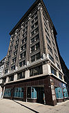
| 9 | Commercial Building Commercial Building (Dayton, Ohio) The Commercial Building built is 1908 is an historic skyscraper located at 44 South Ludlow Street in Dayton, Ohio. It was designed by architects Peters, Burns and Pretzinger.On December 2, 1982, it was added to the National Register of Historic Places.... |
 |
44 S. Ludlow St. 39°45′29"N 84°11′36"W |
||
| 10 | Conover Building Conover Building The Conover Building is an historic structure located at 4 South Main Street in Dayton, Ohio. It was added to the National Register of Historic Places on October 14, 1975.... |
4 S. Main St. 39°45′33"N 84°11′29"W |
|||
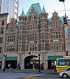
| 11 | Dayton Arcade Dayton Arcade The Dayton Arcade is a collection of five buildings located in Dayton, Ohio.The Historic Arcade is a historical, architecturally elegant complex located in the heart of Dayton’s central business district. Built in 1902, it was conceived by Eugene J... |
 |
From Ludlow to Main St. between 3rd and 4th Sts. 39°45′30"N 84°11′33"W |
||
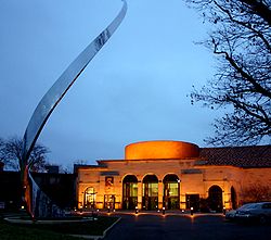
| 12 | Dayton Art Institute Dayton Art Institute The Dayton Art Institute is a museum of fine arts in Dayton, Ohio, USA. The Dayton Art Institute was rated one of the top 10 best art museums in the United States for kids. The museum also ranks in the top 3% of all art museums in North America in 3 of 4 factors... |
 |
Forest and Riverview Aves. 39°45′57"N 84°12′4"W |
||
| 13 | Dayton Aviation Heritage National Historical Park Dayton Aviation Heritage National Historical Park thumb|left|200 px|The Wright Flyer III, now in Carillon Historical Park, shown being flown by Orville Wright on October 4, 1905, over [[Huffman Prairie]] near Dayton... |
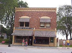 |
16 South Williams Street 39°45′20.78"N 84°12′42.29"W |
||
| 14 | Dayton Canoe Club | 1020 Riverside Dr. 39°46′32.08"N 84°11′47.86"W |
|||
| 15 | Dayton Daily News Building Dayton Daily News Building The Dayton Daily News Building is an historic structure located at the corner of 4th and Ludlow Streets in Dayton, Ohio. It was designed by architect Albert Pretzinger.On November 30, 1978, it was added to the National Register of Historic Places.... |
 |
4th and Ludlow Sts. 39°45′28"N 84°11′37"W |
||
| 16 | Dayton Fire Department Station No. 16 Dayton Fire Department Station No. 16 Dayton Fire Station No. 16 is an historic structure at 31 S. Jersey St. in Dayton, Ohio. It was added to the National Register of Historic Places on May 23, 1980.... |
31 S. Jersey St. 39°45′53"N 84°9′11"W |
|||
| 17 | Dayton Fire Station No. 14 Dayton Fire Station No. 14 Dayton Fire Station No. 14 is an historic structure at 1422 N. Main St. in Dayton, Ohio. It was added to the National Register of Historic Places on September 27, 1980. It was designed by the Peters, Burns & Pretzinger firm.... |
 |
1422 N. Main St. 39°46′38"N 84°12′9"W |
||
| 18 | Dayton Motor Car Company Historic District | 15, 101, 123-5 Bainbridge; 9-111 and 122-124 McDonough 39°45′34"N 84°10′50"W |
|||
| 19 | Dayton Power and Light Building Group | 601, 607-609, 613-645 E. 3rd St. 39°45′40"N 84°10′57"W |
|||
| 20 | Dayton Stove and Cornice Works | 24-28 N. Patterson Boulevard 39°45′39"N 84°11′12"W |
|||
| 21 | Dayton Terra-Cotta Historic District | S. Ludlow and W. 5th Sts. 39°45′23"N 84°11′32"W |
|||
| 22 | Dayton View Historic District Dayton View Historic District The Dayton View Historic District is a sector of Dayton developed in the late 19th century consisting of 219 structures in the registry.-Historic District:... |
Roughly bounded by Broadway, Harvard Boulevard, and Superior and Salem Aves. 39°46′4"N 84°12′59"W |
|||
| 23 | Dayton Women's Club | 225 N. Ludlow St. 39°45′46"N 84°11′42"W |
|||
| 24 | Dayton Young Men's Christian Association Building Dayton Young Men's Christian Association Building The Landing Apartments is an historic structure located at 117 West Monument Street in Dayton, Ohio. It was designed by Schenck & Williams and added to the National Register of Historic Places on August 25, 1988.... |
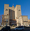 |
117 W. Monument Ave. 39°45′49"N 84°11′45"W |
||
| 25 | Deeds Carillon Carillon Historical Park Carillon Historical Park is a 65-acre park and museum in Dayton, Ohio, which contains historic buildings and exhibits concerning the history of technology and the history of Dayton and its residents from 1796 to the present. The historical elements of the park were the brainchild of Colonel... |
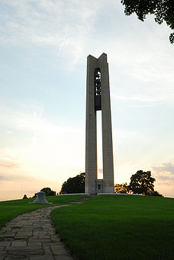 |
1000 Carillon Boulevard 39°43′51"N 84°11′51"W |
||
| 26 | Dunbar Historic District Dunbar Historic District The Dunbar Historic District is a nationally recognized historic district on North Summit Street in Dayton, Ohio. The district is famous for being the home of Paul Laurence Dunbar.On June 30, 1980, it was added to the National Register of Historic Places... |
N. Summit St. 39°45′23"N 84°13′8"W |
|||
| 27 | Paul Laurence Dunbar House Paul Laurence Dunbar House The Paul Laurence Dunbar House was the 1904-1906 home of poet Paul Laurence Dunbar in Dayton, Ohio. It is a historic house museum owned by the state of Ohio and operated by Dayton History on behalf of the Ohio Historical Society... |
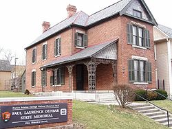 |
219 N. Summit St. 39°45′20"N 84°13′8"W |
||
| 28 | Duncarrick | Webster and Keowee Sts. 39°46′44"N 84°11′3"W |
|||
| 29 | Eagles Building Eagles Building (Dayton, Ohio) The Eagles Building built in 1916 is an historic Fraternal Order of Eagles meeting hall-office building located at 320 South Main Street in Dayton, Ohio. It is also known as the City Mission.... |
320 S. Main St. 39°45′17"N 84°11′24"W |
|||
| 30 | East Second Street District | 3-27 E. 2nd St. 39°45′40"N 84°11′30"W |
|||
| 31 | East Third Street Historic District | 424-520 East 3rd St. (southern side only) 39°45′37"N 84°11′8"W |
|||
| 32 | Engineers Club of Dayton Engineers Club of Dayton The Engineers Club of Dayton was founded by Colonel Edward A. Deeds and Charles F. Kettering in Dayton, Ohio in 1914. The club's building is listed on the National Register of Historic Places and the history of the club involves notable Daytonians and historical figures such as Orville... |
110 E. Monument Ave. 39°45′49"N 84°11′27"W |
|||
| 33 | Exposition Hall, Montgomery County Fairgrounds | Montgomery County Fairgrounds, 1043 S. Main St. 39°44′38"N 84°11′20"W |
|||
| 34 | Fire Blocks Historic District | Roughly bounded by Jefferson, 4th, St. Clair, and 2nd Sts. 39°45′30"N 84°11′20"W |
|||
| 35 | First Lutheran Church First Lutheran Church (Dayton, Ohio) The First Lutheran Church is a historic Lutheran church located at 138 West First Street in Dayton, Ohio, United States. On March 29, 1983, it was added to the National Register of Historic Places. The building was designed by Peters, Burns, & Pretzinger.... |
 |
138 W. 1st St. 39°45′41"N 84°11′45"W |
||
| 36 | Philip E. Gilbert Houses | 1012 Huffman Ave. and 18-30 Belpre Pl. 39°45′27"N 84°9′5"W |
|||
| 37 | Oscar M. Gottschall House | 20 Livingston Ave. 39°45′27"N 84°8′54"W |
|||
| 38 | Grafton-Rockwood Historic District | Parts of Grafton, Homewood, Rockwood Ave, Oaks Ave, Old Orchard Ave. 39°46′24.05"N 84°12′23.08"W |
|||
| 39 | Graphic Arts Building Graphic Arts Building (Dayton, Ohio) The Graphic Arts Building in Dayton, Ohio was designed by the Dayton architectural firm of Schenck & Williams, and was listed on the National Register of Historic Places.... |
221-223 S. Ludlow St. 39°45′21.08"N 84°11′34.86"W |
|||
| 40 | Gummer House | 1428 Huffman Ave. 39°45′26"N 84°8′35"W |
|||
| 41 | Hanitch-Huffman House | 139 W. Monument Ave. 39°45′47"N 84°11′46"W |
|||
| 42 | Holy Cross Lithuanian Roman Catholic Church | 1924 Leo St. 39°46′53"N 84°10′4"W |
|||
| 43 | Huffman Historic District Huffman Historic District The Huffman Historic District is one of ten designated historic districts in Dayton, Ohio, United States. This 10-square block of land was named after William P. Huffman. Its many Victorian style homes range from the time period between 1860 and 1900. In the mid 19th century the area began to grow... |
Roughly bounded by E. 3rd, Hamilton, Van Lear, and Beckel Sts. 39°45′41"N 84°9′59"W |
|||
| 44 | Incinerator Site SunWatch Indian Village SunWatch Indian Village / Archaeological Park is a recreated Fort Ancient Native American village that sits alongside the Great Miami River in Dayton, Ohio.... |
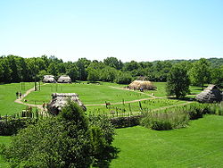 |
2301 W. River Rd. 39°42′47.664"N 84°13′55.524"W |
Also known as SunWatch Indian Village | |
| 45 | Independent Order of Oddfellows, Dayton Lodge No. 273 | 8 LaBelle St. 39°45′30"N 84°11′4"W |
|||
| 46 | Insco Apartments Building Insco Apartments Building The Insco Apartments Building is an historic structure located at 255 North Main Street in Dayton, Ohio. It was designed Charles Insco Williams, a native of Dayton, and added to the National Register of Historic Places on February 18, 1994.... |
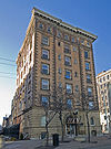 |
255 N. Main St. 39°45′48"N 84°11′37"W |
||
| 47 | Jacob O. Joyce House | 6 Josie St. 39°45′21"N 84°10′33"W |
|||
| 48 | Julienne Girls Catholic High School | 325 Homewood Ave. 39°46′34.248"N 84°12′17.208"W |
|||
| 49 | Kelly Family Home Kelly Family Home The Kelly Family Home is a historic structure at 57 S. Main St. in Dayton, Ohio. It was added to the National Register of Historic Places on June 30, 1975.... |
 |
657 S. Main St. 39°44′58"N 84°11′21"W |
||
| 50 | Lewis Kemp House | 4800 Burkhardt Ave. 39°45′29"N 84°7′33"W |
|||
| 51 | Kenilworth Avenue Historic District Kenilworth Avenue Historic District The Kenilworth Avenue Historic District is the 700 Block Kenilworth Ave. and 1131–1203 Salem Ave., located in the Five Oaks neighborhood, just northwest of downtown Dayton, Ohio.- Architecture :... |
1131-1203 Salem Ave., 701-761 Kenilworth 39°46′33"N 84°12′58"W |
|||
| 52 | Kossuth Colony Historic District Kossuth Colony Historic District Kossuth Colony Historic District, named for Lajos Kossuth, is a nationally recognized historic district bounded by Baltimore Street, Mack Avenue and Notre Dame Avenue in Dayton, Ohio. The Kossuth Colony was built between 1905 and 1906 to house Hungarian immigrant workers for the Barney and Smith... |
Baltimore St., Mack and Notre Dame Aves. 39°47′0"N 84°10′17"W |
|||
| 53 | Benjamin F. Kuhns Building Benjamin F. Kuhns Building The Kuhns Building is an historic structure located at 43 South Main Street in Dayton, Ohio. It was designed by Peters & Burns, and added to the National Register of Historic Places on April 24, 1978.-References:... |
 |
43 S. Main St. 39°45′29"N 84°11′31"W |
||
| 54 | Lafee Building | 22 E. 3rd St. 39°45′33.5"N 84°11′28"W |
|||
| 55 | Lichliter Mound and Village Site | Fields on the northern side of an intermittent stream, 1 miles (1.6 km) above Wolf Creek and 6 miles (9.7 km) above the Great Miami River Great Miami River The Great Miami River is a tributary of the Ohio River, approximately long, in southwestern Ohio in the United States... 39°46′46"N 84°17′8"W |
|||
| 56 | Lindsey Building Lindsey Building The Lindsay Building is an historic structure located at 25 South Main Street in Dayton, Ohio. It was added to the National Register of Historic Places on March 14, 1985.... |
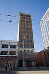 |
25 S. Main St. 39°45′31"N 84°11′31"W |
||
| 57 | McCormick Manufacturing Company Building McCormick Manufacturing Company Building The McCormick Manufacturing Company Building is an historic structure located at 434-438 E. First St. in Dayton, Ohio. It was added to the National Register of Historic Places on February 2, 2001.... |
 |
434-438 E. 1st St. 39°45′48"N 84°11′3"W |
||
| 58 | McPherson Town Historic District McPherson Town Historic District The McPherson Town Historic District contains roughly 90 structures located on the north side of downtown Dayton, Ohio just on the other side of the Great Miami River.-History:... |
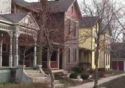 |
Roughly bounded by Main St., the Great Miami River Great Miami River The Great Miami River is a tributary of the Ohio River, approximately long, in southwestern Ohio in the United States... , and Interstate 75 Interstate 75 Interstate 75 is a major north–south Interstate Highway in the Great Lakes and Southeastern regions of the United States. It travels from State Road 826 and State Road 924 in Hialeah, Florida to Sault Ste. Marie, Michigan, at the Ontario, Canada, border... 39°46′3"N 84°11′46"W |
||
| 59 | Memorial Hall Memorial Hall (Dayton, Ohio) Memorial Hall is a historic structure, located at 125 East First Street, in Dayton, Ohio.It was added to the National Register of Historic Places on July 14, 1988.-External links:*... |
125 E. 1st St. 39°45′51"N 84°11′23"W |
|||
| 60 | Daniel Miller House | 3525 Dandridge Ave. 39°45′59"N 84°14′48"W |
|||
| 61 | Montgomery County Courthouse Montgomery County Courthouse (Ohio) The Montgomery County Courthouse , built in 1847, is an historic Greek Revival building located on the northwest corner of Third and Main streets in Dayton, Ohio. It is referred to locally as the Old Courthouse... |
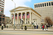 |
Northwestern corner of 3rd and Main Sts. 39°45′33"N 84°11′33"W |
||
| 62 | Jacob H.W. Mumma House | 2239 Kipling Dr. 39°47′24"N 84°14′36"W |
|||
| 63 | Mutual Home & Savings Association Building Liberty Tower (Dayton) The Liberty Tower is a high-rise office building in Dayton, Ohio, United States. The tower was designed by the Dayton architectural firm of Schenck & Williams. The tower is named Liberty Tower after [].-History:... |
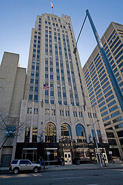 |
120 W. 2nd St. 39°45′37"N 84°11′43"W |
||
| 64 | Newcom House | 53 Sherman St. 39°45′23"N 84°9′49"W |
|||
| 65 | Nicholas Ohmer House | 1350 Creighton St. 39°44′26"N 84°9′14"W |
|||
| 66 | Old Post Office And Federal Building | Southeastern corner of W. 3rd and Wilkinson Sts. 39°45′30"N 84°11′41"W |
|||
| 67 | Oregon Historic District Oregon Historic District The Oregon Historic District embraces the earliest surviving, relatively intact combination of commercial and residential architecture in Dayton, Ohio. Examples of Dayton’s architectural history from 1830 to 1910 line the streets and lanes in this 40-plus block area. Styles range from Federal to... |
Between Patterson Boulevard and Wayne Ave., north to Gates St. and south to U.S. Route 35 U.S. Route 35 U.S. Route 35 is a north–south United States highway that runs northwest-southeast for approximately from northern Indiana to the western suburbs of Charleston, West Virginia. The highway's northern terminus is in Michigan City, Indiana, at U.S. Route 20. Its southern terminus is in Scott... 39°45′19"N 84°11′4"W |
|||
| 68 | Isaac Pollack House Isaac Pollack House The Isaac Pollack House is a historic structure now located at 208 West Monument Avenue in Dayton, Ohio. It was added to the National Register of Historic Places on December 16, 1974. In 1977, it was moved from its former location at 319 West 3rd St. The house was estimated to weigh 300 tons and... |
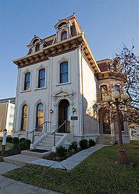 |
319 W. 3rd St. 39°45′47"N 84°12′30"W |
||
| 69 | Rudolph Pretzinger House Rudolph Pretzinger House The Rudolph Pretzinger House is a historic structure at 908 S. Main St in Dayton, Ohio. It was designed by architect Albert Pretzinger, and added to the National Register of Historic Places on August 24, 1979.... |
 |
908 S. Main St 39°44′45"N 84°11′16"W |
||
| 70 | Red Oak-William C. Sherman House | 1231 Hook Estates Dr. 39°47′39"N 84°14′1"W |
|||
| 71 | John R. Reynolds House | 24 Klee St. 39°45′27"N 84°8′58"W |
|||
| 72 | Rubicon Farm Patterson Homestead The Patterson Homestead is a historic house museum located at 1815 Brown Street in Dayton, Ohio, USA. It was built in 1816 by American Revolutionary War veteran Colonel Robert Patterson.... |
1815 Brown St. 39°44′4"N 84°10′56"W |
|||
| 73 | Sachs and Pruden Ale Company Building | 127 Wyandot St. 39°45′30"N 84°11′15"W |
|||
| 74 | Sacred Heart Church Sacred Heart Church (Dayton, Ohio) Sacred Heart Church is a historic structure at 217 West 4th Street in Dayton, Ohio. Renowned Dayton architect Charles Insco Williams designed it in 1888. It was added to the National Register of Historic Places on October 22, 1987.... |
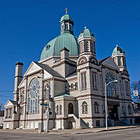 |
217 W. 4th St. 39°45′27"N 84°11′43"W |
||
| 75 | St. Adalbert Polish Catholic Church | 1511 Valley St. 39°47′1"N 84°9′22"W |
|||
| 76 | Saint Anne's Hill Historic District Saint Anne's Hill Historic District Saint Anne's Hill Historic District is part of the Historic Inner East neighborhood in Dayton, Ohio, United States. St. Anne's Hill constitutes an excellent grouping of both vernacular and high style Victorian residences which date roughly from 1860 to the early 20th century... |
Roughly bounded by 4th, McClure, Josie, High, and Dutoit Sts. 39°45′24"N 84°10′23"W |
|||
| 77 | St. Mary Roman Catholic Church | 543 Xenia Ave. 39°45′10"N 84°10′4"W |
|||
| 78 | St. Mary's Hall, University of Dayton | 300 College Park 39°44′22"N 84°10′41"W |
|||
| 79 | Hyman Schriber Building | 306-308 Washington St. 39°45′5"N 84°11′43"W |
|||
| 80 | Shawen Acres Shawen Acres Shawen Acres, also known as the Montgomery County Children's Home, is an historic complex at 3304 N. Main St. in Dayton, Ohio. It was added to the National Register of Historic Places on October 9, 1991.It was originally designed as an orphan’s home. Dr... |
 |
3304 N. Main St. 39°47′47"N 84°12′53"W |
||
| 81 | Sig's General Store | 1400 Valley St. 39°46′54"N 84°9′30"W |
|||
| 82 | Edwin Smith House Edwin Smith House (Dayton, Ohio) The Edwin Smith House is an historic structure at 131 West Third Street in Dayton, Ohio. It was added to the National Register of Historic Places on August 13, 1974. It is also known as the Dayton Bicycle Club and Craighead House.... |
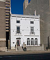 |
131 W. 3rd St. 39°45′32"N 84°11′42"W |
||
| 83 | South Park Historic District | Roughly bounded by Park, Morton, Hickory, and Wayne Ave.; also roughly bounded by Wayne, Wyoming, Nathan, Oak, Alberta and Blaine 39°44′56"N 84°10′43"W |
Second set of boundaries represents a boundary increase | ||
| 84 | Southern Ohio Lunatic Asylum Southern Ohio Lunatic Asylum The Southern Ohio Lunatic Asylum is an historic structure at 2335 Wayne Ave. in Dayton, Ohio. It was added to the National Register of Historic Places on November 15, 1979.... |
 |
2335 Wayne Ave. 39°44′16"N 84°9′40"W |
||
| 85 | Squirrel-Forest Historic District | North of Homewood Ave. and along the west side of Forest Ave. 39°46′27"N 84°12′8"W |
|||
| 86 | Steele's Hill-Grafton Hill Historic District Steele's Hill-Grafton Hill Historic District The Steele's Hill-Grafton Hill Historic District, or simply known locally as Grafton Hill, is a small 18-block sector of Dayton, Ohio, United States that was developed in the late 19th century.-Historic district:... |
Roughly bounded by Grand, Plymouth, Forest, and Salem 39°45′59"N 84°12′15"W |
|||
| 87 | John S. Stengel House | 325 W. 2nd St. 39°45′37"N 84°11′52"W |
|||
| 88 | Stivers High School Stivers School for the Arts Stivers School for the Arts is a magnet school in the Dayton City Schools in Dayton, Ohio, USA, located in the St. Anne's Hill Historic District neighborhood. It is a public middle- and high school that focuses on education in the visual and performing arts. U.S... |
1313 E. 5th St. 39°45′31.2"N 84°10′32"W |
|||
| 89 | Traxler Mansion |  |
42 Yale Ave. 39°46′14"N 84°12′54"W |
||
| 90 | Unit III, Dayton Project | 1601 W. 1st St. 39°45′25"N 84°13′19"W |
|||
| 91 | United Brethren Publishing House |  |
40-46 S. Main St. (7-21 E. 4th St.) 39°45′30"N 84°11′29"W |
||
| 92 | Victory Theater Building Victoria Theatre (Dayton, Ohio) The Victoria Theatre is a historic 1,154-seat performing arts venue located in downtown Dayton, Ohio, USA.-History:The Victoria, one of the oldest continually operated theaters on the continent, was opened to the public as the Turner Opera House on New Year's Day, 1866, at a cost of $225,000... |
 |
138 N. Main St. 39°45′42"N 84°11′32"W |
||
| 93 | Dr. Jefferson A. Walters House Dr. Jefferson A. Walters House Dr. Jefferson A. Walters House is an historic structure at 35 East First Street in Dayton, Ohio. It was added to the National Register of Historic Places on November 20, 1974. Acquired and renovated by the prominent Dayton intellectual property law firm of Biebel & French, the property was sold... |
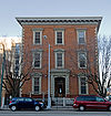 |
35 E. 1st St. 39°45′45.9"N 84°11′28.7"W |
||
| 94 | West Third Street Historic District | Roughly W. 3rd St. between Broadway and Shannon St. 39°45′21"N 84°12′43"W |
|||
| 95 | Westbrock Funeral Home |  |
1712 Wayne Ave. 39°44′41"N 84°10′6"W |
||
| 96 | Women's Christian Association | 800 W. 5th St. 39°45′11"N 84°12′28"W |
Razed in November 2007 | ||
| 97 | Woodland Cemetery Gateway, Chapel and Office | 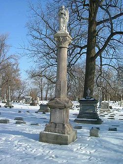 |
118 Woodland Ave. 39°44′34"N 84°10′45"W |
||
| 98 | Wright Cycle Company-Wright and Wright Printing Offices Wright Cycle Company The bicycle business of the Wright brothers, the Wright Cycle Company occupied five different locations in Dayton, Ohio. Orville and Wilbur Wright began their bicycle repair business in 1892, and soon added rentals and sales. In 1896 they began manufacturing and selling bicycles of their own... |
22 S. Williams St. 39°45′13"N 84°12′43"W |
|||
| 99 | Wright Flyer III Wright Flyer III The Wright Flyer III was the third powered aircraft built by the Wright Brothers. Orville Wright made the first flight with it on June 23, 1905. The Flyer III had an airframe of spruce construction with a wing camber of 1-in-20 as used in 1903, rather than the less effective 1-in-25 used in 1904... |
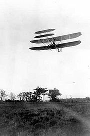 |
Carillon Park, 2001 S. Patterson Boulevard 39°43′40"N 84°12′7"W |
See also
- List of National Historic Landmarks in Ohio
- National Register of Historic Places listings in Ohio

