Nevada State Route 443
Encyclopedia
State Route 443 is a state highway
in the Reno-Sparks metropolitan area
of the state of Nevada
. It is the main connection between the city of Reno
and the community of Sun Valley
to the north. SR 443 is known as Clear Acre Lane in Reno and Sun Valley Drive within Sun Valley.
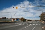
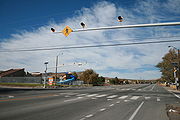
 State Route 443 begins at its intersection with North McCarran Boulevard (SR 659
). Just north of this junction, SR 443 interchanges with US 395
. From here, the highway heads slightly northeast to the intersection of Dandini Blvd & El Rancho Drive, where the road changes names from Clear Acre Lane into Sun Valley Drive ("Sun Valley Boulevard" on some signs). SR 443 continues north from this intersection through Sun Valley, where it terminates at 7th Avenue.
). By 2006, the highway had been truncated to its current terminus at North McCarran Boulevard.
In 2004, the Washoe County Regional Transportation Commission began the US 395/Clear Acre reconstruction project. The project created new US 395 freeway access at Clear Acre Lane and reconstructed the North McCarran Boulevard (SR 659) bridge and interchange ramps. Previously, the only access between SR 443 and US 395 was a northbound US 395 off ramp; other movements were made via the nearby McCarran Boulevard interchange. As of June 2007, the construction project was substantially completed.
.
State highway
State highway, state road or state route can refer to one of three related concepts, two of them related to a state or provincial government in a country that is divided into states or provinces :#A...
in the Reno-Sparks metropolitan area
Reno-Sparks metropolitan area
The Reno–Sparks Metropolitan Statistical Area, as defined by the United States Census Bureau, is an area consisting of two counties in western Nevada, anchored by the cities of Reno and Sparks...
of the state of Nevada
Nevada
Nevada is a state in the western, mountain west, and southwestern regions of the United States. With an area of and a population of about 2.7 million, it is the 7th-largest and 35th-most populous state. Over two-thirds of Nevada's people live in the Las Vegas metropolitan area, which contains its...
. It is the main connection between the city of Reno
Reno, Nevada
Reno is the county seat of Washoe County, Nevada, United States. The city has a population of about 220,500 and is the most populous Nevada city outside of the Las Vegas metropolitan area...
and the community of Sun Valley
Sun Valley, Nevada
Sun Valley is a census-designated place in Washoe County, Nevada, USA. The population was 19,461 at the 2000 census. It is a northern suburb of the city of Reno and is part of the Reno–Sparks Metropolitan Statistical Area.-Geography:...
to the north. SR 443 is known as Clear Acre Lane in Reno and Sun Valley Drive within Sun Valley.
Route description

Nevada State Route 659
State Route 659 is a state highway in Washoe County, Nevada. The route follows McCarran Boulevard, an arterial ring road serving the cities of Reno and Sparks. The route provides access to many businesses and residential areas in the Truckee Meadows....
). Just north of this junction, SR 443 interchanges with US 395
U.S. Route 395 in Nevada
In the U.S. state of Nevada, U.S. Route 395 clips a corner of Nevada near Lake Tahoe and serves the cities of Gardnerville, Minden, Carson City and Reno. Most of US 395 north of Carson City is a freeway and is built up to Interstate standards. Part of the freeway section is also currently...
. From here, the highway heads slightly northeast to the intersection of Dandini Blvd & El Rancho Drive, where the road changes names from Clear Acre Lane into Sun Valley Drive ("Sun Valley Boulevard" on some signs). SR 443 continues north from this intersection through Sun Valley, where it terminates at 7th Avenue.
History
Originally, SR 443 extended further south to terminate at Wedekind Road (former SR 880Nevada State Route 880
State Route 880 is a state highway located in Sparks, Nevada. It starts at the beginning of state maintenance near the Orr Irrigation Ditch and runs northeast along Wedekind Road...
). By 2006, the highway had been truncated to its current terminus at North McCarran Boulevard.
In 2004, the Washoe County Regional Transportation Commission began the US 395/Clear Acre reconstruction project. The project created new US 395 freeway access at Clear Acre Lane and reconstructed the North McCarran Boulevard (SR 659) bridge and interchange ramps. Previously, the only access between SR 443 and US 395 was a northbound US 395 off ramp; other movements were made via the nearby McCarran Boulevard interchange. As of June 2007, the construction project was substantially completed.
Major intersections
The entire route lies within Washoe CountyWashoe County, Nevada
Washoe County is a county located in the U.S. state of Nevada. The population was 421,407 at the 2010 census. Its county seat is Reno. Washoe County includes the Reno-Sparks metropolitan area.-History:...
.
| Location | Mile | Roads Intersected | Notes |
|---|---|---|---|
| Reno Reno, Nevada Reno is the county seat of Washoe County, Nevada, United States. The city has a population of about 220,500 and is the most populous Nevada city outside of the Las Vegas metropolitan area... |
Southern terminus; road continues beyond terminus | ||
| Sun Valley Sun Valley, Nevada Sun Valley is a census-designated place in Washoe County, Nevada, USA. The population was 19,461 at the 2000 census. It is a northern suburb of the city of Reno and is part of the Reno–Sparks Metropolitan Statistical Area.-Geography:... |
3.59 | 7th Avenue | Northern terminus; road continues beyond terminus |

