Nevada Wilderness Areas
Encyclopedia
The following Wilderness Areas were expanded or designated in the Humboldt National Forest:
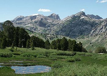
- The Jarbidge Wilderness AreaJarbidge WildernessThe Jarbidge Wilderness is located in the upper elevations of the Jarbidge Mountains in northern Elko County, in northeastern Nevada in the western United States. Established in 1964, it was the first wilderness area in the state...
, previously 64667 acres (26,169.8 ha), was expanded to 113167 acres (45,797.1 ha). This area protects wilderness in the higher elevations of the Jarbidge MountainsJarbidge MountainsThe Jarbidge Mountains are a range of high peaks in northern Elko County, in northeastern Nevada in the western United States. The range extends southward approximately 25 miles from a point near the small community of Jarbidge. To the east is the East Fork of the Jarbidge River, O'Neil...
in far northern Elko CountyElko County, Nevada-Demographics:As of the census of 2000, there were 45,291 people, 15,638 households, and 11,493 families residing in the county. The population density was 3/sq mi . There were 18,456 housing units at an average density of 1/sq mi...
.
- The Currant Mountain Wilderness AreaCurrant Mountain WildernessThe Currant Mountain Wilderness is a wilderness area in the White Pine Range of Nye County and White Pine County, in the eastern section of the state of Nevada in the western United States....
was created, protecting approximately 36000 acres (14,568.7 ha) in the upper elevations of the White Pine RangeWhite Pine RangeThe White Pine Range is a group of mountains in southern White Pine County, in eastern Nevada. The range runs for approximately 51 miles from Beck Pass in the north to Currant Pass in the south. To the west of the range are the Duckwater tribal lands and the northern arm of large Railroad Valley...
in eastern White Pine CountyWhite Pine County, NevadaWhite Pine County is a county located in the U.S. state of Nevada. Its population at the 2010 census was 10,030. Its county seat is Ely. It is the home of Great Basin National Park...
.
- The East Humboldt Wilderness AreaEast Humboldt WildernessThe East Humboldt Wilderness is a protected wilderness area in the East Humboldt Range of Elko County, in the northeast section of the state of Nevada in the western United States....
was created, protecting approximately 36900 acres (14,932.9 ha) in the upper elevations of the East Humboldt RangeEast Humboldt RangeThe East Humboldt Range is a line of mountains in northeastern Nevada in the Great Basin region of the western United States. It located in central Elko County in the upper watershed of the Humboldt River, which flows to the southwest from its source just north of the range.The East Humboldts run...
in central Elko CountyElko County, Nevada-Demographics:As of the census of 2000, there were 45,291 people, 15,638 households, and 11,493 families residing in the county. The population density was 3/sq mi . There were 18,456 housing units at an average density of 1/sq mi...
.
- The Quinn Canyon Wilderness AreaQuinn Canyon WildernessThe Quinn Canyon Wilderness is a protected wilderness area in the Quinn Canyon Range of Nye County, in the central section of the state of Nevada in the western United States....
was created, protecting approximately 27000 acres (10,926.5 ha) in the upper elevations of the Quinn Canyon RangeQuinn Canyon RangeThe Quinn Canyon Range is a remote group of mountains in northeastern Nye County, in central Nevada in the western United States.It is closely associated with the Grant Range, which meets it at Cherry Creek Summit . From there, the range runs for approximately 33 miles to the southwest...
in northeastern Nye CountyNye County, Nevada-National protected areas:* Ash Meadows National Wildlife Refuge* Death Valley National Park * Humboldt-Toiyabe National Forest * Spring Mountains National Recreation Area -Demographics:...
.
- The Ruby Mountains Wilderness AreaRuby Mountains WildernessThe Ruby Mountains Wilderness is a protected wilderness area in the Ruby Mountains of Elko County, in the northeast section of the state of Nevada in the western United States. It covers an area of approximately 90,000 acres , and is administered by the Humboldt-Toiyabe National Forest.-External...
was created, protecting approximately 90000 acres (36,421.7 ha) in the upper elevations of the Ruby MountainsRuby MountainsThe Ruby Mountains comprise one of the many mountain ranges of the Great Basin in the western United States. They are the predominant range in Elko County, in the northeastern section of the state of Nevada. To the north is Secret Pass and the East Humboldt Range, and from there the Rubies run...
in southern Elko CountyElko County, Nevada-Demographics:As of the census of 2000, there were 45,291 people, 15,638 households, and 11,493 families residing in the county. The population density was 3/sq mi . There were 18,456 housing units at an average density of 1/sq mi...
.
- The Grant Range Wilderness AreaGrant Range WildernessThe Grant Range Wilderness is a protected wilderness area in the Grant Range of Nye County, in the central section of the state of Nevada in the western United States....
was created, protecting approximately 50000 acres (20,234.3 ha) in the upper elevations of the Grant RangeGrant RangeThe Grant Range is a mountain chain in east-central Nevada in the western United States. It runs for approximately 30 miles in a generally north-south direction in northeastern Nye County. It is located south of the Horse Range and northeast of the closely associated Quinn Canyon Range. To the...
in northeastern Nye CountyNye County, Nevada-National protected areas:* Ash Meadows National Wildlife Refuge* Death Valley National Park * Humboldt-Toiyabe National Forest * Spring Mountains National Recreation Area -Demographics:...
.
- The Mount Moriah Wilderness Area was created, protecting approximately 82000 acres (33,184.3 ha) in the upper elevations of the north section of the Snake RangeSnake RangeThe Snake Range is a line of high mountains in eastern White Pine County, in east-central Nevada in the western United States. Typical of other ranges in the Basin and Range Province, it runs in a north-south direction, in this case for approximately...
in eastern White Pine CountyWhite Pine County, NevadaWhite Pine County is a county located in the U.S. state of Nevada. Its population at the 2010 census was 10,030. Its county seat is Ely. It is the home of Great Basin National Park...
.
- The Santa Rosa-Paradise Peak Wilderness AreaSanta Rosa-Paradise Peak WildernessThe Santa Rosa-Paradise Peak Wilderness is a protected wilderness area in the southern part of the Santa Rosa Range in Humboldt County, in northern Nevada in the western United States. It covers an area of approximately 31,000 acres , and is administered by the Humboldt-Toiyabe National...
was created, protecting approximately 31000 acres (12,545.3 ha) in the upper elevations of the southern section of the Santa Rosa RangeSanta Rosa RangeThe Santa Rosa Range is a line of mountains in northern Nevada in the western United States. The range extends for approximately 75 miles north from the Humboldt River west of Winnemucca through eastern Humboldt County to the border with Oregon. The highest peaks in the range are Granite Peak ...
in northern Humboldt CountyHumboldt County, NevadaHumboldt County is a county located in the U.S. state of Nevada. As of 2007, the population was estimated to be 18,052. Its county seat is Winnemucca.The county was the site of an arrest in 2000 that led to the U.S. Supreme Court decision Hiibel v...
.
The following Wilderness Areas were designated in the Toiyabe National Forest:
- The Alta Toquima Wilderness AreaAlta Toquima WildernessThe Alta Toquima Wilderness is a protected wilderness area in the Toquima Range of Nye County, in the central section of the state of Nevada in the western United States. It covers an area of ,...
was created, protecting approximately 38000 acres (15,378.1 ha) in the upper elevations of the Toquima RangeToquima RangeThe Toquima Range is a line of mountains in northwestern Nye County, in central Nevada in the western United States. From Hickson Summit on U.S. Route 50, the range runs for approximately 71 miles to the south-southwest. To its west are Big Smoky Valley, scenic State Route 376, and the large...
in northwestern Nye CountyNye County, Nevada-National protected areas:* Ash Meadows National Wildlife Refuge* Death Valley National Park * Humboldt-Toiyabe National Forest * Spring Mountains National Recreation Area -Demographics:...
.
- The Arc Dome Wilderness AreaArc Dome WildernessThe Arc Dome Wilderness is a protected wilderness area in the Toiyabe Range of Nye County, in the central section of the state of Nevada in the western United States. It covers an area of approximately , Nevada’s largest Wilderness area...
was created, protecting approximately 115000 acres (46,538.9 ha) in the upper elevations of the Toiyabe RangeToiyabe RangeThe Toiyabe Range is a range of mountains in central Nevada in the western United States. It starts in northwestern Nye County north of Tonopah, Nevada and runs approximately 120 miles north-northeast through eastern Lander County, making it the second longest range in the state...
in northwestern Nye CountyNye County, Nevada-National protected areas:* Ash Meadows National Wildlife Refuge* Death Valley National Park * Humboldt-Toiyabe National Forest * Spring Mountains National Recreation Area -Demographics:...
.
- The Mount Rose Wilderness Area was created, protecting approximately 28000 acres (11,331.2 ha) in the upper elevations of the Carson RangeCarson RangeThe Carson Range is a spur of the Sierra Nevada in eastern California and western Nevada that starts at Luther Pass and West Carson Canyon and goes to the Truckee River...
in southern Washoe CountyWashoe County, NevadaWashoe County is a county located in the U.S. state of Nevada. The population was 421,407 at the 2010 census. Its county seat is Reno. Washoe County includes the Reno-Sparks metropolitan area.-History:...
.
- The Mount Charleston Wilderness Area was created, protecting approximately 43000 acres (17,401.5 ha) in the upper elevations of the Spring MountainsSpring MountainsThe Spring Mountains are a mountain range of southern Nevada in the United States, running generally northwest-southeast along the west side of Las Vegas and down to the border with California...
in western Clark CountyClark County, Nevada-Demographics:As of the census of 2000, there were 1,375,765 people, 512,253 households, and 339,693 families residing within the MSA. The racial makeup of the MSA was 71.6% White , 9.1% Black, 5.7% Asian, 0.8% American Indian and 12.8% of other or mixed race. 22.0% were Hispanic of any race...
.
- The Table Mountain Wilderness AreaTable Mountain WildernessThe Table Mountain Wilderness is a protected wilderness area in the Monitor Range of Nye County in central section of the state of Nevada. It is the third largest wilderness area in the state. The nearest city is Tonopah, Nevada. The Table Mountain Wilderness Area covers an area of , and is...
was created, protecting approximately 98000 acres (39,659.2 ha) of the Monitor RangeMonitor RangeThe Monitor Range is located in south-central Nevada in the United States. The range lies west and northwest of the Hot Creek Range and north of Highway 6 in Nye County, and extends for approximately 106 miles into Eureka County at its northern end.The Forest Service is in charge of 83.6% of the...
in north-central Nye CountyNye County, Nevada-National protected areas:* Ash Meadows National Wildlife Refuge* Death Valley National Park * Humboldt-Toiyabe National Forest * Spring Mountains National Recreation Area -Demographics:...
.
Finally, the Boundary Peak Wilderness was created in the Inyo National Forest
Inyo National Forest
Inyo National Forest is a federally administered forest in the United States. The forest covers parts of the eastern Sierra Nevada of California, and the White Mountains of California and Nevada. It contains two wilderness areas: the John Muir Wilderness and the Ansel Adams Wilderness...
, protecting approximately 10000 acres (4,046.9 ha) in the northern section of the White Mountains
White Mountains (California)
The White Mountains of California are a triangular fault block mountain range facing the Sierra Nevada across the upper Owens Valley. They extend for approximately as a greatly elevated plateau about wide on the south, narrowing to a point at the north, with elevations generally increasing...
in western Esmeralda County
Esmeralda County, Nevada
Esmeralda County is a county in the west of U.S. state of Nevada. Its county seat is Goldfield. Its 2000 census population was officially 971, making its population density 0.1045 inhabitants/km² , the second-lowest of any county-equivalent outside of Alaska. As of 2010, the population had...
. Additional areas are under consideration for designation as Wilderness Areas - for more information link to the Nevada Wilderness site listed below.