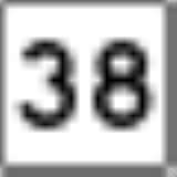
New Hampshire Route 38
Encyclopedia
New Hampshire Route 38 is an 8.7 miles (14 km) long north–south state highway
in extreme southeastern New Hampshire
. It is the main road connecting Pelham
with Salem
.
The northern terminus of NH 38 is in Salem at New Hampshire Route 28
. The southern terminus is in Pelham at the Massachusetts
state line, where the road continues south as Massachusetts Route 38, which runs 27 miles (43.5 km) from Dracut
to Boston.
Pelham
Salem
State highway
State highway, state road or state route can refer to one of three related concepts, two of them related to a state or provincial government in a country that is divided into states or provinces :#A...
in extreme southeastern New Hampshire
New Hampshire
New Hampshire is a state in the New England region of the northeastern United States of America. The state was named after the southern English county of Hampshire. It is bordered by Massachusetts to the south, Vermont to the west, Maine and the Atlantic Ocean to the east, and the Canadian...
. It is the main road connecting Pelham
Pelham, New Hampshire
The earliest census data shows the town of Pelham having a population of 543 residents in 1767.As of the census of 2000, there were 10,914 people, 3,606 households, and 2,982 families residing in the town. The population density was 412.9 people per square mile . There were 3,740 housing units at...
with Salem
Salem, New Hampshire
Salem is a town in Rockingham County, New Hampshire, United States. The population was 28,776 at the 2010 census. Salem is a marketing and distributing center north of Boston, with a major amusement attraction, Canobie Lake Park, and a large shopping mall, the Mall at Rockingham Park.- History :The...
.
The northern terminus of NH 38 is in Salem at New Hampshire Route 28
New Hampshire Route 28
New Hampshire Route 28 is an north–south state highway in southeastern New Hampshire. It connects the town of Ossipee in east-central New Hampshire with Salem on the Massachusetts border....
. The southern terminus is in Pelham at the Massachusetts
Massachusetts
The Commonwealth of Massachusetts is a state in the New England region of the northeastern United States of America. It is bordered by Rhode Island and Connecticut to the south, New York to the west, and Vermont and New Hampshire to the north; at its east lies the Atlantic Ocean. As of the 2010...
state line, where the road continues south as Massachusetts Route 38, which runs 27 miles (43.5 km) from Dracut
Dracut, Massachusetts
Dracut is a town in Middlesex County, Massachusetts, United States. As of the 2010 census, the town population was 29,457. Dracut is primarily a suburban community, belonging to Greater Lowell and bordering southern New Hampshire...
to Boston.
Road names used
Route 38 uses the following local road names:Pelham
- Bridge Street
- Gage Hill Road
Salem
- Lowell Road
- Pleasant Street

