Newry Canal
Encyclopedia

Northern Ireland
Northern Ireland is one of the four countries of the United Kingdom. Situated in the north-east of the island of Ireland, it shares a border with the Republic of Ireland to the south and west...
, was built to link the Tyrone coalfields (via Lough Neagh
Lough Neagh
Lough Neagh, sometimes Loch Neagh, is a large freshwater lake in Northern Ireland. Its name comes .-Geography:With an area of , it is the largest lake in the British Isles and ranks among the forty largest lakes of Europe. Located twenty miles to the west of Belfast, it is approximately twenty...
and the River Bann) to the Irish Sea
Irish Sea
The Irish Sea separates the islands of Ireland and Great Britain. It is connected to the Celtic Sea in the south by St George's Channel, and to the Atlantic Ocean in the north by the North Channel. Anglesey is the largest island within the Irish Sea, followed by the Isle of Man...
at Carlingford Lough
Carlingford Lough
Carlingford Lough is a glacial fjord or sea inlet that forms part of the border between Northern Ireland to the north and the Republic of Ireland to the south. On its northern shore is County Down and on its southern shore is County Louth...
near Newry
Newry
Newry is a city in Northern Ireland. The River Clanrye, which runs through the city, formed the historic border between County Armagh and County Down. It is from Belfast and from Dublin. Newry had a population of 27,433 at the 2001 Census, while Newry and Mourne Council Area had a population...
.
History
The canal was commissioned by the Commissioners of Inland Navigation for Ireland, which had been set up in 1729 by the Irish parliament. Edward Lovatt Pearce was the Surveyor General at the time, and was asked to oversee the scheme in 1731, but gave the task to one of his architectural assistants, Richard CasselsRichard Cassels
Richard Cassels , who anglicised his name to Richard Castle, ranks with Edward Lovett Pearce as one of the greatest architects working in Ireland in the 18th century. Cassels was born in 1690 in Kassel, Germany. Although German, his family were of French origin, descended from the...
. With the death of Pearce in 1733, Cassels became the engineer
Engineer
An engineer is a professional practitioner of engineering, concerned with applying scientific knowledge, mathematics and ingenuity to develop solutions for technical problems. Engineers design materials, structures, machines and systems while considering the limitations imposed by practicality,...
for the project, which included building the first navigation lock in Ireland. The reasons why he was dismissed from the project are unclear, but he was replaced by Thomas Steers
Thomas Steers
Thomas Steers was thought to have been born in 1672 in Kent and died in 1750. He was England's first major civil engineer and built many canals, the world's first commercial wet dock, the Old Dock at Liverpool, and a theatre...
, who employed a local man called William Gilbert to oversee the work, which was completed by 1741. It was the first summit-level canal to be built in the British Isles
British Isles
The British Isles are a group of islands off the northwest coast of continental Europe that include the islands of Great Britain and Ireland and over six thousand smaller isles. There are two sovereign states located on the islands: the United Kingdom of Great Britain and Northern Ireland and...
since Roman times, pre-dating the more famous Bridgewater Canal
Bridgewater Canal
The Bridgewater Canal connects Runcorn, Manchester and Leigh, in North West England. It was commissioned by Francis Egerton, 3rd Duke of Bridgewater, to transport coal from his mines in Worsley to Manchester...
by nearly thirty years.
The canal has 14 locks, nine of them to the south of the summit, which is 29 m (94 ft) above the level of Carlingford Lough. The locks are 13 m (44 ft) long and 5 m (15 ft 6 in) wide and could accommodate boats of up to 120 tonnes. They were 3.6 to 4 m(12 to 13 ft) deep and each lock was faced with stone from the Benburb quarries early in the 1800s after the original brick sides began to crumble.
As the Lower Bann drains Lough Neagh north into the Atlantic Ocean and the Newry Canal (with a bit of the Upper Bann) connects it south to the Irish Sea, the whole system taken as a whole can be conceived speculatively and imaginatively to cut off the old Counties Down
County Down
-Cities:*Belfast *Newry -Large towns:*Dundonald*Newtownards*Bangor-Medium towns:...
and Antrim
County Antrim
County Antrim is one of six counties that form Northern Ireland, situated in the north-east of the island of Ireland. Adjoined to the north-east shore of Lough Neagh, the county covers an area of 2,844 km², with a population of approximately 616,000...
as an island separate from the rest of Ireland.
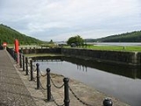
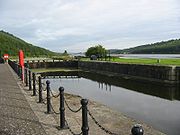
With the coming of the railways in the 1850s, the canal went into decline, and finally closed to commercial traffic in the late 1930s. Some sections have steadily fallen into a state of disrepair since then. Although most of the lock gates have long since rotted away, many of the locks themselves are in excellent condition, being constructed from local granite. It is now overgrown for much of its length; however, this means that it is now a haven for wildlife, and with the construction of broad paths is enjoying a renaissance, with many families and individuals using these for walking and cycling. The towpath has been incorporated into the National Cycle Network
National Cycle Network
The National Cycle Network is a network of cycle routes in the United Kingdom.The National Cycle Network was created by the charity Sustrans , and aided by a £42.5 million National Lottery grant. In 2005 it was used for over 230 million trips.Many routes hope to minimise contact with motor...
. The Newry section of the canal remains the most vandalised and unsightly part of the canal. Although several locks have been restored to their original appearance, however local anti-social behaviour and a lack of interest and action from Newry and Mourne District Council, has allowed this section to get worse.
Various schemes have been mooted in recent years to restore the canal and open it to leisure traffic, but as yet (2008) nothing has been approved. However with the recent announcement that the Ulster Canal
Ulster Canal
The Ulster Canal is a disused canal running through part of County Armagh, County Tyrone and County Fermanagh in Northern Ireland and County Monaghan in the Republic of Ireland...
will be re-developed and re-opened, it is hoped interest will again be renewed in the Newry Canal.
The canal towpath is maintained by two wardens throughout the year.
See also
- Canals of IrelandCanals of Ireland*Boyne Navigation*Broharris Canal*Coalisland Canal *Dukart's Canal*Grand Canal*Lacy's Canal*Lagan Canal*Lecarrow Canal*Newry Canal*Royal Canal*Shannon-Erne Waterway*Strabane Canal*Ulster Canal...
- Canals of the United KingdomCanals of the United KingdomThe canals of the United Kingdom are a major part of the network of inland waterways in the United Kingdom. They have a colourful history, from use for irrigation and transport, through becoming the focus of the Industrial Revolution, to today's role for recreational boating...

