Ngarrabullgan
Encyclopedia
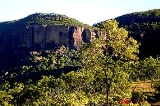
Ngarrabullgan officially named Mount Mulligan by the State, is a large tabletop mountain
(18 km by 6.5 km) located 100 kilometers west of Cairns in the north of Queensland
(Australia).
The tabletop mountain is a monolith bounded by high cliffs (or escarpments) that fall 200 to 400 m to the surrounding Hodgkinson Basin, making it an impressive natural monument which is regarded by the local Djungan Aboriginal peoples to be a sacred 'Dreaming' place (see Dreamtime
), and features in the mythological legends and beliefs of other Aboriginal groups for hundreds of kilometers around.
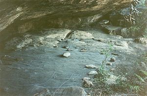
On the tabletop itself are found the two oldest-known Aboriginal sites in Queensland: Nonda Rock and Ngarrabullgan Cave. Here Aboriginal cultural deposits have been radiocarbon dated, and dated by optically stimulated luminescence
(OSL), back to 40,000+ years ago.
Other ancient Aboriginal rockshelter sites on the mountain have been dated to the end of the last Ice Age
, and, together, the many 'archaeological' caves and rockshelters found in and around Ngarrabullgan constitutes Queensland's greatest density of known sites dating back more than 4 000 years BP.
The combination of impressive natural feature, Aboriginal beliefs and mythologies, and archaeological sites of such antiquity make Ngarrabullgan the oldest known and dated cultural landscape
in Queensland, and a place of state, national and international interest and scientific significance.
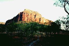 The mountain was originally formed in a narrow faulted rift
(running in a general south-east to north-west direction) within the deformed and folded metamorphic rock
(arenite
) of the Hodgkinson Basin. Successive layers of sediment were deposited into this rift filling it first with Permian
coal (at its base), then Permian conglomerates, with Triassic
sandstone
s above. With tectonic uplift the original arenite surrounding the deposits eroded away leaving Ngarrabullgan as a free-standing conglomerate and sandstone massif
.
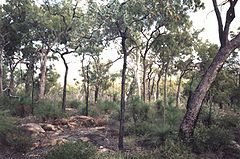 The vegetation on the Ngarrabullgan tabletop (plateau) has been described as wet sclerophyll
forest
s, mainly of a bloodwood
species of Eucalyptus
, with a well-developed understory. These tabletop forests contrast, noticeably, with the open sclerophyll woodland
of the surrounding hills and plains below.
Studies of both Ngarrabullgan's eucalypt forests and its surrounding woodlands identified 13 distinct land units supporting:
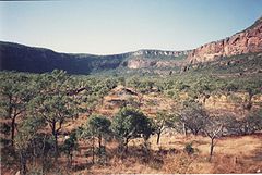 Flora: 10 plant species that are considered either rare or threatened, including 8 plant species that are found nowhere else.
Fauna: 8 frog species, 55 reptile species, 99 bird species and 20 mammal species; 22 of which are species of special conservation significance under either the Queensland or Australian biodiversity conservation statutory regimes.
 (a) important evidence enhancing the Australian communities' knowledge of Aboriginal occupation of Pleistocene
into the Holocene
;
(b) large diversity of well preserved (intact) archaeological sites and features, some of which are directly associated with locally known initiation sites and places still sacred to the local Aboriginal peoples (both on top of the mountain and around the mountain's base);
(c) strong potential to yield new and important information about Aboriginal occupation, use, beliefs and lifestyles from the Pleistocene down to the present (especially as new archaeological techniques are developed and combined with further, ongoing research and study);
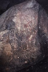
(d) excellent examples of the rock art and resource use of those Aboriginal peoples who have occupied and used the area for many generations and still, to this day, view the mountain as a major spiritual site at the heart of their country;
(e) considerable aesthetic impact combining an impressive physical presence as a large natural monument, together with natural and cultural features valuable to the Djungan peoples, other Aboriginal peoples, the people of Mareeba Shire, the North Queensland
region more generally, and Australia as a whole.
Ion Idriess
in his far north Queensland gold prospecting story, wrote about Ngarrabullgan as follows:
During the Hodgkinson River gold rush of the 1870s-1890'S the local Djungan population was decimated and the survivors were drawn to the fringes of mining settlements formed at Thornborough
and Mount Mulligan. The Djungan peoples tell of how their grandparents had to flee from police and settlers, and by climbing Ngarrabullgan's escarpments they could sometimes escape the horses (some Djungan remember a cave on the south of the mountain where many were massacred and hidden).
It was also during these times that townspeople within the Hodgkinson goldfields fearful of Aborigines first experimented with a policy of 'pacification'. Local shop owner, John Byrnes, in 1882 brought a small group of Djungan peoples into town, feeding them meat and potatoes, and, soon, there were 150 Aborigines living in a camp just 8 km from Ngarrabullgan.
). To the Djungan people this was retribution for disturbing the sacred mountain in which dwelt a 'white horse' and the spirit Eekoo.
By 1990 the coal mine had long been closed (since 1957); the mining towns had all broken down and been deserted; and the cattle-properties were profitless, run down with rubber-vine, feral pigs and brumbies
. Ngarrabullgan, however, still stood to become the focus of a Djungan Aboriginal people's 'cultural renaissance'.
to offer tourists and visitors an exciting, authentic 'outback Queensland' experience. .
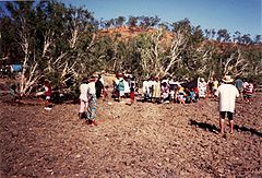 27 July: over 150 Djungan people had travelled from Cairns, Yarrabah, Innisfail
, Townsville, Chillagoe and Mareeba, to re-unite and form the Kuku Djungan Aboriginal Corporation; to raise the pan-Australian Aboriginal flag; and to resolve to regain ownership of Ngarrabullgan.
August: the Australian Government (i.e. Aboriginal and Torres Strait Islander Commission) approved the purchase of Kondoparinga property, and Ngarrabullgan, for the Djungan people.
December: Kondoparinga had been purchased, and the Djungan peoples had regained ownership of Ngarrabullgan. Queensland Government's Department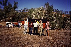 of Environment had sought to excise Ngarrabullgan from the property at the time of purchase, but, at the last moment, a binding agreement was negotiated and agreed to see Ngrrabullgan remain part of the property and later declared a National Park
to be managed by a majority Djungan board of management
Mountain
Image:Himalaya_annotated.jpg|thumb|right|The Himalayan mountain range with Mount Everestrect 58 14 160 49 Chomo Lonzorect 200 28 335 52 Makalurect 378 24 566 45 Mount Everestrect 188 581 920 656 Tibetan Plateaurect 250 406 340 427 Rong River...
(18 km by 6.5 km) located 100 kilometers west of Cairns in the north of Queensland
Queensland
Queensland is a state of Australia, occupying the north-eastern section of the mainland continent. It is bordered by the Northern Territory, South Australia and New South Wales to the west, south-west and south respectively. To the east, Queensland is bordered by the Coral Sea and Pacific Ocean...
(Australia).
The tabletop mountain is a monolith bounded by high cliffs (or escarpments) that fall 200 to 400 m to the surrounding Hodgkinson Basin, making it an impressive natural monument which is regarded by the local Djungan Aboriginal peoples to be a sacred 'Dreaming' place (see Dreamtime
Dreamtime
In the animist framework of Australian Aboriginal mythology, The Dreaming is a sacred era in which ancestral Totemic Spirit Beings formed The Creation.-The Dreaming of the Aboriginal times:...
), and features in the mythological legends and beliefs of other Aboriginal groups for hundreds of kilometers around.
On the tabletop itself are found the two oldest-known Aboriginal sites in Queensland: Nonda Rock and Ngarrabullgan Cave. Here Aboriginal cultural deposits have been radiocarbon dated, and dated by optically stimulated luminescence
Optically stimulated luminescence
In physics, optically stimulated luminescence is a method for measuring doses from ionizing radiation.The method makes use of electrons trapped between the valence and conduction bands in the crystalline structure of certain types of matter . The trapping sites are imperfections of the lattice -...
(OSL), back to 40,000+ years ago.
Other ancient Aboriginal rockshelter sites on the mountain have been dated to the end of the last Ice Age
Ice age
An ice age or, more precisely, glacial age, is a generic geological period of long-term reduction in the temperature of the Earth's surface and atmosphere, resulting in the presence or expansion of continental ice sheets, polar ice sheets and alpine glaciers...
, and, together, the many 'archaeological' caves and rockshelters found in and around Ngarrabullgan constitutes Queensland's greatest density of known sites dating back more than 4 000 years BP.
The combination of impressive natural feature, Aboriginal beliefs and mythologies, and archaeological sites of such antiquity make Ngarrabullgan the oldest known and dated cultural landscape
Cultural landscape
Cultural Landscapes have been defined by the World Heritage Committee as distinct geographical areas or properties uniquely "..represent[ing] the combined work of nature and of man.."....
in Queensland, and a place of state, national and international interest and scientific significance.
Geomorphology

Rift
In geology, a rift or chasm is a place where the Earth's crust and lithosphere are being pulled apart and is an example of extensional tectonics....
(running in a general south-east to north-west direction) within the deformed and folded metamorphic rock
Metamorphic rock
Metamorphic rock is the transformation of an existing rock type, the protolith, in a process called metamorphism, which means "change in form". The protolith is subjected to heat and pressure causing profound physical and/or chemical change...
(arenite
Arenite
Arenite is a sedimentary clastic rock with sand grain size between 0.0625 mm and 2 mm and contain less than 15% matrix. The related adjective is arenaceous...
) of the Hodgkinson Basin. Successive layers of sediment were deposited into this rift filling it first with Permian
Permian
The PermianThe term "Permian" was introduced into geology in 1841 by Sir Sir R. I. Murchison, president of the Geological Society of London, who identified typical strata in extensive Russian explorations undertaken with Edouard de Verneuil; Murchison asserted in 1841 that he named his "Permian...
coal (at its base), then Permian conglomerates, with Triassic
Triassic
The Triassic is a geologic period and system that extends from about 250 to 200 Mya . As the first period of the Mesozoic Era, the Triassic follows the Permian and is followed by the Jurassic. Both the start and end of the Triassic are marked by major extinction events...
sandstone
Sandstone
Sandstone is a sedimentary rock composed mainly of sand-sized minerals or rock grains.Most sandstone is composed of quartz and/or feldspar because these are the most common minerals in the Earth's crust. Like sand, sandstone may be any colour, but the most common colours are tan, brown, yellow,...
s above. With tectonic uplift the original arenite surrounding the deposits eroded away leaving Ngarrabullgan as a free-standing conglomerate and sandstone massif
Massif
In geology, a massif is a section of a planet's crust that is demarcated by faults or flexures. In the movement of the crust, a massif tends to retain its internal structure while being displaced as a whole...
.
Flora & Fauna

Sclerophyll
Sclerophyll is the term for a type of vegetation that has hard leaves and short internodes . The word comes from the Greek sclero and phyllon ....
forest
Forest
A forest, also referred to as a wood or the woods, is an area with a high density of trees. As with cities, depending where you are in the world, what is considered a forest may vary significantly in size and have various classification according to how and what of the forest is composed...
s, mainly of a bloodwood
Bloodwood
Bloodwood has several meanings. It is the name of a dark red wood, from South America. It is also a common name for several unrelated groups of trees, for instance:* Brosimum paraense, a tree found in Central and South America...
species of Eucalyptus
Eucalyptus
Eucalyptus is a diverse genus of flowering trees in the myrtle family, Myrtaceae. Members of the genus dominate the tree flora of Australia...
, with a well-developed understory. These tabletop forests contrast, noticeably, with the open sclerophyll woodland
Woodland
Ecologically, a woodland is a low-density forest forming open habitats with plenty of sunlight and limited shade. Woodlands may support an understory of shrubs and herbaceous plants including grasses. Woodland may form a transition to shrubland under drier conditions or during early stages of...
of the surrounding hills and plains below.
Studies of both Ngarrabullgan's eucalypt forests and its surrounding woodlands identified 13 distinct land units supporting:

Fauna: 8 frog species, 55 reptile species, 99 bird species and 20 mammal species; 22 of which are species of special conservation significance under either the Queensland or Australian biodiversity conservation statutory regimes.
Register of the National Estate
The Australian Heritage Commission included Ngarrabullgan on its register of the National Estate on 24 June 1997, describing it as a place that holds:
Pleistocene
The Pleistocene is the epoch from 2,588,000 to 11,700 years BP that spans the world's recent period of repeated glaciations. The name pleistocene is derived from the Greek and ....
into the Holocene
Holocene
The Holocene is a geological epoch which began at the end of the Pleistocene and continues to the present. The Holocene is part of the Quaternary period. Its name comes from the Greek words and , meaning "entirely recent"...
;
(b) large diversity of well preserved (intact) archaeological sites and features, some of which are directly associated with locally known initiation sites and places still sacred to the local Aboriginal peoples (both on top of the mountain and around the mountain's base);
(c) strong potential to yield new and important information about Aboriginal occupation, use, beliefs and lifestyles from the Pleistocene down to the present (especially as new archaeological techniques are developed and combined with further, ongoing research and study);
(d) excellent examples of the rock art and resource use of those Aboriginal peoples who have occupied and used the area for many generations and still, to this day, view the mountain as a major spiritual site at the heart of their country;
(e) considerable aesthetic impact combining an impressive physical presence as a large natural monument, together with natural and cultural features valuable to the Djungan peoples, other Aboriginal peoples, the people of Mareeba Shire, the North Queensland
North Queensland
North Queensland or the Northern Region is the northern part of the state of Queensland in Australia. Queensland is a massive state, larger than most countries, and the tropical northern part of it has been historically remote and undeveloped, resulting in a distinctive regional character and...
region more generally, and Australia as a whole.
Queensland Register of Aboriginal Heritage
For similar reasons the Queensland Government formally registered Ngarrabullgan as "The Mount Mulligan Aboriginal Cultural Heritage Area" under its Aboriginal heritage legislation (Aboriginal Cultural Heritage Act 2006 (Qld)) in 2006.Hodgkinson River gold-rush
Prior to gold rushes and the associated occupation of the Hodgkinson River area, Ngarrabullgin was a place of some spiritual and ceremonial significance to the Djungan Aboriginal peoplesIon Idriess
Ion Idriess
Ion Llewellyn Idriess, OBE was a prolific and influential Australian author. He wrote more than 50 books over 43 years between 1927 to 1969 - an average of one book every 10 months, and twice published three books in one year...
in his far north Queensland gold prospecting story, wrote about Ngarrabullgan as follows:
"Farther out in those Chillagoe lands an outstanding landmark on the Hodgkinson is a massive wall of rock overlooking 'Mulligan's goldfield'. A meeting-place of the aborigines from time immemorial, it has seen the passing of a thousand tribes."
During the Hodgkinson River gold rush of the 1870s-1890'S the local Djungan population was decimated and the survivors were drawn to the fringes of mining settlements formed at Thornborough
Thornborough
Thornborough is the name of more than one place:In the England:*Thornborough, Buckinghamshire*Thornborough, North Yorkshire*Thornborough Henges, North YorkshireIn Australia:*Thornborough, Queensland...
and Mount Mulligan. The Djungan peoples tell of how their grandparents had to flee from police and settlers, and by climbing Ngarrabullgan's escarpments they could sometimes escape the horses (some Djungan remember a cave on the south of the mountain where many were massacred and hidden).
It was also during these times that townspeople within the Hodgkinson goldfields fearful of Aborigines first experimented with a policy of 'pacification'. Local shop owner, John Byrnes, in 1882 brought a small group of Djungan peoples into town, feeding them meat and potatoes, and, soon, there were 150 Aborigines living in a camp just 8 km from Ngarrabullgan.
Mount Mulligan Coal Mining
By 1921 the Hodgkinson gold fields had declined and a coal mine at Mount Mulligan had burrowed its way into the side of Ngarrabullgan, much to the fear of the Djungan Aboriginal peoples. On 19 September 1921 there was a huge explosion killing 75 people in what turned out to be Queensland's worst mining disaster (see also Mount Mulligan mine disasterMount Mulligan mine disaster
]]The Mount Mulligan mine disaster occurred on 19 September 1921 in Mount Mulligan, Far North Queensland, Australia. A series of explosions in the local coal mine, audible as much as 30 km away, rocked the close knit township....
). To the Djungan people this was retribution for disturbing the sacred mountain in which dwelt a 'white horse' and the spirit Eekoo.
By 1990 the coal mine had long been closed (since 1957); the mining towns had all broken down and been deserted; and the cattle-properties were profitless, run down with rubber-vine, feral pigs and brumbies
Brumby
A Brumby is a free-roaming feral horse in Australia. Although found in many areas around the country, the best-known brumbies are found in the Australian Alps region in south-eastern Australia. Today, most of them are found in the Northern Territory, with the second largest population in Queensland...
. Ngarrabullgan, however, still stood to become the focus of a Djungan Aboriginal people's 'cultural renaissance'.
1986
Queensland Tourist and Travel Corporation (QTTC) staff, followed by Sir Frank Moore (QTTC Chairman) and the Queensland Minister for Tourism, visited Ngarrabullgan and Kondoparinga Station (the pastoral property within which Ngarrabullgan sits)to see if a small tourist resort should be built, and tourist enterprise developed within the vicinity of Ngarrabullgan, offering tourists an 'experience' of the mountain and surrounding heritage.1988
Queensland Tourist and Travel Corporation (QTTC) had prepared and costed the feasibility of developing the tourism potential of Ngarrabullgan, and, by this time there was some genuine commercial interest in purchasing Kondoparinga property and Ngarrabullgan to enable a corporation operating out of Port DouglasPort Douglas, Queensland
Port Douglas is a town in Far North Queensland, Australia, approximately north of Cairns. Its permanent population was 948 residents in 2006. The town's population can often double, however, with the influx of tourists during the peak tourism season May–September. The town is named in honour of...
to offer tourists and visitors an exciting, authentic 'outback Queensland' experience. .
1990
The person occupying Kondoparinga pastoral property and joint owner of the property (Mr Reg Adams) approached people then living in Mareeba expressing a strong wish to see Ngarrabullgan sold to the Djungan peoples who had enjoyed free access to his property for many years. The other owner of the property, Skyfleet, wished to see the property sold to the Japanese owned consortium who were interested in developing the property's identified tourism potential.:1991

Innisfail, Queensland
Innisfail is a town located in the far north of the state of Queensland, Australia. It is the major township of the Cassowary Coast and is well renowned for its sugar and banana industries, as well as for being one of Australia's wettest towns...
, Townsville, Chillagoe and Mareeba, to re-unite and form the Kuku Djungan Aboriginal Corporation; to raise the pan-Australian Aboriginal flag; and to resolve to regain ownership of Ngarrabullgan.
August: the Australian Government (i.e. Aboriginal and Torres Strait Islander Commission) approved the purchase of Kondoparinga property, and Ngarrabullgan, for the Djungan people.
December: Kondoparinga had been purchased, and the Djungan peoples had regained ownership of Ngarrabullgan. Queensland Government's Department

National park
A national park is a reserve of natural, semi-natural, or developed land that a sovereign state declares or owns. Although individual nations designate their own national parks differently A national park is a reserve of natural, semi-natural, or developed land that a sovereign state declares or...
to be managed by a majority Djungan board of management
2007
November: the Djungan people:- have ownership of the mountain and developed management plans for its future protection and management;
- have registered the mountain with the Australian Heritage Commission to form part of Australia's 'National Estate'
- have nominated the mountain to be declared an Indigenous Protected Area under the Australian Government's protected area program
- have seen the mountain declared a 'Aboriginal cultural heritage area' under Queensland legislation.
- are still seeking to see Ngarrabullgin declared a National Park with a majority Djungan board of management, as agreed back in December 1991.
Archaeological Sites
Published archaeological sites (listed in rough geographical order, generally running from north to south).:- Initiation Cave
- Gorge Creek Shelter
- Waterhole Cave

- Ngarrabullgan Cave
- Nonda Rock
- Quinine Bush Shelter
- Kookaburra Rock
- Courtyard Rock
- Dragonfly Hollow
- Fig Tree Shelter
- Hand Shelter:
- Grass Tree Shelter
- Lookout Shelter
- Painted Ell
- Tunnell Shelter
- Bush Peg Shelter

