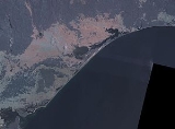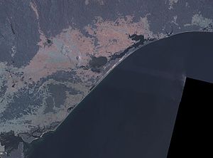
Ninety Mile Beach, Victoria
Encyclopedia

Beach
A beach is a geological landform along the shoreline of an ocean, sea, lake or river. It usually consists of loose particles which are often composed of rock, such as sand, gravel, shingle, pebbles or cobblestones...
is a sandy stretch of south-eastern coastline of Victoria, Australia
Australia
Australia , officially the Commonwealth of Australia, is a country in the Southern Hemisphere comprising the mainland of the Australian continent, the island of Tasmania, and numerous smaller islands in the Indian and Pacific Oceans. It is the world's sixth-largest country by total area...
along the Gippsland Lakes
Gippsland Lakes
The Gippsland Lakes are a network of lakes, marshes and lagoons in east Gippsland, Victoria, Australia covering an area of about 600 km2. The largest of the lakes are Lake Wellington , Lake King and Lake Victoria. They are fed by the Avon, Thomson, Latrobe, Mitchell, Nicholson and Tambo...
region of East Gippsland
East Gippsland
East Gippsland is the eastern region of Gippsland, Australia covering 31,740 square kilometres of Victoria. It has a population of 80,114....
on Bass Strait
Bass Strait
Bass Strait is a sea strait separating Tasmania from the south of the Australian mainland, specifically the state of Victoria.-Extent:The International Hydrographic Organization defines the limits of the Bass Strait as follows:...
. The beach is just over 151 kilometres (93.8 mi) long running northeastward from a spit near Port Albert
Port Albert, Victoria
Port Albert is a coastal town in Victoria, Australia, on the coast of Corner Inlet on the Yarram - Port Albert Road, kilometres south-east of Morwell, kilometres south-east of Melbourne, in the Shire of Wellington. At the 2006 census, Port Albert had a population of 248.Port Albert was one of the...
to the man-made channel at Lakes Entrance. The beach is located just over 250 kilometres (155.3 mi) from Melbourne and can be reached from the South Gippsland Highway
South Gippsland Highway
The South Gippsland Highway is a partially divided highway in Victoria, Australia which connects the city of Melbourne with the South Gippsland region of Victoria, ending in the town of Sale...
passing the coastal towns of Woodside
Woodside, Victoria
Woodside is a village in Victoria, Australia. At the 2006 census, Woodside and the surrounding area had a population of 267. Near Woodside there is the tallest construction of the southern hemisphere, the aerial mast of the VLF Transmitter Woodside...
, Seaspray
SEASPRAY
SEASPRAY was a clandestine U.S. Army special operations unit. Its existence within the U.S. Department of Defense was held secret insofar as it testifies to the close links between the United States Army and the Central Intelligence Agency....
, Golden Beach
Golden Beach, Victoria
Golden Beach VictoriaGolden Beach is a small settlement situated on the Ninety Mile Beach in Gippsland Victoria.21 Camp sites are available to visitors along the foreshore. Camps 1-6 allow visitors to bring dogs....
, and Loch Sport.
The beach is made up of long sandy dunes which separate the various lakes and lagoons from the ocean. For the northern part of its route the beach runs along a sandbar on what amounts to a series of tidal islands and behind which are several large lakes and numerous shallow littoral lagoons. The three main lakes are Lake King, Lake Victoria and Lake Wellington. The area comprises The Lakes National Park
The Lakes National Park
The Lakes National Park is a national park in Victoria, Australia, east of Melbourne....
.
The beach's length ensures that the waves break too close to the beach for good surfing
Surfing
Surfing' is a surface water sport in which the surfer rides a surfboard on the crest and face of a wave which is carrying the surfer towards the shore...
, and there are strong rip current
Rip current
A rip current, commonly referred to by the misnomer rip tide, is a strong channel of water flowing seaward from near the shore, typically through the surf line. Typical flow is at 0.5 metres per second , and can be as fast as 2.5 metres per second...
s and cross-currents making the conditions somewhat hazardous for the inexperienced swimmer. The local authorities recommend that swimmers swim at Woodside, Seaspray and Lakes Entrance, which have life saving beach patrols during the summer season.
The beach is a white sand beach, with crashing waves and a natural bush environment. It is part of the Ninety Mile Beach Marine National Park, which covers 2,750 hectares and 5 kilometres (3.1 mi) of coastline, 30 kilometres (18.6 mi) south of Sale
Sale
Sale may refer to:* Sales * Sale, discounts and allowances in the prices of goods, such as:**Fire sale, a drastic discount in prices**Loan sale, a sale under contract of all or part of the cash stream from a specific loan...
. There are basic camping facilities within the park at Emu Bight, as well as accommodation at Seaspray and Lakes Entrance.
Rotamah Island, which is part of the Lakes National Park, has a large bird observatory, and can be visited by boat from Paynesville
Paynesville, Victoria
Paynesville is a tourist/holiday resort town in the Gippsland region of Victoria, Australia. At the 2006 census, Paynesville had a population of 2967. The town is located east of the state capital, Melbourne. It is known as the boating capital of Victoria....
, about 6 kilometres (3.7 mi) away.
The beach is believed to be the third longest uninterrupted beach in the world, behind Praia do Cassino
Praia do Cassino
Praia do Cassino is located adjacent to the city of Rio Grande, in the state of Rio Grande do Sul, Brazil. It is commonly known in Brazil as the longest beach in the world , stretching from the Molhes in Cassino beach to nearly Chuí, on...
on the Brazilian southern coast and Padre Island
Padre Island
Padre Island is part of the U.S. state of Texas. The island is located on Texas' southern coast of the Gulf of Mexico and is famous for its white sandy beaches at the south end...
on the US Gulf Coast.

