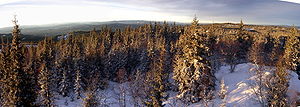
Nordmarka
Encyclopedia

Forest
A forest, also referred to as a wood or the woods, is an area with a high density of trees. As with cities, depending where you are in the world, what is considered a forest may vary significantly in size and have various classification according to how and what of the forest is composed...
ed region which makes up the northern part of Oslo
Oslo
Oslo is a municipality, as well as the capital and most populous city in Norway. As a municipality , it was established on 1 January 1838. Founded around 1048 by King Harald III of Norway, the city was largely destroyed by fire in 1624. The city was moved under the reign of Denmark–Norway's King...
, Norway
Norway
Norway , officially the Kingdom of Norway, is a Nordic unitary constitutional monarchy whose territory comprises the western portion of the Scandinavian Peninsula, Jan Mayen, and the Arctic archipelago of Svalbard and Bouvet Island. Norway has a total area of and a population of about 4.9 million...
. The area called "Nordmarka" also extends into the municipalities of Hole
Hole, Norway
Hole is a municipality in Buskerud county, Norway. It is part of the traditional region of Ringerike. The administrative centre of the municipality is the village of Vik. Hole is located around lake Tyrifjorden and extends to the woodland around Oslo...
, Ringerike
Ringerike
oskar er kjempe kulRingerike is a municipality in Buskerud county, Norway. It is part of the traditional region of Ringerike...
, Lunner
Lunner
Lunner is a municipality in Oppland county, Norway. It is part of the traditional region of Hadeland. The administrative centre of the municipality is the village of Roa...
, Jevnaker
Jevnaker
Jevnaker is a municipality in Oppland county, Norway. The administrative centre of the municipality is the village of Jevnaker with a population of 4,302.The parish of Jævnaker was established as a municipality on 1 January 1838...
and Nittedal
Nittedal
Nittedal is a municipality in Akershus county, Norway. It is part of the traditional region of Romerike. The administrative centre of the municipality is the village of Rotnes....
. It is the largest part of the Marka
Marka, Oslo
Marka is the name of the forested and hilly areas surrounding Oslo, Norway. It includes areas within the municipality of Oslo, but also large areas in Hole, Ringerike, Jevnaker, Lunner, Nittedal, Bærum, Asker, and other municipalities in Oppland and Akershus counties.The name is actually just the...
borough. The forests are popular sites for hiking and skiing. Most of the forests are protected, and it is not possible to obtain building permits for cottages in the area.
There are several lakes in Nordmarka, which are used as a supply for drinking water
Drinking water
Drinking water or potable water is water pure enough to be consumed or used with low risk of immediate or long term harm. In most developed countries, the water supplied to households, commerce and industry is all of drinking water standard, even though only a very small proportion is actually...
, largest of these is the Maridalsvannet
Maridalsvannet
Maridalsvannet is a lake in Maridalen, Oslo, Norway. It is the largest lake in the municipitality of Oslo, and serves as the main drinking water supply for the city. The lake drains via the river Akerselva to the Oslofjord. The primary inflows are Skjærsjøelva and Dausjøelva. The Hammeren...
. Svarttjernshøgda in Jevnaker is the highest point in Jevnaker, at a height of 717 m.
The name
The first element is nord 'northNorth
North is a noun, adjective, or adverb indicating direction or geography.North is one of the four cardinal directions or compass points. It is the opposite of south and is perpendicular to east and west.By convention, the top side of a map is north....
', the last element is the finite form of mark f 'woodland, forest
Forest
A forest, also referred to as a wood or the woods, is an area with a high density of trees. As with cities, depending where you are in the world, what is considered a forest may vary significantly in size and have various classification according to how and what of the forest is composed...
'. The name is first mentioned on a map from 1760.

