
North Carolina Highway 268
Encyclopedia
NC 268 is an 86 miles North Carolina
state highway
. It connects manny communities as it traverses through the northwestern North Carolina mountains
and foothills.
in Caldwell County. From its western terminus, the route heads on a curvy northeasterly path roughly following the Yadkin River
. Entering Wilkes County, it follows the southern shoreline of the W. Kerr Scott Reservoir and continues into the county seat of Wilkesboro
. Before entering downtown Wilkesboro, the route has an interchange with US 421/NC 16 and meets NC 18. NC 268 joins NC 18 for a short concurrency through downtown North Wilkesboro, joining the business route of US 421 across a bridge over the Yadkin River into North Wilkesboro. NC 18 and NC 268 split from US 421 Business in central North Wilkesboro, pass by the western terminus of NC 115 and continue north one mile (1.6 km) before separating. NC 268 continues independently east roughly paralleling the Yadkin River through the town of Ronda
on its way to the Surry County line.
that passes through northern Elkin
while NC 268 Business goes through downtown/southern Elkin. The bypass route meets the business route of US 21 (North Bridge Street) and has an interchange with US 21 Bypass before meeting I-77 (exit 85) in northeast Elkin. NC 268 Bypass passes through the I-77 interchange, continuing east along C.C. Camp Road to rejoin its business partner just west of the junction of the Mitchell River
and the Yadkin River at the Burch
community.
The mainline NC 268 highway then ventures northeast from this point through the community of Little Richmond
to meet US 601 at Fairview Crossroads, just south of Dobson. Passing through the crossroads, the route returns to an easterly path and crosses the Fisher River
before passing through the communities of Level Cross
and Pine Hill
. NC 268 then crosses the Ararat River
and passes to the north of Pilot Mountain
to meet US 52 (Future I-74) in the town of Pilot Mountain
. NC 268 passes through the town and crosses the county line into Stokes County. The final eastern segment of NC 268 is a curvy one through the Sauratown Mountains
, crossing NC 66 to end at NC 89 north of Moores Springs and northwest of Danbury.
North Carolina
North Carolina is a state located in the southeastern United States. The state borders South Carolina and Georgia to the south, Tennessee to the west and Virginia to the north. North Carolina contains 100 counties. Its capital is Raleigh, and its largest city is Charlotte...
state highway
State highway
State highway, state road or state route can refer to one of three related concepts, two of them related to a state or provincial government in a country that is divided into states or provinces :#A...
. It connects manny communities as it traverses through the northwestern North Carolina mountains
Western North Carolina
Western North Carolina is the region of North Carolina which includes the Appalachian Mountains, thus it is often known geographically as the state's Mountain Region. It is sometimes included with upstate South Carolina as the "Western Carolinas", which is also counted as a single media market...
and foothills.
Caldwell and Wilkes counties
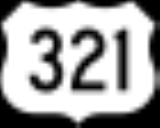
NC 268 begins in the west at an intersetction with US 321 a few miles north of LenoirLenoir, North Carolina
Lenoir is a city in Caldwell County, North Carolina, United States. The population was 18,228 at the 2010 census. It is the county seat of Caldwell County. Lenoir is located in the Blue Ridge foothills. The city also contains the Brushy Mountains, a spur of the Blue Ridge Mountains...
in Caldwell County. From its western terminus, the route heads on a curvy northeasterly path roughly following the Yadkin River
Yadkin River
The Yadkin River is one of the longest rivers in North Carolina, flowing . It rises in the northwestern portion of the state near the Blue Ridge Parkway's Thunder Hill Overlook. Several parts of the river are impounded by dams for water, power, and flood control. The river becomes the Pee Dee...
. Entering Wilkes County, it follows the southern shoreline of the W. Kerr Scott Reservoir and continues into the county seat of Wilkesboro
Wilkesboro, North Carolina
Wilkesboro is a town in and the county seat of Wilkes County, North Carolina, United States. The population was 3,159 at the 2000 census, and it is the second largest municipality in the county. The 2010 Census listed the town's population at 3,044. The town is located along the south bank of the...
. Before entering downtown Wilkesboro, the route has an interchange with US 421/NC 16 and meets NC 18. NC 268 joins NC 18 for a short concurrency through downtown North Wilkesboro, joining the business route of US 421 across a bridge over the Yadkin River into North Wilkesboro. NC 18 and NC 268 split from US 421 Business in central North Wilkesboro, pass by the western terminus of NC 115 and continue north one mile (1.6 km) before separating. NC 268 continues independently east roughly paralleling the Yadkin River through the town of Ronda
Ronda, North Carolina
Ronda is a town in Wilkes County, North Carolina, United States. The population was 560 at the 2000 census. Ronda was named after a nearby estate called "Roundabout", which was the residence of Benjamin Cleveland, a locally prominent planter and a colonel in the North Carolina militia during the...
on its way to the Surry County line.
Surry and Stokes counties
Just shy of the Wilkes-Surry county line near Pleasant Hill, NC 268 splits onto a business route and a bypass route. NC 268 Bypass is an expresswayLimited-access road
A limited-access road known by various terms worldwide, including limited-access highway, dual-carriageway and expressway, is a highway or arterial road for high-speed traffic which has many or most characteristics of a controlled-access highway , including limited or no access to adjacent...
that passes through northern Elkin
Elkin, North Carolina
Elkin is a town in Surry and Wilkes counties in the U.S. state of North Carolina, along the Yadkin River. Elkin shares its name with the surrounding township of Elkin Township...
while NC 268 Business goes through downtown/southern Elkin. The bypass route meets the business route of US 21 (North Bridge Street) and has an interchange with US 21 Bypass before meeting I-77 (exit 85) in northeast Elkin. NC 268 Bypass passes through the I-77 interchange, continuing east along C.C. Camp Road to rejoin its business partner just west of the junction of the Mitchell River
Mitchell River (North Carolina)
The Mitchell River is a tributary of the Yadkin River in northwestern North Carolina in the United States. Via the Yadkin it is part of the watershed of the Pee Dee River, which flows to the Atlantic Ocean...
and the Yadkin River at the Burch
Burch, North Carolina
Burch, or more commonly known locally as Burch Station, is a small community along the Yadkin River in the Marsh Township of Surry County, North Carolina. The community sits on the mouth of the Mitchell River where it empties into the Yadkin...
community.
The mainline NC 268 highway then ventures northeast from this point through the community of Little Richmond
Little Richmond, North Carolina
Little Richmond is an unincorporated community located in the Marsh Township of Surry County, North Carolina.-Geography:The community is centered around the intersection of North Carolina Highway 268 and Joe Layne Mill Road. Near this intersection are the Little Richmond Baptist Church, founded in...
to meet US 601 at Fairview Crossroads, just south of Dobson. Passing through the crossroads, the route returns to an easterly path and crosses the Fisher River
Fisher River (North Carolina)
The Fisher River is a tributary of the Yadkin River in northwestern North Carolina in the United States, also draining a very small portion of southwestern Virginia. Via the Yadkin it is part of the watershed of the Pee Dee River, which flows to the Atlantic Ocean...
before passing through the communities of Level Cross
Level Cross, Surry County, North Carolina
Level Cross is an unincorporated community located in the Rockford Township of Surry County, North Carolina.-Geography:The community is centered around the intersection of North Carolina Highway 268 and Siloam Road. The community derives its name from this intersection as the two roads crossed...
and Pine Hill
Pine Hill, North Carolina
Pine Hill is a small unincorporated community in the Eldora Township of Surry County, North Carolina. The community is centered around the intersection of Eldora Road/Quaker Church Road and North Carolina Highway 268. Prominent landmarks in the community include the Pine Hill Friends Meeting and...
. NC 268 then crosses the Ararat River
Ararat River
The Ararat River is a tributary of the Yadkin River in southwestern Virginia and northwestern North Carolina in the United States. Via the Yadkin it is part of the watershed of the Pee Dee River, which flows to the Atlantic Ocean....
and passes to the north of Pilot Mountain
Pilot Mountain (North Carolina)
Pilot Mountain, a metamorphic quartzite monadnock rising to a peak above sea level, is one of the most distinctive natural features in the state of North Carolina. It is a remnant of the ancient chain of Sauratown Mountains. The Saura were the earliest known inhabitants of the region...
to meet US 52 (Future I-74) in the town of Pilot Mountain
Pilot Mountain, North Carolina
Pilot Mountain is a town in Surry County, North Carolina, United States. The population was 1,477 at the 2010 census. It is named for the nearby landmark of Pilot Mountain, a distinctive geological formation...
. NC 268 passes through the town and crosses the county line into Stokes County. The final eastern segment of NC 268 is a curvy one through the Sauratown Mountains
Sauratown Mountains
The Sauratown Mountains, which are sometimes called "the mountains away from the mountains", are an isolated mountain range located within Stokes and Surry counties in the U.S. state of North Carolina...
, crossing NC 66 to end at NC 89 north of Moores Springs and northwest of Danbury.