
North Carolina Highway 56
Encyclopedia
NC 56 is a 39-mile North Carolina
state highway
and a semi-rural traffic artery connecting U.S. 1
and US 15 as well as I-85 to many small-to-medium sized towns in the The Triangle
region north of the cities of Raleigh and Durham.
The highway will meet with US 1A (South Main Street) in Franklinton and underpass U.S. 1
just west of town as it continues on towards Creedmoor, crossing NC 96 halfway at Wilton. NC 56 will turn left onto US 15 at Creedmoor and then take the next right (West Lake Road), continuing towards Butner. Just before crossing the railroad tracks into Butner, NC 56 overpasses I-85 (Exit #191 off the interstate) as it continues to its western terminus at Central Avenue.
North Carolina
North Carolina is a state located in the southeastern United States. The state borders South Carolina and Georgia to the south, Tennessee to the west and Virginia to the north. North Carolina contains 100 counties. Its capital is Raleigh, and its largest city is Charlotte...
state highway
State highway
State highway, state road or state route can refer to one of three related concepts, two of them related to a state or provincial government in a country that is divided into states or provinces :#A...
and a semi-rural traffic artery connecting U.S. 1
U.S. Route 1 in North Carolina
U.S. Route 1 is an north–south United States highway that runs for from the South Carolina state line, near Rockingham, to the Virginia state line, near Wise...
and US 15 as well as I-85 to many small-to-medium sized towns in the The Triangle
The Triangle (North Carolina)
The Research Triangle, also known as Raleigh-Durham and commonly referred to as simply "The Triangle", is a region in the Piedmont of North Carolina in the United States, anchored by North Carolina State University, Duke University, University of North Carolina at Chapel Hill, and cities of...
region north of the cities of Raleigh and Durham.
Route description
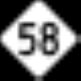
The eastern terminus of NC 56 begins at NC 58 just over the Nash/Franklin County line northwest of Castalia and travels west to Louisburg. Upon entering town, NC 56 will turn left onto South Bickett Boulevard, merging with US 401 and NC 39, and pass through the shopping district of Louisburg. The highway continues to follow US 401 as NC 39 breaks off at the south end of town and heads towards Bunn. NC 56 will turn right a short distance further at the junctions of South Main Street and Burke Boulevard and continue west towards Franklinton.The highway will meet with US 1A (South Main Street) in Franklinton and underpass U.S. 1
U.S. Route 1 in North Carolina
U.S. Route 1 is an north–south United States highway that runs for from the South Carolina state line, near Rockingham, to the Virginia state line, near Wise...
just west of town as it continues on towards Creedmoor, crossing NC 96 halfway at Wilton. NC 56 will turn left onto US 15 at Creedmoor and then take the next right (West Lake Road), continuing towards Butner. Just before crossing the railroad tracks into Butner, NC 56 overpasses I-85 (Exit #191 off the interstate) as it continues to its western terminus at Central Avenue.
Concurrencies
NC 56 has five highway concurrencies along its route. These include...- NC 581 for 4.3 miles (6.9 km) between Mapleville and Louisburg
- NC 39 for 1 mile (1.6 km) in Louisburg
- US 401 for 1.6 miles (2.6 km) in Louisburg
- NC 50 for 0.2 mile (0.3 km) in Creedmoor
- US 15 for 0.1 mile (0.2 km) in Creedmoor
Attractions along the way
- Louisburg Historic District
- Louisburg CollegeLouisburg CollegeLouisburg College is a private two-year college located in Louisburg, North Carolina. The Methodist-affiliated college claims that 90 percent of its graduates move on to four-year institutions...
- Historic areas of Franklinton and Creedmoor
Trivia
- There are two state highways which have its terminus when concurrent with NC 56 as the highway continues, NC 581 at US 401 & NC 39 in Louisburg and NC 50 at US 15 in Creedmoor.